El río Támesis ( / t ɛ m z / TEMZ), también conocido en algunas partes comorío Isis, es un río que fluye porel sur de Inglaterra,incluidaLondres. Con 215 millas (346 km), es el río más largo de toda Inglaterra y elsegundo más largo del Reino Unido, después delrío Severn.
El río nace en Thames Head en Gloucestershire y desemboca en el mar del Norte cerca de Tilbury , Essex y Gravesend , Kent, a través del estuario del Támesis . Desde el oeste, fluye a través de Oxford (donde a veces se lo llama Isis), Reading , Henley-on-Thames y Windsor . El Támesis también drena todo el Gran Londres . [1]
El curso inferior del río se denomina Tideway , derivado de su largo tramo de marea hasta Teddington Lock . Su sección de marea incluye la mayor parte de su tramo de Londres y tiene una subida y bajada de 23 pies (7 m). Desde Oxford hasta el estuario, el Támesis desciende 55 metros (180 pies). Al atravesar algunas de las partes más secas de Gran Bretaña continental y ser objeto de una gran extracción de agua potable, el caudal del Támesis es bajo teniendo en cuenta su longitud y anchura: el Severn tiene un caudal casi el doble de grande en promedio a pesar de tener una cuenca de drenaje más pequeña . En Escocia , el Tay alcanza más del doble del caudal promedio del Támesis a partir de una cuenca de drenaje que es un 60% más pequeña.
A lo largo de su curso hay 45 esclusas de navegación con sus correspondientes diques . Su área de captación cubre gran parte del sureste y una pequeña parte del oeste de Inglaterra; el río es alimentado por al menos 50 afluentes con nombre . El río contiene más de 80 islas . Con sus aguas que varían desde agua dulce hasta casi agua de mar, el Támesis sustenta una variedad de vida silvestre y tiene varios sitios adyacentes de especial interés científico , siendo el más grande en las marismas del norte de Kent y cubre 20,4 millas cuadradas (5289 ha). [2]


Según Mallory y Adams, el Támesis, del inglés medio Temese , se deriva del nombre britónico para el río, Tamesas (de * tamēssa ), [3] registrado en latín como Tamesis y que produce el galés moderno Tafwys "Támesis".
El elemento del nombre Tam puede haber significado "oscuro" y puede compararse con otros cognados como el ruso темно ( protoeslavo * tĭmĭnŭ ), el lituano tamsi "oscuro", el letón tumsa "oscuridad", el sánscrito tamas y el galés tywyll "oscuridad" y el irlandés medio teimen "gris oscuro". [3] [b] El origen es compartido por muchos otros nombres de ríos en Gran Bretaña, como el río Tamar en la frontera de Devon y Cornualles , varios ríos llamados Tame en Midlands y North Yorkshire , el Tavy en Dartmoor , el Team del noreste, el Teifi y Teme de Gales , el Teviot en las fronteras escocesas y un afluente del Támesis, el Thame .
Kenneth H. Jackson propuso que el nombre del Támesis no es indoeuropeo (y de significado desconocido), [5] mientras que Peter Kitson sugirió que es indoeuropeo pero se originó antes de los británicos y tiene un nombre que indica "lodo" de una raíz *tā- , 'derretirse'. [6]

Las primeras variantes del nombre incluyen:
Una prueba indirecta de la antigüedad del nombre "Támesis" la proporciona un fragmento de cerámica romana hallado en Oxford, que lleva la inscripción Tamesubugus fecit (Tamesubugus hizo [esto]). Se cree que el nombre de Tamesubugus deriva del nombre del río. [7] En la Cosmografía de Rávena ( c. 700 d. C. ) se hace referencia a Tamesu como un lugar, no como un río .
El nombre del río siempre se ha pronunciado con una simple t /t/ ; la ortografía del inglés medio era típicamente temes y la forma britónica Tamesis . Una ortografía similar de 1210, "Tamisiam" (el caso acusativo de "Tamisia"; véase Kingston upon Thames § Historia temprana ), se encuentra en la Carta Magna . [8]
El río Támesis que pasa por Oxford se denomina a veces [¿ cuándo? ] Isis . Históricamente, y especialmente en la época victoriana , los diccionarios geográficos y cartógrafos insistían en que todo el río se llamaba correctamente Isis desde su nacimiento hasta Dorchester on Thames y que solo a partir de este punto, donde el río se encuentra con el Támesis y se convierte en el "Támesis-isis" (supuestamente abreviado posteriormente como Támesis), debería llamarse así. [ cita requerida ] Los mapas de Ordnance Survey todavía etiquetan al Támesis como "río Támesis o Isis" hasta Dorchester. Desde principios del siglo XX, esta distinción se ha perdido en el uso común fuera de Oxford, y algunos historiadores [ ¿quiénes? ] sugieren que el nombre Isis no es más que una truncación de Tamesis , el nombre en latín del Támesis. Las esculturas tituladas Tamesis e Isis de Anne Seymour Damer se encuentran en el puente de Henley-on-Thames , Oxfordshire (los modelos originales de terracota y yeso se exhibieron en la Royal Academy , Londres , en 1785. Ahora están [ ¿cuándo? ] en exhibición en el River and Rowing Museum en Henley). [9]
Richard Coates sugiere que, si bien el río en su conjunto se llamaba Támesis, una parte del mismo, donde era demasiado ancho para vadearlo, se llamaba * (p)lowonida . Esto dio el nombre a un asentamiento en sus orillas, que se conoció como Londinium , de las raíces indoeuropeas * pleu- "fluir" y * -nedi "río", que significan algo así como el río que fluye o el río ancho que fluye y no se puede vadear. [10] [11]
El río da nombre a tres áreas informales: el valle del Támesis , una región de Inglaterra alrededor del río entre Oxford y el oeste de Londres; la Puerta del Támesis ; y el estuario del Támesis, que se superpone en gran medida alrededor del Támesis mareal al este de Londres e incluye la propia vía fluvial. La Policía del Valle del Támesis es un organismo formal que toma su nombre del río y cubre tres condados . En el uso no administrativo, el nombre del río se usa en los de Thames Valley University , Thames Water , Thames Television , la editorial Thames & Hudson , Thameslink (servicio ferroviario norte-sur que pasa por el centro de Londres ) y South Thames College . Un ejemplo de su uso en los nombres de entidades históricas es la Thames Ironworks and Shipbuilding Company .
En varios puntos del río se pueden ver huellas de actividad humana, que en algunos casos datan de la época prerromana de Gran Bretaña . Entre ellas se incluyen diversas estructuras relacionadas con el uso del río, como vías de navegación, puentes y molinos de agua , así como túmulos funerarios prehistóricos .
En la época romana, el bajo Támesis era una vía fluvial poco profunda que serpenteaba entre pantanos. Sin embargo, siglos de intervención humana lo han transformado en un profundo canal de mareas que fluye entre 320 kilómetros de muros sólidos que defienden una llanura aluvial donde trabajan y viven 1,5 millones de personas.
En gran parte de su recorrido se forma una importante ruta marítima para el transporte y el abastecimiento: a través del puerto de Londres para el comercio internacional, a lo largo de su recorrido interno y por su conexión con el sistema de canales británico. La posición del río lo ha situado en el centro de muchos acontecimientos de la historia británica, lo que ha llevado a que John Burns lo describiera como "historia líquida".
Dos amplios canales unen el río con otros ríos: el canal Kennet y Avon ( de Reading a Bath ) y el canal Grand Union (de Londres a las Midlands). El Grand Union evitaba de manera efectiva el anterior, estrecho y sinuoso canal de Oxford , que sigue abierto como una popular ruta recreativa escénica. Otros tres canales que cruzan la cuenca están en desuso, pero se encuentran en diversas etapas de reconstrucción: el canal Thames and Severn (a través de Stroud ), que funcionó hasta 1927 (hasta la costa oeste de Inglaterra), el canal Wey and Arun hasta Littlehampton , que funcionó hasta 1871 (hasta la costa sur), y el canal Wilts & Berks .
A lo largo del Támesis, por el que pueden navegar este tipo de embarcaciones, son habituales los clubes de remo y vela. También se practica kayak y piragüismo . Entre los principales eventos anuales se incluyen la Henley Royal Regatta y la Boat Race , mientras que el Támesis se ha utilizado durante dos Juegos Olímpicos de verano : 1908 ( remo ) y 1948 ( remo y piragüismo ). Las cabeceras y los tramos seguros son un lugar de verano para la natación organizada, que está prohibida por motivos de seguridad en un tramo centrado en el centro de Londres .
Después de que el río tomó su curso actual, muchas de las orillas del estuario del Támesis y el valle del Támesis en Londres estaban parcialmente cubiertas de marismas , al igual que el adyacente valle Lower Lea . Arroyos y ríos como el río Lea , Tyburn Brook y Bollo Brook desembocaban en el río, mientras que algunas islas, por ejemplo, Thorney Island , se formaron a lo largo de los siglos. El extremo norte de la antigua parroquia de Lambeth , por ejemplo, era una marisma conocida como Lambeth Marshe , pero fue drenada en el siglo XVIII; los nombres de las calles Lower Marsh y Upper Marsh conservan un recuerdo. [12]
Hasta mediados de la era victoriana, la malaria era una enfermedad común en las orillas del río Támesis, incluso en Londres, y con frecuencia era mortal. Algunos casos continuaron produciéndose hasta principios del siglo XX. El drenaje de las marismas contribuyó a su erradicación, pero las causas son complejas y poco claras.
El East End de Londres , también conocido simplemente como East End , era la zona de Londres al este de la ciudad medieval amurallada de Londres y al norte del río Támesis, aunque no está definido por límites formales universalmente aceptados; el río Lea puede considerarse otro límite. [13] La mayor parte de la ribera local también era pantanosa. La tierra fue drenada y se convirtió en tierra de cultivo; se construyó sobre ella después de la Revolución Industrial .
La isla Canvey , en el sur de Essex (superficie de 18,45 km2 , 7,12 millas cuadradas; población de 40.000 [14] ), fue una vez pantanosa, pero ahora es una isla completamente recuperada del mar en el estuario del Támesis, separada del continente del sur de Essex por una red de arroyos. Situada por debajo del nivel del mar, es propensa a inundaciones con mareas excepcionales, pero, no obstante, ha estado habitada desde la época romana.


La fuente del Támesis que se suele citar es Thames Head (en la referencia de cuadrícula ST980994 ). Está a unos 2,4 km [15] al norte del pueblo de Kemble en el sur de Gloucestershire , cerca de la ciudad de Cirencester , en los Cotswolds . [16] Sin embargo, Seven Springs cerca de Cheltenham , donde nace el Churn (que desemboca en el Támesis cerca de Cricklade ), también se cita a veces como la fuente del Támesis, [17] [18] ya que esta ubicación es la más alejada de la desembocadura y añade unos 23 km (14 mi) a la longitud del río. En Seven Springs, sobre la fuente, hay una piedra con la inscripción en hexámetros latinos "Hic tuus o Tamesine pater septemgeminus fons", que significa "Aquí, oh Padre Támesis, [está] tu séptuple fuente". [19]
Los manantiales de Seven Springs fluyen durante todo el año, mientras que los de Thames Head son estacionales (un winterbourne ). Con una longitud de 215 mi (346 km), [20] el Támesis es el río más largo de Inglaterra. (El río más largo del Reino Unido, el Severn , fluye parcialmente en Gales ). Sin embargo, como el río Churn, que nace en Seven Springs, es 14 mi (23 km) más largo que la sección del Támesis desde su fuente tradicional en Thames Head hasta la confluencia, la longitud total del Támesis medida desde Seven Springs, a 229 mi (369 km), es mayor que la longitud del Severn de 220 mi (350 km). [21] Por lo tanto, el río "Churn/Thames" puede considerarse el río natural más largo del Reino Unido. Al arroyo de Seven Springs se une en Coberley un afluente más largo que podría aumentar aún más la longitud del Támesis, con su fuente en los terrenos del National Star College en Ullenwood .
El Támesis fluye a través o junto a Ashton Keynes , Cricklade , Lechlade , Oxford , Abingdon-on-Thames , Wallingford , Goring-on-Thames y Streatley (en el Goring Gap ), Pangbourne y Whitchurch-on-Thames , Reading , Wargrave , Henley-on-Thames , Marlow , Maidenhead , Windsor y Eton , Staines-upon-Thames y Egham , Chertsey , Shepperton , Weybridge , Sunbury-on-Thames , Walton-on-Thames , Molesey y Thames Ditton . El río fue objeto de pequeñas redefiniciones y ensanchamiento del canal principal alrededor de Oxford, Abingdon y Marlow antes de 1850, cuando cortes adicionales para facilitar la navegación redujeron aún más las distancias.
Molesey se encuentra frente a Hampton , y en el Gran Londres el Támesis pasa por el palacio de Hampton Court , Surbiton , Kingston upon Thames , Teddington , Twickenham , Richmond (con una famosa vista del Támesis desde Richmond Hill), Syon House , Kew , Brentford , Chiswick , Barnes , Hammersmith , Fulham , Putney , Wandsworth , Battersea y Chelsea . En el centro de Londres , el río pasa por Pimlico y Vauxhall , y luego forma uno de los ejes principales de la ciudad, desde el Palacio de Westminster hasta la Torre de Londres . En este punto, históricamente formaba el límite sur de la ciudad medieval, con Southwark , en la orilla opuesta, siendo entonces parte de Surrey .
Más allá del centro de Londres, el río pasa por Bermondsey , Wapping , Shadwell , Limehouse , Rotherhithe , Millwall , Deptford , Greenwich , Cubitt Town , Blackwall , New Charlton y Silvertown , antes de fluir a través de la barrera del Támesis , que protege el centro de Londres de las inundaciones causadas por las mareas de tormenta . Por debajo de la barrera, el río pasa por Woolwich , Thamesmead , Dagenham , Erith , Purfleet , Dartford , West Thurrock , Northfleet , Tilbury y Gravesend antes de entrar en el estuario del Támesis cerca de Southend-on-Sea .
El nivel del mar en el estuario del Támesis está aumentando y la tasa de aumento está aumentando. [22] [23]
Los núcleos de sedimentos de hasta 10 m de profundidad recogidos por el British Geological Survey en las orillas del río Támesis contienen información geoquímica y fósiles que proporcionan un registro de 10.000 años de cambios en el nivel del mar. [24] En conjunto, este y otros estudios sugieren que el nivel del mar en el Támesis ha aumentado más de 30 m durante el Holoceno a un ritmo de alrededor de 5-6 mm por año desde hace 10.000 a 6.000 años. [24] El aumento del nivel del mar se redujo drásticamente cuando el derretimiento del hielo casi concluyó [ aclaración necesaria ] durante los últimos 4.000 años. Desde principios del siglo XX, las tasas de aumento del nivel del mar varían de 1,22 mm por año a 2,14 mm por año. [24]
El distrito de la cuenca del río Támesis [25] , incluida la cuenca del río Medway, cubre un área de 16 130 km² (6229 mi² ) . [26] Toda la cuenca del río es una mezcla de paisaje urbano y rural, con un paisaje rural predominante en la parte occidental. La zona es una de las más secas del Reino Unido. Los recursos hídricos consisten en agua subterránea de acuíferos y agua extraída del Támesis y sus afluentes, gran parte de la cual se almacena en grandes embalses en las orillas . [26]
El Támesis proporciona dos tercios del agua potable de Londres, mientras que las aguas subterráneas abastecen aproximadamente el 40 por ciento del suministro público de agua en toda la zona de captación. Las aguas subterráneas son una fuente importante de agua, especialmente en los meses más secos, por lo que mantener su calidad y cantidad es extremadamente importante. Las aguas subterráneas son vulnerables a la contaminación superficial, especialmente en áreas altamente urbanizadas. [26]


Arroyos, canales y ríos, dentro de un área de 3.842 millas cuadradas (9.951 km 2 ), [27] se combinan para formar 38 afluentes principales que alimentan el Támesis entre su fuente y Teddington Lock . Este es el límite de marea habitual ; sin embargo, las mareas altas vivas pueden elevar el nivel del agua de cabecera en el tramo por encima de Teddington y ocasionalmente pueden invertir el flujo del río por un corto tiempo. En estas circunstancias, los efectos de las mareas se pueden observar río arriba hasta la siguiente esclusa junto al vertedero de Molesey , [27] que es visible desde el camino de sirga y el puente junto al Palacio de Hampton Court . Antes de que se construyera Teddington Lock en 1810-12, el río tenía mareas en las mareas vivas máximas hasta Staines upon Thames .
En orden descendente, los afluentes no relacionados del Támesis no mareal, con estatus de río, son el Churn , Leach , Cole , Ray , Coln , Windrush , Evenlode , Cherwell , Ock , Thame , Pang , Kennet , Loddon , Colne , Wey y Mole . Además, hay remansos ocasionales y cortes artificiales que forman islas, distributarios (más numerosos en el caso del Colne ) y distributarios artificiales como el río Longford . Tres canales cruzan este tramo: el canal de Oxford , el canal de Kennet y Avon y Wey Navigation .
Su canal secundario artificial más largo (corte), el río Jubilee , se construyó entre Maidenhead y Windsor para aliviar las inundaciones y se completó en 2002. [28] [29]
La sección no mareal del río está gestionada por la Agencia de Medio Ambiente , que es responsable de gestionar el flujo de agua para ayudar a prevenir y mitigar las inundaciones, y proporcionar navegación: el volumen y la velocidad del agua río abajo se gestionan ajustando las compuertas en cada uno de los vertederos y, en el pico de agua alta, los niveles generalmente se disipan sobre las llanuras de inundación preferidas adyacentes al río. Ocasionalmente, la inundación de áreas habitadas es inevitable y la agencia emite advertencias de inundación. Debido a las duras sanciones aplicables en el río no mareal, que es una fuente de agua potable antes del tratamiento, el desbordamiento de alcantarillado sanitario de las muchas plantas de tratamiento de aguas residuales que cubren la cuenca superior del Támesis debería ser poco común en el Támesis no mareal. Sin embargo, los desbordamientos de aguas residuales pluviales siguen siendo comunes en casi todos los principales afluentes del Támesis [30] [31] a pesar de las afirmaciones de Thames Water de lo contrario. [32]


Más allá de la esclusa de Teddington (a unos 89 km aguas arriba del estuario del Támesis), el río está sujeto a la actividad de las mareas del mar del Norte . Antes de que se instalara la esclusa, el río sufría mareas hasta Staines, a unos 26 km aguas arriba. [33] Londres, capital de la Britania romana , se estableció sobre dos colinas, ahora conocidas como Cornhill y Ludgate Hill . Estas proporcionaron una base firme para un centro comercial en el punto más bajo posible del Támesis. [34]
En el lugar donde se encontraba el Puente de Londres se construyó un cruce fluvial . Ahora, el Puente de Londres se utiliza como base para las tablas de mareas publicadas que indican los horarios de las mareas altas . La marea alta llega a Putney unos 30 minutos más tarde que al Puente de Londres, y a Teddington aproximadamente una hora más tarde. El tramo de mareas del río se conoce como "la vía de mareas ". Las tablas de mareas son publicadas por la Autoridad del Puerto de Londres y están disponibles en línea. Los horarios de las mareas altas y bajas también se publican en Twitter.
Los principales afluentes del río Támesis en el Tideway incluyen los ríos Crane , Brent , Wandle , Ravensbourne (cuyo tramo final se llama Deptford Creek ), Lea (cuyo tramo final se llama Bow Creek ), Roding (Barking Creek), Darent e Ingrebourne . En Londres, el agua es ligeramente salobre con sal marina, siendo una mezcla de agua de mar y agua dulce.

Esta parte del río está gestionada por la Autoridad Portuaria de Londres . La amenaza de inundaciones aquí proviene de las mareas altas y los fuertes vientos del Mar del Norte, y la Barrera del Támesis se construyó en la década de 1980 para proteger a Londres de este riesgo.
El Nore es el banco de arena que marca la desembocadura del estuario del Támesis , donde el desembocadura del Támesis se encuentra con el mar del Norte . Está aproximadamente a medio camino entre Havengore Creek en Essex y Warden Point en la isla de Sheppey en Kent. Hasta 1964 marcó el límite marítimo de la Autoridad del Puerto de Londres. Como el banco de arena era un gran peligro para los barcos que entraban y salían de Londres, en 1732 recibió el primer barco faro del mundo . Esto se convirtió en un hito importante y se utilizó como punto de reunión para los barcos. Hoy está marcado por la boya Sea Reach No. 1. [35]

El río Támesis contiene más de 80 islas, que van desde las grandes marismas estuarinas de la isla de Sheppey y la isla Canvey hasta pequeños islotes cubiertos de árboles como Rose Isle en Oxfordshire y Headpile Eyot en Berkshire. Se encuentran desde Fiddler's Island en Oxfordshire hasta la isla de Sheppey en Kent. Algunas de las islas interiores más grandes, por ejemplo, la isla Formosa cerca de Cookham y la isla Andersey en Abingdon, se crearon de forma natural cuando el curso del río se dividió en arroyos separados.
En la zona de Oxford, el río se divide en varios arroyos a lo largo de la llanura aluvial ( Seacourt Stream , Castle Mill Stream , Bulstake Stream y otros), lo que crea varias islas ( Fiddler's Island , Osney y otras). Desborough Island , Ham Island en Old Windsor y Penton Hook Island se crearon artificialmente mediante cortes de esclusas y canales de navegación. Chiswick Eyot es un punto de referencia en el recorrido de la carrera de botes, mientras que Glover's Island forma el centro de una vista desde Richmond Hill .
Entre las islas de interés histórico se encuentran la isla Magna Carta en Runnymede , la isla Fry en Reading y la isla Pharaoh cerca de Shepperton. En tiempos más recientes, Platts Eyot en Hampton fue el lugar donde se construyeron los barcos torpederos a motor (MTB), la isla Tagg cerca de Molesey se asoció con el empresario Fred Karno y la isla Eel Pie en Twickenham fue la cuna de la escena musical R&B del sureste .
La Abadía de Westminster y el Palacio de Westminster (conocido hoy en día como las Casas del Parlamento ) se construyeron en la isla Thorney , que solía ser un eoyot .
Los investigadores han identificado el río Támesis como una línea de drenaje discreta que fluía hace 58 millones de años, en la etapa Thanetiense del Paleoceno tardío . [36] Hasta hace unos 500.000 años, el Támesis fluía en su curso actual a través de lo que ahora es Oxfordshire , antes de girar al noreste a través de Hertfordshire y East Anglia y llegar al Mar del Norte cerca de la actual Ipswich . [37]
En esa época, las cabeceras del sistema fluvial se encontraban en las Midlands occidentales de Inglaterra y, en ocasiones, es posible que recibieran drenaje de las montañas Berwyn en el norte de Gales .
Hace unos 450.000 años, en la Edad de Hielo más extrema del Pleistoceno , la Anglia , la extensión más meridional de la capa de hielo alcanzaba Hornchurch [38] en el este de Londres, el valle de St Albans y Finchley Gap .
Represó el río en Hertfordshire , lo que provocó la formación de grandes lagos de hielo, que finalmente se desbordaron y provocaron que el río se desviara hacia su curso actual a través del área del actual Londres.
El lóbulo de hielo que se detuvo en la actual Finchley depositó allí unos 14 metros de arcilla . [39] Su torrente de agua de deshielo brotó a través del paso de Finchley y hacia el sur en dirección al nuevo curso del Támesis, y procedió a excavar el valle de Brent en el proceso. [40]
El avance del hielo angliano dio lugar a un nuevo curso para el Támesis a través de Berkshire y hacia Londres, después de lo cual el río volvió a unirse a su curso original en el sur de Essex , cerca del actual estuario del río Blackwater . Aquí entró en un importante lago de agua dulce en la cuenca sur del mar del Norte, al sur de lo que se llama Doggerland . El desbordamiento de este lago provocó la formación del río Channel y más tarde la brecha del estrecho de Dover entre la actual Gran Bretaña y Francia. El desarrollo posterior llevó a la continuación del curso que sigue el río en la actualidad. [41]
La mayor parte del lecho rocoso del valle de Aylesbury está compuesto de arcilla y tiza que se formó al final de la edad de hielo y que en un tiempo estuvo bajo el Proto-Támesis . En ese momento se formaron las vastas reservas subterráneas de agua que hacen que el nivel freático sea más alto que el promedio en el valle de Aylesbury. [42]


En el apogeo de la última edad de hielo , alrededor del año 20.000 a. C., Gran Bretaña estaba conectada a la Europa continental por una gran extensión de tierra conocida como Doggerland en la cuenca meridional del Mar del Norte . En ese momento, el curso del Támesis no continuaba hasta Doggerland, sino que fluía hacia el sur desde la costa oriental de Essex, donde se encontraba con las aguas del delta del proto-Rin-Mosa-Escalda [41] que fluía desde lo que ahora son los Países Bajos y Bélgica . Estos ríos formaban un solo río, el río del Canal ( Fleuve Manche ), que pasaba por el estrecho de Dover y desembocaba en el océano Atlántico en el oeste del Canal de la Mancha .
En las laderas de los valles del Támesis y algunos de sus afluentes se pueden ver otras terrazas de tierra laja , superpuestas y a veces intercaladas con arcillas. Estos depósitos fueron traídos por los vientos durante los períodos periglaciares , lo que sugiere que en ese momento formaban parte del paisaje pantanos amplios y planos, que los nuevos ríos fueron excavando.
La inclinación de algunas laderas del valle indica niveles medios del mar mucho más bajos, causados por la glaciación, que retuvo tanta agua sobre las masas de tierra, causando así que el agua del río fluyera rápidamente hacia el mar y erosionara así su lecho rápidamente hacia abajo.
La superficie terrestre original se encontraba entre 110 y 120 m por encima del nivel actual del mar. La superficie tenía depósitos arenosos de un antiguo mar, depositados sobre arcilla sedimentaria (esta es la arcilla azul de Londres ). Toda la erosión de esta superficie terrestre más alta y la acción de clasificación por estos cambios de flujo y dirección del agua formaron lo que se conoce como las Terrazas de grava del río Támesis .
Desde la época romana y quizás antes, el rebote isostático del peso de las capas de hielo anteriores y su interacción con el cambio eustático del nivel del mar han provocado que el antiguo valle del río Brent, junto con el del Támesis, se vuelva a colmatar. Así, a lo largo de gran parte del curso actual del Brent, se pueden distinguir las praderas de aluvión rico, que se ven aumentadas por las frecuentes inundaciones.

Varias especies de aves se alimentan del río o anidan en él, algunas de las cuales se encuentran tanto en el mar como en el interior. Entre ellas se encuentran el cormorán , la gaviota reidora y la gaviota argéntea . El cisne mudo es una vista habitual en el río, pero el cisne negro escapado es más raro. La ceremonia anual de la subida de los cisnes es una antigua tradición de contar las existencias.
Entre los gansos no autóctonos que se pueden ver se encuentran los gansos canadienses , los gansos egipcios y los gansos indios , y entre los patos se incluyen el conocido ánade real autóctono , además del pato mandarín y el pato de los bosques introducidos . Otras aves acuáticas que se pueden encontrar en el Támesis son el somormujo lavanco , la focha común , la gallineta , la garza y el martín pescador . Muchos tipos de aves británicas también viven a lo largo del río, aunque no son específicas del hábitat del río.
El Támesis contiene tanto agua salada como dulce, por lo que proporciona sustento a peces de agua salada y dulce. Sin embargo, muchas poblaciones de peces están en peligro y mueren por decenas de miles debido a los contaminantes que se filtran al río debido a las actividades humanas. [43] Se ha reintroducido el salmón , que habita en ambos entornos, y se han construido una serie de escalas para peces en los vertederos para permitirles viajar río arriba.
El 5 de agosto de 1993, cerca de Boulters Lock en Maidenhead , se capturó el salmón no mareal más grande jamás registrado . El ejemplar pesaba 14 libras .+1⁄2 lb (6.6 kg) and measured 22 in (56 cm) in length. The eel is particularly associated with the Thames and there were formerly many eel traps. Freshwater fish of the Thames and its tributaries include brown trout, chub, dace, roach, barbel, perch, pike, bleak and flounder. Colonies of short-snouted seahorses as well as tope and starry smooth-hound sharks have also recently been discovered in the river.[44][45] The Thames is also host to some invasive crustaceans, including the signal crayfish and the Chinese mitten crab.
Aquatic mammals are also known to inhabit the Thames. The population of grey and harbour seals numbers up to 700 in the Thames Estuary. These animals have been sighted as far upriver as Richmond.[46] Bottlenose dolphins and harbour porpoises are also sighted in the Thames.[47]
On 20 January 2006, a 16–18 ft (4.9–5.5 m) northern bottle-nosed whale was seen in the Thames as far upstream as Chelsea. This was extremely unusual: this whale is generally found in deep sea waters. Crowds gathered along the riverbanks to witness the spectacle but there was soon concern, as the animal came within yards of the banks, almost beaching, and crashed into an empty boat causing slight bleeding. About 12 hours later, the whale is believed to have been seen again near Greenwich, possibly heading back to sea. A rescue attempt lasted several hours, but the whale died on a barge. See River Thames whale.[48]

The River Thames has played several roles in human history: as an economic resource, a maritime route, a boundary, a fresh water source, a source of food and more recently a leisure facility. In 1929, John Burns, one-time MP for Battersea, responded to an American's unfavourable comparison of the Thames with the Mississippi by coining the expression "The Thames is liquid history".
There is evidence of human habitation living off the river along its length dating back to Neolithic times.[49] The British Museum has a decorated bowl (3300–2700 BC), found in the river at Hedsor, Buckinghamshire, and a considerable amount of material was discovered during the excavations of Dorney Lake.[50] A number of Bronze Age sites and artefacts have been discovered along the banks of the river including settlements at Lechlade, Cookham and Sunbury-on-Thames.[51]
So extensive have the changes to this landscape been that what little evidence there is of man's presence before the ice came has inevitably shown signs of transportation here by water and reveals nothing specifically local. Likewise, later evidence of occupation, even since the arrival of the Romans, may lie next to the original banks of the Brent but have been buried under centuries of silt.[51]
Some of the earliest written references to the Thames (Latin: Tamesis) occur in Julius Caesar's account of his second expedition to Britain in 54 BC,[52] when the Thames presented a major obstacle and he encountered the Iron Age Belgic tribes (Catuvellauni and Atrebates) along the river. At the confluence of the Thames and Cherwell was the site of early settlements and the River Cherwell marked the boundary between the Dobunni tribe to the west and the Catuvellauni to the east (these were pre-Roman Celtic tribes). In the late 1980s a large Romano-British settlement was excavated on the edge of the village of Ashton Keynes in Wiltshire.
Starting in AD 43, under the Emperor Claudius, the Romans occupied England and, recognising the river's strategic and economic importance, built fortifications along the Thames valley including a major camp at Dorchester. Cornhill and Ludgate Hill provided a defensible site near a point on the river both deep enough for the era's ships and narrow enough to be bridged; Londinium (London) grew up around the Walbrook on the north bank around the year 47. Boudica's Iceni razed the settlement in AD 60 or 61, but it was soon rebuilt; and once the bridge was built, it grew to become the provincial capital of the island.
The next Roman bridges upstream were at Staines on the Devil's Highway between Londinium and Calleva (Silchester). Boats could be swept up to it on the rising tide, with no need for wind or muscle power.
A Romano-British settlement grew up north of the confluence, partly because the site was naturally protected from attack on the east side by the River Cherwell and on the west by the River Thames. This settlement dominated the pottery trade in what is now central southern England, and pottery was distributed by boats on the Thames and its tributaries.
Competition for the use of the river created the centuries-old conflict between those who wanted to dam the river to build millraces and fish traps and those who wanted to travel and carry goods on it. Economic prosperity and the foundation of wealthy monasteries by the Anglo-Saxons attracted unwelcome visitors and by around AD 870 the Vikings were sweeping up the Thames on the tide and creating havoc as in their destruction of Chertsey Abbey.
_by_Claes_Van_Visscher.jpg/1280px-London_Bridge_(1616)_by_Claes_Van_Visscher.jpg)
Once King William had won total control of the strategically important Thames Valley, he went on to invade the rest of England. He had many castles built, including those at Wallingford, Rochester, Windsor and most importantly the Tower of London. Many details of Thames activity are recorded in the Domesday Book. The following centuries saw the conflict between king and barons coming to a head in AD 1215 when King John was forced to sign Magna Carta on an island in the Thames at Runnymede. Among a host of other things, this granted the barons the right of Navigation under Clause 23.
Another major consequence of John's reign was the completion of the multi-piered London Bridge, which acted as a barricade and barrage on the river, affecting the tidal flow upstream and increasing the likelihood of the river freezing over. In Tudor and Stuart times, various kings and queens built magnificent riverside palaces at Hampton Court, Kew, Richmond on Thames, Whitehall and Greenwich.
As early as the 1300s, the Thames was used to dispose of waste matter produced in the city of London, thus turning the river into an open sewer. In 1357, Edward III described the state of the river in a proclamation: "... dung and other filth had accumulated in divers places upon the banks of the river with ... fumes and other abominable stenches arising therefrom."[53]
The growth of the population of London greatly increased the amount of waste that entered the river, including human excrement, animal waste from slaughter houses, and waste from manufacturing processes. According to historian Peter Ackroyd, "a public lavatory on London Bridge showered its contents directly onto the river below, and latrines were built over all the tributaries that issued into the Thames."[53]

The Stuart monarchs and the City of London organised pageants on the river, including London's Love to Prince Henry in May 1610,[54] and a theatrical sea battle for the Wedding of Princess Elizabeth and Frederick V of the Palatinate in February 1613.[55] During a series of cold winters the Thames froze over above London Bridge: in the first Frost Fair in 1607, a tent city was set up on the river, along with a number of amusements, including ice bowling.
In good conditions, barges travelled daily from Oxford to London carrying timber, wool, foodstuffs and livestock. The stone from the Cotswolds used to rebuild St Paul's Cathedral after the Great Fire in 1666 was brought all the way down from Radcot. The Thames provided the major route between the City of London and Westminster in the 16th and 17th centuries; the clannish guild of watermen ferried Londoners from landing to landing and tolerated no outside interference. In 1715, Thomas Doggett was so grateful to a local waterman for his efforts in ferrying him home, pulling against the tide, that he set up a rowing race for professional watermen known as "Doggett's Coat and Badge".

By the 18th century, the Thames was one of the world's busiest waterways, as London became the centre of the vast, mercantile British Empire, and progressively over the next century the docks expanded in the Isle of Dogs and beyond. Efforts were made to resolve the navigation conflicts upstream by building locks along the Thames. After temperatures began to rise again, starting in 1814, the river stopped freezing over.[56] The building of a new London Bridge in 1825, with fewer piers (pillars) than the old, allowed the river to flow more freely and prevented it from freezing over in cold winters.[57]
Throughout early modern history the population of London and its industries discarded their rubbish in the river.[58] This included the waste from slaughterhouses, fish markets, and tanneries. The buildup in household cesspools could sometimes overflow, especially when it rained, and was washed into London's streets and sewers which eventually led to the Thames.[59] In the late 18th and 19th centuries people known as mudlarks scavenged in the river mud for a meagre living.

In the 19th century the quality of water in the Thames deteriorated further. The discharge of raw sewage into the Thames was formerly only common in the City of London, making its tideway a harbour for many harmful bacteria. Gasworks were built alongside the river, and their by-products leaked into the water, including spent lime, ammonia, cyanide, and carbolic acid. The river had an unnaturally warm temperature caused by chemical reactions in the water, which also removed the water's oxygen.[60] Four serious cholera outbreaks killed tens of thousands of people between 1832 and 1865. Historians have attributed Prince Albert's death in 1861 to typhoid that had spread in the river's dirty waters beside Windsor Castle.[61] Wells with water tables that mixed with tributaries (or the non-tidal Thames) faced such pollution with the widespread installation of the flush toilet in the 1850s.[61] In the 'Great Stink' of 1858, pollution in the river reached such an extreme that sittings of the House of Commons at Westminster had to be abandoned. Chlorine-soaked drapes were hung in the windows of Parliament in an attempt to stave off the smell of the river, but to no avail.[62]
There followed a concerted effort to contain the city's sewage by constructing massive sewer systems on the north and south river embankments, under the supervision of engineer Joseph Bazalgette. Meanwhile, there were similar huge projects to ensure the water supply: reservoirs and pumping stations were built on the river to the west of London, slowly helping the quality of water to improve.
The Victorian era was one of imaginative engineering. The coming of the railways added railway bridges to the earlier road bridges and also reduced commercial activity on the river. However, sporting and leisure use increased with the establishment of regattas such as Henley and the Boat Race. One of the worst river disasters in England was on 3 September 1878, when the crowded pleasure boat Princess Alice collided with the Bywell Castle, killing over 640 people.

The growth of road transport, and the decline of the Empire in the years following 1914, reduced the economic prominence of the river. During the Second World War, the protection of certain Thames-side facilities, particularly docks and water treatment plants, was crucial to the munitions and water supply of the country. The river's defences included the Maunsell forts in the estuary, and the use of barrage balloons to counter German bombers using the reflectivity and shapes of the river to navigate during the Blitz.
In the post-war era, although the Port of London remains one of the UK's three main ports, most trade has moved downstream from central London. In the late 1950s, the discharge of methane gas in the depths of the river caused the water to bubble, and the toxins wore away at boats' propellers.[63]
The decline of heavy industry and tanneries, reduced use of oil-pollutants and improved sewage treatment have led to much better water quality compared to the late 19th and early- to mid-20th centuries and aquatic life has returned to its formerly 'dead' stretches.
Alongside the entire river runs the Thames Path, a National Route for walkers and cyclists.
In the early 1980s a pioneering flood control device, the Thames Barrier, was opened. It is closed to tides several times a year to prevent water damage to London's low-lying areas upstream (the 1928 Thames flood demonstrated the severity of this type of event).

In the late 1990s, the 7 mi (11 km) long Jubilee River was built as a wide "naturalistic" flood relief channel from Taplow to Eton to help reduce the flood risk in Maidenhead, Windsor and Eton,[64] although it appears to have increased flooding in the villages immediately downstream.
In 2010, the Thames won the largest environmental award in the world: the $350,000 International Riverprize.[65]
In August 2022, the first few miles of the river dried up due to the previous month's heatwave, and the source of the river temporarily moved five miles to beyond Somerford Keynes.[66]

One of the major resources provided by the Thames is the water distributed as drinking water by Thames Water, whose area of responsibility covers the length of the River Thames. The Thames Water Ring Main is the main distribution mechanism for water in London, with one major loop linking the Hampton, Walton, Ashford and Kempton Park Water Treatment Works with central London.
In the past, commercial activities on the Thames included fishing (particularly eel trapping), coppicing willows and osiers which provided wood and baskets, and the operation of watermills for flour and paper production and metal beating. These activities have largely disappeared.
The Thames is popular for a wide variety of riverside housing, including high-rise flats in central London and chalets on the banks and islands upstream. Some people live in houseboats, typically around Brentford and Tagg's Island.

In London there are many sightseeing tours in tourist boats, past riverside attractions such as the Houses of Parliament and the Tower of London. There are also regular riverboat services co-ordinated by London River Services. London City Airport is situated on the Thames, in East London. Previously it was a dock.
The leisure navigation and sporting activities on the river have given rise to a number of businesses including boatbuilding, marinas, ships chandlers and salvage services.
In summer, passenger services operate along the entire non-tidal river from Oxford to Teddington. The two largest operators are Salters Steamers and French Brothers. Salters operate services between Folly Bridge, Oxford and Staines. The whole journey takes four days and requires several changes of boat.[67] French Brothers operate passenger services between Maidenhead and Hampton Court.[68]Along the course of the river a number of smaller private companies also offer river trips at Oxford, Wallingford, Reading and Hampton Court.[69] Many companies also provide boat hire on the river.

The London Cable Car over the Thames from the Greenwich Peninsula to the Royal Docks has been in operation since the 2012 Summer Olympics.
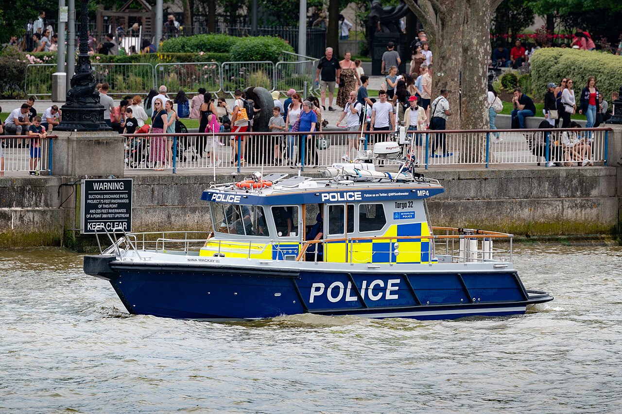
The river is policed by five police forces. The Thames Division is the River Police arm of London's Metropolitan Police, while Surrey Police, Thames Valley Police, Essex Police and Kent Police have responsibilities on their parts of the river outside the metropolitan area. There is also a London Fire Brigade fire boat on the river. The river claims a number of lives each year.[70]
As a result of the Marchioness disaster in 1989 when 51 people died, the Government asked the Maritime and Coastguard Agency, the Port of London Authority and the Royal National Lifeboat Institution (RNLI) to work together to set up a dedicated Search and Rescue service for the tidal River Thames. As a result, there are four lifeboat stations on the River Thames: at Teddington, Chiswick, Tower (based at Victoria Embankment/Waterloo Bridge) and Gravesend.[71]


The Thames is maintained for navigation by powered craft from the estuary as far as Lechlade in Gloucestershire and for very small craft to Cricklade. The original towpath extends upstream from Putney Bridge as far as the connection with the now disused Thames and Severn Canal at Inglesham, one and a half miles upstream of the last boat lock near Lechlade. From Teddington Lock to the head of navigation, the navigation authority is the Environment Agency. Between the sea and Teddington Lock, the river forms part of the Port of London and navigation is administered by the Port of London Authority. Both the tidal river through London and the non-tidal river upstream are intensively used for leisure navigation.
The non-tidal River Thames is divided into reaches by the 45 locks. The locks are staffed for the greater part of the day, but can be operated by experienced users out of hours. This part of the Thames links to existing navigations at the River Wey Navigation, the River Kennet and the Oxford Canal. All craft using it must be licensed. The Environment Agency has patrol boats (named after tributaries of the Thames) and can enforce the limit strictly since river traffic usually has to pass through a lock at some stage. A speed limit of 8 km/h (4.3 kn) applies. There are pairs of transit markers at various points along the non-tidal river that can be used to check speed – a boat travelling legally taking a minute or more to pass between the two markers.
The tidal river is navigable to large ocean-going ships as far upstream as the Pool of London and London Bridge. Although London's upstream enclosed docks have closed and central London sees only the occasional visiting cruise ship or warship, the tidal river remains one of Britain's main ports. Around 60 active terminals cater for shipping of all types including ro-ro ferries, cruise liners and vessels carrying containers, vehicles, timber, grain, paper, crude oil, petroleum products, liquified petroleum gas etc.[72] There is a regular traffic of aggregate or refuse vessels, operating from wharves in the west of London. The tidal Thames links to the canal network at the River Lea Navigation, the Regent's Canal at Limehouse Basin and the Grand Union Canal at Brentford.
Upstream of Wandsworth Bridge a speed limit of 8 kn (15 km/h) is in force for powered craft to protect the riverbank environment and to provide safe conditions for rowers and other river users. There is no absolute speed limit on most of the Tideway downstream of Wandsworth Bridge, although boats are not allowed to create undue wash. Powered boats are limited to 12 knots between Lambeth Bridge and downstream of Tower Bridge, with some exceptions. Boats can be approved by the harbour master to travel at speeds of up to 30 knots from below Tower Bridge to past the Thames Barrier.[73]
The administrative powers of the Thames Conservancy to control river traffic and manage flows have been taken on with some modifications by the Environment Agency and, in respect of the Tideway part of the river, such powers are split between the agency and the Port of London Authority.
In the Middle Ages the Crown exercised general jurisdiction over the Thames, one of the four royal rivers, and appointed water bailiffs to oversee the river upstream of Staines. The City of London exercised jurisdiction over the tidal Thames. However, navigation was increasingly impeded by weirs and mills, and in the 14th century the river probably ceased to be navigable for heavy traffic between Henley and Oxford. In the late 16th century the river seems to have been reopened for navigation from Henley to Burcot.[74]
The first commission concerned with the management of the river was the Oxford-Burcot Commission, formed in 1605 to make the river navigable between Burcot and Oxford.
In 1751 the Thames Navigation Commission was formed to manage the whole non-tidal river above Staines. The City of London long claimed responsibility for the tidal river. A long running dispute between the City and the Crown over ownership of the river was not settled until 1857, when the Thames Conservancy was formed to manage the river from Staines downstream. In 1866 the functions of the Thames Navigation Commission were transferred to the Thames Conservancy, which thus had responsibility for the whole river.
In 1909 the powers of the Thames Conservancy over the tidal river, below Teddington, were transferred to the Port of London Authority.
In 1974 the Thames Conservancy became part of the new Thames Water Authority. When Thames Water was privatised in 1990, its river management functions were transferred to the National Rivers Authority, in 1996 subsumed into the Environment Agency.
In 2010, the Thames won the world's largest environmental award at the time, the $350,000 International Riverprize, presented at the International Riversymposium in Perth, WA in recognition of the substantial and sustained restoration of the river by many hundreds of organisations and individuals since the 1950s.
Until enough crossings were established, the river presented a formidable barrier, with Belgic tribes and Anglo-Saxon kingdoms being defined by which side of the river they were on. When English counties were established their boundaries were partly determined by the Thames. On the northern bank were the ancient counties of Gloucestershire, Oxfordshire, Buckinghamshire, Middlesex and Essex. On the southern bank were the counties of Wiltshire, Berkshire, Surrey and Kent.
Counting bridges to the far bank or to an island connected to such, the Thames has 223. From source to mouth a channel can be found with 138 bridges, plus the temporary footbridge often added during Reading Festival. The river is heavily splayed in Ashton Keynes and Oxford. Where the river is wide 17 tunnels that have been built, many of which for rail or notable electricity cables. The crossings have changed the dynamics and made cross-river development and shared responsibilities more practicable. In 1965, upon the creation of Greater London, the London Borough of Richmond upon Thames incorporated the former 'Middlesex and Surrey' banks, Spelthorne moved from Middlesex to Surrey; and further changes in 1974 moved some of the boundaries away from the river. For example, some areas were transferred from Berkshire to Oxfordshire, and from Buckinghamshire to Berkshire. In many river sports and traditions – for example in rowing – the banks are referred to by their traditional county names.


Many of the present-day road bridges are on the site of earlier fords, ferries and wooden bridges. Swinford Bridge, known as the five pence toll bridge, replaced a ferry that in turn replaced a ford. The earliest known major crossings of the Thames by the Romans were at London Bridge and Staines Bridge. At Folly Bridge in Oxford the remains of an original Saxon structure can be seen, and medieval stone bridges such as Newbridge, Wallingford Bridge[75] and Abingdon Bridge are still in use.
Kingston's growth is believed to stem from its having the only crossing between London Bridge and Staines until the beginning of the 18th century. During the 18th century, many stone and brick road bridges were built from new or to replace existing bridges both in London and along the length of the river. These included Putney Bridge, Westminster Bridge, Datchet Bridge, Windsor Bridge and Sonning Bridge.
Several central London road bridges were built in the 19th century, most conspicuously Tower Bridge, the only Bascule bridge on the river, designed to allow ocean-going ships to pass beneath it. The most recent road bridges are the bypasses at Isis Bridge and Marlow By-pass Bridge and the motorway bridges, most notably the two on the M25 route: Queen Elizabeth II Bridge and M25 Runnymede Bridge.
Railway development in the 19th century resulted in a spate of bridge building including Blackfriars Railway Bridge and Charing Cross (Hungerford) Railway Bridge in central London, and the railway bridges by Isambard Kingdom Brunel at Maidenhead Railway Bridge, Gatehampton Railway Bridge and Moulsford Railway Bridge.
The world's first underwater tunnel was Marc Brunel's Thames Tunnel built in 1843 and now used to carry the East London Line. The Tower Subway was the first railway under the Thames, which was followed by all the deep-level tube lines. Road tunnels were built in East London at the end of the 19th century, being the Blackwall Tunnel and the Rotherhithe Tunnel. The latest tunnels are the Dartford Crossings.
Many foot crossings were established across the weirs that were built on the non-tidal river, and some of these remained when the locks were built – for example at Benson Lock. Others were replaced by a footbridge when the weir was removed as at Hart's Weir Footbridge. Around 2000, several footbridges were added along the Thames, either as part of the Thames Path or in commemoration of the millennium. These include Temple Footbridge, Bloomers Hole Footbridge, the Hungerford Footbridges and the Millennium Bridge, all of which have distinctive design characteristics.
Before bridges were built, the main means of crossing the river was by ferry. A significant number of ferries were provided specifically for navigation purposes. When the towpath changed sides, it was necessary to take the towing horse and its driver across the river. This was no longer necessary when barges were powered by steam. Some ferries still operate on the river. The Woolwich Ferry carries cars and passengers across the river in the Thames Gateway and links the North Circular and South Circular roads. Upstream are smaller pedestrian ferries, for example Hampton Ferry and Shepperton to Weybridge Ferry, the last being the only non-permanent crossing that remains on the Thames Path.
Whilst the use of the river to drive water-mills has largely died out, there has been a recent trend to use the head of water provided by the river's existing weirs to drive small hydro-electric power plants, using Archimedes screw turbines. Operational schemes include:
Treated waste water from all the towns and villages in the Thames catchment flow into the Thames via sewage treatment plants. This includes all that from Swindon, Oxford, Berkshire and almost all of Surrey.
However, untreated sewage still often enters the Thames during wet weather. When London's sewerage system was built, sewers were designed to overflow through discharge points along the river during heavy storms. Originally, this would happen once or twice a year, however overflows now happen once a week on average.[81] In 2013, over 55m tonnes of dilute raw sewage overflowed into the tidal Thames. These discharge events kill fish, leave raw sewage on the riverbanks, and decrease the water quality of the river.[82][83] A 2022 investigation by the Environment Agency found "widespread and serious non-compliance with the relevant regulations".[84][85] Thames Water has also published an interactive map showing discharges as they happen.[86][87]
To reduce the release of this into the river, the Thames Tideway Scheme is currently under construction at a cost of £4.2 billion. This project will collect sewage from the Greater London area before it overflows, before channelling it down a 25 km (15 mi) tunnel underneath the tidal Thames, so that it can be treated at Beckton Sewage Treatment Works.[88][89] The project is planned to reduce sewage discharges into the Thames in the Greater London area by 90%, dramatically increasing water quality.[90] After its completion, it is estimated that two million tonnes of sewage will still enter the Thames each year.[91]
Mercury (Hg) is an environmentally persistent heavy metal which can be toxic to marine life and humans. Sixty sediment cores of 1 m in depth, spanning the entire tidal River Thames between Brentford and the Isle of Grain, have been analysed for total Hg. The sediment records show a clear rise and fall of Hg pollution through history.[92] Mercury concentrations in the River Thames decrease downstream from London to the outer Estuary, with the total Hg levels ranging from 0.01 to 12.07 mg/kg, giving a mean of 2.10 mg/kg which is higher than many other UK and European river estuaries.[93][92]
The most sedimentary-hosted Hg pollution in the Thames estuary occurs in the central London area between Vauxhall Bridge and Woolwich.[92] The majority of sediment cores show a clear decrease in Hg concentrations close to the surface, which is attributed to an overall reduction in polluting activities as well as improved effectiveness of recent environmental legalisation and river management (e.g. Oslo-Paris convention).
The Thames has relatively high levels of plastic pollution, with an estimated 94,000 microplastics per second moving through some parts of the river. These microplastics come from the breakdown of larger items but also glitter and microbeads from cosmetics.[94]
One study found one-fifth of macroplastics found in the river were from food packaging.[95]
There are several watersports prevalent on the Thames, with many clubs encouraging participation and organising racing and inter-club competitions.

The Thames is the historic heartland of rowing in the United Kingdom. There are over 200 clubs on the river, and over 8,000 members of British Rowing (over 40% of its membership).[96] Most towns and districts of any size on the river have at least one club. Internationally attended centres are Oxford, Henley-on-Thames and events and clubs on the stretch of river from Chiswick to Putney.
Two rowing events on the River Thames are traditionally part of the wider English sporting calendar:
The University Boat Race (between Oxford and Cambridge) takes place in late March or early April, on the Championship Course from Putney to Mortlake in the west of London.
Henley Royal Regatta takes place over five days at the start of July in the upstream town of Henley-on-Thames. Besides its sporting significance the regatta is an important date on the English social calendar alongside events like Royal Ascot and Wimbledon.
Other significant or historic rowing events on the Thames include:
Other regattas, head races and university bumping races are held along the Thames which are described under Rowing on the River Thames.

Sailing is practised on both the tidal and non-tidal reaches of the river. The highest club upstream is at Oxford. The most popular sailing craft used on the Thames are lasers, GP14s and Wayfarers. One sailing boat unique to the Thames is the Thames Rater, which is sailed around Raven's Ait.
Skiffing has dwindled in favour of private motor boat ownership but is competed on the river in the summer months. Six clubs and a similar number of skiff regattas exist from the Skiff Club, Teddington upstream.
Unlike the "pleasure punting" common on the Cherwell in Oxford and the Cam in Cambridge, punting on the Thames is competitive as well as recreational and uses narrower craft, typically based at the few skiff clubs.
Kayaking and canoeing are common, with sea kayakers using the tidal stretch for touring. Kayakers and canoeists use the tidal and non-tidal sections for training, racing and trips. Whitewater playboaters and slalom paddlers are catered for at weirs like those at Hurley Lock, Sunbury Lock and Boulter's Lock. At Teddington just before the tidal section of the river starts is Royal Canoe Club, said to be the oldest in the world and founded in 1866. Since 1950, almost every year at Easter, long distance canoeists have been competing in what is now known as the Devizes to Westminster International Canoe Race,[97] which follows the course of the Kennet and Avon Canal, joins the River Thames at Reading and runs right up to a grand finish at Westminster Bridge.
In 2006, British swimmer and environmental campaigner Lewis Pugh became the first person to swim the full length of the Thames from outside Kemble to Southend-on-Sea to draw attention to the severe drought in England which saw record temperatures indicative of a degree of global warming. The 202 mi (325 km) swim took him 21 days to complete. The official headwater of the river had stopped flowing due to the drought, forcing Pugh to run the first 26 mi (42 km).[98]
Since June 2012, the Port of London Authority has made a by-law, which it enforces, that bans swimming between Putney Bridge and Crossness, Thamesmead (thus including all of central London), without obtaining prior permission, on the grounds that swimmers in that area of the river endanger not only themselves, due to the strong current of the river, but also other river users.[99]
Organised swimming events take place at various points generally upstream of Hampton Court, including Windsor, Marlow and Henley.[100][101][102] In 2011, comedian David Walliams swam the 140 mi (230 km) from Lechlade to Westminster Bridge and raised over £1 million for charity.[103]
In non-tidal stretches swimming was, and still is, a leisure and fitness activity among experienced swimmers where safe, deeper outer channels are used in times of low stream.[104]
A Thames meander is a long-distance journey over all or part of the Thames by running, swimming or using any of the above means. It is often carried out as an athletic challenge in a competition or for a record attempt.
The River Thames has been a subject for artists, great and minor, over the centuries. Four major artists with works based on the Thames are Canaletto, J. M. W. Turner, Claude Monet and James Abbott McNeill Whistler.[105] The 20th-century British artist Stanley Spencer produced many works at Cookham.[106]
John Kaufman's sculpture The Diver: Regeneration is sited in the Thames near Rainham.[107]
The river and bridges are portrayed as being destroyed – together with much of London – in the film Independence Day 2.[108]


The Thames is mentioned in many works of literature including novels, diaries and poetry. It is the central theme in three in particular:
Three Men in a Boat by Jerome K. Jerome, first published in 1889, is a humorous account of a boating holiday on the Thames between Kingston and Oxford. The book was intended initially to be a serious travel guide, with accounts of local history of places along the route, but the humorous elements eventually took over. The landscape and features of the Thames as described by Jerome are virtually unchanged, and the book's enduring popularity has meant that it has never been out of print since it was first published.
Charles Dickens' Our Mutual Friend (written in the years 1864–65) describes the river in a grimmer light. It begins with a scavenger and his daughter pulling a dead man from the river near London Bridge, to salvage what the body might have in its pockets, and leads to its conclusion with the deaths of the villains drowned in Plashwater Lock upstream. The workings of the river and the influence of the tides are described with great accuracy. Dickens opens the novel with this sketch of the river, and the people who work on it:
In these times of ours, though concerning the exact year there is no need to be precise, a boat of dirty and disreputable appearance, with two figures in it, floated on the Thames, between Southwark Bridge which is of iron, and London Bridge which is of stone, as an autumn evening was closing in.The figures in this boat were those of a strong man with ragged grizzled hair and a sun-browned face, and a girl of nineteen or twenty. The girl rowed, pulling a pair of sculls very easily; the man with the rudder-lines slack in his hands, and his hands loose in his waisteband, kept an eager look-out.
Kenneth Grahame's The Wind in the Willows, written in 1908, is set in the middle to upper reaches of the river. It starts as a tale of anthropomorphic characters "simply messing about in boats" but develops into a more complex story combining elements of mysticism with adventure and reflection on Edwardian society. It is generally considered one of the most beloved works of children's literature[109] and the illustrations by E.H.Shepard and Arthur Rackham feature the Thames and its surroundings.
The river almost inevitably features in many books set in London. Most of Dickens' other novels include some aspect of the Thames. Oliver Twist finishes in the slums and rookeries along its south bank. The Sherlock Holmes stories by Arthur Conan Doyle often visit riverside parts as in The Sign of Four. In Heart of Darkness by Joseph Conrad, the serenity of the contemporary Thames is contrasted with the savagery of the Congo River, and with the wilderness of the Thames as it would have appeared to a Roman soldier posted to Britannia two thousand years before. Conrad also gives a description of the approach to London from the Thames Estuary in his essays The Mirror of the Sea (1906). Upriver, Henry James' Portrait of a Lady uses a large riverside mansion on the Thames as one of its key settings.
Literary non-fiction works include Samuel Pepys' diary, in which he recorded many events relating to the Thames including the Fire of London. He was disturbed while writing it in June 1667 by the sound of gunfire as Dutch warships broke through the Royal Navy on the Thames.
In poetry, William Wordsworth's sonnet On Westminster Bridge closes with the lines:
T. S. Eliot makes several references to the Thames in The Fire Sermon, Section III of The Waste Land.
The Sweet Thames line is taken from Edmund Spenser's Prothalamion which presents a more idyllic image:
Also writing of the upper reaches is Matthew Arnold in The Scholar Gypsy:
Wendy Cope's poem 'After the Lunch' is set on Waterloo Bridge, beginning:
Dylan Thomas mentions the Thames in his poem "A Refusal to Mourn the Death, by Fire, of a Child in London". "London's Daughter", the subject of the poem, lays "Deep with the first dead...secret by the unmourning water of the riding Thames".

Science-fiction novels make liberal use of a futuristic Thames. The utopian News from Nowhere by William Morris is mainly the account of a journey through the Thames valley in a socialist future. The Thames features in H. G. Wells' The War of the Worlds. The Thames also features prominently in Philip Pullman's His Dark Materials trilogy, as a communications artery for the waterborne Gyptian people of Oxford and the Fens, and as a prominent setting for his novel La Belle Sauvage.
In The Deptford Mice trilogy by Robin Jarvis, the Thames appears several times. In one book, rat characters swim through it to Deptford. Winner of the Nestlé Children's Book Prize Gold Award I, Coriander, by Sally Gardner is a fantasy novel in which the heroine lives on the banks of the Thames. Mark Wallington describes a journey up the Thames in a camping skiff, in his 1989 book Boogie up the River.
Many of the principal characters of the Rivers of London urban fantasy series by Ben Aaronovitch are genii locorum (local gods) associated with River Thames and its tributaries. This includes Father Thames, the original god of the Thames but now (in the books) confined to non-tidal reaches above Teddington Lock and Mama Thames the goddess of the tidal Thames below Teddington.
The Water Music composed by George Frideric Handel premiered on 17 July 1717, when King George I requested a concert on the River Thames. The concert was performed for King George I on his barge and he is said to have enjoyed it so much that he ordered the 50 exhausted musicians to play the suites three times on the trip.
The song 'Old Father Thames' was recorded by Peter Dawson at Abbey Road Studios in 1933 and by Gracie Fields five years later. Jessie Matthews sings "My river" in the 1938 film Sailing Along, and the tune is the centrepiece of a major dance number near the end of the film.
The Sex Pistols played a concert on the Queen Elizabeth Riverboat on 7 June 1977, Queen Elizabeth II's Silver Jubilee year, while sailing down the river. The choral line "(I) (liaised) live by the river" in the song "London Calling" by the Clash refers to the River Thames.
Two songs by the Kinks feature the Thames as the setting of the first song's title and, for the second song, arguably in its mention of 'the river': "Waterloo Sunset" is about a couple's meetings on Waterloo Bridge, London and starts: "Dirty old river, must you keep rolling, flowing into the night?" and continues "Terry meets Julie, Waterloo station" and "...but Terry and Julie cross over the river where they feel safe and sound...". "See My Friends" continually refers to the singer's friends "playing 'cross the river" instead of the girl who "just left". Furthermore, Ray Davies as a solo artist refers to the River Thames in his "London Song".[110]
Ewan MacColl's "Sweet Thames, Flow Softly", written in the early 1960s, is a tragic love ballad set on trip up the river (see Edmund Spenser's love poem's refrain above). Culture Club are travelling the River Thames in a riverboat in the video for "Karma Chameleon". English musician Imogen Heap wrote a song from the point of view of the River Thames entitled "You Know Where To Find Me". The song was released in 2012 on 18 October as the sixth single from her fourth album Sparks.[111]
The 1928 Thames flood was a disastrous flood of the River Thames that affected much of riverside London on 7 January 1928, as well as places further downriver. Fourteen people were drowned in London and thousands were made homeless when flood waters poured over the top of the Thames Embankment and part of the Chelsea Embankment collapsed. It was the last major flood to affect central London, and, particularly following the disastrous North Sea flood of 1953, helped lead to the implementation of new flood-control measures that culminated in the construction of the Thames Barrier in the 1970s.
The 1947 Thames flood was overall the worst 20th-century flood of the River Thames, affecting much of the Thames Valley as well as elsewhere in England during the middle of March 1947 after a very severe winter.
The floods were caused by 4.6 in (120 mm) of rainfall (including snow); the peak flow was 61.7×10⁹ L (13.6×10⁹ imp gal) of water per day and the damage cost a total of £12 million to repair.[112]War damage to some of the locks made matters worse.
Other significant Thames floods since 1947 have occurred in 1968, 1993, 1998, 2000, 2003, 2006 and 2014.

On the night of 31 January, the North Sea flood of 1953 devastated the island, taking the lives of 58 islanders and forcing the temporary evacuation of the 13,000 residents.[113] Canvey is consequently protected by modern sea defences comprising 15 mi (24 km) of concrete seawall.[114] Many of the victims were in the holiday bungalows of the eastern Newlands estate and perished as the water reached ceiling level. The small village area of the island is approximately two foot (0.6 m) above sea level and consequently escaped the effects of the flood.
_-_Claude_Monet.jpg/1280px-Brooklyn_Museum_-_Houses_of_Parliament_Sunlight_Effect_(Le_Parlement_effet_de_soleil)_-_Claude_Monet.jpg)


