Marte contiene agua, aunque principalmente en forma de permafrost . Como capa superficial superior, el agua aparece fácilmente visible en algunos lugares, como el cráter polar Korolev .
Lo que se pensaba que eran salmueras líquidas de bajo volumen en el suelo marciano poco profundo , también llamadas líneas de pendiente recurrentes , [2] [3] pueden ser granos de arena y polvo que fluyen deslizándose cuesta abajo para formar vetas oscuras. [4] Si bien la mayor parte del hielo de agua está enterrado, está expuesto en la superficie en varios lugares de Marte. En las latitudes medias, está expuesto por cráteres de impacto, escarpados acantilados y barrancos. [5] [6] [7] Además, el hielo de agua también es visible en la superficie en la capa de hielo del polo norte . [8] También hay abundante hielo de agua debajo de la capa de hielo permanente de dióxido de carbono en el polo sur marciano. Se han detectado más de 5 millones de km3 de hielo en o cerca de la superficie de Marte, suficiente para cubrir todo el planeta hasta una profundidad de 35 metros (115 pies). [9] Incluso más hielo podría estar encerrado en el subsuelo profundo. [10] [11]
Es posible que hoy en día exista algo de agua líquida de forma transitoria en la superficie marciana, pero limitada a trazas de humedad disuelta de la atmósfera y películas delgadas, que son entornos desafiantes para la vida conocida. [3] [12] [13] No se ha descubierto evidencia de agua líquida actual en la superficie del planeta porque, en condiciones marcianas típicas (presión de vapor de agua <1 Pa [14] y presión atmosférica ambiental ~700 Pa [15] ), el hielo de agua calentado en la superficie marciana se sublimaría a velocidades de hasta 4 metros por año. [16] Antes de hace unos 3.800 millones de años , Marte puede haber tenido una atmósfera más densa y temperaturas superficiales más altas, [17] [18] [19] [20] lo que potencialmente permitió mayores cantidades de agua líquida en la superficie, [21] [22] [23] [24] posiblemente incluyendo un gran océano [25] [26] [27] [28] que puede haber cubierto un tercio del planeta. [29] [30] [31] El agua también aparentemente ha fluido a través de la superficie durante períodos cortos en varios intervalos más recientemente en la historia de Marte. [32] [33] [34] Aeolis Palus en el cráter Gale , explorado por el rover Curiosity , son los restos geológicos de un antiguo lago de agua dulce que podría haber sido un entorno hospitalario para la vida microbiana . [35][36] [37] [38] El inventario actual de agua en Marte se puede estimar a partir de imágenes de naves espaciales, técnicas de teledetección (mediciones espectroscópicas , [39] [40] radar , [41] etc.), e investigaciones de superficie de módulos de aterrizaje y vehículos exploradores. [42] [43] La evidencia geológica de agua pasada incluye enormes canales de salida tallados por inundaciones, [44] antiguas redes de valles fluviales , [45] [46] deltas , [47] y lechos de lagos ; [48] [49] [50] [51] y la detección de rocas y minerales en la superficie que solo podrían haberse formado en agua líquida. [52] Numerosas características geomórficas sugieren la presencia de hielo terrestre ( permafrost ) [53] y el movimiento del hielo en los glaciares , tanto en el pasado reciente [54] [55] [56] [57] como en el presente. [58] Los barrancos y las líneas de pendiente a lo largo de los acantilados y las paredes de los cráteres sugieren que el agua que fluye continúa dando forma a la superficie de Marte, aunque en un grado mucho menor que en el pasado antiguo.
Aunque la superficie de Marte era periódicamente húmeda y podría haber sido hospitalaria para la vida microbiana hace miles de millones de años, [59] el ambiente actual en la superficie es seco y bajo cero, probablemente presentando un obstáculo insuperable para los organismos vivos. Además, Marte carece de una atmósfera gruesa, capa de ozono y campo magnético , lo que permite que la radiación solar y cósmica golpee la superficie sin impedimentos. Los efectos dañinos de la radiación ionizante en la estructura celular es otro de los principales factores limitantes en la supervivencia de la vida en la superficie. [60] [61] Por lo tanto, las mejores ubicaciones potenciales para descubrir vida en Marte pueden estar en entornos subterráneos. [62] [63] [64] Se han encontrado grandes cantidades de hielo subterráneo en Marte; el volumen de agua detectado es equivalente al volumen de agua en el Lago Superior . [65] [66] [67] En 2018, los científicos informaron el descubrimiento de un lago subglacial en Marte, a 1,5 km (0,93 mi) por debajo de la capa de hielo del polo sur , con una extensión horizontal de unos 20 km (12 mi), el primer cuerpo estable conocido de agua líquida en el planeta, [68] [69] pero trabajos posteriores han cuestionado esta detección. [70] [71]
Comprender la extensión y la situación del agua en Marte es vital para evaluar el potencial del planeta para albergar vida y proporcionar recursos utilizables para la futura exploración humana . Por esta razón, "Seguir el agua" fue el tema científico del Programa de Exploración de Marte (MEP) de la NASA en la primera década del siglo XXI. Las misiones de la NASA y la ESA , incluidas 2001 Mars Odyssey , Mars Express , Mars Exploration Rovers (MER), Mars Reconnaissance Orbiter (MRO) y Mars Phoenix lander, han proporcionado información sobre la abundancia y distribución del agua en Marte. [72] Mars Odyssey, Mars Express, MRO y el rover Curiosity de Mars Science Lander todavía están en funcionamiento y se siguen realizando descubrimientos. En septiembre de 2020, los científicos confirmaron la existencia de varios grandes lagos de agua salada bajo el hielo en la región polar sur del planeta Marte . Según uno de los investigadores, "identificamos el mismo cuerpo de agua [como se sugirió anteriormente en una detección inicial preliminar], pero también encontramos otros tres cuerpos de agua alrededor del principal... Es un sistema complejo". [73] [74] En marzo de 2021, los investigadores informaron que ha quedado una cantidad considerable de agua en el antiguo Marte, pero que, en su mayor parte, probablemente ha quedado secuestrada en las rocas y la corteza del planeta a lo largo de los años. [75] [76] [77] [78] En agosto de 2024, un análisis más detallado de los datos del módulo de aterrizaje InSight Mars de la NASA permitió a los investigadores descubrir un depósito de agua líquida a profundidades de 10 a 20 kilómetros (6,2 a 12,4 millas) bajo la corteza marciana. [79]
Antecedentes históricos
La idea de que había agua en Marte precedió a la era espacial en cientos de años. Los primeros observadores telescópicos supusieron correctamente que los casquetes polares blancos y las nubes eran indicios de la presencia de agua. Estas observaciones, junto con el hecho de que Marte tiene un día de 24 horas, llevaron al astrónomo William Herschel a declarar en 1784 que Marte probablemente ofrecía a sus habitantes "una situación en muchos aspectos similar a la nuestra". [80]
A principios del siglo XX, la mayoría de los astrónomos reconocieron que Marte era mucho más frío y seco que la Tierra. Ya no se aceptaba la presencia de océanos, por lo que el paradigma cambió a una imagen de Marte como un planeta "moribundo" con solo una cantidad exigua de agua. Las áreas oscuras, que se podía ver que cambiaban según la estación, se consideraron entonces extensiones de vegetación. [81] La persona más responsable de popularizar esta visión de Marte fue Percival Lowell (1855-1916), quien imaginó una raza de marcianos construyendo una red de canales para llevar agua desde los polos hasta los habitantes del ecuador. Aunque generaron un enorme entusiasmo público, las ideas de Lowell fueron rechazadas por la mayoría de los astrónomos. La opinión mayoritaria del establishment científico de la época probablemente esté mejor resumida por el astrónomo inglés Edward Walter Maunder (1851-1928), quien comparó el clima de Marte con las condiciones en la cima de un pico de veinte mil pies (6100 m) en una isla ártica [82] donde solo se podría esperar que sobrevivieran los líquenes .
Mientras tanto, muchos astrónomos estaban perfeccionando la herramienta de la espectroscopia planetaria con la esperanza de determinar la composición de la atmósfera marciana . Entre 1925 y 1943, Walter Adams y Theodore Dunham, en el Observatorio del Monte Wilson, intentaron identificar oxígeno y vapor de agua en la atmósfera marciana, con resultados generalmente negativos. El único componente de la atmósfera marciana conocido con certeza era el dióxido de carbono (CO 2 ), identificado espectroscópicamente por Gerard Kuiper en 1947. [83] El vapor de agua no se detectó inequívocamente en Marte hasta 1963. [84]
La Mariner 4 adquirió esta imagen que muestra un planeta estéril (1965).
La composición de los casquetes polares , que se supone que son hielo de agua desde la época de Cassini (1666), fue cuestionada por algunos científicos a finales del siglo XIX que favorecían el hielo de CO2 , debido a la baja temperatura general del planeta y la aparente falta de agua apreciable. Esta hipótesis fue confirmada teóricamente por Robert Leighton y Bruce Murray en 1966. [85] Hoy se sabe que los casquetes invernales en ambos polos están compuestos principalmente de hielo de CO2 , pero que un casquete permanente (o perenne) de hielo de agua permanece durante el verano en el polo norte. En el polo sur, un pequeño casquete de hielo de CO2 permanece durante el verano, pero este casquete también está sustentado por hielo de agua.
La última pieza del rompecabezas del clima marciano fue proporcionada por el Mariner 4 en 1965. Las imágenes granuladas de televisión de la nave espacial mostraron una superficie dominada por cráteres de impacto , lo que implicaba que la superficie era muy antigua y no había experimentado el nivel de erosión y actividad tectónica visto en la Tierra. La poca erosión significaba que el agua líquida probablemente no había jugado un papel importante en la geomorfología del planeta durante miles de millones de años. [86] Además, las variaciones en la señal de radio de la nave espacial a medida que pasaba detrás del planeta permitieron a los científicos calcular la densidad de la atmósfera. Los resultados mostraron una presión atmosférica inferior al 1% de la de la Tierra a nivel del mar, lo que efectivamente excluía la existencia de agua líquida, que herviría o se congelaría rápidamente a presiones tan bajas. [87] Así, nació una visión de Marte de un mundo muy parecido a la Luna, pero con solo una pizca de atmósfera para soplar el polvo a su alrededor. Esta visión de Marte duraría casi otra década hasta que la Mariner 9 mostró un Marte mucho más dinámico con indicios de que el ambiente pasado del planeta era más clemente que el actual.
Durante muchos años se creyó que los restos observados de inundaciones fueron causados por la liberación de agua de un nivel freático global, pero una investigación publicada en 2015 revela que los depósitos regionales de sedimentos y hielo emplazados 450 millones de años antes fueron la fuente. [91] "La deposición de sedimentos de los ríos y el deshielo glacial llenaron cañones gigantescos debajo del océano primigenio contenido dentro de las tierras bajas del norte del planeta. Fue el agua preservada en estos sedimentos de los cañones la que luego se liberó en forma de grandes inundaciones, cuyos efectos se pueden ver hoy en día". [44] [91]
Evidencias de rocas y minerales
Se acepta ampliamente que Marte tuvo abundante agua muy temprano en su historia, [92] [93] pero todas las grandes áreas de agua líquida han desaparecido desde entonces. Una fracción de esta agua se retiene en el Marte moderno tanto en forma de hielo como encerrada en la estructura de abundantes materiales ricos en agua, incluidos minerales arcillosos ( filosilicatos ) y sulfatos . [94] [95] Los estudios de las proporciones isotópicas del hidrógeno indican que los asteroides y cometas de más allá de las 2,5 unidades astronómicas (UA) proporcionan la fuente de agua de Marte, [96] que actualmente totaliza entre el 6% y el 27% del océano actual de la Tierra. [96]
Historia del agua en Marte. Los números representan cuántos miles de millones de años atrás.
Agua en productos de meteorización (minerales acuosos)
Un efecto directo de la meteorización química es el consumo de agua y otras especies químicas reactivas, extrayéndolas de depósitos móviles como la atmósfera y la hidrosfera y secuestrándolas en rocas y minerales. [99] Actualmente se desconoce la cantidad de agua en la corteza marciana almacenada como minerales hidratados , pero puede ser bastante grande. [100] Por ejemplo, los modelos mineralógicos de los afloramientos rocosos examinados por los instrumentos del rover Opportunity en Meridiani Planum sugieren que los depósitos de sulfato allí podrían contener hasta un 22% de agua en peso. [101]
En la Tierra, todas las reacciones de meteorización química involucran agua en algún grado. [102] Por lo tanto, muchos minerales secundarios en realidad no incorporan agua, pero aún requieren agua para formarse. Algunos ejemplos de minerales secundarios anhidros incluyen muchos carbonatos , algunos sulfatos (por ejemplo, anhidrita ) y óxidos metálicos como el mineral de óxido de hierro hematita . En Marte, algunos de estos productos de meteorización pueden formarse teóricamente sin agua o con escasas cantidades presentes como hielo o en películas delgadas a escala molecular ( monocapas ). [103] [104] El grado en que estos procesos de meteorización exóticos operan en Marte aún es incierto. Los minerales que incorporan agua o se forman en presencia de agua generalmente se denominan "minerales acuosos".
Los minerales acuosos son indicadores sensibles del tipo de entorno que existía cuando se formaron los minerales. La facilidad con la que ocurren las reacciones acuosas (ver energía libre de Gibbs ) depende de la presión, la temperatura y las concentraciones de las especies gaseosas y solubles involucradas. [105] Dos propiedades importantes son el pH y el potencial de oxidación-reducción (E h ) . Por ejemplo, el mineral de sulfato jarosita se forma solo en agua de pH bajo (altamente ácida). Los filosilicatos generalmente se forman en agua de pH neutro a alto (alcalina). E h es una medida del estado de oxidación de un sistema acuoso. Juntos, E h y pH indican los tipos de minerales que son termodinámicamente más estables y, por lo tanto, es más probable que se formen a partir de un conjunto dado de componentes acuosos. Por lo tanto, las condiciones ambientales pasadas en Marte, incluidas las propicias para la vida, se pueden inferir a partir de los tipos de minerales presentes en las rocas.
Alteración hidrotermal
Los minerales acuosos también pueden formarse en el subsuelo por la migración de fluidos hidrotermales a través de poros y fisuras. La fuente de calor que impulsa un sistema hidrotermal puede ser cuerpos de magma cercanos o calor residual de grandes impactos . [106] Un tipo importante de alteración hidrotermal en la corteza oceánica de la Tierra es la serpentinización , que ocurre cuando el agua de mar migra a través de rocas ultramáficas y basálticas. Las reacciones agua-roca dan como resultado la oxidación del hierro ferroso en olivino y piroxeno para producir hierro férrico (como el mineral magnetita ) produciendo hidrógeno molecular (H 2 ) como subproducto. El proceso crea un entorno altamente alcalino y reductor (bajo Eh) que favorece la formación de ciertos filosilicatos (minerales de serpentina) y varios minerales de carbonato, que juntos forman una roca llamada serpentinita . [107] El gas hidrógeno producido puede ser una fuente de energía importante para los organismos quimiosintéticos o puede reaccionar con CO2 para producir gas metano , un proceso que se ha considerado como una fuente no biológica de las trazas de metano reportadas en la atmósfera marciana. [108] Los minerales serpentinos también pueden almacenar mucha agua (como hidroxilo) en su estructura cristalina. Un estudio reciente ha sostenido que las serpentinitas hipotéticas en la antigua corteza de las tierras altas de Marte podrían contener una capa equivalente global (GEL) de agua de hasta 500 metros (1.600 pies) de espesor. [109] Aunque se han detectado algunos minerales serpentinos en Marte, no hay afloramientos generalizados evidentes a partir de datos de teledetección. [110] Este hecho no excluye la presencia de grandes cantidades de serpentinita ocultas en profundidad en la corteza marciana.
Tasas de meteorización
Las velocidades a las que los minerales primarios se convierten en minerales acuosos secundarios varían. Los minerales de silicato primarios cristalizan a partir del magma bajo presiones y temperaturas mucho más altas que las condiciones en la superficie de un planeta. Cuando se exponen a un entorno de superficie, estos minerales están fuera de equilibrio y tenderán a interactuar con los componentes químicos disponibles para formar fases minerales más estables. En general, los minerales de silicato que cristalizan a las temperaturas más altas (se solidifican primero en un magma que se enfría) se desgastan más rápidamente. [111] [112] En la Tierra y Marte, el mineral más común que cumple este criterio es el olivino , que se desgasta fácilmente a minerales arcillosos en presencia de agua. El olivino está muy extendido en Marte, [113] lo que sugiere que la superficie de Marte no ha sido alterada de manera generalizada por el agua; abundante evidencia geológica sugiere lo contrario. [114] [115] [116]
Se han encontrado más de 60 meteoritos que vinieron de Marte. [117] Algunos de ellos contienen evidencia de que estuvieron expuestos al agua cuando estaban en Marte. Algunos meteoritos marcianos llamados shergottitas basálticas , parecen (por la presencia de carbonatos hidratados y sulfatos ) haber estado expuestos a agua líquida antes de ser expulsados al espacio. [118] [119] Se ha demostrado que otra clase de meteoritos, las nakhlitas , estaban bañadas de agua líquida hace unos 620 millones de años y que fueron expulsados de Marte hace unos 10,75 millones de años por el impacto de un asteroide. Cayeron a la Tierra en los últimos 10.000 años. [120] El meteorito marciano NWA 7034 tiene un orden de magnitud más de agua que la mayoría de los otros meteoritos marcianos. Es similar a los basaltos estudiados por las misiones rover, y se formó en la época amazónica temprana . [121] [122]
En 1996, un grupo de científicos informó de la posible presencia de microfósiles en el Allan Hills 84001 , un meteorito de Marte. [123] Muchos estudios disputaron la validez de su interpretación basándose principalmente en la forma de estos presuntos fósiles. [124] [125] Se encontró que la mayor parte de la materia orgánica en el meteorito era de origen terrestre. [126] Además, el consenso científico es que "la morfología por sí sola no puede usarse de manera inequívoca como una herramienta para la detección de vida primitiva". [127] [128] [129] La interpretación de la morfología es notoriamente subjetiva, y su uso por sí solo ha llevado a numerosos errores de interpretación. [127]
Evidencia geomorfológica
Lagos y valles fluviales
La sonda espacial Mariner 9 de 1971 provocó una revolución en nuestras ideas sobre el agua en Marte. Se encontraron enormes valles fluviales en muchas áreas. Las imágenes mostraron que las inundaciones de agua rompieron presas, excavaron valles profundos, erosionaron surcos en el lecho de roca y viajaron miles de kilómetros. [44] Las áreas de arroyos ramificados, en el hemisferio sur, sugirieron que alguna vez cayó lluvia. [130] [131] El número de valles reconocidos ha aumentado con el tiempo. La investigación publicada en junio de 2010 cartografió 40.000 valles fluviales en Marte, aproximadamente cuadruplicando el número de valles fluviales que se habían identificado anteriormente. [31] Las características desgastadas por el agua marciana se pueden clasificar en dos clases distintas: 1) redes de valles dendríticos (ramificados), a escala terrestre, ampliamente distribuidos, de la era Noéica y 2) canales de salida de la era Hespériense excepcionalmente grandes, largos, de un solo hilo, aislados . Trabajos recientes sugieren que también puede haber una clase de canales actualmente enigmáticos, más pequeños y más jóvenes ( desde el Hespériense hasta el Amazónico ) en las latitudes medias, tal vez asociados con el derretimiento local ocasional de depósitos de hielo. [132] [133]
Kasei Valles, un importante canal de salida, visto en los datos de elevación de MOLA . El flujo se produjo de abajo a la izquierda a la derecha. La imagen tiene aproximadamente 1600 km de ancho. El sistema de canales se extiende otros 1200 km al sur de esta imagen hasta Echus Chasma .
Algunas partes de Marte muestran un relieve invertido . Esto ocurre cuando los sedimentos se depositan en el fondo de un arroyo y luego se vuelven resistentes a la erosión, tal vez por cementación. Más tarde, el área puede quedar enterrada. Finalmente, la erosión elimina la capa de cobertura y los arroyos anteriores se vuelven visibles ya que son resistentes a la erosión. [134] Mars Global Surveyor encontró varios ejemplos de este proceso. [135] [136] Se han descubierto muchos arroyos invertidos en varias regiones de Marte, especialmente en la Formación Medusae Fossae , [137] el Cráter Miyamoto , [138] el Cráter Saheki , [139] y la Meseta Juventae. [140] [141]
Se han descubierto diversas cuencas lacustres en Marte. [142] Algunas son comparables en tamaño a los lagos más grandes de la Tierra, como el mar Caspio , el mar Negro y el lago Baikal . En las tierras altas del sur se encuentran lagos que fueron alimentados por redes de valles. Hay lugares que son depresiones cerradas con valles fluviales que desembocan en ellas. Se cree que estas áreas alguna vez contuvieron lagos; uno está en Terra Sirenum , cuyo desbordamiento se movió a través de Ma'adim Vallis hacia el cráter Gusev , explorado por el rover de exploración de Marte Spirit . Otro está cerca de Parana Valles y Loire Vallis. [143] Se cree que algunos lagos se formaron por precipitación, mientras que otros se formaron a partir de aguas subterráneas. [48] [49] Se estima que existieron lagos en la cuenca de Argyre, [37] [38] la cuenca de Hellas, [50] y tal vez en Valles Marineris . [51] [144] [145] Es probable que en algún momento del Noé, muchos cráteres albergaran lagos. Estos lagos son compatibles con un entorno hidrológico frío y seco (según los estándares de la Tierra) similar al de la Gran Cuenca del oeste de los EE. UU. durante el Último Máximo Glacial . [146]
Una investigación de 2010 sugiere que Marte también tenía lagos a lo largo de partes del ecuador. Aunque investigaciones anteriores habían demostrado que Marte tuvo una historia temprana cálida y húmeda que se secó hace mucho tiempo, estos lagos existieron en la Época Hespérica , un período mucho más posterior. Utilizando imágenes detalladas del Mars Reconnaissance Orbiter de la NASA , los investigadores especulan que puede haber habido un aumento de la actividad volcánica, impactos de meteoritos o cambios en la órbita de Marte durante este período para calentar la atmósfera de Marte lo suficiente como para derretir el abundante hielo presente en el suelo. Los volcanes habrían liberado gases que espesaron la atmósfera durante un período temporal, atrapando más luz solar y calentándola lo suficiente para que existiera agua líquida. En este estudio, se descubrieron canales que conectaban cuencas lacustres cerca de Ares Vallis . Cuando un lago se llenaba, sus aguas desbordaban las orillas y excavaban los canales hasta una zona más baja donde se formaría otro lago. [147] [148] Estos lagos secos serían objetivos para buscar evidencia ( biofirmas ) de vida pasada.
El 27 de septiembre de 2012, los científicos de la NASA anunciaron que el rover Curiosity encontró evidencia directa de un antiguo lecho fluvial en el cráter Gale , lo que sugiere un antiguo "flujo vigoroso" de agua en Marte. [149] [150] [151] [152] En particular, el análisis del lecho fluvial ahora seco indicó que el agua corría a 3,3 km/h (0,92 m/s), [149] posiblemente a la altura de la cadera. La prueba de agua corriente llegó en forma de guijarros redondeados y fragmentos de grava que solo podrían haber sido erosionados por fuertes corrientes líquidas. Su forma y orientación sugieren transporte de larga distancia desde encima del borde del cráter, donde un canal llamado Peace Vallis alimenta el abanico aluvial .
El lago Eridania es un lago teóricamente antiguo con una superficie de aproximadamente 1,1 millones de kilómetros cuadrados. [153] [154] [155] Su profundidad máxima es de 2.400 metros y su volumen es de 562.000 km 3 . Era más grande que el mar sin salida al mar más grande de la Tierra, el mar Caspio , y contenía más agua que todos los demás lagos marcianos juntos. El mar de Eridania contenía más de nueve veces más agua que todos los Grandes Lagos de América del Norte . [156] [157] [158] Se suponía que la superficie superior del lago estaba a la altura de las redes de valles que rodean el lago; todos terminan a la misma altura, lo que sugiere que desembocaban en un lago. [159] [160] Las investigaciones en esta cuenca con CRISM encontraron depósitos gruesos, de más de 400 metros de espesor, que contenían los minerales saponita , talco-saponita, mica rica en Fe (por ejemplo, glauconita - nontronita ), serpentina de Fe y Mg, carbonato de Mg-Fe-Ca y probable sulfuro de Fe . El sulfuro de Fe probablemente se formó en aguas profundas a partir de agua calentada por volcanes . Tal proceso, clasificado como hidrotermal, puede haber sido un lugar donde comenzó la vida en la Tierra. [158]
Mapa que muestra la profundidad estimada del agua en diferentes partes del mar de Eridania. Este mapa tiene unas 530 millas de ancho.
Depósitos de cuencas profundas del fondo del mar de Eridania. Las mesetas del fondo están allí porque estaban protegidas contra la intensa erosión por una capa profunda de agua y hielo. Las mediciones de CRISM muestran que los minerales pueden provenir de depósitos hidrotermales del fondo marino.
Diagrama que muestra cómo la actividad volcánica pudo haber provocado la deposición de minerales en el fondo del mar de Eridania. Los cloruros se depositaron a lo largo de la costa por evaporación.
Los investigadores han encontrado numerosos ejemplos de deltas que se formaron en lagos marcianos. [30] Encontrar deltas es una señal importante de que Marte alguna vez tuvo mucha agua líquida. Los deltas generalmente requieren agua profunda durante un largo período de tiempo para formarse. Además, el nivel del agua debe ser estable para evitar que los sedimentos se arrastren. Se han encontrado deltas en una amplia gama geográfica, [48] aunque hay algunos indicios de que los deltas pueden estar concentrados alrededor de los bordes del supuesto antiguo océano norte de Marte. [161]
Agua subterránea
Las capas pueden formarse a medida que el agua subterránea asciende gradualmente.
En 1979 se pensaba que los canales de salida se formaban en rupturas únicas y catastróficas de depósitos de agua subterráneos, posiblemente sellados por hielo, que descargaban cantidades colosales de agua a través de una superficie marciana por lo demás árida. [162] [163] Además, se encuentran pruebas a favor de inundaciones fuertes o incluso catastróficas en las ondulaciones gigantes en el valle de Athabasca . [164] [165] Muchos canales de salida comienzan en las características de Chaos o Chasma , lo que proporciona evidencia de la ruptura que podría haber roto un sello de hielo subterráneo. [144]
Las redes de valles ramificados de Marte no son compatibles con la formación por una liberación catastrófica repentina de agua subterránea, tanto en términos de sus formas dendríticas que no provienen de un único punto de salida, como en términos de las descargas que aparentemente fluyeron a lo largo de ellas. [166] En cambio, algunos autores han argumentado que se formaron por una filtración lenta de agua subterránea desde el subsuelo esencialmente como manantiales. [167] En apoyo de esta interpretación, los extremos aguas arriba de muchos valles en tales redes comienzan con cañones en forma de caja o cabezas de "anfiteatro", que en la Tierra suelen estar asociados con la filtración de agua subterránea. También hay poca evidencia de canales o valles de escala más fina en las puntas de los canales, que algunos autores han interpretado como una muestra de que el flujo apareció repentinamente desde el subsuelo con una descarga apreciable, en lugar de acumularse gradualmente a través de la superficie. [144] Otros han cuestionado el vínculo entre las cabeceras de anfiteatro de los valles y la formación por las aguas subterráneas en el caso de los ejemplos terrestres, [168] y han argumentado que la falta de cabeceras de escala fina en las redes de valles se debe a su eliminación por la erosión o la jardinería de impacto . [144] La mayoría de los autores aceptan que la mayoría de las redes de valles fueron al menos parcialmente influenciadas y moldeadas por los procesos de filtración de aguas subterráneas.
Se cree que la preservación y cementación de la estratigrafía de las dunas eólicas en Burns Cliff en el cráter Endurance estuvo controlada por el flujo de aguas subterráneas poco profundas. [169]
Las aguas subterráneas también desempeñaron un papel vital en el control de los patrones y procesos de sedimentación a gran escala en Marte. [170] Según esta hipótesis, las aguas subterráneas con minerales disueltos llegaron a la superficie, dentro y alrededor de los cráteres, y ayudaron a formar capas agregando minerales, especialmente sulfato, y cementando sedimentos . [169] [171] [172] [173] [174] [175] En otras palabras, algunas capas pueden haberse formado por el ascenso de las aguas subterráneas depositando minerales y cementando sedimentos eólicos sueltos existentes . En consecuencia, las capas endurecidas están más protegidas de la erosión . Un estudio publicado en 2011 utilizando datos del Mars Reconnaissance Orbiter , muestra que existen los mismos tipos de sedimentos en una gran área que incluye Arabia Terra . [176] Se ha argumentado que las áreas que son ricas en rocas sedimentarias también son aquellas áreas que probablemente experimentaron un afloramiento de agua subterránea a escala regional. [177]
En febrero de 2019, científicos europeos publicaron evidencia geológica de un antiguo sistema de agua subterránea a nivel planetario que, posiblemente, estaba conectado a un supuesto vasto océano. [178] [179] [180] [181] En septiembre de 2019, los investigadores informaron que el módulo de aterrizaje InSight descubrió pulsos magnéticos inexplicables y oscilaciones magnéticas consistentes con un depósito planetario de agua líquida en las profundidades del subsuelo. [182]
Hipótesis del océano de Marte
Se plantea la hipótesis de que la región azul de baja topografía en el hemisferio norte marciano es el sitio de un océano primordial de agua líquida. [183]
La hipótesis del océano de Marte propone que la cuenca de Vastitas Borealis fue el sitio de un océano de agua líquida al menos una vez, [23] y presenta evidencia de que casi un tercio de la superficie de Marte estaba cubierta por un océano líquido al principio de la historia geológica del planeta . [142] [184] Este océano, llamado Oceanus Borealis , [23] habría llenado la cuenca de Vastitas Borealis en el hemisferio norte, una región que se encuentra a 4-5 kilómetros (2,5-3,1 mi) por debajo de la elevación planetaria media. Se han sugerido dos posibles líneas costeras principales: una más alta, que data de un período de tiempo de aproximadamente 3.800 millones de años atrás y que coincide con la formación de las redes de valles en las Tierras Altas, y una más baja, tal vez correlacionada con los canales de salida más jóvenes . La más alta, la "costa de Arabia", se puede rastrear por todo Marte excepto a través de la región volcánica de Tharsis. La parte inferior, llamada 'Deuteronilus', sigue la formación Vastitas Borealis . [144]
Un estudio de junio de 2010 concluyó que el océano más antiguo habría cubierto el 36% de Marte. [30] [31] Los datos del altímetro láser Mars Orbiter (MOLA), que mide la altitud de todo el terreno en Marte, se utilizaron en 1999 para determinar que la cuenca hidrográfica de un océano de este tipo habría cubierto aproximadamente el 75% del planeta. [185] El Marte primitivo habría requerido un clima más cálido y una atmósfera más densa para permitir que existiera agua líquida en la superficie. [186] [187] Además, la gran cantidad de redes de valles respalda firmemente la posibilidad de un ciclo hidrológico en el planeta en el pasado. [171] [188]
La existencia de un océano marciano primordial sigue siendo controvertida entre los científicos, y las interpretaciones de algunas características como "costas antiguas" han sido cuestionadas. [189] [190] Un problema con la supuesta costa de 2 mil millones de años (2 Ga ) es que no es plana, es decir, no sigue una línea de potencial gravitacional constante. Esto podría deberse a un cambio en la distribución de la masa de Marte, tal vez debido a una erupción volcánica o al impacto de un meteorito; [191] la provincia volcánica Elysium o la enorme cuenca Utopia que está enterrada debajo de las llanuras del norte se han propuesto como las causas más probables. [171]
En marzo de 2015, los científicos afirmaron que existe evidencia de un antiguo océano marciano, probablemente en el hemisferio norte del planeta y de un tamaño similar al del océano Ártico de la Tierra , o aproximadamente el 19 % de la superficie marciana. Este hallazgo se derivó de la proporción de agua y deuterio en la atmósfera marciana moderna en comparación con la proporción encontrada en la Tierra. Se encontró ocho veces más deuterio en Marte que el que existe en la Tierra, lo que sugiere que el antiguo Marte tenía niveles significativamente más altos de agua. Los resultados del rover Curiosity habían encontrado previamente una alta proporción de deuterio en el cráter Gale , aunque no lo suficientemente alta como para sugerir la presencia de un océano. Otros científicos advierten que este nuevo estudio no ha sido confirmado y señalan que los modelos climáticos marcianos aún no han demostrado que el planeta fuera lo suficientemente cálido en el pasado como para soportar cuerpos de agua líquida. [192]
En mayo de 2016 se publicó una nueva evidencia de la existencia de un océano del norte, en la que se describe cómo dos tsunamis alteraron parte de la superficie del cuadrángulo de Ismenius Lacus . Los tsunamis fueron causados por asteroides que impactaron el océano. Se cree que ambos fueron lo suficientemente fuertes como para crear cráteres de 30 km de diámetro. El primer tsunami recogió y arrastró rocas del tamaño de automóviles o casas pequeñas. La corriente de retorno de la ola formó canales al reorganizar las rocas. El segundo se produjo cuando el océano estaba 300 m más bajo. El segundo arrastró una gran cantidad de hielo que se dejó caer en valles. Los cálculos muestran que la altura media de las olas habría sido de 50 m, pero las alturas variarían de 10 m a 120 m. Las simulaciones numéricas muestran que en esta parte particular del océano se formarían dos cráteres de impacto del tamaño de 30 km de diámetro cada 30 millones de años. La implicación aquí es que puede haber existido un gran océano del norte durante millones de años. Un argumento en contra de la existencia de un océano ha sido la falta de características costeras. Estas características pueden haber sido arrasadas por estos tsunamis. Las partes de Marte estudiadas en esta investigación son Chryse Planitia y el noroeste de Arabia Terra . Estos tsunamis afectaron algunas superficies en el cuadrángulo Ismenius Lacus y en el cuadrángulo Mare Acidalium . [193] [194] [195]
En enero de 2022, un estudio sobre el clima de hace 3 Gy en Marte muestra que un océano es estable con un ciclo de agua cerrado. [198] Estiman que un flujo de agua de retorno, en forma de hielo en el glaciar, desde las tierras altas heladas hasta el océano es en magnitud menor que la Tierra en el último máximo glacial. Esta simulación incluye por primera vez una circulación del océano. Demuestran que la circulación del océano evita que el océano se congele. Esto también muestra que las simulaciones concuerdan con las características geomorfológicas observadas identificadas como antiguos valles glaciares.
Evidencia de flujos recientes
Flujos de estación cálida en la pendiente del cráter Newton . [199]Barrancos ramificados.Conjunto de barrancos profundos.
El agua líquida pura no puede existir en forma estable en la superficie de Marte con su actual baja presión atmosférica y baja temperatura porque herviría, excepto en las elevaciones más bajas durante unas pocas horas. [200] [201] Así, un misterio geológico comenzó en 2006 cuando las observaciones del Mars Reconnaissance Orbiter de la NASA revelaron depósitos de cárcavas que no estaban allí diez años antes, posiblemente causados por salmuera líquida que fluía durante los meses más cálidos en Marte. [202] [203] Las imágenes eran de dos cráteres en Terra Sirenum y Centauri Montes que parecen mostrar la presencia de flujos (húmedos o secos) en Marte en algún momento entre 1999 y 2001. [202] [204] [205]
En la comunidad científica no hay acuerdo sobre si los barrancos se forman o no a partir de agua líquida. Mientras que algunos científicos creen que la mayoría de los barrancos se forman a partir de agua líquida que se forma a partir de la nieve o el hielo que se derrite, [206] [207] [208] otros científicos creen que los barrancos se forman a partir de corrientes secas posiblemente lubricadas por la sublimación del dióxido de carbono que se forma a partir de la congelación de la atmósfera marciana. [209] [210] [211]
Algunos estudios atestiguan que los barrancos que se forman en las tierras altas del sur no podrían haber sido formados por agua debido a condiciones inadecuadas. Las regiones de baja presión, no geotérmicas y más frías no darían paso a agua líquida en ningún momento del año, pero serían ideales para el dióxido de carbono sólido. El dióxido de carbono que se derrite en el verano más cálido produciría dióxido de carbono líquido que luego formaría los barrancos. [212] [213] Incluso si los barrancos son tallados por agua que fluye en la superficie, no se entiende la fuente exacta del agua ni los mecanismos detrás de su movimiento. [214]
En agosto de 2011, la NASA anunció el descubrimiento de cambios estacionales actuales en pendientes pronunciadas debajo de afloramientos rocosos cerca de bordes de cráteres en el hemisferio sur. Se observó que estas rayas oscuras, ahora llamadas líneas de pendiente recurrentes (RSL), crecían pendiente abajo durante la parte más cálida del verano marciano, para luego desvanecerse gradualmente durante el resto del año, recurriendo cíclicamente entre años. [12] Los investigadores sugirieron que estas marcas eran consistentes con agua salada ( salmueras ) que fluían pendiente abajo y luego se evaporaban, posiblemente dejando algún tipo de residuo. [215] [216] Desde entonces, el instrumento espectroscópico CRISM ha realizado observaciones directas de sales hidratadas que aparecen al mismo tiempo que se forman estas líneas de pendiente recurrentes, confirmando en 2015 que estas líneas son producidas por el flujo de salmueras líquidas a través de suelos poco profundos. Las líneas contienen sales de clorato y perclorato hidratadas ( ClO 4− ), que contienen moléculas de agua líquida. [217] Las líneas fluyen cuesta abajo en el verano marciano, cuando la temperatura es superior a −23 °C (−9 °F; 250 K). [218] Sin embargo, la fuente del agua sigue siendo desconocida. [3] [219] [220] Sin embargo, los datos del espectrómetro de neutrones del orbitador Mars Odyssey obtenidos durante una década, se publicaron en diciembre de 2017 y no muestran evidencia de agua (regolito hidrogenado) en los sitios activos, por lo que sus autores también apoyan las hipótesis de deliquescencia de vapor de agua atmosférico de corta duración o flujos granulares secos. [210] Concluyen que el agua líquida en el Marte actual puede estar limitada a trazas de humedad disuelta de la atmósfera y películas delgadas, que son entornos desafiantes para la vida como se la conoce actualmente. [221]
Un escenario alternativo es un efecto de bombeo de Knudsen, de fotoforético cuando las sombras se producen en un material granular. [222] Los autores demostraron que las RSL se detuvieron en un ángulo de 28° en el cráter Garni, de acuerdo con una avalancha granular seca. Además, los autores señalaron varias limitaciones de la hipótesis húmeda, como el hecho de que la detección de agua fue solo indirecta (detección de sal pero no de agua).
Agua presente
Se ha observado una cantidad significativa de hidrógeno superficial a nivel mundial mediante el espectrómetro de neutrones y el espectrómetro de rayos gamma Mars Odyssey [223] y la cámara estéreo de alta resolución Mars Express (HRSC). [224] Se cree que este hidrógeno está incorporado a la estructura molecular del hielo y, mediante cálculos estequiométricos, los flujos observados se han convertido en concentraciones de hielo de agua en el metro superior de la superficie marciana. Este proceso ha revelado que el hielo está extendido y es abundante en la superficie actual. Por debajo de los 60 grados de latitud, el hielo se concentra en varias regiones, particularmente alrededor de los volcanes Elysium , Terra Sabaea y al noroeste de Terra Sirenum , y existe en concentraciones de hasta un 18% de hielo en el subsuelo. Por encima de los 60 grados de latitud, el hielo es muy abundante. Hacia los polos, a 70 grados de latitud, las concentraciones de hielo superan el 25% casi en todas partes y se acercan al 100% en los polos. [225] Los instrumentos de sondeo de radar SHARAD y MARSIS también han confirmado que determinadas características de la superficie son ricas en hielo. Debido a la inestabilidad conocida del hielo en las condiciones actuales de la superficie marciana, se cree que casi todo este hielo está cubierto por una fina capa de material rocoso o polvoriento.
Las observaciones del espectrómetro de neutrones de Mars Odyssey indican que si todo el hielo en el metro superior de la superficie marciana se distribuyera uniformemente, daría una capa global equivalente de agua (WEG) de al menos ≈14 centímetros (5,5 pulgadas); en otras palabras, la superficie marciana promedio global es aproximadamente 14% de agua. [226] El hielo de agua actualmente bloqueado en ambos polos marcianos corresponde a una WEG de 30 metros (98 pies), y la evidencia geomórfica favorece cantidades significativamente mayores de agua superficial a lo largo de la historia geológica, con WEG tan profunda como 500 metros (1.600 pies). [9] [226] Se cree que parte de esta agua pasada se ha perdido en el subsuelo profundo y parte en el espacio, aunque el balance de masa detallado de estos procesos sigue siendo poco conocido. [144] El actual reservorio atmosférico de agua es importante como conducto que permite la migración gradual del hielo de una parte de la superficie a otra tanto en escalas temporales estacionales como en escalas temporales más largas, pero es insignificante en volumen, con un WEG de no más de 10 micrómetros (0,00039 pulgadas). [226]
Es posible que también pueda existir agua líquida en la superficie de Marte a través de la formación de salmueras sugeridas por la abundancia de sales hidratadas. [227] [228] Las salmueras son importantes en Marte porque pueden estabilizar el agua líquida a temperaturas más bajas que el agua pura por sí sola. [229] [230] El agua líquida pura es inestable en la superficie del planeta, ya que está sujeta a congelación, evaporación y ebullición. [229] De manera similar a cómo se aplica sal a las carreteras en la Tierra para evitar que se congelen, las mezclas salobres de agua y sal en Marte pueden tener puntos de congelación lo suficientemente bajos como para generar líquido estable en la superficie. Dada la naturaleza compleja del regolito marciano , se sabe que las mezclas de sales cambian la estabilidad de las salmueras. [231] El modelado de la deliquescencia de mezclas de sal se puede utilizar para probar la estabilidad de la salmuera y puede ayudarnos a determinar si hay salmueras líquidas presentes en la superficie de Marte. La composición del regolito marciano, determinada por el módulo de aterrizaje Phoenix , se puede utilizar para limitar estos modelos y dar una representación precisa de cómo las salmueras pueden formarse realmente en el planeta. [232] [233] Los resultados de estos modelos dan valores de actividad de agua para varias sales a diferentes temperaturas, donde cuanto menor sea la actividad de agua, más estable será la salmuera. A temperaturas entre 208 K y 253 K, las sales de clorato exhiben los valores de actividad de agua más bajos, y por debajo de 208 K las sales de cloruro exhiben los valores más bajos. Los resultados del modelado muestran que las mezclas complejas de sales antes mencionadas no aumentan significativamente la estabilidad de las salmueras, lo que indica que las salmueras pueden no ser una fuente significativa de agua líquida en la superficie de Marte. [234]
Capas de hielo polares
La sonda Mars Global Surveyor adquirió esta imagen de la capa de hielo del polo norte marciano a principios del verano boreal.
La existencia de hielo en los casquetes polares norte ( Planum Boreum ) y sur ( Planum Australe ) de Marte se conoce desde la época del orbitador Mariner 9. [235] Sin embargo, la cantidad y pureza de este hielo no se conocían hasta principios de la década de 2000. En 2004, la sonda de radar MARSIS en el satélite europeo Mars Express confirmó la existencia de hielo relativamente limpio en el casquete polar sur que se extiende hasta una profundidad de 3,7 kilómetros (2,3 millas) debajo de la superficie. [236] [237] De manera similar, la sonda de radar SHARAD a bordo del Mars Reconnaissance Orbiter observó la base del casquete polar norte a 1,5 – 2 km debajo de la superficie. En conjunto, el volumen de hielo presente en los casquetes polares norte y sur de Marte es similar al de la capa de hielo de Groenlandia . [238]
Sección transversal de una porción de la capa de hielo del polo norte de Marte, obtenida a partir de un sondeo de radar satelital.
Se sospecha que una capa de hielo aún más grande en la región del polo sur se retiró en tiempos antiguos ( período Hesperiano ), que puede haber contenido 20 millones de km3 de hielo de agua, lo que equivale a una capa de 137 m de profundidad sobre todo el planeta. [239] [240]
Ambos casquetes polares revelan abundantes capas internas de hielo y polvo cuando se examinan con imágenes de las depresiones en forma de espiral que cortan su volumen, y las mediciones de radar del subsuelo mostraron que estas capas se extienden continuamente a través de las capas de hielo. Esta estratificación contiene un registro de los climas pasados en Marte, de la misma manera que las capas de hielo de la Tierra tienen un registro del clima de la Tierra. Sin embargo, la lectura de este registro no es sencilla [241] , por lo que muchos investigadores han estudiado esta estratificación no solo para comprender la estructura, la historia y las propiedades de flujo de los casquetes polares [144] , sino también para comprender la evolución del clima en Marte [242] [243] .
Alrededor de los casquetes polares hay muchas capas de hielo más pequeñas dentro de cráteres, algunos de los cuales se encuentran bajo gruesos depósitos de arena o polvo marciano. [244] [245] En particular, se estima que el cráter Korolev de 81,4 kilómetros (50,6 millas) de ancho contiene aproximadamente 2200 kilómetros cúbicos (530 millas cúbicas) de hielo de agua expuesto a la superficie. [246] El suelo de Korolev se encuentra a unos 2 kilómetros (1,2 millas) por debajo del borde, y está cubierto por un montículo central de 1,8 kilómetros (1,1 millas) de profundidad de hielo de agua permanente, de hasta 60 kilómetros (37 millas) de diámetro. [246] [247]
Agua líquida subglacial
Sitio del cuerpo de agua subglacial del polo sur (informado en julio de 2018).
La existencia de lagos subglaciales en Marte se planteó como hipótesis cuando el modelado del lago Vostok en la Antártida mostró que este lago podría haber existido antes de la glaciación antártica, y que un escenario similar podría haber ocurrido potencialmente en Marte. [248] En julio de 2018, científicos de la Agencia Espacial Italiana informaron sobre la detección de un lago subglacial de este tipo en Marte, a 1,5 kilómetros (1 mi) por debajo de la capa de hielo del polo sur , y con una extensión de 20 kilómetros (10 mi) horizontalmente, la primera evidencia de un cuerpo estable de agua líquida en el planeta. [68] [249] [250] [251] La evidencia de este lago marciano se dedujo de un punto brillante en los datos de sondeo de eco de radar del radar MARSIS a bordo del orbitador europeo Mars Express , [252] recopilados entre mayo de 2012 y diciembre de 2015. El lago detectado está centrado en 193°E, 81°S, un área plana que no exhibe ninguna característica topográfica peculiar pero está rodeada de terreno más alto, excepto en su lado este donde hay una depresión. [68] El radar SHARAD a bordo del Mars Reconnaissance Orbiter de la NASA no ha visto señales del lago. Las frecuencias operativas de SHARAD están diseñadas para una mayor resolución, pero una menor profundidad de penetración, por lo que si el hielo suprayacente contiene una cantidad significativa de silicatos, es poco probable que SHARAD pueda detectar el supuesto lago.
El 28 de septiembre de 2020, se confirmó el descubrimiento de MARSIS, utilizando nuevos datos y volviendo a analizar todos los datos con una nueva técnica. Estos nuevos estudios de radar informan de la existencia de tres lagos subglaciales más en Marte. Todos ellos se encuentran a 1,5 km (0,93 mi) por debajo del manto glaciar del polo sur . El tamaño del primer lago descubierto, y el más grande, se ha corregido a 30 km (19 mi) de ancho. Está rodeado por tres lagos más pequeños, cada uno de unos pocos kilómetros de ancho. [253]
Parche de hielo de agua en el suelo del cráter Frouin, cerca del polo norte de Marte (70,5° Norte y 103° Este)
Como se estima que la temperatura en la base del casquete polar es de 205 K (−68 °C; −91 °F), los científicos suponen que el agua puede permanecer líquida gracias al efecto anticongelante de los percloratos de magnesio y calcio . [68] [254] La capa de hielo de 1,5 kilómetros (0,93 millas) que cubre el lago está compuesta de hielo de agua con un 10 a 20% de polvo mezclado, y estacionalmente cubierta por una capa de 1 metro de espesor (3 pies 3 pulgadas) de hielo de CO2 . [ 68] Dado que la cobertura de datos brutos del casquete polar sur es limitada, los descubridores afirmaron que "no hay razón para concluir que la presencia de agua subterránea en Marte se limita a una única ubicación". [68]
En 2019, se publicó un estudio que exploraba las condiciones físicas necesarias para que existiera un lago de este tipo. [255] El estudio calculó la cantidad de calor geotérmico necesario para alcanzar temperaturas bajo las cuales una mezcla de agua líquida y perclorato sería estable bajo el hielo. Los autores concluyeron que "incluso si hay concentraciones locales de grandes cantidades de sales de perclorato en la base del hielo del polo sur, las condiciones típicas marcianas son demasiado frías para derretir el hielo... se necesita una fuente de calor local dentro de la corteza para aumentar las temperaturas, y una cámara de magma a 10 km del hielo podría proporcionar dicha fuente de calor. Este resultado sugiere que si la interpretación del agua líquida de las observaciones es correcta, el magmatismo en Marte puede haber estado activo muy recientemente".
El explorador chino Zhurong, que estudió la región marciana de Utopia Planitia, descubrió un desplazamiento de las dunas de arena aproximadamente al mismo tiempo que cambiaban las capas de la región del polo norte. Los investigadores creen que la inclinación de Marte cambió en ese momento y produjo cambios en los vientos en el lugar de aterrizaje de Zhurong y en las capas de la capa de hielo. [256]
Si efectivamente existe un lago líquido, su agua salada también puede estar mezclada con tierra para formar un lodo. [257] Los altos niveles de sal del lago presentarían dificultades para la mayoría de las formas de vida. En la Tierra, existen organismos llamados halófilos que prosperan en condiciones extremadamente saladas, aunque no en soluciones oscuras, frías y concentradas de perclorato. [257] Sin embargo, los organismos halotolerantes podrían ser capaces de hacer frente a mayores concentraciones de perclorato recurriendo a adaptaciones fisiológicas similares a las observadas en la levadura Debaryomyces hansenii expuesta en experimentos de laboratorio a concentraciones crecientes de NaClO 4 . [258]
Hielo terrestre y hielo subterráneo
Durante muchos años, varios científicos han sugerido que algunas superficies marcianas se parecen a las regiones periglaciales de la Tierra. [259] Por analogía con estas características terrestres, se ha argumentado durante muchos años que estas pueden ser regiones de permafrost . Esto sugeriría que el agua congelada se encuentra justo debajo de la superficie. [210] [260] Una característica común en las latitudes más altas, el suelo estampado , puede ocurrir en varias formas, incluidas rayas y polígonos. En la Tierra, estas formas son causadas por la congelación y descongelación del suelo. [261] Hay otros tipos de evidencia de grandes cantidades de agua congelada debajo de la superficie de Marte, como el suavizado del terreno , que redondea las características topográficas agudas. [262] La evidencia del espectrómetro de rayos gamma de Mars Odyssey y las mediciones directas con el módulo de aterrizaje Phoenix han corroborado que muchas de estas características están íntimamente asociadas con la presencia de hielo en el suelo. [263]
En 2018, utilizando la cámara HiRISE a bordo del Mars Reconnaissance Orbiter (MRO), los investigadores encontraron al menos ocho pendientes erosionadas que mostraban capas de hielo de agua expuestas de hasta 100 metros de espesor, cubiertas por una capa de aproximadamente 1 o 2 metros de espesor de suelo . [264] [266] Los sitios están en latitudes de aproximadamente 55 a 58 grados, lo que sugiere que hay hielo terrestre poco profundo debajo de aproximadamente un tercio de la superficie marciana. [264] Esta imagen confirma lo que se detectó previamente con el espectrómetro en 2001 Mars Odyssey , los radares de penetración terrestre en MRO y en Mars Express , y por la excavación in situ del módulo de aterrizaje Phoenix . [264] Estas capas de hielo contienen pistas fácilmente accesibles sobre la historia climática de Marte y hacen que el agua congelada sea accesible para futuros exploradores robóticos o humanos. [264] Algunos investigadores sugirieron que estos depósitos podrían ser los restos de glaciares que existieron hace millones de años, cuando el eje de rotación y la órbita del planeta eran diferentes (véase la sección Edades de hielo de Marte a continuación). Un estudio más detallado publicado en 2019 descubrió que existe hielo de agua en latitudes al norte de 35°N y al sur de 45°S, con algunas placas de hielo a solo unos centímetros de la superficie cubiertas de polvo. La extracción de hielo de agua en estas condiciones no requeriría equipo complejo. [267] [268]
Hielo que desaparece tras quedar expuesto por el impacto.
Vista de cerca de la pared de una depresión triangular, como la observa HiRISE. En la pared se pueden ver capas que contienen hielo. Las capas inferiores están inclinadas, mientras que las capas cercanas a la superficie son más o menos horizontales. Esta disposición de capas se denomina " discordancia angular ". [269]
Vista cercana de un cráter de impacto que puede haberse formado en un terreno rico en hielo, como lo vio HiRISE en el marco del programa HiWish. Nótese que el material eyectado parece estar más bajo que el entorno. El material eyectado caliente puede haber hecho que parte del hielo desapareciera, lo que redujo el nivel del material eyectado.
Mapa del hielo cercano a la superficie
Topografía festoneada
Algunas regiones de Marte presentan depresiones con forma de festones . Se sospecha que las depresiones son los restos de un depósito de manto rico en hielo en degradación. Las festones son causadas por la sublimación del hielo del suelo congelado. Las formas del terreno de topografía festoneada pueden formarse por la pérdida del hielo de agua del subsuelo por sublimación en las condiciones climáticas marcianas actuales. Un modelo predice formas similares cuando el suelo tiene grandes cantidades de hielo puro, hasta muchas decenas de metros de profundidad. [270] Este material del manto probablemente se depositó desde la atmósfera como hielo formado sobre polvo cuando el clima era diferente debido a los cambios en la inclinación del polo marciano (ver § Edades de hielo, a continuación). [271] [272] [273] Las festones suelen tener decenas de metros de profundidad y de unos pocos cientos a unos pocos miles de metros de ancho. Pueden ser casi circulares o alargadas. Algunas parecen haberse fusionado causando la formación de un gran terreno muy picado. El proceso de formación del terreno puede comenzar con la sublimación de una grieta. A menudo hay grietas poligonales donde se forman festones, y la presencia de topografía festoneada parece ser una indicación de suelo congelado. [141] [263]
El 22 de noviembre de 2016, la NASA informó haber encontrado una gran cantidad de hielo subterráneo en la región Utopia Planitia de Marte. [274] Se ha estimado que el volumen de agua detectado es equivalente al volumen de agua del Lago Superior . [65] [66] [67]
El volumen de hielo de agua en la región se basó en mediciones del instrumento de radar de penetración terrestre en Mars Reconnaissance Orbiter , llamado SHARAD . A partir de los datos obtenidos de SHARAD, se determinó la “ permitividad dieléctrica ”, o la constante dieléctrica. El valor de la constante dieléctrica fue consistente con una gran concentración de hielo de agua. [275] [276] [277]
Estas características festoneadas son superficialmente similares a las características del queso suizo , que se encuentran alrededor del casquete polar sur. Se cree que las características del queso suizo se deben a cavidades que se forman en una capa superficial de dióxido de carbono sólido , en lugar de hielo de agua, aunque los fondos de estos agujeros probablemente sean ricos en H 2 O. [278]
Manchas de hielo
Hielo de agua precipitada que cubre la llanura marciana Utopia Planitia , el hielo de agua precipitado al adherirse al hielo seco (observado por el módulo de aterrizaje Viking 2 )
El 28 de julio de 2005, la Agencia Espacial Europea anunció la existencia de un cráter parcialmente lleno de agua congelada; [279] algunos interpretaron entonces el descubrimiento como un "lago de hielo". [280] Las imágenes del cráter, tomadas por la cámara estéreo de alta resolución a bordo del orbitador Mars Express de la Agencia Espacial Europea , muestran claramente una amplia capa de hielo en el fondo de un cráter sin nombre ubicado en Vastitas Borealis , una amplia llanura que cubre gran parte de las latitudes más septentrionales de Marte, aproximadamente a 70,5° Norte y 103° Este. El cráter tiene 35 kilómetros (22 millas) de ancho y unos 2 kilómetros (1,2 millas) de profundidad. La diferencia de altura entre el suelo del cráter y la superficie del hielo de agua es de unos 200 metros (660 pies). Los científicos de la ESA han atribuido la mayor parte de esta diferencia de altura a las dunas de arena debajo del hielo de agua, que son parcialmente visibles. Aunque los científicos no se refieren a esta zona como un "lago", la zona de hielo de agua es notable por su tamaño y por estar presente durante todo el año. Se han encontrado depósitos de hielo de agua y capas de escarcha en muchos lugares diferentes del planeta.
A medida que la generación moderna de orbitadores ha ido fotografiando cada vez más la superficie de Marte, se ha hecho cada vez más evidente que probablemente haya muchas más manchas de hielo esparcidas por la superficie marciana. Muchas de estas supuestas manchas de hielo se concentran en las latitudes medias marcianas (≈30–60° N/S del ecuador). Por ejemplo, muchos científicos creen que las características generalizadas en esas bandas de latitud, descritas de diversas formas como "manto dependiente de la latitud" o "terreno pegado", consisten en manchas de hielo cubiertas de polvo o escombros, que se están degradando lentamente. [144] Se requiere una cubierta de escombros tanto para explicar las superficies opacas que se ven en las imágenes y que no reflejan como el hielo, como también para permitir que las manchas existan durante un período prolongado de tiempo sin sublimar completamente. Se ha sugerido que estas manchas son posibles fuentes de agua para algunas de las enigmáticas características de flujo canalizado, como los barrancos, que también se ven en esas latitudes.
En la parte sur de Elysium Planitia se han descubierto características superficiales que coinciden con el hielo acumulado . [142] Lo que parecen ser placas, cuyo tamaño varía entre 30 metros (98 pies) y 30 kilómetros (19 millas), se encuentran en canales que conducen a una gran zona inundada. Las placas muestran signos de ruptura y rotación que las distinguen claramente de las placas de lava de otras partes de la superficie de Marte. Se cree que la fuente de la inundación es la falla geológica cercana Cerberus Fossae , que arrojó agua y lava de entre 2 y 10 millones de años de antigüedad. Se sugirió que el agua que salió de Cerberus Fossae se acumuló y se congeló en las llanuras bajas y niveladas y que tales lagos congelados aún pueden existir. [281] [282] [283]
Glaciares
Vista de un depósito lobulado de 5 km de ancho, similar a un glaciar, que se inclina hacia un cañón en forma de caja. La superficie tiene morrenas , depósitos de rocas que muestran cómo avanzó el glaciar.
Muchas grandes áreas de Marte parecen albergar glaciares o tienen evidencia de que solían estar presentes. Se sospecha que gran parte de las áreas en latitudes altas, especialmente el cuadrángulo Ismenius Lacus , aún contienen enormes cantidades de hielo de agua. [284] [285] Evidencias recientes han llevado a muchos científicos planetarios a concluir que el hielo de agua todavía existe como glaciares en gran parte de las latitudes medias y altas de Marte, protegido de la sublimación por delgadas capas de roca aislante y/o polvo. [41] [58] Un ejemplo de esto son las características similares a los glaciares llamadas delantales de escombros lobulados en un área llamada Deuteronilus Mensae , que muestran evidencia generalizada de hielo debajo de unos pocos metros de escombros de roca. [58] Los glaciares están asociados con terreno erosionado y muchos volcanes. Los investigadores han descrito depósitos glaciares en Hecates Tholus , [286] Arsia Mons , [287] Pavonis Mons , [288] y Olympus Mons . [289] También se han reportado glaciares en varios cráteres marcianos más grandes en latitudes medias y superiores.
Las características similares a glaciares en Marte se conocen como características de flujo viscoso, [290] características de flujo marciano, delantales de escombros lobulados, [58] o relleno de valle lineado, [54] dependiendo de la forma de la característica, su ubicación, las formas del terreno con las que está asociada y el autor que la describe. Muchos, pero no todos, los glaciares pequeños parecen estar asociados con barrancos en las paredes de cráteres y material de manto. [291] Los depósitos lineados conocidos como relleno de valle lineado son probablemente glaciares cubiertos de roca que se encuentran en los pisos de la mayoría de los canales dentro del terreno erosionado que se encuentra alrededor de Arabia Terra en el hemisferio norte. Sus superficies tienen materiales estriados y estriados que se desvían alrededor de los obstáculos. Los depósitos de piso lineados pueden estar relacionados con los delantales de escombros lobulados , que han demostrado contener grandes cantidades de hielo mediante radar en órbita. [41] [58] Durante muchos años, los investigadores interpretaron que las características llamadas "delantales de escombros lobulados" eran flujos glaciares y se pensó que existía hielo debajo de una capa de rocas aislantes. [57] [292] [293] Con nuevas lecturas de instrumentos, se ha confirmado que los delantales de escombros lobulados contienen hielo casi puro que está cubierto con una capa de rocas. [41] [58]
El hielo en movimiento transporta material rocoso y luego lo deja caer a medida que desaparece. Esto suele ocurrir en el hocico o los bordes del glaciar. En la Tierra, estas características se llamarían morrenas , pero en Marte se las conoce normalmente como crestas similares a morrenas , crestas concéntricas o crestas arqueadas . [294] Dado que el hielo tiende a sublimar en lugar de derretirse en Marte, y debido a que las bajas temperaturas de Marte tienden a hacer que los glaciares sean "de base fría" (congelados hasta sus lechos e incapaces de deslizarse), los restos de estos glaciares y las crestas que dejan no parecen exactamente iguales a los glaciares normales en la Tierra. En particular, las morrenas marcianas tienden a depositarse sin ser desviadas por la topografía subyacente, lo que se cree que refleja el hecho de que el hielo en los glaciares marcianos normalmente está congelado y no puede deslizarse. [144] Las crestas de escombros en la superficie de los glaciares indican la dirección del movimiento del hielo. La superficie de algunos glaciares presenta texturas rugosas debido a la sublimación del hielo enterrado. El hielo se evapora sin fundirse y deja un espacio vacío. El material que se encuentra sobre él colapsa en el vacío. [295] A veces, trozos de hielo caen del glaciar y quedan enterrados en la superficie terrestre. Cuando se derriten, queda un agujero más o menos redondo. Muchos de estos " agujeros en forma de caldera " se han identificado en Marte. [296]
A pesar de la fuerte evidencia de flujo glaciar en Marte, hay poca evidencia convincente de accidentes geográficos tallados por la erosión glaciar , por ejemplo, valles en forma de U , peñascos y colinas de cola, aristas , drumlins . Tales características son abundantes en regiones glaciares en la Tierra, por lo que su ausencia en Marte ha resultado desconcertante. Se cree que la falta de estos accidentes geográficos está relacionada con la naturaleza fría del hielo en los glaciares más recientes en Marte. Debido a que la insolación solar que llega al planeta, la temperatura y la densidad de la atmósfera y el flujo de calor geotérmico son más bajos en Marte que en la Tierra, el modelado sugiere que la temperatura de la interfaz entre un glaciar y su lecho se mantiene por debajo del punto de congelación y el hielo está literalmente congelado hasta el suelo. Esto evita que se deslice a través del lecho, lo que se cree que inhibe la capacidad del hielo para erosionar la superficie. [144]
Agua subterránea
In August 2024, a reservoir of liquid water was discovered on Mars - deep in the rocky outer crust of the planet. The findings came from a new analysis of data from Nasa’s Mars Insight Lander, which recorded four years' of vibrations - Mars quakes - from deep inside the Red Planet. The analysis revealed reservoirs of water at depths of about six to 12 miles (10 to 20km) in the Martian crust.[297][298]
As per estimates, there may be enough water, trapped in tiny cracks and pores of rock in the middle of the Martian crust, to fill oceans on the planet’s surface. The groundwater would likely cover the entirety of Mars to a depth of 1 mile (1.6 kilometers), the study found.[298]
Development of Mars' water inventory
The variation in Mars's surface water content is strongly coupled to the evolution of its atmosphere and may have been marked by several key stages. Head and others put together a detailed history of water on Mars and presented it in March, 2023.[299]
The early Noachian era was characterized by atmospheric loss to space from heavy meteoritic bombardment and hydrodynamic escape.[300] Ejection by meteorites may have removed ~60% of the early atmosphere.[300][301] Significant quantities of phyllosilicates may have formed during this period requiring a sufficiently dense atmosphere to sustain surface water, as the spectrally dominant phyllosilicate group, smectite, suggests moderate water-to-rock ratios.[302] However, the pH-pCO2 between smectite and carbonate show that the precipitation of smectite would constrain pCO2 to a value not more than 1×10⁻² atm (1.0 kPa).[302] As a result, the dominant component of a dense atmosphere on early Mars becomes uncertain, if the clays formed in contact with the Martian atmosphere,[303] particularly given the lack of evidence for carbonate deposits. An additional complication is that the ~25% lower brightness of the young Sun would have required an ancient atmosphere with a significant greenhouse effect to raise surface temperatures to sustain liquid water.[303] Higher CO2 content alone would have been insufficient, as CO2 precipitates at partial pressures exceeding 1.5 atm (1,500 hPa), reducing its effectiveness as a greenhouse gas.[303]
Middle to late Noachean era (4.1 Ga to 3.8 Ga)
During the middle to late Noachean era, Mars underwent potential formation of a secondary atmosphere by outgassing dominated by the Tharsis volcanoes, including significant quantities of H2O, CO2, and SO2.[300][301] Martian valley networks date to this period, indicating globally widespread and temporally sustained surface water as opposed to catastrophic floods.[300] The end of this period coincides with the termination of the internal magnetic field and a spike in meteoritic bombardment.[300][301] The cessation of the internal magnetic field and subsequent weakening of any local magnetic fields allowed unimpeded atmospheric stripping by the solar wind. For example, when compared with their terrestrial counterparts, 38Ar/36Ar, 15N/14N, and 13C/12C ratios of the Martian atmosphere are consistent with ~60% loss of Ar, N2, and CO2 by solar wind stripping of an upper atmosphere enriched in the lighter isotopes via Rayleigh fractionation.[300] Supplementing the solar wind activity, impacts would have ejected atmospheric components in bulk without isotopic fractionation. Nevertheless, cometary impacts in particular may have contributed volatiles to the planet.[300]
Hesperian to Amazonian era (present) (~3.8 Ga to present)
Atmospheric enhancement by sporadic outgassing events were countered by solar wind stripping of the atmosphere, albeit less intensely than by the young Sun.[301] Catastrophic floods date to this period, favoring sudden subterranean release of volatiles, as opposed to sustained surface flows.[300] While the earlier portion of this era may have been marked by aqueous acidic environments and Tharsis-centric groundwater discharge[304] dating to the late Noachian, much of the surface alteration processes during the latter portion is marked by oxidative processes including the formation of Fe3+ oxides that impart a reddish hue to the Martian surface.[301] Such oxidation of primary mineral phases can be achieved by low-pH (and possibly high temperature) processes related to the formation of palagonitic tephra,[305] by the action of H2O2 that forms photochemically in the Martian atmosphere,[306] and by the action of water,[302] none of which require free O2. The action of H2O2 may have dominated temporally given the drastic reduction in aqueous and igneous activity in this recent era, making the observed Fe3+ oxides volumetrically small, though pervasive and spectrally dominant.[307] Nevertheless, aquifers may have driven sustained, but highly localized surface water in recent geologic history, as evident in the geomorphology of craters such as Mojave.[308] Furthermore, the Lafayette Martian meteorite shows evidence of aqueous alteration as recently as 650 Ma.[300]
Mars before and after/during the 2018 global dust storm
In 2020 scientists reported that Mars' current loss of atomic hydrogen from water is largely driven by seasonal processes and dust storms that transport water directly to the upper atmosphere and that this has influenced the planet's climate likely during the last 1 Ga.[309][310] More recent studies have suggested that upward propagating atmospheric gravity waves can play an important role during global dust storms in modulating water escape.[311][312]
Ice ages
North polar layered deposits of ice and dust.
Mars has experienced about 40 large scale changes in the amount and distribution of ice on its surface over the past five million years,[313][288] with the most recent happening about 2.1 to 0.4 Myr ago, during the Late Amazonian glaciation at the dichotomy boundary.[314][315] These changes are known as ice ages.[316] Ice ages on Mars are very different from the ones that the Earth experiences. Ice ages are driven by changes in Mars's orbit and tilt —also known as obliquity. Orbital calculations show that Mars wobbles on its axis far more than Earth does. The Earth is stabilized by its proportionally large moon, so it only wobbles a few degrees. Mars may change its tilt by many tens of degrees.[273][317] When this obliquity is high, its poles get much more direct sunlight and heat; this causes the ice caps to warm and become smaller as ice sublimes. Adding to the variability of the climate, the eccentricity of the orbit of Mars changes twice as much as Earth's eccentricity. As the poles sublime, the ice is redeposited closer to the equator, which receive somewhat less solar insolation at these high obliquities.[318] Computer simulations have shown that a 45° tilt of the Martian axis would result in ice accumulation in areas that display glacial landforms.[319]
The moisture from the ice caps travels to lower latitudes in the form of deposits of frost or snow mixed with dust. The atmosphere of Mars contains a great deal of fine dust particles, the water vapor condenses on these particles that then fall down to the ground due to the additional weight of the water coating. When ice at the top of the mantling layer returns to the atmosphere, it leaves behind dust that serves to insulate the remaining ice.[318] The total volume of water removed is a few percent of the ice caps, or enough to cover the entire surface of the planet under one meter of water. Much of this moisture from the ice caps results in a thick smooth mantle with a mixture of ice and dust.[271][272][320][321] This ice-rich mantle, that can be 100 meters thick at mid-latitudes,[322] smoothes the land at lower latitudes, but in places it displays a bumpy texture or patterns that give away the presence of former water ice underneath.
Since the Viking landers that searched for current microbial life in 1976, NASA has pursued a "follow the water" strategy on Mars. However, liquid water is a necessary but not sufficient condition for life as we know it because habitability is a function of a multitude of environmental parameters.[323] Chemical, physical, geological, and geographic attributes shape the environments on Mars. Isolated measurements of these factors may be insufficient to deem an environment habitable, but the sum of measurements can help predict locations with greater or lesser habitability potential.[324]
Habitable environments need not be inhabited, and for purposes of planetary protection, scientists are trying to identify potential habitats where stowaway bacteria from Earth on spacecraft could contaminate Mars.[325] If life exists—or existed—on Mars, evidence or biosignatures could be found in the subsurface, away from present-day harsh surface conditions such as perchlorates,[326][327] ionizing radiation, desiccation and freezing.[328] Habitable locations could occur kilometers below the surface in a hypothetical hydrosphere, or it could occur near the sub-surface in contact with permafrost.[60][61][62][63][64]
The Curiosity rover is assessing Mars' past and present habitability potential. The European-Russian ExoMars programme is an astrobiology project dedicated to the search for and identification of biosignatures on Mars. It includes the ExoMars Trace Gas Orbiter that started mapping the atmospheric methane in April 2018, and the 2022 ExoMars rover that will drill and analyze subsurface samples 2 meters deep. NASA's Mars 2020 rover will cache dozens of drilled core samples for their potential transport to Earth laboratories in the late 2020s or 2030s.
Findings by probes
Mariner 9
Meander in Scamander Vallis, as seen by Mars Global Surveyor. Such images implied that large amounts of water once flowed on the surface of Mars.
The images acquired by the Mariner 9 Mars orbiter, launched in 1971, revealed the first direct evidence of past water in the form of dry river beds, canyons (including the Valles Marineris, a system of canyons over about 4,020 kilometres (2,500 mi) long), evidence of water erosion and deposition, weather fronts, fogs, and more.[329] The findings from the Mariner 9 missions underpinned the later Viking program. The enormous Valles Marineris canyon system is named after Mariner 9 in honor of its achievements.
Viking program
Streamlined islands in Maja Valles suggest that large floods occurred on Mars.
By discovering many geological forms that are typically formed from large amounts of water, the two Viking orbiters and the two landers caused a revolution in our knowledge about water on Mars. Huge outflow channels were found in many areas. They showed that floods of water broke through dams, carved deep valleys, eroded grooves into bedrock, and traveled thousands of kilometers.[330] Large areas in the southern hemisphere contained branched valley networks, suggesting that rain once fell.[331] Many craters look as if the impactor fell into mud. When they were formed, ice in the soil may have melted, turned the ground into mud, then the mud flowed across the surface.[130][131][259][332] Regions, called "Chaotic Terrain," seemed to have quickly lost great volumes of water that caused large channels to form downstream. Estimates for some channel flows run to ten thousand times the flow of the Mississippi River.[333] Underground volcanism may have melted frozen ice; the water then flowed away and the ground collapsed to leave chaotic terrain. Also, general chemical analysis by the two Viking landers suggested the surface has been either exposed to or submerged in water in the past.[334][335]
Mars Global Surveyor
Map showing the distribution of hematite in Sinus Meridiani. This data was used to target the landing of the Opportunity rover that found definite evidence of past water.
The Mars Global Surveyor's Thermal Emission Spectrometer (TES) is an instrument able to determine the mineral composition on the surface of Mars. Mineral composition gives information on the presence or absence of water in ancient times. TES identified a large (30,000 square kilometres (12,000 sq mi)) area in the Nili Fossae formation that contains the mineral olivine.[336] It is thought that the ancient asteroid impact that created the Isidis basin resulted in faults that exposed the olivine. The discovery of olivine is strong evidence that parts of Mars have been extremely dry for a long time. Olivine was also discovered in many other small outcrops within 60 degrees north and south of the equator.[337] The probe has imaged several channels that suggest past sustained liquid flows, two of them are found in Nanedi Valles and in Nirgal Vallis.[338]
Inner channel (near top of the image) on floor of Nanedi Valles that suggests that water flowed for a fairly long period. Image from Lunae Palus quadrangle.
Mars Pathfinder
The Pathfinder lander recorded the variation of diurnal temperature cycle. It was coldest just before sunrise, about −78 °C (−108 °F; 195 K), and warmest just after Mars noon, about −8 °C (18 °F; 265 K). At this location, the highest temperature never reached the freezing point of water (0 °C (32 °F; 273 K)), too cold for pure liquid water to exist on the surface.
The atmospheric pressure measured by the Pathfinder on Mars is very low —about 0.6% of Earth's, and it would not permit pure liquid water to exist on the surface.[339]
Other observations were consistent with water being present in the past. Some of the rocks at the Mars Pathfinder site leaned against each other in a manner geologists term imbricated. It is suspected that strong flood waters in the past pushed the rocks around until they faced away from the flow. Some pebbles were rounded, perhaps from being tumbled in a stream. Parts of the ground are crusty, maybe due to cementing by a fluid containing minerals.[340] There was evidence of clouds and maybe fog.[340]
The 2001 Mars Odyssey found much evidence for water on Mars in the form of images, and with its neutron spectrometer, it proved that much of the ground is loaded with water ice. Mars has enough ice just beneath the surface to fill Lake Michigan twice.[341] In both hemispheres, from 55° latitude to the poles, Mars has a high density of ice just under the surface; one kilogram of soil contains about 500 grams (18 oz) of water ice. But close to the equator, there is only 2% to 10% of water in the soil.[342] Scientists think that much of this water is also locked up in the chemical structure of minerals, such as clay and sulfates.[343][344] Although the upper surface contains a few percent of chemically-bound water, ice lies just a few meters deeper, as it has been shown in Arabia Terra, Amazonis quadrangle, and Elysium quadrangle that contain large amounts of water ice.[345] The orbiter also discovered vast deposits of bulk water ice near the surface of equatorial regions.[210] Evidence for equatorial hydration is both morphological and compositional and is seen at both the Medusae Fossae formation and the Tharsis Montes.[210] Analysis of the data suggests that the southern hemisphere may have a layered structure, suggestive of stratified deposits beneath a now extinct large water mass.[346]
Blocks in Aram showing a possible ancient source of water. Location is Oxia Palus quadrangle.
The instruments aboard the Mars Odyssey are able to study the top meter of soil. In 2002, available data were used to calculate that if all soil surfaces were covered by an even layer of water, this would correspond to a global layer of water (GLW) 0.5–1.5 kilometres (0.31–0.93 mi).[347]
Thousands of images returned from Odyssey orbiter also support the idea that Mars once had great amounts of water flowing across its surface. Some images show patterns of branching valleys; others show layers that may have been formed under lakes; even river and lake deltas have been identified.[48][348]For many years researchers suspected that glaciers exist under a layer of insulating rocks.[41][57][58]Lineated valley fill is one example of these rock-covered glaciers. They are found on the floors of some channels. Their surfaces have ridged and grooved materials that deflect around obstacles. Lineated floor deposits may be related to lobate debris aprons, which have been shown by orbiting radar to contain large amounts of ice.[41][58]
The Phoenix lander also confirmed the existence of large amounts of water ice in the northern region of Mars.[349][350] This finding was predicted by previous orbital data and theory,[351] and was measured from orbit by the Mars Odyssey instruments.[342] On June 19, 2008, NASA announced that dice-sized clumps of bright material in the "Dodo-Goldilocks" trench, dug by the robotic arm, had vaporized over the course of four days, strongly indicating that the bright clumps were composed of water ice that sublimes following exposure. Recent radiative transfer modeling has shown that this water ice was snow with a grain size of ~350 μm with 0.015% dust.[352] Even though CO2 (dry ice) also sublimes under the conditions present, it would do so at a rate much faster than observed.[353] On July 31, 2008, NASA announced that Phoenix further confirmed the presence of water ice at its landing site. During the initial heating cycle of a sample, the mass spectrometer detected water vapor when the sample temperature reached 0 °C (32 °F; 273 K).[354] Stable liquid water cannot exist on the surface of Mars with its present low atmospheric pressure and temperature (it would boil), except at the lowest elevations for short periods.[200][201][349][355]
The presence of the perchlorate (ClO4–) anion, a strong oxidizer, in the martian soil was confirmed. This salt can considerably lower the water freezing point.
View underneath Phoenix lander showing water ice exposed by the landing retrorockets.
When Phoenix landed, the retrorockets splashed soil and melted ice onto the vehicle.[356] Photographs showed the landing had left blobs of material stuck to the landing struts.[356] The blobs expanded at a rate consistent with deliquescence, darkened before disappearing (consistent with liquefaction followed by dripping), and appeared to merge. These observations, combined with thermodynamic evidence, indicated that the blobs were likely liquid brine droplets.[356][357] Other researchers suggested the blobs could be "clumps of frost."[358][359][360] In 2015 it was confirmed that perchlorate plays a role in forming recurring slope lineae on steep gullies.[3][361]
For about as far as the camera can see, the landing site is flat, but shaped into polygons between 2–3 metres (6 ft 7 in – 9 ft 10 in) in diameter which are bounded by troughs that are 20–50 centimetres (7.9–19.7 in) deep. These shapes are due to ice in the soil expanding and contracting due to major temperature changes. The microscope showed that the soil on top of the polygons is composed of rounded particles and flat particles, probably a type of clay.[362] Ice is present a few inches below the surface in the middle of the polygons, and along its edges, the ice is at least 8 inches (200 mm) deep.[355]
Snow was observed to fall from cirrus clouds. The clouds formed at a level in the atmosphere that was around −65 °C (−85 °F; 208 K), so the clouds would have to be composed of water-ice, rather than carbon dioxide-ice (CO2 or dry ice), because the temperature for forming carbon dioxide ice is much lower than −120 °C (−184 °F; 153 K). As a result of mission observations, it is now suspected that water ice (snow) would have accumulated later in the year at this location.[363] The highest temperature measured during the mission, which took place during the Martian summer, was −19.6 °C (−3.3 °F; 253.6 K), while the coldest was −97.7 °C (−143.9 °F; 175.5 K). So, in this region the temperature remained far below the freezing point (0 °C (32 °F; 273 K)) of water.[364]
Mars Exploration Rovers
Close-up of a rock outcrop.Thin rock layers, not all parallel to each other.Hematite spherules.Partly embedded spherules.
The Mars Exploration Rovers, Spirit and Opportunity found a great deal of evidence for past water on Mars. The Spirit rover landed in what was thought to be a large lake bed. The lake bed had been covered over with lava flows, so evidence of past water was initially hard to detect. On March 5, 2004, NASA announced that Spirit had found hints of water history on Mars in a rock dubbed "Humphrey".[365]
As Spirit traveled in reverse in December 2007, pulling a seized wheel behind, the wheel scraped off the upper layer of soil, uncovering a patch of white ground rich in silica. Scientists think that it must have been produced in one of two ways.[366] One: hot spring deposits produced when water dissolved silica at one location and then carried it to another (i.e. a geyser). Two: acidic steam rising through cracks in rocks stripped them of their mineral components, leaving silica behind.[367] The Spirit rover also found evidence for water in the Columbia Hills of Gusev crater. In the Clovis group of rocks the Mössbauer spectrometer (MB) detected goethite,[368] that forms only in the presence of water,[369][370][371] iron in the oxidized form Fe3+,[372]carbonate-rich rocks, which means that regions of the planet once harbored water.[373][374]
The Opportunity rover was directed to a site that had displayed large amounts of hematite from orbit. Hematite often forms from water. The rover indeed found layered rocks and marble- or blueberry-like hematite concretions. Elsewhere on its traverse, Opportunity investigated aeolian dune stratigraphy in Burns Cliff in Endurance Crater. Its operators concluded that the preservation and cementation of these outcrops had been controlled by flow of shallow groundwater.[169] In its years of continuous operation, Opportunity sent back evidence that this area on Mars was soaked in liquid water in the past.[375][376]
The MER rovers found evidence for ancient wet environments that were very acidic. In fact, what Opportunity found evidence of sulfuric acid, a harsh chemical for life.[42][43][377][378] But on May 17, 2013, NASA announced that Opportunity found clay deposits that typically form in wet environments that are near neutral acidity. This find provides additional evidence about a wet ancient environment possibly favorable for life.[42][43]
Mars Reconnaissance Orbiter
Springs in Vernal Crater, as seen by HIRISE. These springs may be good places to look for evidence of past life, because hot springs can preserve evidence of life forms for a long time. Location is Oxia Palus quadrangle.
The Mars Reconnaissance Orbiter's HiRISE instrument has taken many images that strongly suggest that Mars has had a rich history of water-related processes. A major discovery was finding evidence of ancient hot springs. If they have hosted microbial life, they may contain biosignatures.[379] Research published in January 2010, described strong evidence for sustained precipitation in the area around Valles Marineris.[140][141] The types of minerals there are associated with water. Also, the high density of small branching channels indicates a great deal of precipitation.
Rocks on Mars have been found to frequently occur as layers, called strata, in many different places.[380] Layers form by various ways, including volcanoes, wind, or water.[381] Light-toned rocks on Mars have been associated with hydrated minerals like sulfates and clay.[382]
Layers on the west slope of Asimov Crater. Location is Noachis quadrangle.
The orbiter helped scientists determine that much of the surface of Mars is covered by a thick smooth mantle that is thought to be a mixture of ice and dust.[272][383][384]
The ice mantle under the shallow subsurface is thought to result from frequent, major climate changes. Changes in Mars' orbit and tilt cause significant changes in the distribution of water ice from polar regions down to latitudes equivalent to Texas. During certain climate periods water vapor leaves polar ice and enters the atmosphere. The water returns to the ground at lower latitudes as deposits of frost or snow mixed generously with dust. The atmosphere of Mars contains a great deal of fine dust particles.[203] Water vapor condenses on the particles, then they fall down to the ground due to the additional weight of the water coating. When ice at the top of the mantling layer goes back into the atmosphere, it leaves behind dust, which insulates the remaining ice.[318]
In 2008, research with the Shallow Radar on the Mars Reconnaissance Orbiter provided strong evidence that the lobate debris aprons (LDA) in Hellas Planitia and in mid northern latitudes are glaciers that are covered with a thin layer of rocks. Its radar also detected a strong reflection from the top and base of LDAs, meaning that pure water ice made up the bulk of the formation.[41] The discovery of water ice in LDAs demonstrates that water is found at even lower latitudes.[259]
Research published in September 2009, demonstrated that some new craters on Mars show exposed, pure water ice.[385] After a time, the ice disappears, evaporating into the atmosphere. The ice is only a few feet deep. The ice was confirmed with the Compact Imaging Spectrometer (CRISM) on board the Mars Reconnaissance Orbiter.[386] Similar exposures of ice have been detected within the mid-latitude mantle (originally proposed to contain buried dusty snow covered with dust and regolith;[271]) that drapes most pole-facing slopes in the mid-latitudes using spectral analysis of HiRISE images.[387]
Additional collaborating reports published in 2019 evaluated the amount of water ice located at the northern pole. One report used data from the MRO's SHARAD (SHAllow RADar sounder) probes. SHARAD has the capability scanning up to about 2 kilometres (1.2 mi) below the surface at 15 metres (49 ft) intervals. The analysis of past SHARAD runs showed evidence of strata of water ice and sand below the Planum Boreum, with as much as 60% to 88% of the volume being water ice. This supports the theory of the long-term global weather of Mars consisting of cycles of global warming and cooling; during cooling periods, water gathered at the poles to form the ice layers, and then as global warming occurred, the unthawed water ice was covered by dust and dirt from Mars' frequent dust storms. The total ice volume determine by this study indicated that there was approximately 2.2×10⁵ cubic kilometres (5.3×10⁴ cu mi), or enough water, if melted, to fully cover the Mars surface with a 1.5 metres (4.9 ft) layer of water.[388] The work was corroborated by a separate study that used recorded gravity data to estimate the density of the Planum Boreum, indicating that on average, it contained up to 55% by volume of water ice.[389]
Many features that look like the pingos on the Earth were found in Utopia Planitia (~35-50° N; ~80-115° E) by examining photos from HiRISE. Pingos contain a core of ice.[390]
Very early in its ongoing mission, NASA's Curiosity rover discovered unambiguous fluvial sediments on Mars. The properties of the pebbles in these outcrops suggested former vigorous flow on a streambed, with flow between ankle- and waist-deep. These rocks were found at the foot of an alluvial fan system descending from the crater wall, which had previously been identified from orbit.[149][150][151]
In October 2012, the first X-ray diffraction analysis of a Martian soil was performed by Curiosity. The results revealed the presence of several minerals, including feldspar, pyroxenes and olivine, and suggested that the Martian soil in the sample was similar to the weathered basaltic soils of Hawaiian volcanoes. The sample used is composed of dust distributed from global dust storms and local fine sand. So far, the materials Curiosity has analyzed are consistent with the initial ideas of deposits in Gale Crater recording a transition through time from a wet to dry environment.[391]
On September 26, 2013, NASA scientists reported the Mars Curiosity rover detected abundant chemically-bound water (1.5 to 3 weight percent) in soil samples at the Rocknest region of Aeolis Palus in Gale Crater.[397][398][399][400][401][402] In addition, NASA reported the rover found two principal soil types: a fine-grained mafic type and a locally derived, coarse-grained felsic type.[399][401][403] The mafic type, similar to other martian soils and martian dust, was associated with hydration of the amorphous phases of the soil.[403] Also, perchlorates, the presence of which may make detection of life-related organic molecules difficult, were found at the Curiosity rover landing site (and earlier at the more polar site of the Phoenix lander) suggesting a "global distribution of these salts".[402] NASA also reported that Jake M rock, a rock encountered by Curiosity on the way to Glenelg, was a mugearite and very similar to terrestrial mugearite rocks.[404]
On December 9, 2013, NASA reported that Mars once had a large freshwater lake inside Gale Crater,[35][36] that could have been a hospitable environment for microbial life.
On December 16, 2014, NASA reported detecting an unusual increase, then decrease, in the amounts of methane in the atmosphere of the planet Mars; in addition, organic chemicals were detected in powder drilled from a rock by the Curiosity rover. Also, based on deuterium to hydrogen ratio studies, much of the water at Gale Crater on Mars was found to have been lost during ancient times, before the lake bed in the crater was formed; afterwards, large amounts of water continued to be lost.[405][406][407]
On April 13, 2015, Nature published an analysis of humidity and ground temperature data collected by Curiosity, showing evidence that films of liquid brine water form in the upper 5 cm of Mars's subsurface at night. The water activity and temperature remain below the requirements for reproduction and metabolism of known terrestrial microorganisms.[2][408]
On October 8, 2015, NASA confirmed that lakes and streams existed in Gale crater 3.3 – 3.8 billion years ago delivering sediments to build up the lower layers of Mount Sharp.[409][410]
On November 4, 2018, geologists presented evidence, based on studies in Gale Crater by the Curiosity rover, that there was plenty of water on early Mars.[411][412]
Mars Express
The Mars Express Orbiter, launched by the European Space Agency, has been mapping the surface of Mars and using radar equipment to look for evidence of sub-surface water. Between 2012 and 2015, the Orbiter scanned the area beneath the ice caps on the Planum Australe. Scientists determined by 2018 that the readings indicated a sub-surface lake bearing water about 20 kilometres (12 mi) wide. The top of the lake is located 1.5 kilometres (0.93 mi) under the planet's surface; how much deeper the liquid water extends remains unknown.[413][414]
Zhurong Rover
China's Zhurong touched down on Mars in the area called Utopia Planitia on May 14, 2021. Its six scientific instruments including two panoramic cameras, a ground-penetrating radar and a magnetic field detector. Zhurong used a laser to zap rocks to study their compositions.[415]
Zhurong found evidence of water when it examined the crust at the surface, called "duricrust." The crust
contained hydrated sulfate/silica materials in the Amazonian-age terrain of the landing site. The duricrust was produced either by subsurface ice melting or groundwater rising.[416][417]
Looking at the dunes at Zhurong's landing site, researchers found a large shift in wind direction (as evidenced in the dune directions) that occurred about the same time that layers in the Martian northern ice caps changed. It was suggested that these events happened when the rotational tilt of the planet changed.[418]
Interactive map
Interactive image map of the global topography of Mars. Hover your mouse over the image to see the names of over 60 prominent geographic features, and click to link to them. Coloring of the base map indicates relative elevations, based on data from the Mars Orbiter Laser Altimeter on NASA's Mars Global Surveyor. Whites and browns indicate the highest elevations (+12 to +8 km); followed by pinks and reds (+8 to +3 km); yellow is 0 km; greens and blues are lower elevations (down to −8 km). Axes are latitude and longitude; Polar regions are noted.
^Jakosky, B. M.; Haberle, R.M. (1992). "The Seasonal Behavior of Water on Mars". In Kieffer, H. H.; et al. (eds.). Mars. Tucson, Arizona: University of Arizona Press. pp. 969–1016.
^ a bMartín-Torres, F. Javier; Zorzano, María-Paz; Valentín-Serrano, Patricia; Harri, Ari-Matti; Genzer, Maria (April 13, 2015). "Transient liquid water and water activity at Gale crater on Mars". Nature Geoscience. 8 (5): 357–361. Bibcode:2015NatGe...8..357M. doi:10.1038/ngeo2412.
^ a b c dOjha, L.; Wilhelm, M. B.; Murchie, S. L.; McEwen, A. S.; Wray, J. J.; Hanley, J.; Massé, M.; Chojnacki, M. (2015). "Spectral evidence for hydrated salts in recurring slope lineae on Mars". Nature Geoscience. 8 (11): 829–832. Bibcode:2015NatGe...8..829O. doi:10.1038/ngeo2546. S2CID 59152931.
^"Recurring Martian Streaks: Flowing Sand, Not Water?" Archived December 8, 2021, at the Wayback Machine NASA, November 20, 2017
^Byrne, Shane; Dundas, Colin M.; Kennedy, Megan R.; Mellon, Michael T.; McEwen, Alfred S.; Cull, Selby C.; Daubar, Ingrid J.; Shean, David E.; Seelos, Kimberly D.; Murchie, Scott L.; Cantor, Bruce A.; Arvidson, Raymond E.; Edgett, Kenneth S.; Reufer, Andreas; Thomas, Nicolas (September 25, 2009). "Distribution of Mid-Latitude Ground Ice on Mars from New Impact Craters". Science. 325 (5948): 1674–1676. Bibcode:2009Sci...325.1674B. doi:10.1126/science.1175307. ISSN 0036-8075. PMID 19779195. S2CID 10657508. Archived from the original on July 14, 2023. Retrieved July 14, 2023.
^Dundas, Colin M.; Bramson, Ali M.; Ojha, Lujendra; Wray, James J.; Mellon, Michael T.; Byrne, Shane; McEwen, Alfred S.; Putzig, Nathaniel E.; Viola, Donna; Sutton, Sarah; Clark, Erin; Holt, John W. (January 12, 2018). "Exposed subsurface ice sheets in the Martian mid-latitudes". Science. 359 (6372): 199–201. Bibcode:2018Sci...359..199D. doi:10.1126/science.aao1619. ISSN 0036-8075. PMID 29326269. S2CID 206662378.
^Khuller, Aditya; Christensen, Philip (January 18, 2021). "Evidence of Exposed Dusty Water Ice within Martian Gullies". Journal of Geophysical Research: Planets. 126 (2). Bibcode:2021JGRE..12606539R. doi:10.1029/2020JE006539. ISSN 2169-9097. S2CID 234174382. Archived from the original on June 11, 2024. Retrieved July 27, 2022.
^Carr, M. H. (1996). Water on Mars. New York: Oxford University Press. p. 197.
^ a bChristensen, P. R. (2006). "Water at the Poles and in Permafrost Regions of Mars". Elements. 3 (2): 151–155. Bibcode:2006Eleme...2..151C. doi:10.2113/gselements.2.3.151.
^Carr, 2006, p. 173.
^Chryse Planitia
^ a bWebster, Guy; Brown, Dwayne (December 10, 2013). "NASA Mars Spacecraft Reveals a More Dynamic Red Planet". NASA. Archived from the original on December 14, 2013. Retrieved December 11, 2013.
^"Liquid Water From Ice and Salt on Mars". Geophysical Research Letters. NASA Astrobiology. July 3, 2014. Archived from the original on August 14, 2014. Retrieved August 13, 2014.
^Fischer, E.; Martínez, G. M.; Rennó, N. O.; Tamppari, L. K.; Zent, A. P. (November 2019). "Relative Humidity on Mars: New Results From the Phoenix TECP Sensor". Journal of Geophysical Research: Planets. 124 (11): 2780–2792. Bibcode:2019JGRE..124.2780F. doi:10.1029/2019je006080. ISSN 2169-9097. PMC 6988475. PMID 32025455. Archived from the original on June 11, 2024. Retrieved April 11, 2024.
^Hess, Seymour L.; Henry, Robert M.; Tillman, James E. (June 10, 1979). "The seasonal variation of atmospheric pressure on Mars as affected by the south polar cap". Journal of Geophysical Research: Solid Earth. 84 (B6): 2923–2927. Bibcode:1979JGR....84.2923H. doi:10.1029/jb084ib06p02923. ISSN 0148-0227. Archived from the original on June 11, 2024. Retrieved April 11, 2024.
^Khuller, Aditya R.; Clow, Gary D. (April 2024). "Turbulent Fluxes and Evaporation/Sublimation Rates on Earth, Mars, Titan, and Exoplanets". Journal of Geophysical Research: Planets. 129 (4). Bibcode:2024JGRE..12908114K. doi:10.1029/2023JE008114. ISSN 2169-9097.
^Pollack, J. B. (1979). "Climatic Change on the Terrestrial Planets". Icarus. 37 (3): 479–553. Bibcode:1979Icar...37..479P. doi:10.1016/0019-1035(79)90012-5.
^Pollack, J. B.; Kasting, J. F.; Richardson, S. M.; Poliakoff, K. (1987). "The Case for a Wet, Warm Climate on Early Mars". Icarus. 71 (2): 203–224. Bibcode:1987Icar...71..203P. doi:10.1016/0019-1035(87)90147-3. hdl:2060/19870013977. PMID 11539035.
^Fairén, A. G. (2010). "A cold and wet Mars Mars". Icarus. 208 (1): 165–175. Bibcode:2010Icar..208..165F. doi:10.1016/j.icarus.2010.01.006.
^Fairén, A. G.; et al. (2009). "Stability against freezing of aqueous solutions on early Mars". Nature. 459 (7245): 401–404. Bibcode:2009Natur.459..401F. doi:10.1038/nature07978. PMID 19458717. S2CID 205216655. Archived from the original on August 3, 2020. Retrieved August 29, 2020.
^"releases/2015/03/150305140447". sciencedaily.com. Archived from the original on December 12, 2023. Retrieved May 25, 2015.
^Villanueva, G.; Mumma, M.; Novak, R.; Käufl, H.; Hartogh, P.; Encrenaz, T.; Tokunaga, A.; Khayat, A.; Smith, M. (2015). "Strong water isotopic anomalies in the martian atmosphere: Probing current and ancient reservoirs". Science. 348 (6231): 218–221. Bibcode:2015Sci...348..218V. doi:10.1126/science.aaa3630. PMID 25745065. S2CID 206633960. Archived from the original on November 1, 2021. Retrieved July 23, 2019.
^ a b cBaker, V. R.; Strom, R. G.; Gulick, V. C.; Kargel, J. S.; Komatsu, G.; Kale, V. S. (1991). "Ancient oceans, ice sheets and the hydrological cycle on Mars". Nature. 352 (6348): 589–594. Bibcode:1991Natur.352..589B. doi:10.1038/352589a0. S2CID 4321529.
^Salese, F.; Ansan, V.; Mangold, N.; Carter, J.; Anouck, O.; Poulet, F.; Ori, G. G. (2016). "A sedimentary origin for intercrater plains north of the Hellas basin: Implications for climate conditions and erosion rates on early Mars" (PDF). Journal of Geophysical Research: Planets. 121 (11): 2239–2267. Bibcode:2016JGRE..121.2239S. doi:10.1002/2016JE005039. S2CID 132873898. Archived (PDF) from the original on March 10, 2020. Retrieved November 22, 2019.
^Parker, T. J.; Saunders, R. S.; Schneeberger, D. M. (1989). "Transitional Morphology in West Deuteronilus Mensae, Mars: Implications for Modification of the Lowland/Upland Boundary". Icarus. 82 (1): 111–145. Bibcode:1989Icar...82..111P. doi:10.1016/0019-1035(89)90027-4. S2CID 120460110.
^Dohm, J. M.; Baker, Victor R.; Boynton, William V.; Fairén, Alberto G.; Ferris, Justin C.; Finch, Michael; Furfaro, Roberto; Hare, Trent M.; Janes, Daniel M.; Kargel, Jeffrey S.; Karunatillake, Suniti; Keller, John; Kerry, Kris; Kim, Kyeong J.; Komatsu, Goro; Mahaney, William C.; Schulze-Makuch, Dirk; Marinangeli, Lucia; Ori, Gian G.; Ruiz, Javier; Wheelock, Shawn J. (2009). "GRS Evidence and the Possibility of Paleooceans on Mars" (PDF). Planetary and Space Science. 57 (5–6): 664–684. Bibcode:2009P&SS...57..664D. doi:10.1016/j.pss.2008.10.008. Archived from the original (PDF) on September 22, 2017. Retrieved July 23, 2019.
^"PSRD: Ancient Floodwaters and Seas on Mars". Planetary Science Research Discoveries. University of Hawaii. July 16, 2003. Archived from the original on January 4, 2011. Retrieved December 18, 2009.
^"Gamma-Ray Evidence Suggests Ancient Mars Had Oceans". SpaceRef. November 17, 2008.
^Clifford, S. M.; Parker, T. J. (2001). "The Evolution of the Martian Hydrosphere: Implications for the Fate of a Primordial Ocean and the Current State of the Northern Plains". Icarus. 154 (1): 40–79. Bibcode:2001Icar..154...40C. doi:10.1006/icar.2001.6671. S2CID 13694518.
^ a b cDi Achille, Gaetano; Hynek, Brian M. (2010). "Ancient ocean on Mars supported by global distribution of deltas and valleys". Nature Geoscience. 3 (7): 459–463. Bibcode:2010NatGe...3..459D. doi:10.1038/ngeo891.
^ a b c"Ancient ocean may have covered third of Mars". Science Daily. June 14, 2010. Archived from the original on October 9, 2021. Retrieved February 28, 2018.
^Carr, 2006, pp. 144–147.
^Fassett, C. I.; Dickson, James L.; Head, James W.; Levy, Joseph S.; Marchant, David R. (2010). "Supraglacial and Proglacial Valleys on Amazonian Mars". Icarus. 208 (1): 86–100. Bibcode:2010Icar..208...86F. doi:10.1016/j.icarus.2010.02.021.
^"Flashback: Water on Mars Announced 10 Years Ago". Space.com. June 22, 2000. Archived from the original on December 22, 2010. Retrieved June 23, 2010.
^ a bChang, Kenneth (December 9, 2013). "On Mars, an Ancient Lake and Perhaps Life". The New York Times. Archived from the original on December 9, 2013. Retrieved February 26, 2017.
^ a bVarious (December 9, 2013). "Science – Special Collection – Curiosity Rover on Mars". Science. Archived from the original on January 28, 2014. Retrieved June 30, 2022.
^ a bParker, T.; Clifford, S. M.; Banerdt, W. B. (2000). "Argyre Planitia and the Mars Global Hydrologic Cycle" (PDF). Lunar and Planetary Science. XXXI: 2033. Bibcode:2000LPI....31.2033P. Archived (PDF) from the original on July 6, 2021. Retrieved December 19, 2010.
^ a bHeisinger, H.; Head, J. (2002). "Topography and morphology of the Argyre basin, Mars: implications for its geologic and hydrologic history". Planetary and Space Science. 50 (10–11): 939–981. Bibcode:2002P&SS...50..939H. doi:10.1016/S0032-0633(02)00054-5.
^Soderblom, L. A. (1992). Kieffer, H. H.; et al. (eds.). The composition and mineralogy of the Martian surface from spectroscopic observations – 0.3 micron to 50 microns. Tucson, Arizona: University of Arizona Press. pp. 557–593. ISBN 978-0-8165-1257-7.
^Glotch, T.; Christensen, P. (2005). "Geologic and mineralogical mapping of Aram Chaos: Evidence for water-rich history". Journal of Geophysical Research. 110 (E9): E09006. Bibcode:2005JGRE..110.9006G. doi:10.1029/2004JE002389. S2CID 53489327.
^ a b c d e f gHolt, J. W.; Safaeinili, A.; Plaut, J. J.; Young, D. A.; Head, J. W.; Phillips, R. J.; Campbell, B. A.; Carter, L. M.; Gim, Y.; Seu, R.; Team, Sharad (2008). "Radar Sounding Evidence for Ice within Lobate Debris Aprons near Hellas Basin, Mid-Southern Latitudes of Mars" (PDF). Lunar and Planetary Science. XXXIX (1391): 2441. Bibcode:2008LPI....39.2441H. Archived (PDF) from the original on June 11, 2016. Retrieved December 19, 2010.
^ a b cAmos, Jonathan (June 10, 2013). "Old Opportunity Mars rover makes rock discovery". BBC News. Archived from the original on October 9, 2021. Retrieved June 22, 2018.
^ a b c"Mars Rover Opportunity Examines Clay Clues in Rock". Jet Propulsion Laboratory, NASA. May 17, 2013. Archived from the original on June 11, 2013. Retrieved June 16, 2013.
^ a b c"Regional, Not Global, Processes Led to Huge Martian Floods". Planetary Science Institute. September 11, 2015. Archived from the original on September 29, 2015. Retrieved September 12, 2015 – via SpaceRef.
^Harrison, K; Grimm, R. (2005). "Groundwater-controlled valley networks and the decline of surface runoff on early Mars". Journal of Geophysical Research. 110 (E12): E12S16. Bibcode:2005JGRE..11012S16H. doi:10.1029/2005JE002455. S2CID 7755332.
^Howard, A.; Moore, Jeffrey M.; Irwin, Rossman P. (2005). "An intense terminal epoch of widespread fluvial activity on early Mars: 1. Valley network incision and associated deposits". Journal of Geophysical Research. 110 (E12): E12S14. Bibcode:2005JGRE..11012S14H. doi:10.1029/2005JE002459. S2CID 14890033.
^Salese, F.; Di Achille, G.; Neesemann, A.; Ori, G. G.; Hauber, E. (2016). "Hydrological and sedimentary analyses of well-preserved paleofluvial-paleolacustrine systems at Moa Valles, Mars". Journal of Geophysical Research: Planets. 121 (2): 194–232. Bibcode:2016JGRE..121..194S. doi:10.1002/2015JE004891. S2CID 130651090.
^ a b c dIrwin, Rossman P.; Howard, Alan D.; Craddock, Robert A.; Moore, Jeffrey M. (2005). "An intense terminal epoch of widespread fluvial activity on early Mars: 2. Increased runoff and paleolake development". Journal of Geophysical Research. 110 (E12): E12S15. Bibcode:2005JGRE..11012S15I. doi:10.1029/2005JE002460.
^ a bFassett, C.; Head, III (2008). "Valley network-fed, open-basin lakes on Mars: Distribution and implications for Noachian surface and subsurface hydrology". Icarus. 198 (1): 37–56. Bibcode:2008Icar..198...37F. doi:10.1016/j.icarus.2008.06.016.
^ a bMoore, J.; Wilhelms, D. (2001). "Hellas as a possible site of ancient ice-covered lakes on Mars" (PDF). Icarus. 154 (2): 258–276. Bibcode:2001Icar..154..258M. doi:10.1006/icar.2001.6736. hdl:2060/20020050249. S2CID 122991710. Archived (PDF) from the original on October 9, 2021. Retrieved July 7, 2017.
^ a bWeitz, C.; Parker, T. (2000). "New evidence that the Valles Marineris interior deposits formed in standing bodies of water" (PDF). Lunar and Planetary Science. XXXI: 1693. Bibcode:2000LPI....31.1693W. Archived (PDF) from the original on July 6, 2021. Retrieved December 19, 2010.
^"New Signs That Ancient Mars Was Wet". Space.com. October 28, 2008. Archived from the original on November 10, 2021. Retrieved October 3, 2011.
^Squyres, S. W.; et al. (1992). "Ice in the Martian Regolith". In Kieffer, H. H. (ed.). Mars. Tucson, Arizona: University of Arizona Press. pp. 523–554. ISBN 978-0-8165-1257-7.
^ a bHead, J.; Marchant, D. (2006). "Modifications of the walls of a Noachian crater in Northern Arabia Terra (24 E, 39 N) during northern mid-latitude Amazonian glacial epochs on Mars: Nature and evolution of Lobate Debris Aprons and their relationships to lineated valley fill and glacial systems (abstract)". Lunar and Planetary Science. 37: 1128.
^Head, J.; et al. (2006). "Modification if the dichotomy boundary on Mars by Amazonian mid-latitude regional glaciation". Geophysical Research Letters. 33 (8): 33. Bibcode:2006GeoRL..33.8S03H. doi:10.1029/2005gl024360. S2CID 9653193.
^Head, J.; Marchant, D. (2006). "Evidence for global-scale northern mid-latitude glaciation in the Amazonian period of Mars: Debris-covered glacial and valley glacial deposits in the 30–50 N latitude band". Lunar and Planetary Science. 37: 1127.
^ a b cLewis, Richard (April 23, 2008). "Glaciers Reveal Martian Climate Has Been Recently Active". Brown University. Archived from the original on October 12, 2013. Retrieved October 12, 2009.
^ a b c d e f g hPlaut, Jeffrey J.; Safaeinili, Ali; Holt, John W.; Phillips, Roger J.; Head, James W.; Seu, Roberto; Putzig, Nathaniel E.; Frigeri, Alessandro (2009). "Radar Evidence for Ice in Lobate Debris Aprons in the Mid-Northern Latitudes of Mars" (PDF). Geophysical Research Letters. 36 (2): n/a. Bibcode:2009GeoRL..36.2203P. doi:10.1029/2008GL036379. S2CID 17530607. Archived from the original (PDF) on January 23, 2021. Retrieved April 4, 2010.
^Wall, Mike (March 25, 2011). "Q & A with Mars Life-Seeker Chris Carr". Space.com. Archived from the original on June 3, 2013. Retrieved June 16, 2013.
^ a bDartnell, L. R.; Desorgher; Ward; Coates (January 30, 2007). "Modelling the surface and subsurface Martian radiation environment: Implications for astrobiology". Geophysical Research Letters. 34 (2): L02207. Bibcode:2007GeoRL..34.2207D. doi:10.1029/2006GL027494. S2CID 59046908. Archived from the original on October 7, 2019. Retrieved July 23, 2019. The damaging effect of ionising radiation on cellular structure is one of the prime limiting factors on the survival of life in potential astrobiological habitats.
^ a bDartnell, L. R.; Desorgher, L.; Ward, J. M.; Coates, A. J. (2007). "Martian sub-surface ionising radiation: biosignatures and geology" (PDF). Biogeosciences. 4 (4): 545–558. Bibcode:2007BGeo....4..545D. doi:10.5194/bg-4-545-2007. Archived (PDF) from the original on July 9, 2014. Retrieved September 1, 2019. This ionising radiation field is deleterious to the survival of dormant cells or spores and the persistence of molecular biomarkers in the subsurface, and so its characterisation. ... Even at a depth of 2 meters beneath the surface, any microbes would likely be dormant, cryopreserved by the current freezing conditions, and so metabolically inactive and unable to repair cellular degradation as it occurs.
^ a bde Morais, A. (2012). "A Possible Biochemical Model for Mars" (PDF). 43rd Lunar and Planetary Science Conference. Archived (PDF) from the original on July 6, 2021. Retrieved June 5, 2013. The extensive volcanism at that time much possibly created subsurface cracks and caves within different strata, and the liquid water could have been stored in these subterraneous places, forming large aquifers with deposits of saline liquid water, minerals organic molecules, and geothermal heat – ingredients for life as we know on Earth.
^ a bDidymus, JohnThomas (January 21, 2013). "Scientists find evidence Mars subsurface could hold life". Digital Journal – Science. Archived from the original on December 13, 2013. Retrieved June 16, 2013. There can be no life on the surface of Mars, because it is bathed in radiation and it's completely frozen. Life in the subsurface would be protected from that. – Prof. Parnell.
^ a bSteigerwald, Bill (January 15, 2009). "Martian Methane Reveals the Red Planet is not a Dead Planet". NASA's Goddard Space Flight Center. NASA. Archived from the original on January 17, 2009. Retrieved June 16, 2013. If microscopic Martian life is producing the methane, it likely resides far below the surface, where it's still warm enough for liquid water to exist
^ a bStaff (November 22, 2016). "Scalloped Terrain Led to Finding of Buried Ice on Mars". NASA. Archived from the original on November 24, 2016. Retrieved November 23, 2016.
^ a b"Lake of frozen water the size of New Mexico found on Mars – NASA". The Register. November 22, 2016. Archived from the original on November 23, 2016. Retrieved November 23, 2016.
^ a b"Mars Ice Deposit Holds as Much Water as Lake Superior". NASA. November 22, 2016. Archived from the original on November 23, 2016. Retrieved November 23, 2016.
^ a b c d e fOrosei, R.; et al. (July 25, 2018). "Radar evidence of subglacial liquid water on Mars". Science. 361 (6401): 490–493. arXiv:2004.04587. Bibcode:2018Sci...361..490O. doi:10.1126/science.aar7268. hdl:11573/1148029. PMID 30045881. S2CID 206666385.
^Halton, Mary (July 25, 2018). "Liquid water 'lake' revealed on Mars". BBC News. Archived from the original on July 25, 2018. Retrieved July 26, 2018.
^Grima, Cyril; Mouginot, Jeremie; Kofman, Wlodek; Herique, A.; Beck, P. (January 2022). "The Basal Detectability of an Ice-Covered Mars by MARSIS" (PDF). Geophysical Research Letters. 49 (2). Bibcode:2022GeoRL..4996518G. doi:10.1029/2021GL096518. S2CID 246327935. Archived (PDF) from the original on June 11, 2024. Retrieved August 29, 2022.
^Howell, Elizabeth (January 25, 2022). "Mars' suspected underground lake could be just volcanic rock, new study finds". Space.com. Archived from the original on April 4, 2022. Retrieved April 4, 2022.
^Wilson, Jim; Dunbar, Brian (August 3, 2017). "Mars Overview". NASA.gov. Archived from the original on December 9, 2021.
^Lauro, Sebastian Emanuel; et al. (September 28, 2020). "Multiple subglacial water bodies below the south pole of Mars unveiled by new MARSIS data". Nature Astronomy. 5: 63–70. arXiv:2010.00870. Bibcode:2021NatAs...5...63L. doi:10.1038/s41550-020-1200-6. S2CID 222125007. Archived from the original on December 31, 2021. Retrieved September 29, 2020.
^O'Callaghan, Jonathan (September 28, 2020). "Water on Mars: discovery of three buried lakes intrigues scientists". Nature. doi:10.1038/d41586-020-02751-1. PMID 32989309. S2CID 222155190. Archived from the original on January 11, 2022. Retrieved September 29, 2020.
^Hautaluoma, Grey; Johnson, Alana; Good, Andrew (March 16, 2021). "New Study Challenges Long-Held Theory of Fate of Mars' Water". NASA. Archived from the original on October 11, 2021. Retrieved March 16, 2021.
^Mack, Eric (March 16, 2021). "Mars hides an ancient ocean beneath its surface". CNET. Archived from the original on March 17, 2021. Retrieved March 16, 2021.
^Scheller, E. L.; et al. (March 16, 2021). "Long-term drying of Mars by sequestration of ocean-scale volumes of water in the crust". Science. 372 (6537): 56–62. Bibcode:2021Sci...372...56S. doi:10.1126/science.abc7717. PMC 8370096. PMID 33727251.
^Chang, Kenneth (March 19, 2021). "The Water on Mars Vanished. This Might Be Where It Went". The New York Times. Archived from the original on November 24, 2021. Retrieved March 19, 2021.
^Wright, Vashan; Morzfeld, Matthias; Manga, Michael (August 12, 2024). David Kohlstedt (ed.). "Liquid water in the Martian mid-crust". PNAS. 121 (35): e2409983121. doi:10.1073/pnas.2409983121. PMC 11363344. PMID 39133865.
^Sheehan, 1996, p. 35.
^Kieffer, H.H.; Jakosky, B.M; Snyder, C. (1992). "The Planet Mars: From Antiquity to the Present". In Kieffer, H.H.; et al. (eds.). Mars. Tucson, AZ: University of Arizona Press. pp. 1–33.
^hartmann, 2003, p. 20.
^Sheehan, 1996, p. 150.
^Spinrad, H.; Münch, G.; Kaplan, L. D. (1963). "Letter to the Editor: the Detection of Water Vapor on Mars". Astrophysical Journal. 137: 1319. Bibcode:1963ApJ...137.1319S. doi:10.1086/147613.
^Leighton, R.B.; Murray, B.C. (1966). "Behavior of Carbon Dioxide and Other Volatiles on Mars". Science. 153 (3732): 136–144. Bibcode:1966Sci...153..136L. doi:10.1126/science.153.3732.136. PMID 17831495. S2CID 28087958.
^Kliore, A.; et al. (1965). "Occultation Experiment: Results of the First Direct Measurement of Mars's Atmosphere and Ionosphere". Science. 149 (3689): 1243–1248. Bibcode:1965Sci...149.1243K. doi:10.1126/science.149.3689.1243. PMID 17747455. S2CID 34369864.
^Grotzinger, John P. (January 24, 2014). "Introduction to Special Issue – Habitability, Taphonomy, and the Search for Organic Carbon on Mars". Science. 343 (6169): 386–387. Bibcode:2014Sci...343..386G. doi:10.1126/science.1249944. PMID 24458635.
^Various (January 24, 2014). "Special Issue – Table of Contents – Exploring Martian Habitability". Science. 343 (6169): 345–452. Archived from the original on January 29, 2014. Retrieved June 30, 2022.
^Grotzinger, J.P.; et al. (January 24, 2014). "A Habitable Fluvio-Lacustrine Environment at Yellowknife Bay, Gale Crater, Mars". Science. 343 (6169): 1242777. Bibcode:2014Sci...343A.386G. CiteSeerX10.1.1.455.3973. doi:10.1126/science.1242777. PMID 24324272. S2CID 52836398.
^ a bRodriguez, J. Alexis P.; Kargel, Jeffrey S.; Baker, Victor R.; Gulick, Virginia C.; et al. (September 8, 2015). "Martian outflow channels: How did their source aquifers form, and why did they drain so rapidly?". Scientific Reports. 5: 13404. Bibcode:2015NatSR...513404R. doi:10.1038/srep13404. PMC 4562069. PMID 26346067.
^"Ancient Mars Water Existed Deep Underground". Space.com. July 2, 2012. Archived from the original on May 9, 2021. Retrieved July 13, 2012.
^Craddock, R.; Howard, A. (2002). "The case for rainfall on a warm, wet early Mars". Journal of Geophysical Research. 107 (E11): E11. Bibcode:2002JGRE..107.5111C. doi:10.1029/2001je001505.
^Head, J.; et al. (2006). "Extensive valley glacier deposits in the northern mid-latitudes of Mars: Evidence for the late Amazonian obliquity-driven climate change". Earth and Planetary Science Letters. 241 (3–4): 663–671. Bibcode:2006E&PSL.241..663H. doi:10.1016/j.epsl.2005.11.016.
^Staff (October 28, 2008). "NASA Mars Reconnaissance Orbiter Reveals Details of a Wetter Mars". SpaceRef. NASA. Archived from the original on February 2, 2013.
^ a bLunine, Jonathan I.; Chambers, John; et al. (September 2003). "The Origin of Water on Mars". Icarus. 165 (1): 1–8. Bibcode:2003Icar..165....1L. doi:10.1016/S0019-1035(03)00172-6.
^Soderblom, L. A.; Bell, J. F. (2008). "Exploration of the Martian Surface: 1992–2007". In Bell, J. F. (ed.). The Martian Surface: Composition, Mineralogy, and Physical Properties. Cambridge University Press. pp. 3–19. Bibcode:2008mscm.book.....B. ISBN 9780521866989.
^Ming, D. W.; Morris, R. V.; Clark, R. C. (2008). "Aqueous Alteration on Mars". In Bell, J. F. (ed.). The Martian Surface: Composition, Mineralogy, and Physical Properties. Cambridge University Press. pp. 519–540. Bibcode:2008mscm.book.....B. ISBN 9780521866989.
^Lewis, J. S. (1997). Physics and Chemistry of the Solar System (revised ed.). San Diego, California: Academic Press. ISBN 978-0-12-446742-2.
^Lasue, J.; et al. (2013). "Quantitative Assessments of the Martian Hydrosphere". Space Science Reviews. 174 (1–4): 155–212. Bibcode:2013SSRv..174..155L. doi:10.1007/s11214-012-9946-5. S2CID 122747118.
^Clark, B. C.; et al. (2005). "Chemistry and Mineralogy of Outcrops at Meridiani Planum". Earth and Planetary Science Letters. 240 (1): 73–94. Bibcode:2005E&PSL.240...73C. doi:10.1016/j.epsl.2005.09.040.
^Bloom, A. L. (1978). Geomorphology: A Systematic Analysis of Late Cenozoic Landforms. Englewood Cliffs, New Jersey: Prentice-Hall. p. 114. ISBN 9780133530865.
^Boynton, W. V.; et al. (2009). "Evidence for Calcium Carbonate at the Mars Phoenix Landing Site". Science. 325 (5936): 61–4. Bibcode:2009Sci...325...61B. doi:10.1126/science.1172768. PMID 19574384. S2CID 26740165.
^Gooding, J. L.; Arvidson, R. E.; Zolotov, M. Yu. (1992). "Physical and Chemical Weathering". In Kieffer, H. H.; et al. (eds.). Mars. Tucson, Arizona: University of Arizona Press. pp. 626–651. ISBN 978-0-8165-1257-7.
^Melosh, H. J. (2011). Planetary Surface Processes. Cambridge University Press. p. 296. ISBN 978-0-521-51418-7.
^Abramov, O.; Kring, D. A. (2005). "Impact-Induced Hydrothermal Activity on Early Mars". Journal of Geophysical Research. 110 (E12): E12S09. Bibcode:2005JGRE..11012S09A. doi:10.1029/2005JE002453. S2CID 20787765.
^Schrenk, M. O.; Brazelton, W. J.; Lang, S. Q. (2013). "Serpentinization, Carbon, and Deep Life". Reviews in Mineralogy & Geochemistry. 75 (1): 575–606. Bibcode:2013RvMG...75..575S. doi:10.2138/rmg.2013.75.18. S2CID 8600635.
^Baucom, Martin (March–April 2006). "Life on Mars?". American Scientist. 94 (2): 119. doi:10.1511/2006.58.119. Archived from the original on June 15, 2017. Retrieved October 23, 2013.
^Chassefière, E; Langlais, B.; Quesnel, Y.; Leblanc, F. (2013), "The Fate of Early Mars' Lost Water: The Role of Serpentinization" (PDF), EPSC Abstracts, vol. 8, p. EPSC2013-188, archived (PDF) from the original on July 6, 2021, retrieved October 23, 2013
^Ehlmann, B. L.; Mustard, J. F.; Murchie, S. L. (2010). "Geologic Setting of Serpentine Deposits on Mars" (PDF). Geophysical Research Letters. 37 (6): L06201. Bibcode:2010GeoRL..37.6201E. doi:10.1029/2010GL042596. S2CID 10738206. Archived (PDF) from the original on September 18, 2021. Retrieved July 23, 2019.
^Bloom, A. L. (1978). Geomorphology: A Systematic Analysis of Late Cenozoic Landforms. Englewood Cliffs, New Jersey: Prentice-Hall. ISBN 9780133530865.., p. 120
^Ody, A.; et al. (2013). "Global Investigation of Olivine on Mars: Insights into Crust and Mantle Compositions". Journal of Geophysical Research. 118 (2): 234–262. Bibcode:2013JGRE..118..234O. doi:10.1029/2012JE004149.
^Swindle, T. D.; Treiman, A. H.; Lindstrom, D. J.; Burkland, M. K.; Cohen, B. A.; Grier, J. A.; Li, B.; Olson, E. K. (2000). "Noble Gases in Iddingsite from the Lafayette meteorite: Evidence for Liquid water on Mars in the last few hundred million years". Meteoritics and Planetary Science. 35 (1): 107–115. Bibcode:2000M&PS...35..107S. doi:10.1111/j.1945-5100.2000.tb01978.x.
^Head, J.; Kreslavsky, M. A.; Ivanov, M. A.; Hiesinger, H.; Fuller, E. R.; Pratt, S. (2001). "Water in Middle Mars History: New Insights From MOLA Data". AGU Spring Meeting Abstracts. 2001: P31A–02 INVITED. Bibcode:2001AGUSM...P31A02H.
^Head, J.; et al. (2001). "Exploration for standing Bodies of Water on Mars: When Were They There, Where did They go, and What are the Implications for Astrobiology?". AGU Fall Meeting Abstracts. 21: P21C–03. Bibcode:2001AGUFM.P21C..03H.
^Meyer, C. (2012) The Martian Meteorite Compendium; National Aronautics and Space Administration. http://curator.jsc.nasa.gov/antmet/mmc/ Archived May 7, 2021, at the Wayback Machine.
^"Shergotty Meteorite – JPL, NASA". NASA. Archived from the original on January 18, 2011. Retrieved December 19, 2010.
^Hamiliton, W.; Christensen, Philip R.; McSween, Harry Y. (1997). "Determination of Martian meteorite lithologies and mineralogies using vibrational spectroscopy". Journal of Geophysical Research. 102 (E11): 25593–25603. Bibcode:1997JGR...10225593H. doi:10.1029/97JE01874.
^Treiman, A. (2005). "The nakhlite meteorites: Augite-rich igneous rocks from Mars" (PDF). Chemie der Erde – Geochemistry. 65 (3): 203–270. Bibcode:2005ChEG...65..203T. doi:10.1016/j.chemer.2005.01.004. Archived (PDF) from the original on March 27, 2009. Retrieved September 8, 2006.
^Agee, Carl B.; Wilson, Nicole V.; McCubbin, Francis M.; Ziegler, Karen; Polyak, Victor J.; Sharp, Zachary D.; Asmerom, Yemane; Nunn, Morgan H.; Shaheen, Robina; Thiemens, Mark H.; Steele, Andrew; Fogel, Marilyn L.; Bowden, Roxane; Glamoclija, Mihaela; Zhang, Zhisheng; Elardo, Stephen M. (February 15, 2013). "Unique Meteorite from Early Amazonian Mars: Water-Rich Basaltic Breccia Northwest Africa 7034". Science. 339 (6121): 780–785. Bibcode:2013Sci...339..780A. doi:10.1126/science.1228858. PMID 23287721. S2CID 206544554.
^Agree, C.; et al. (2013). "Unique Meteorite from Early Amazonian Mars: Water-Rich Basaltic Breccia Northwest Africa 7034". Science. 339 (6121): 780–785. Bibcode:2013Sci...339..780A. doi:10.1126/science.1228858. PMID 23287721. S2CID 206544554.
^McKay, D. Jr.; Gibson, E. K.; Thomas-Keprta, K. L.; Vali, H.; Romanek, C. S.; Clemett, S. J.; Chillier, X. D.; Maechling, C. R.; Zare, R. N. (1996). "Search for Past Life on Mars: Possible Relic Biogenic Activity in Martian Meteorite AL84001". Science. 273 (5277): 924–930. Bibcode:1996Sci...273..924M. doi:10.1126/science.273.5277.924. PMID 8688069. S2CID 40690489.
^Gibbs, W.; Powell, C. (August 19, 1996). "Bugs in the Data?". Scientific American. Archived from the original on October 17, 2012. Retrieved December 19, 2010.
^"Controversy Continues: Mars Meteorite Clings to Life – Or Does It?". Space.com. March 20, 2002. Archived from the original on April 4, 2002. Retrieved November 27, 2009.
^Bada, J.; Glavin, D. P.; McDonald, G. D.; Becker, L. (1998). "A Search for Endogenous Amino Acids in Martian Meteorite AL84001". Science. 279 (5349): 362–365. Bibcode:1998Sci...279..362B. doi:10.1126/science.279.5349.362. PMID 9430583. S2CID 32301715.
^ a bGarcia-Ruiz, Juan-Manuel Garcia-Ruiz (December 30, 1999). "Morphological behavior of inorganic precipitation systems". In Hoover, Richard B. (ed.). Instruments, Methods, and Missions for Astrobiology II. Vol. 3755. pp. 74–82. doi:10.1117/12.375088. S2CID 84764520. It is concluded that 'morphology cannot be used unambiguously as a tool for primitive life detection'.{{cite book}}: |journal= ignored (help)
^Agresti; House; Jögi; Kudryavstev; McKeegan; Runnegar; Schopf; Wdowiak (December 3, 2008). "Detection and geochemical characterization of Earth's earliest life". NASA Astrobiology Institute. NASA. Archived from the original on January 23, 2013. Retrieved January 15, 2013.
^Schopf, J. William; Kudryavtsev, Anatoliy B.; Czaja, Andrew D.; Tripathi, Abhishek B. (April 28, 2007). "Evidence of Archean life: Stromatolites and microfossils" (PDF). Precambrian Research. 158 (3–4): 141–155. Bibcode:2007PreR..158..141S. doi:10.1016/j.precamres.2007.04.009. Archived from the original (PDF) on December 24, 2012. Retrieved January 15, 2013.
^ a bRaeburn, P. (1998). "Uncovering the Secrets of the Red Planet Mars". National Geographic. Washington D.C.
^ a bMoore, P.; et al. (1990). The Atlas of the Solar System. New York: Mitchell Beazley Publishers.
^Berman, Daniel C.; Crown, David A.; Bleamaster, Leslie F. (2009). "Degradation of mid-latitude craters on Mars". Icarus. 200 (1): 77–95. Bibcode:2009Icar..200...77B. doi:10.1016/j.icarus.2008.10.026.
^Fassett, Caleb I.; Head, James W. (2008). "The timing of martian valley network activity: Constraints from buffered crater counting". Icarus. 195 (1): 61–89. Bibcode:2008Icar..195...61F. doi:10.1016/j.icarus.2007.12.009.
^"HiRISE | HiPOD: 29 Jul 2023". Archived from the original on July 31, 2023. Retrieved July 31, 2023.
^Malin, Michael C. (2010). "An overview of the 1985–2006 Mars Orbiter Camera science investigation". The Mars Journal. 5: 1–60. Bibcode:2010IJMSE...5....1M. doi:10.1555/mars.2010.0001. S2CID 128873687.
^"Sinuous Ridges Near Aeolis Mensae". University of Arizona. January 31, 2007. Archived from the original on March 5, 2016. Retrieved October 8, 2009.
^Zimbelman, J.; Griffin, L. (2010). "HiRISE images of yardangs and sinuous ridges in the lower member of the Medusae Fossae Formation, Mars". Icarus. 205 (1): 198–210. Bibcode:2010Icar..205..198Z. doi:10.1016/j.icarus.2009.04.003.
^Newsom, H.; Lanza, Nina L.; Ollila, Ann M.; Wiseman, Sandra M.; Roush, Ted L.; Marzo, Giuseppe A.; Tornabene, Livio L.; Okubo, Chris H.; Osterloo, Mikki M.; Hamilton, Victoria E.; Crumpler, Larry S. (2010). "Inverted channel deposits on the floor of Miyamoto crater, Mars". Icarus. 205 (1): 64–72. Bibcode:2010Icar..205...64N. doi:10.1016/j.icarus.2009.03.030.
^Morgan, A. M.; Howard, A. D.; Hobley, D. E. J.; Moore, J. M.; Dietrich, W. E.; Williams, R. M. E.; Burr, D. M.; Grant, J. A.; Wilson, S. A.; Matsubara, Y. (2014). "Sedimentology and climatic environment of alluvial fans in the martian Saheki crater and a comparison with terrestrial fans in the Atacama Desert" (PDF). Icarus. 229: 131–156. Bibcode:2014Icar..229..131M. doi:10.1016/j.icarus.2013.11.007. Archived (PDF) from the original on July 20, 2018. Retrieved July 23, 2019.
^ a bWeitz, C.; Milliken, R.E.; Grant, J.A.; McEwen, A.S.; Williams, R.M.E.; Bishop, J.L.; Thomson, B.J. (2010). "Mars Reconnaissance Orbiter observations of light-toned layered deposits and associated fluvial landforms on the plateaus adjacent to Valles Marineris". Icarus. 205 (1): 73–102. Bibcode:2010Icar..205...73W. doi:10.1016/j.icarus.2009.04.017.
^ a b cZendejas, J.; Segura, A.; Raga, A.C. (December 2010). "Atmospheric mass loss by stellar wind from planets around main sequence M stars". Icarus. 210 (2): 539–1000. arXiv:1006.0021. Bibcode:2010Icar..210..539Z. doi:10.1016/j.icarus.2010.07.013. S2CID 119243879.
^ a b cCabrol, N.; Grin, E., eds. (2010). Lakes on Mars. New York: Elsevier.
^Goldspiel, J.; Squires, S. (2000). "Groundwater sapping and valley formation on Mars". Icarus. 148 (1): 176–192. Bibcode:2000Icar..148..176G. doi:10.1006/icar.2000.6465.
^ a b c d e f g h i jCarr, Michael H. The Surface of Mars. Cambridge Planetary Science. Cambridge University Press. ISBN 978-0-511-26688-1.
^Nedell, S.; Squyres, Steven W.; Andersen, David W. (1987). "Origin and evolution of the layered deposits in the Valles Marineris, Mars". Icarus. 70 (3): 409–441. Bibcode:1987Icar...70..409N. doi:10.1016/0019-1035(87)90086-8.
^Matsubara, Yo; Howard, Alan D.; Drummond, Sarah A. (2011). "Hydrology of early Mars: Lake basins". Journal of Geophysical Research: Planets. 116 (116.E4). Bibcode:2011JGRE..116.4001M. doi:10.1029/2010JE003739.
^"Spectacular Mars images reveal evidence of ancient lakes". Sciencedaily.com. January 4, 2010. Archived from the original on August 23, 2016. Retrieved February 28, 2018.
^Gupta, Sanjeev; Warner, Nicholas; Kim, Rack; Lin, Yuan; Muller, Jan; -1#Jung-, Shih- (2010). "Hesperian equatorial thermokarst lakes in Ares Vallis as evidence for transient warm conditions on Mars". Geology. 38 (1): 71–74. Bibcode:2010Geo....38...71W. doi:10.1130/G30579.1.{{cite journal}}: CS1 maint: numeric names: authors list (link)
^ a b c dBrown, Dwayne; Cole, Steve; Webster, Guy; Agle, D.C. (September 27, 2012). "NASA Rover Finds Old Streambed On Martian Surface". NASA.
^ a b cNASA (September 27, 2012). "NASA's Curiosity Rover Finds Old Streambed on Mars – video (51:40)". NASAtelevision. Archived from the original on November 13, 2021.
^ a b cChang, Alicia (September 27, 2012). "Mars rover Curiosity finds signs of ancient stream". Associated Press.
^"NASA Rover Finds Conditions Once Suited for Ancient Life on Mars". NASA. March 12, 2013. Archived from the original on July 3, 2013. Retrieved June 16, 2013.
^Parker, Timothy J.; Currey, Donald R. (April 2001). "Extraterrestrial coastal geomorphology". Geomorphology. 37 (3–4): 303–328. Bibcode:2001Geomo..37..303P. doi:10.1016/s0169-555x(00)00089-1. ISSN 0169-555X.
^de Pablo, M.A.; Druet, M. (2002). "Description, Origin and Evolution of a Basin in Sirenum Terrae, Mars, Including Atlantis Chaos: a Preliminary Study" (PDF). Lunar and Planetary Science Conference XXXIII 11-15 March, 2002: 1032. Bibcode:2002LPI....33.1032D. abstract no.1032.
^de Pablo, M.A. (2003). "Mola Topographic Data Analysis of the Atlantis Paleolake Basin, Sirenum Terrae, Mars" (PDF). Sixth International Conference on Mars. 20–25 July, 2003. Pasadena, California: 3037. Bibcode:2003mars.conf.3037D. abstract #3037.
^"Mars Study Yields Clues to Possible Cradle of Life". Astrobiology Magazine. October 8, 2017. Archived from the original on October 11, 2017.{{cite magazine}}: CS1 maint: unfit URL (link)
^"Mars' Eridania Basin Once Held Vast Sea". Sci-News.com. October 9, 2017. Archived from the original on April 22, 2023. Retrieved June 6, 2022.
^ a bMichalski, J.; et al. (2017). "Ancient hydrothermal seafloor deposits in Eridania basin on Mars". Nature Communications. 8: 15978. Bibcode:2017NatCo...815978M. doi:10.1038/ncomms15978. PMC 5508135. PMID 28691699.
^Irwin, R.; et al. (2004). "Geomorphology of Ma'adim Vallis, Mars, and associated paleolake basins". Journal of Geophysical Research: Planets. 109 (E12): E12009. Bibcode:2004JGRE..10912009I. doi:10.1029/2004je002287. S2CID 12637702.
^Hynek, B.; et al. (2010). "Updated global map of Martian valley networks and implications for climate and hydrologic processes". Journal of Geophysical Research. 115 (E9): E09008. Bibcode:2010JGRE..115.9008H. doi:10.1029/2009je003548.
^Di Achille, Gaetano; Hynek, Brian M. (2010). "Ancient ocean on Mars supported by global distribution of deltas and valleys". Nature Geoscience. 3 (7): 459–463. Bibcode:2010NatGe...3..459D. doi:10.1038/ngeo891.
^Carr, M. H. (1979). "Formation of Martian flood features by release of water from confined aquifers" (PDF). Journal of Geophysical Research. 84: 2995–3007. Bibcode:1979JGR....84.2995C. doi:10.1029/JB084iB06p02995. Archived from the original (PDF) on September 24, 2015. Retrieved June 16, 2013.
^Baker, V.; Milton, D. (1974). "Erosion by Catastrophic Floods on Mars and Earth". Icarus. 23 (1): 27–41. Bibcode:1974Icar...23...27B. doi:10.1016/0019-1035(74)90101-8.
^"Mars Global Surveyor MOC2-862 Release". Malin Space Science Systems. Archived from the original on April 12, 2009. Retrieved January 16, 2012.
^Andrews-Hanna, Jeffrey C.; Phillips, Roger J.; Zuber, Maria T. (2007). "Meridiani Planum and the global hydrology of Mars". Nature. 446 (7132): 163–136. Bibcode:2007Natur.446..163A. doi:10.1038/nature05594. PMID 17344848. S2CID 4428510.
^Irwin; Rossman, P.; Craddock, Robert A.; Howard, Alan D. (2005). "Interior channels in Martian valley networks: Discharge and runoff production". Geology. 33 (6): 489–492. Bibcode:2005Geo....33..489I. doi:10.1130/g21333.1. S2CID 5663347.
^Jakosky, Bruce M. (1999). "Water, Climate, and Life". Science. 283 (5402): 648–649. doi:10.1126/science.283.5402.648. PMID 9988657. S2CID 128560172.
^Lamb, Michael P.; et al. (2006). "Can springs cut canyons into rock?". Journal of Geophysical Research: Planets. 111 (111.E7). Bibcode:2006JGRE..111.7002L. doi:10.1029/2005JE002663. Archived from the original on April 22, 2023. Retrieved June 23, 2022.
^ a b cGrotzinger, J. P.; Arvidson, R. E.; Bell III, J. F.; Calvin, W.; Clark, B. C.; Fike, D. A.; Golombek, M.; Greeley, R.; Haldemann, A.; Herkenhoff, K. E.; Jolliff, B. L.; Knoll, A. H.; Malin, M.; McLennan, S. M.; Parker, T.; Soderblom, L.; Sohl-Dickstein, J. N.; Squyres, S. W.; Tosca, N. J.; Watters, W. A. (November 25, 2005). "Stratigraphy and sedimentology of a dry to wet eolian depositional system, Burns formation, Meridiani Planum". Earth and Planetary Science Letters. 240 (1): 11–72. Bibcode:2005E&PSL.240...11G. doi:10.1016/j.epsl.2005.09.039. ISSN 0012-821X.
^Michalski, Joseph R.; Niles, Paul B.; Cuadros, Javier; Parnell, John; Rogers, A. Deanne; Wright, Shawn P. (January 20, 2013). "Groundwater activity on Mars and implications for a deep biosphere". Nature Geoscience. 6 (2): 133–138. Bibcode:2013NatGe...6..133M. doi:10.1038/ngeo1706. Here we present a conceptual model of subsurface habitability of Mars and evaluate evidence for groundwater upwelling in deep basins.
^ a b cZuber, Maria T. (2007). "Planetary Science: Mars at the tipping point". Nature. 447 (7146): 785–786. Bibcode:2007Natur.447..785Z. doi:10.1038/447785a. PMID 17568733. S2CID 4427572.
^Andrews-Hanna, J. C.; Zuber, M. T.; Arvidson, R. E.; Wiseman, S. M. (2010). "Early Mars hydrology: Meridiani playa deposits and the sedimentary record of Arabia Terra". Journal of Geophysical Research. 115 (E6): E06002. Bibcode:2010JGRE..115.6002A. doi:10.1029/2009JE003485.
^McLennan, S. M.; et al. (2005). "Provenance and diagenesis of the evaporitebearing Burns formation, Meridiani Planum, Mars". Earth and Planetary Science Letters. 240 (1): 95–121. Bibcode:2005E&PSL.240...95M. doi:10.1016/j.epsl.2005.09.041.
^Squyres, S. W.; Knoll, A. H. (2005). "Sedimentary rocks at Meridiani Planum: Origin, diagenesis, and implications for life on Mars". Earth and Planetary Science Letters. 240 (1): 1–10. Bibcode:2005E&PSL.240....1S. doi:10.1016/j.epsl.2005.09.038..
^Squyres, S. W.; et al. (2006). "Two years at Meridiani Planum: Results from the Opportunity rover" (PDF). Science. 313 (5792): 1403–1407. Bibcode:2006Sci...313.1403S. doi:10.1126/science.1130890. PMID 16959999. S2CID 17643218. Archived (PDF) from the original on August 31, 2021. Retrieved March 16, 2019..
^Wiseman, M.; Andrews-Hanna, J. C.; Arvidson, R. E.; Mustard, J. F.; Zabrusky, K. J. (2011). Distribution of Hydrated Sulfates Across Arabia Terra Using CRISM Data: Implications for Martian Hydrology (PDF). 42nd Lunar and Planetary Science Conference. Archived (PDF) from the original on September 18, 2021. Retrieved October 3, 2018.
^Andrews-Hanna, Jeffrey C.; Lewis, Kevin W. (2011). "Early Mars hydrology: 2. Hydrological evolution in the Noachian and Hesperian epochs". Journal of Geophysical Research: Planets. 116 (E2): E2. Bibcode:2011JGRE..116.2007A. doi:10.1029/2010je003709. S2CID 17293290.
^ESA Staff (February 28, 2019). "First Evidence of 'Planet-Wide Groundwater System' on Mars Found". European Space Agency. Archived from the original on September 15, 2019. Retrieved February 28, 2019.
^Houser, Kristin (February 28, 2019). "First Evidence of 'Planet-Wide Groundwater System' on Mars Found". Futurism.com. Archived from the original on January 19, 2021. Retrieved February 28, 2019.
^Salese, Francesco; Pondrelli, Monica; Neeseman, Alicia; Schmidt, Gene; Ori, Gian Gabriele (2019). "Geological Evidence of Planet-Wide Groundwater System on Mars". Journal of Geophysical Research: Planets. 124 (2): 374–395. Bibcode:2019JGRE..124..374S. doi:10.1029/2018JE005802. PMC 6472477. PMID 31007995.
^"Mars: Planet-Wide Groundwater System – New Geological Evidence". February 19, 2019. Archived from the original on August 18, 2020. Retrieved March 2, 2019.
^Andrews, Robin George (September 20, 2019). "Mysterious magnetic pulses discovered on Mars". National Geographic Society. Archived from the original on September 20, 2019. Retrieved September 20, 2019.
^Brandenburg, John E. (1987), "The Paleo-Ocean of Mars", MECA Symposium on Mars: Evolution of its Climate and Atmosphere, Lunar and Planetary Institute, pp. 20–22, Bibcode:1987meca.symp...20B
^Clifford, S. M.; Parker, T. J. (2001). "The Evolution of the Martian Hydrosphere: Implications for the Fate of a Primordial Ocean and the Current State of the Northern Plains". Icarus. 154 (1): 40–79. Bibcode:2001Icar..154...40C. doi:10.1006/icar.2001.6671. S2CID 13694518.
^Smith, D.; et al. (1999). "The Gravity Field of Mars: Results from Mars Global Surveyor" (PDF). Science. 286 (5437): 94–97. Bibcode:1999Sci...286...94S. doi:10.1126/science.286.5437.94. PMID 10506567. Archived from the original (PDF) on March 5, 2016. Retrieved December 19, 2010.
^Read, Peter L.; Lewis, S. R. (2004). The Martian Climate Revisited: Atmosphere and Environment of a Desert Planet. Chichester, UK: Praxis. ISBN 978-3-540-40743-0. Archived from the original (Paperback) on July 24, 2011. Retrieved December 19, 2010.
^"Martian North Once Covered by Ocean". Astrobiology Magazine. November 26, 2009. Archived from the original on June 4, 2011. Retrieved December 19, 2010.{{cite web}}: CS1 maint: unfit URL (link)
^"New Map Bolsters Case for Ancient Ocean on Mars". SPACE.com. November 23, 2009. Archived from the original on March 15, 2010. Retrieved November 24, 2009.
^Carr, M.; Head, J. (2003). "Oceans on Mars: An assessment of the observational evidence and possible fate". Journal of Geophysical Research. 108 (E5): 5042. Bibcode:2003JGRE..108.5042C. doi:10.1029/2002JE001963. S2CID 16367611.
^"Mars Ocean Hypothesis Hits the Shore". NASA Astrobiology. NASA. January 26, 2001. Archived from the original on February 20, 2012.
^Perron; Taylor, J.; et al. (2007). "Evidence for an ancient Martian ocean in the topography of deformed shorelines". Nature. 447 (7146): 840–843. Bibcode:2007Natur.447..840P. doi:10.1038/nature05873. PMID 17568743. S2CID 4332594.
^Kaufman, Marc (March 5, 2015). "Mars Had an Ocean, Scientists Say, Pointing to New Data". The New York Times. Archived from the original on March 7, 2020. Retrieved March 5, 2015.
^"Ancient Tsunami Evidence on Mars Reveals Life Potential". Astrobiology (Press release). Cornell University. May 20, 2016. Archived from the original on June 11, 2024. Retrieved May 30, 2016.
^Rodriguez, J. Alexis P.; Fairén, Alberto G.; Tanaka, Kenneth L.; Zarroca, Mario; Linares, Rogelio; Platz, Thomas; Komatsu, Goro; Miyamoto, Hideaki; Kargel, Jeffrey S.; Yan, Jianguo; Gulick, Virginia; Higuchi, Kana; Baker, Victor R.; Glines, Natalie (May 19, 2016). "Tsunami waves extensively resurfaced the shorelines of an early Martian ocean". Scientific Reports. 6 (1): 25106. Bibcode:2016NatSR...625106R. doi:10.1038/srep25106. PMC 4872529. PMID 27196957.
^"Ancient tsunami evidence on Mars reveals life potential". ScienceDaily (Press release). Cornell University. May 19, 2016. Archived from the original on October 9, 2021. Retrieved February 28, 2018.
^Andrews, Robin George (July 30, 2019). "When a Mega-Tsunami Drowned Mars, This Spot May Have Been Ground Zero". The New York Times. Archived from the original on December 14, 2021. Retrieved July 31, 2019.
^Costard, F.; et al. (June 26, 2019). "The Lomonosov Crater Impact Event: A Possible Mega-Tsunami Source on Mars". Journal of Geophysical Research: Planets. 124 (7): 1840–1851. Bibcode:2019JGRE..124.1840C. doi:10.1029/2019JE006008. hdl:20.500.11937/76439. S2CID 198401957.
^Schmidt, Frédéric; Way, Michael; et al. (2022). "Circumpolar ocean stability on Mars 3 Gy ago". Proceedings of the National Academy of Sciences. 119 (4). arXiv:2310.00461. Bibcode:2022PNAS..11912930S. doi:10.1073/pnas.2112930118. PMC 8795497. PMID 35042794.
^Stillman, D., et al. 2017. Characteristics of the numerous and widespread recurring slope lineae (RSL) in Valles Marineris, Mars. Icarus. Volume 285. Pages 195-210
^ a bKostama, V.-P.; Kreslavsky, M. A.; Head, J. W. (June 3, 2006). "Recent high-latitude icy mantle in the northern plains of Mars: Characteristics and ages of emplacement". Geophysical Research Letters. 33 (11): L11201. Bibcode:2006GeoRL..3311201K. CiteSeerX10.1.1.553.1127. doi:10.1029/2006GL025946. S2CID 17229252. Archived from the original on March 18, 2009. Retrieved October 8, 2009.
^ a bHeldmann, Jennifer L.; et al. (May 7, 2005). "Formation of Martian gullies by the action of liquid water flowing under current Martian environmental conditions" (PDF). Journal of Geophysical Research. 110 (E5): Eo5004. Bibcode:2005JGRE..110.5004H. doi:10.1029/2004JE002261. hdl:2060/20050169988. S2CID 1578727. Archived from the original (PDF) on October 1, 2008. Retrieved October 8, 2009. 'conditions such as now occur on Mars, outside of the temperature-pressure stability regime of liquid water' … 'Liquid water is typically stable at the lowest elevations and at low latitudes on the planet, because the atmospheric pressure is greater than the vapor pressure of water and surface temperatures in equatorial regions can reach 220 K (−53 °C; −64 °F) for parts of the day.
^ a bMalin, Michael C.; Edgett, Kenneth S.; Posiolova, Liliya V.; McColley, Shawn M.; Dobrea, Eldar Z. Noe (December 8, 2006). "Present-Day Impact Cratering Rate and Contemporary Gully Activity on Mars". Science. 314 (5805): 1573–1577. Bibcode:2006Sci...314.1573M. doi:10.1126/science.1135156. PMID 17158321. S2CID 39225477.
^ a bHead, J. W.; Marchant, D. R; Kreslavsky, M. A. (2008). "Formation of gullies on Mars: Link to recent climate history and insolation microenvironments implicate surface water flow origin". PNAS. 105 (36): 13258–13263. Bibcode:2008PNAS..10513258H. doi:10.1073/pnas.0803760105. PMC 2734344. PMID 18725636.
^Henderson, Mark (December 7, 2006). "Water has been flowing on Mars within past five years, Nasa says". The Times. London. Archived from the original on April 22, 2023. Retrieved June 6, 2022.
^Malin, Michael C.; Edgett, Kenneth S. (2000). "Evidence for Recent Groundwater Seepage and Surface Runoff on Mars". Science. 288 (5475): 2330–2335. Bibcode:2000Sci...288.2330M. doi:10.1126/science.288.5475.2330. PMID 10875910. S2CID 14232446.
^Christensen, Philip R. (February 19, 2003). "Formation of recent martian gullies through melting of extensive water-rich snow deposits". Nature. 422 (6927): 45–48. Bibcode:2003Natur.422...45C. doi:10.1038/nature01436. ISSN 0028-0836. PMID 12594459. Archived from the original on June 11, 2024. Retrieved April 11, 2024.
^Rai Khuller, Aditya; Russel Christensen, Philip (February 2021). "Evidence of Exposed Dusty Water Ice within Martian Gullies". Journal of Geophysical Research: Planets. 126 (2). Bibcode:2021JGRE..12606539R. doi:10.1029/2020je006539. ISSN 2169-9097. Archived from the original on June 11, 2024. Retrieved April 11, 2024.
^Dickson, J. L.; Palumbo, A. M.; Head, J. W.; Kerber, L.; Fassett, C. I.; Kreslavsky, M. A. (2023). "Gullies on Mars could have formed by melting of water ice during periods of high obliquity". Science. 380 (6652): 1363–1367. Bibcode:2023Sci...380.1363D. doi:10.1126/science.abk2464. PMID 37384686. S2CID 259287608.
^Dundas, Colin M.; McEwen, Alfred S.; Diniega, Serina; Hansen, Candice J.; Byrne, Shane; McElwaine, Jim N. (November 27, 2017). "The formation of gullies on Mars today". Geological Society, London, Special Publications. 467 (1): 67–94. doi:10.1144/sp467.5. hdl:10150/633371. ISSN 0305-8719.
^ a b c d eWilson, Jack T.; et al. (January 2018). "Equatorial locations of water on Mars: Improved resolution maps based on Mars Odyssey Neutron Spectrometer data". Icarus. 299: 148–160. arXiv:1708.00518. Bibcode:2018Icar..299..148W. doi:10.1016/j.icarus.2017.07.028. S2CID 59520156.
^Kolb, K.; Pelletier, Jon D.; McEwen, Alfred S. (2010). "Modeling the formation of bright slope deposits associated with gullies in Hale Crater, Mars: Implications for recent liquid water". Icarus. 205 (1): 113–137. Bibcode:2010Icar..205..113K. doi:10.1016/j.icarus.2009.09.009.
^Hoffman, Nick (2002). "Active polar gullies on Mars and the role of carbon dioxide". Astrobiology. 2 (3): 313–323. Bibcode:2002AsBio...2..313H. doi:10.1089/153110702762027899. PMID 12530241.
^Musselwhite, Donald S.; Swindle, Timothy D.; Lunine, Jonathan I. (2001). "Liquid CO2 breakout and the formation of recent small gullies on Mars". Geophysical Research Letters. 28 (7): 1283–1285. Bibcode:2001GeoRL..28.1283M. doi:10.1029/2000gl012496.
^McEwen, Alfred. S.; Ojha, Lujendra; Dundas, Colin M. (June 17, 2011). "Seasonal Flows on Warm Martian Slopes". Science. 333 (6043). American Association for the Advancement of Science: 740–743. Bibcode:2011Sci...333..740M. doi:10.1126/science.1204816. ISSN 0036-8075. PMID 21817049. S2CID 10460581.
^"NASA Spacecraft Data Suggest Water Flowing on Mars". NASA. August 4, 2011. Archived from the original on March 4, 2016. Retrieved August 4, 2011.
^Drake, Nadia (September 28, 2015). "NASA Finds 'Definitive' Liquid Water on Mars". National Geographic News. Archived from the original on September 30, 2015. Retrieved September 30, 2015.
^Moskowitz, Clara. "Water Flows on Mars Today, NASA Announces". Scientific American. Archived from the original on May 15, 2021. Retrieved September 30, 2015.
^"NASA News Conference: Evidence of Liquid Water on Today's Mars". NASA. September 28, 2015. Archived from the original on October 1, 2015. Retrieved September 30, 2015.
^"NASA Confirms Evidence That Liquid Water Flows on Today's Mars". September 28, 2015. Archived from the original on January 4, 2022. Retrieved September 30, 2015.
^"Recurring Martian Streaks: Flowing Sand, Not Water?". JPL NASA News. Jet Propulsion Laboratory, NASA. November 20, 2017. Archived from the original on November 9, 2020. Retrieved December 18, 2017.
^Schmidt, Frédéric; Andrieu, François; Costard, François; Kocifaj, Miroslav; Meresescu, Alina G. (2017). "Formation of recurring slope lineae on Mars by rarefied gas-triggered granular flows". Nature Geoscience. 10 (4): 270–273. arXiv:1802.05018. Bibcode:2017NatGe..10..270S. doi:10.1038/ngeo2917. S2CID 55016186.
^Boynton, W. V.; et al. (2007). "Concentration of H, Si, Cl, K, Fe, and Th in the low and mid latitude regions of Mars". Journal of Geophysical Research: Planets. 112 (E12): E12S99. Bibcode:2007JGRE..11212S99B. doi:10.1029/2007JE002887.
^"Mars Express". www.esa.int. Archived from the original on January 21, 2022. Retrieved January 21, 2022.
^Feldman, W. C.; Prettyman, T. H.; Maurice, S.; Plaut, J. J.; Bish, D. L.; Vaniman, D. T.; Tokar, R. L. (2004). "Global distribution of near-surface hydrogen on Mars". Journal of Geophysical Research. 109 (E9): E9. Bibcode:2004JGRE..109.9006F. doi:10.1029/2003JE002160. E09006.
^ a b cFeldman, W. C.; et al. (2004). "Global distribution of near-surface hydrogen on Mars". Journal of Geophysical Research. 109 (E9): E09006. Bibcode:2004JGRE..109.9006F. doi:10.1029/2003JE002160.
^Chevrier, Vincent F.; Rivera-Valentin, Edgard G. (November 2012). "Formation of recurring slope lineae by liquid brines on present-day Mars: LIQUID BRINES ON MARS". Geophysical Research Letters. 39 (21): n/a. doi:10.1029/2012GL054119. S2CID 1077206.
^Gough, R.V.; Primm, K.M.; Rivera-Valentín, E.G.; Martínez, G.M.; Tolbert, M.A. (March 2019). "Solid-solid hydration and dehydration of Mars-relevant chlorine salts: Implications for Gale Crater and RSL locations". Icarus. 321: 1–13. Bibcode:2019Icar..321....1G. doi:10.1016/j.icarus.2018.10.034. S2CID 106323485. Archived from the original on July 7, 2022. Retrieved May 13, 2022.
^ a bChevrier, Vincent F.; Altheide, Travis S. (November 18, 2008). "Low temperature aqueous ferric sulfate solutions on the surface of Mars". Geophysical Research Letters. 35 (22): L22101. Bibcode:2008GeoRL..3522101C. doi:10.1029/2008GL035489. ISSN 0094-8276. S2CID 97468338.
^Chevrier, Vincent F.; Hanley, Jennifer; Altheide, Travis S. (May 20, 2009). "Stability of perchlorate hydrates and their liquid solutions at the Phoenix landing site, Mars". Geophysical Research Letters. 36 (10): L10202. Bibcode:2009GeoRL..3610202C. doi:10.1029/2009GL037497. ISSN 0094-8276. S2CID 42150205.
^Gough, R.V.; Chevrier, V.F.; Tolbert, M.A. (May 2014). "Formation of aqueous solutions on Mars via deliquescence of chloride–perchlorate binary mixtures". Earth and Planetary Science Letters. 393: 73–82. Bibcode:2014E&PSL.393...73G. doi:10.1016/j.epsl.2014.02.002. Archived from the original on July 7, 2022. Retrieved May 13, 2022.
^Hecht, M. H.; Kounaves, S. P.; Quinn, R. C.; West, S. J.; Young, S. M. M.; Ming, D. W.; Catling, D. C.; Clark, B. C.; Boynton, W. V.; Hoffman, J.; DeFlores, L. P. (July 3, 2009). "Detection of Perchlorate and the Soluble Chemistry of Martian Soil at the Phoenix Lander Site". Science. 325 (5936): 64–67. Bibcode:2009Sci...325...64H. doi:10.1126/science.1172466. ISSN 0036-8075. PMID 19574385. S2CID 24299495. Archived from the original on May 13, 2022. Retrieved May 13, 2022.
^Kounaves, Samuel P.; Hecht, Michael H.; Kapit, Jason; Quinn, Richard C.; Catling, David C.; Clark, Benton C.; Ming, Douglas W.; Gospodinova, Kalina; Hredzak, Patricia; McElhoney, Kyle; Shusterman, Jennifer (May 2010). "Soluble sulfate in the martian soil at the Phoenix landing site: SULFATE AT THE PHOENIX LANDING SITE". Geophysical Research Letters. 37 (9): n/a. Bibcode:2010GeoRL..37.9201K. doi:10.1029/2010GL042613. S2CID 12914422.
^Chevrier, Vincent (2022). "Limited stability of multi-component brines on the surface of Mars". The Planetary Science Journal. 3 (5): 125. Bibcode:2022PSJ.....3..125C. doi:10.3847/PSJ/ac6603. S2CID 249227810.
^Cutts, James A. (July 10, 1973). "Nature and origin of layered deposits of the Martian polar regions". Journal of Geophysical Research. 78 (20): 4231–4249. Bibcode:1973JGR....78.4231C. doi:10.1029/JB078i020p04231.
^"Mars' South Pole Ice Deep and Wide". NASA News & Media Resources. NASA. March 15, 2007. Archived from the original on December 8, 2021. Retrieved March 18, 2013.
^Plaut, J. J.; et al. (March 15, 2007). "Subsurface Radar Sounding of the South Polar Layered Deposits of Mars". Science. 316 (5821): 92–95. Bibcode:2007Sci...316...92P. doi:10.1126/science.1139672. PMID 17363628. S2CID 23336149.
^Byrne, Shane (2009). "The Polar Deposits of Mars". Annual Review of Earth and Planetary Sciences. 37 (1): 535–560. Bibcode:2009AREPS..37..535B. doi:10.1146/annurev.earth.031208.100101. S2CID 54874200.
^Scanlon, K., et al. 2018. The Dorsa Argentea Formation and the Noachian-Hesperian climate transition. Icarus: 299, 339–363.
^Head, J, S. Pratt. 2001. Extensive Hesperian-aged south polar ice sheet on Mars: Evidence for massive melting and retreat, and lateral flow and pending of meltwater. J. Geophys. Res.-Planet, 106 (E6), 12275-12299.
^Fishbaugh, KE; Byrne, Shane; Herkenhoff, Kenneth E.; Kirk, Randolph L.; Fortezzo, Corey; Russell, Patrick S.; McEwen, Alfred (2010). "Evaluating the meaning of "layer" in the Martian north polar layered depsoits and the impact on the climate connection" (PDF). Icarus. 205 (1): 269–282. Bibcode:2010Icar..205..269F. doi:10.1016/j.icarus.2009.04.011. Archived (PDF) from the original on July 6, 2021. Retrieved January 19, 2012.
^"How Mars Got Its Layered North Polar Cap". Eos. February 8, 2017. Archived from the original on November 10, 2021. Retrieved September 26, 2019.
^"Peeling Back the Layers of the Climate of Mars". Eos. July 18, 2019. Archived from the original on December 5, 2021. Retrieved September 26, 2019.
^Conway, Susan J.; Hovius, Niels; Barnie, Talfan; Besserer, Jonathan; Le Mouélic, Stéphane; Orosei, Roberto; Read, Natalie Anne (July 1, 2012). "Climate-driven deposition of water ice and the formation of mounds in craters in Mars' north polar region" (PDF). Icarus. 220 (1): 174–193. Bibcode:2012Icar..220..174C. doi:10.1016/j.icarus.2012.04.021. ISSN 0019-1035. S2CID 121435046. Archived (PDF) from the original on September 18, 2021. Retrieved October 14, 2019.
^"Ice islands on Mars and Pluto could reveal past climate change". phys.org. Archived from the original on October 9, 2021. Retrieved September 26, 2019.
^ a b"A winter wonderland in red and white – Korolev Crater on Mars". German Aerospace Center (DLR). Archived from the original on October 17, 2020. Retrieved December 20, 2018.
^Sample, Ian (December 21, 2018). "Mars Express beams back images of ice-filled Korolev crater". The Guardian. Archived from the original on February 8, 2020. Retrieved December 21, 2018.
^Duxbury, N. S.; Zotikov, I. A.; Nealson, K. H.; Romanovsky, V. E.; Carsey, F. D. (2001). "A numerical model for an alternative origin of Lake Vostok and its exobiological implications for Mars" (PDF). Journal of Geophysical Research. 106 (E1): 1453. Bibcode:2001JGR...106.1453D. doi:10.1029/2000JE001254.
^Chang, Kenneth; Overbye, Dennis (July 25, 2018). "A Watery Lake Is Detected on Mars, Raising the Potential for Alien Life – The discovery suggests that watery conditions beneath the icy southern polar cap may have provided one of the critical building blocks for life on the red planet". The New York Times. Archived from the original on July 25, 2018. Retrieved July 25, 2018.
^"Huge reservoir of liquid water detected under the surface of Mars". EurekAlert. July 25, 2018. Archived from the original on July 25, 2018. Retrieved July 25, 2018.
^"Liquid water 'lake' revealed on Mars". BBC News. July 25, 2018. Archived from the original on July 25, 2018. Retrieved July 25, 2018.
^Supplementary Materials Archived July 9, 2022, at the Wayback Machine for: Orosei, R; Lauro, SE; Pettinelli, E; Cicchetti, A; Coradini, M; Cosciotti, B; Di Paolo, F; Flamini, E; Mattei, E; Pajola, M; Soldovieri, F; Cartacci, M; Cassenti, F; Frigeri, A; Giuppi, S; Martufi, R; Masdea, A; Mitri, G; Nenna, C; Noschese, R; Restano, M; Seu, R (2018). "Radar evidence of subglacial liquid water on Mars". Science. 361 (6401): 490–493. arXiv:2004.04587. Bibcode:2018Sci...361..490O. doi:10.1126/science.aar7268. PMID 30045881.
^Lauro, Sebastian Emanuel; Pettinelli, Elena; Caprarelli, Graziella; Guallini, Luca; Rossi, Angelo Pio; Mattei, Elisabetta; Cosciotti, Barbara; Cicchetti, Andrea; Soldovieri, Francesco; Cartacci, Marco; Di Paolo, Federico; Noschese, Raffaella; Orosei, Roberto (September 28, 2020). "Multiple subglacial water bodies below the south pole of Mars unveiled by new MARSIS data". Nature Astronomy. 5: 63–70. arXiv:2010.00870. Bibcode:2021NatAs...5...63L. doi:10.1038/s41550-020-1200-6. ISSN 2397-3366. S2CID 222125007.
^Halton, Mary (July 25, 2018). "Liquid water 'lake' revealed on Mars". BBC News. Archived from the original on July 25, 2018. Retrieved July 25, 2018.
^Sori, Michael M.; Bramson, Ali M. (2019). "Water on Mars, With a Grain of Salt: Local Heat Anomalies Are Required for Basal Melting of Ice at the South Pole Today". Geophysical Research Letters. 46 (3): 1222–1231. Bibcode:2019GeoRL..46.1222S. doi:10.1029/2018GL080985. hdl:10150/633584. ISSN 1944-8007. S2CID 134166238.
^Liu, J., et al. 2023. "Martian dunes indicative of wind regime shift in line with end of ice age". Nature. doi:10.1038/s41586-023-06206-1
^ a b"Giant liquid water lake found under Martian ice". RTÉ. July 25, 2018. Archived from the original on July 25, 2021. Retrieved July 26, 2018.
^ a b cKieffer, Hugh H. (1992). Mars. University of Arizona Press. ISBN 978-0-8165-1257-7. Retrieved March 7, 2011.
^Howell, Elizabeth (October 2, 2017). "Water Ice Mystery Found at Martian Equator". Space.com. Archived from the original on November 11, 2021. Retrieved October 2, 2017.
^"Polygonal Patterned Ground: Surface Similarities Between Mars and Earth". SpaceRef. September 28, 2002.
^Squyres, S. (1989). "Urey Prize Lecture: Water on Mars". Icarus. 79 (2): 229–288. Bibcode:1989Icar...79..229S. doi:10.1016/0019-1035(89)90078-X.
^ a bLefort, A.; Russell, P.S.; Thomas, N. (2010). "Scalloped terrains in the Peneus and Amphitrites Paterae region of Mars as observed by HiRISE". Icarus. 205 (1): 259–268. Bibcode:2010Icar..205..259L. doi:10.1016/j.icarus.2009.06.005.
^ a b c d eSteep Slopes on Mars Reveal Structure of Buried Ice Archived June 17, 2019, at the Wayback Machine. NASA Press Release. January 11, 2018.
^Dundas, Colin M.; Bramson, Ali M.; Ojha, Lujendra; Wray, James J.; Mellon, Michael T.; Byrne, Shane; McEwen, Alfred S.; Putzig, Nathaniel E.; Viola, Donna; Sutton, Sarah; Clark, Erin; Holt, John W. (2018). "Exposed subsurface ice sheets in the Martian mid-latitudes". Science. 359 (6372): 199–201. Bibcode:2018Sci...359..199D. doi:10.1126/science.aao1619. PMID 29326269.
^Ice cliffs spotted on Mars Archived January 28, 2018, at the Wayback Machine. Science News. Paul Voosen. January 11, 2018.
^Piqueux, Sylvain; Buz, Jennifer; Edwards, Christopher S.; Bandfield, Joshua L.; Kleinböhl, Armin; Kass, David M.; Hayne, Paul O. (December 10, 2019). "Widespread Shallow Water Ice on Mars at High and Mid Latitudes" (PDF). Geophysical Research Letters. doi:10.1029/2019GL083947. S2CID 212982895. Archived (PDF) from the original on September 18, 2021. Retrieved December 12, 2019.
^"NASA's Treasure Map for Water Ice on Mars". Jet Propulsion Laboratory. December 10, 2019. Archived from the original on June 29, 2021. Retrieved December 12, 2019.
^Dundas, Colin M.; Bramson, Ali M.; Ojha, Lujendra; Wray, James J.; Mellon, Michael T.; Byrne, Shane; McEwen, Alfred S.; Putzig, Nathaniel E.; Viola, Donna; Sutton, Sarah; Clark, Erin; Holt, John W. (January 12, 2018). "Exposed subsurface ice sheets in the Martian mid-latitudes". Science. 359 (6372): 199–201. Bibcode:2018Sci...359..199D. doi:10.1126/science.aao1619. ISSN 0036-8075. PMID 29326269.
^Dundas, C.; Bryrne, S.; McEwen, A. (2015). "Modeling the development of martian sublimation thermokarst landforms". Icarus 262, 154–169.
^ a b cChristensen, Philip R. (March 2003). "Formation of recent martian gullies through melting of extensive water-rich snow deposits". Nature. 422 (6927): 45–48. Bibcode:2003Natur.422...45C. doi:10.1038/nature01436. ISSN 1476-4687. PMID 12594459. S2CID 4385806. Archived from the original on August 9, 2021. Retrieved July 27, 2022.
^ a b cHead, James W.; Mustard, John F.; Kreslavsky, Mikhail A.; Milliken, Ralph E.; Marchant, David R. (2003). "Recent ice ages on Mars". Nature. 426 (6968): 797–802. Bibcode:2003Natur.426..797H. doi:10.1038/nature02114. PMID 14685228. S2CID 2355534.
^ a b"HiRISE Dissected Mantled Terrain (PSP_002917_2175)". Arizona University. Archived from the original on August 21, 2017. Retrieved December 19, 2010.
^"Huge Underground Ice Deposit on Mars Is Bigger Than New Mexico". Space.com. November 22, 2016. Archived from the original on January 12, 2018. Retrieved November 29, 2016.
^Bramson, A, et al. (2015). "Widespread excess ice in Arcadia Planitia, Mars". Geophysical Research Letters 42, 6566–6574.
^Stuurman, Cassie. "Widespread, Thick Water Ice found in Utopia Planitia, Mars". Archived from the original on November 30, 2016. Retrieved November 29, 2016.
^Stuurman, C., et al. 2016. "SHARAD detection and characterization of subsurface water ice deposits in Utopia Planitia, Mars". Geophysical Research Letters 43, 9484–9491.
^Byrne, S.; Ingersoll, A. P. (2002). "A Sublimation Model for the Formation of the Martian Polar Swiss-cheese Features". American Astronomical Society. 34: 837. Bibcode:2002DPS....34.0301B.
^"Water ice in crater at Martian north pole" (Press release). ESA. July 27, 2005. Archived from the original on October 6, 2012. Retrieved October 8, 2009.
^"Ice lake found on the Red Planet". BBC. July 29, 2005. Archived from the original on January 13, 2010. Retrieved October 8, 2009.
^Murray, John B.; et al. (2005). "Evidence from the Mars Express High Resolution Stereo Camera for a frozen sea close to Mars' equator". Nature. 434 (7031): 352–356. Bibcode:2005Natur.434..352M. doi:10.1038/nature03379. PMID 15772653. S2CID 4373323. Here we present High Resolution Stereo Camera images from the European Space Agency Mars Express spacecraft that indicate that such lakes may still exist.
^Orosei, R.; Cartacci, M.; Cicchetti, A.; Federico, C.; Flamini, E.; Frigeri, A.; Holt, J. W.; Marinangeli, L.; Noschese, R.; Pettinelli, E.; Phillips, R. J.; Picardi, G.; Plaut, J. J.; Safaeinili, A.; Seu, R. (2008). "Radar subsurface sounding over the putative frozen sea in Cerberus Palus, Mars" (PDF). Proceedings of the XIII Internarional Conference on Ground Penetrating Radar. Vol. XXXIX. pp. P14B–05. Bibcode:2007AGUFM.P14B..05O. doi:10.1109/ICGPR.2010.5550143. ISBN 978-1-4244-4604-9. S2CID 23296246. Archived (PDF) from the original on March 27, 2009. Retrieved January 5, 2010. {{cite book}}: |journal= ignored (help)
^Barlow, Nadine G. (January 10, 2008). Mars: an introduction to its interior, surface and atmosphere. Cambridge University Press. ISBN 978-0-521-85226-5.
^Strom, R.G.; Croft, Steven K.; Barlow, Nadine G. (1992). The Martian Impact Cratering Record, Mars. University of Arizona Press. ISBN 978-0-8165-1257-7.
^"ESA – Mars Express – Breathtaking views of Deuteronilus Mensae on Mars". Esa.int. March 14, 2005. Archived from the original on October 18, 2012. Retrieved October 9, 2009.
^Hauber, E.; et al. (2005). "Discovery of a flank caldera and very young glacial activity at Hecates Tholus, Mars". Nature. 434 (7031): 356–61. Bibcode:2005Natur.434..356H. doi:10.1038/nature03423. PMID 15772654. S2CID 4427179.
^Shean, David E.; Head, James W.; Fastook, James L.; Marchant, David R. (2007). "Recent glaciation at high elevations on Arsia Mons, Mars: Implications for the formation and evolution of large tropical mountain glaciers". Journal of Geophysical Research. 112 (E3): E03004. Bibcode:2007JGRE..112.3004S. doi:10.1029/2006JE002761.
^ a bShean, D.; et al. (2005). "Origin and evolution of a cold-based mountain glacier on Mars: The Pavonis Mons fan-shaped deposit". Journal of Geophysical Research. 110 (E5): E05001. Bibcode:2005JGRE..110.5001S. doi:10.1029/2004JE002360. S2CID 14749707.
^Basilevsky, A.; et al. (2006). "Geological recent tectonic, volcanic and fluvial activity on the eastern flank of the Olympus Mons volcano, Mars". Geophysical Research Letters. 33 (13). L13201. Bibcode:2006GeoRL..3313201B. CiteSeerX10.1.1.485.770. doi:10.1029/2006GL026396. S2CID 16847310.
^Milliken, R.; et al. (2003). "Viscous flow features on the surface of Mars: Observations from high-resolution Mars Orbiter Camera (MOC) images". Journal of Geophysical Research. 108 (E6): 5057. Bibcode:2003JGRE..108.5057M. doi:10.1029/2002je002005. S2CID 12628857.
^Arfstrom, J.; Hartmann, W. (2005). "Martian flow features, moraine-like ridges, and gullies: Terrestrial analogs and interrelationships". Icarus. 174 (2): 321–35. Bibcode:2005Icar..174..321A. doi:10.1016/j.icarus.2004.05.026.
^Head, J. W.; Neukum, G.; Jaumann, R.; Hiesinger, H.; Hauber, E.; Carr, M.; Masson, P.; Foing, B.; Hoffmann, H.; Kreslavsky, M.; Werner, S.; Milkovich, S.; van Gasselt, S.; HRSC Co-Investigator Team (2005). "Tropical to mid-latitude snow and ice accumulation, flow and glaciation on Mars". Nature. 434 (7031): 346–350. Bibcode:2005Natur.434..346H. doi:10.1038/nature03359. PMID 15772652. S2CID 4363630.
^Staff (October 17, 2005). "Mars' climate in flux: Mid-latitude glaciers". Marstoday. Brown University. Archived from the original on June 18, 2013.
^Berman, D.; et al. (2005). "The role of arcuate ridges and gullies in the degradation of craters in the Newton Basin region of Mars". Icarus. 178 (2): 465–86. Bibcode:2005Icar..178..465B. doi:10.1016/j.icarus.2005.05.011.
^"Fretted Terrain Valley Traverse". Hirise.lpl.arizona.edu. Archived from the original on October 13, 2017. Retrieved January 16, 2012.
^"Jumbled Flow Patterns". Arizona University. Archived from the original on August 23, 2016. Retrieved January 16, 2012.
^"Mars water: Liquid water reservoirs found under Martian crust". www.bbc.com. Retrieved August 16, 2024.
^ a bStrickland, Ashley (August 12, 2024). "Oceans of water may be trapped deep beneath the Martian surface". CNN. Retrieved August 16, 2024.
^*Head, J., et al. 2023. GEOLOGICAL AND CLIMATE HISTORY OF MARS: IDENTIFICATION OF POTENTIAL WARM AND
WET CLIMATE 'FALSE POSITIVES'. 54th Lunar and Planetary Science Conference 2023 (LPI Contrib. No. 2806). 1731.pdf
^ a b c d e f g h iJakosky, B. M.; Phillips, R. J. (2001). "Mars' volatile and climate history". Nature. 412 (6843): 237–244. Bibcode:2001Natur.412..237J. doi:10.1038/35084184. PMID 11449285.
^ a b c d eChaufray, J. Y.; et al. (2007). "Mars solar wind interaction: Formation of the Martian corona and atmospheric loss to space" (PDF). Journal of Geophysical Research. 112 (E9): E09009. Bibcode:2007JGRE..112.9009C. doi:10.1029/2007JE002915. Archived (PDF) from the original on November 29, 2021. Retrieved November 22, 2019.
^ a b cChevrier, V.; et al. (2007). "Early geochemical environment of Mars as determined from thermodynamics of phyllosilicates". Nature. 448 (7149): 60–63. Bibcode:2007Natur.448...60C. doi:10.1038/nature05961. PMID 17611538. S2CID 1595292.
^ a b cCatling, D. C. (2007). "Mars: Ancient fingerprints in the clay". Nature. 448 (7149): 31–32. Bibcode:2007Natur.448...31C. doi:10.1038/448031a. PMID 17611529. S2CID 4387261.
^Andrews-Hanna, J. C.; et al. (2007). "Meridiani Planum and the global hydrology of Mars". Nature. 446 (7132): 163–6. Bibcode:2007Natur.446..163A. doi:10.1038/nature05594. PMID 17344848. S2CID 4428510.
^Morris, R. V.; et al. (2001). "Phyllosilicate-poor palagonitic dust from Mauna Kea Volcano (Hawaii): A mineralogical analogue for magnetic Martian dust?". Journal of Geophysical Research. 106 (E3): 5057–5083. Bibcode:2001JGR...106.5057M. doi:10.1029/2000JE001328.
^Chevrier, V.; et al. (2006). "Iron weathering products in a CO2+(H2O or H2O2) atmosphere: Implications for weathering processes on the surface of Mars" (PDF). Geochimica et Cosmochimica Acta. 70 (16): 4295–4317. Bibcode:2006GeCoA..70.4295C. doi:10.1016/j.gca.2006.06.1368. Archived (PDF) from the original on July 13, 2022. Retrieved June 23, 2022.
^Bibring, J-P.; et al. (2006). "Global mineralogical and aqueous mars history derived from OMEGA/Mars Express data". Science. 312 (5772): 400–4. Bibcode:2006Sci...312..400B. doi:10.1126/science.1122659. PMID 16627738.
^McEwen, A. S.; et al. (2007). "A Closer Look at Water-Related Geologic Activity on Mars". Science. 317 (5845): 1706–1709. Bibcode:2007Sci...317.1706M. doi:10.1126/science.1143987. PMID 17885125. S2CID 44822691.
^"Escape from Mars: How water fled the red planet". phys.org. Archived from the original on October 9, 2021. Retrieved December 8, 2020.
^Stone, Shane W.; Yelle, Roger V.; Benna, Mehdi; Lo, Daniel Y.; Elrod, Meredith K.; Mahaffy, Paul R. (November 13, 2020). "Hydrogen escape from Mars is driven by seasonal and dust storm transport of water". Science. 370 (6518): 824–831. Bibcode:2020Sci...370..824S. doi:10.1126/science.aba5229. ISSN 0036-8075. PMID 33184209. S2CID 226308137. Archived from the original on September 16, 2022. Retrieved December 8, 2020.
^Yiğit, Erdal (December 10, 2021). "Martian water escape and internal waves". Science. 374 (6573): 1323–1324. Bibcode:2021Sci...374.1323Y. doi:10.1126/science.abg5893. ISSN 0036-8075. PMID 34882460. S2CID 245012567. Archived from the original on December 16, 2021. Retrieved December 16, 2021.
^Yiğit, Erdal; Medvedev, Alexander S.; Benna, Mehdi; Jakosky, Bruce M. (March 16, 2021). "Dust Storm-Enhanced Gravity Wave Activity in the Martian Thermosphere Observed by MAVEN and Implication for Atmospheric Escape". Geophysical Research Letters. 48 (5). arXiv:2101.07698. Bibcode:2021GeoRL..4892095Y. doi:10.1029/2020GL092095. ISSN 0094-8276. S2CID 234356651. Archived from the original on June 11, 2024. Retrieved December 16, 2021.
^Schorghofer, Norbert (2007). "Dynamics of ice ages on Mars" (PDF). Nature. 449 (7159): 192–194. Bibcode:2007Natur.449..192S. doi:10.1038/nature06082. PMID 17851518. S2CID 4415456. Archived from the original (PDF) on January 13, 2018. Retrieved January 12, 2018.
^Dickson, James L.; Head, James W.; Marchant, David R. (2008). "Late Amazonian glaciation at the dichotomy boundary on Mars: Evidence for glacial thickness maxima and multiple glacial phases". Geology. 36 (5): 411–4. Bibcode:2008Geo....36..411D. doi:10.1130/G24382A.1. S2CID 14291132.
^Head, J. W.; III; Mustard, J. F.; Kreslavsky, M. A.; Milliken, R. E.; Marchant, D. R. (2003). "Recent ice ages on Mars". Nature. 426 (6968): 797–802. Bibcode:2003Natur.426..797H. doi:10.1038/nature02114. PMID 14685228. S2CID 2355534.
^Smith, Isaac B.; Putzig, Nathaniel E.; Holt, John W.; Phillips, Roger J. (May 27, 2016). "An ice age recorded in the polar deposits of Mars". Science. 352 (6289): 1075–1078. Bibcode:2016Sci...352.1075S. doi:10.1126/science.aad6968. PMID 27230372.
^Levrard, B.; Forget, F.; Montmessian, F.; Laskar, J. (2004). "Recent ice-rich deposits formed at high latitudes on Mars by sublimation of unstable equatorial ice during low obliquity". Nature. 431 (7012): 1072–1075. Bibcode:2004Natur.431.1072L. doi:10.1038/nature03055. PMID 15510141. S2CID 4420650.
^ a b c"Mars may be emerging from an ice age". ScienceDaily. MLA NASA/Jet Propulsion Laboratory. December 18, 2003.
^Forget, F.; et al. (2006). "Formation of Glaciers on Mars by Atmospheric Precipitation at High Obliquity". Science. 311 (5759): 368–71. Bibcode:2006Sci...311..368F. doi:10.1126/science.1120335. PMID 16424337. S2CID 5798774.
^Mustard, J.; et al. (2001). "Evidence for recent climate change on Mars from the identification of youthful near-surface ground ice". Nature. 412 (6845): 411–4. Bibcode:2001Natur.412..411M. doi:10.1038/35086515. PMID 11473309. S2CID 4409161.
^Kreslavsky, M.; Head, J. (2002). "Mars: Nature and evolution of young latitude-dependent water-ice-rich mantle". Geophysical Research Letters. 29 (15): 14–1–14–4. Bibcode:2002GeoRL..29.1719K. doi:10.1029/2002GL015392.
^Beatty, Kelly (January 23, 2018). "Water Ice Found Exposed in Martian Cliffs - Sky & Telescope". Sky & Telescope. Retrieved October 3, 2018.
^Astrobiology Strategy 2015 Archived December 22, 2016, at the Wayback Machine (PDF) NASA.
^Conrad, P. G.; Archer, D.; Coll, P.; De La Torre, M.; Edgett, K.; Eigenbrode, J. L.; Fisk, M.; Freissenet, C.; Franz, H.; et al. (2013). "Habitability Assessment at Gale Crater: Implications from Initial Results". 44th Lunar and Planetary Science Conference. 1719 (1719): 2185. Bibcode:2013LPI....44.2185C.
^Committee on an Astrobiology Strategy for the Exploration of Mars; National Research Council (2007). "Planetary Protection for Mars Missions". An Astrobiology Strategy for the Exploration of Mars. The National Academies Press. pp. 95–98. ISBN 978-0-309-10851-5.
^Daley, Jason (July 6, 2017). "Mars Surface May Be Too Toxic for Microbial Life - The combination of UV radiation and perchlorates common on Mars could be deadly for bacteria". Smithsonian. Retrieved July 8, 2017.
^Wadsworth, Jennifer; Cockell, Charles S. (July 6, 2017). "Perchlorates on Mars enhance the bacteriocidal effects of UV light". Scientific Reports. 7 (4662): 4662. Bibcode:2017NatSR...7.4662W. doi:10.1038/s41598-017-04910-3. PMC 5500590. PMID 28684729.
^"NASA Astrobiology Strategy" (PDF). NASA. 2015. Archived from the original (PDF) on December 22, 2016. Retrieved September 5, 2018.
^"Mars Exploration: Missions". Marsprogram.jpl.nasa.gov. Archived from the original on April 11, 2004. Retrieved December 19, 2010.
^Carr, M. H.; Baum, W. A.; Blasius, K. R.; Briggs, G. A.; Cutts, J. A.; Duxbury, T. C.; Greeley, R.; Guest, J.; Masursky, H.; Smith, B. A. (January 1980). "Viking Orbiter Views of Mars". History.nasa.gov. Retrieved December 19, 2010.
^Carr, M. H.; Baum, W. A.; Blasius, K. R.; Briggs, G. A.; Cutts, J. A.; Duxbury, T. C.; Greeley, R.; Guest, J.; Masursky, H.; Smith, B. A. (January 1980). "ch5". NASA History. NASA. Retrieved December 19, 2010.
^Carr, M. H.; Baum, W. A.; Blasius, K. R.; Briggs, G. A.; Cutts, J. A.; Duxbury, T. C.; Greeley, R.; Guest, J.; Masursky, H.; Smith, B. A. (January 1980). "Craters". NASA. Retrieved December 19, 2010.
^Morton, O. (2002). Mapping Mars. Picador, NY. ISBN 9780312245511.
^Arvidson, R; Gooding, James L.; Moore, Henry J. (1989). "The Martian surface as Imaged, Sampled, and Analyzed by the Viking Landers". Reviews of Geophysics. 27 (1): 39–60. Bibcode:1989RvGeo..27...39A. doi:10.1029/RG027i001p00039.
^Hoefen, T.M.; et al. (2003). "Discovery of Olivine in the Nili Fossae Region of Mars". Science. 302 (5645): 627–630. Bibcode:2003Sci...302..627H. doi:10.1126/science.1089647. PMID 14576430. S2CID 20122017.
^Hoefen, T.; Clark, RN; Bandfield, JL; Smith, MD; Pearl, JC; Christensen, PR (2003). "Discovery of Olivine in the Nili Fossae Region of Mars". Science. 302 (5645): 627–630. Bibcode:2003Sci...302..627H. doi:10.1126/science.1089647. PMID 14576430. S2CID 20122017.
^Malin, Michael C.; Edgett, Kenneth S. (2001). "Mars Global Surveyor Mars Orbiter Camera: Interplanetary cruise through primary mission". Journal of Geophysical Research. 106 (E10): 23429–23570. Bibcode:2001JGR...10623429M. doi:10.1029/2000JE001455. S2CID 129376333.
^"Atmospheric and Meteorological Properties". NASA.
^ a bGolombek, M. P.; Cook, R. A.; Economou, T.; Folkner, W. M.; Haldemann, A. F. C.; Kallemeyn, P. H.; Knudsen, J. M.; Manning, R. M.; Moore, H. J.; Parker, T. J.; Rieder, R.; Schofield, J. T.; Smith, P. H.; Vaughan, R. M. (1997). "Overview of the Mars Pathfinder Mission and Assessment of Landing Site Predictions". Science. 278 (5344): 1743–1748. Bibcode:1997Sci...278.1743G. doi:10.1126/science.278.5344.1743. PMID 9388167.
^"Mars Odyssey: Newsroom". Mars.jpl.nasa.gov. May 28, 2002.
^ a bFeldman, W.C.; et al. (2004). "Global Distribution of Near-Surface Hydrogen on Mars". Journal of Geophysical Research. 109 (E9). Bibcode:2004JGRE..109.9006F. doi:10.1029/2003JE002160.
^Murche, S.; Mustard, John; Bishop, Janice; Head, James; Pieters, Carle; Erard, Stephane (1993). "Spatial Variations in the Spectral Properties of Bright Regions on Mars". Icarus. 105 (2): 454–468. Bibcode:1993Icar..105..454M. doi:10.1006/icar.1993.1141.
^"Home Page for Bell (1996) Geochemical Society paper". Marswatch.tn.cornell.edu. Retrieved December 19, 2010.
^Feldman, W. C.; Boynton, W. V.; Tokar, R. L.; Prettyman, T. H.; Gasnault, O.; Squyres, S. W.; Elphic, R. C.; Lawrence, D. J.; Lawson, S. L.; Maurice, S.; McKinney, G. W.; Moore, K. R.; Reedy, R. C. (2002). "Global Distribution of Neutrons from Mars: Results from Mars Odyssey". Science. 297 (5578): 75–78. Bibcode:2002Sci...297...75F. doi:10.1126/science.1073541. PMID 12040088. S2CID 11829477.
^Mitrofanov, I.; Anfimov, D.; Kozyrev, A.; Litvak, M.; Sanin, A.; Tret'yakov, V.; Krylov, A.; Shvetsov, V.; Boynton, W.; Shinohara, C.; Hamara, D.; Saunders, R. S. (2002). "Maps of Subsurface Hydrogen from the High Energy Neutron Detector, Mars Odyssey". Science. 297 (5578): 78–81. Bibcode:2002Sci...297...78M. doi:10.1126/science.1073616. PMID 12040089. S2CID 589477.
^Boynton, W. V.; Feldman, W. C.; Squyres, S. W.; Prettyman, T. H.; Brückner, J.; Evans, L. G.; Reedy, R. C.; Starr, R.; Arnold, J. R.; Drake, D. M.; Englert, P. A. J.; Metzger, A. E.; Mitrofanov, Igor; Trombka, J. I.; d'Uston, C.; Wänke, H.; Gasnault, O.; Hamara, D. K.; Janes, D. M.; Marcialis, R. L.; Maurice, S.; Mikheeva, I.; Taylor, G. J.; Tokar, R.; Shinohara, C. (2002). "Distribution of Hydrogen in the Near Surface of Mars: Evidence for Subsurface Ice Deposits". Science. 297 (5578): 81–85. Bibcode:2002Sci...297...81B. doi:10.1126/science.1073722. PMID 12040090. S2CID 16788398.
^"Dao Vallis". Mars Odyssey Mission. THEMIS. August 7, 2002. Retrieved December 19, 2010.
^ a bSmith, P. H.; Tamppari, L.; Arvidson, R. E.; Bass, D.; Blaney, D.; Boynton, W.; Carswell, A.; Catling, D.; Clark, B.; Duck, T.; DeJong, E.; Fisher, D.; Goetz, W.; Gunnlaugsson, P.; Hecht, M.; Hipkin, V.; Hoffman, J.; Hviid, S.; Keller, H.; Kounaves, S.; Lange, C. F.; Lemmon, M.; Madsen, M.; Malin, M.; Markiewicz, W.; Marshall, J.; McKay, C.; Mellon, M.; Michelangeli, D.; et al. (2008). "Introduction to special section on the phoenix mission: Landing site characterization experiments, mission overviews, and expected science". Journal of Geophysical Research. 113 (E12): E00A18. Bibcode:2008JGRE..113.0A18S. doi:10.1029/2008JE003083. hdl:2027.42/94752. S2CID 38911896.
^"NASA Data Shed New Light About Water and Volcanoes on Mars". NASA. September 9, 2010. Archived from the original on January 26, 2021. Retrieved March 21, 2014.
^Mellon, M.; Jakosky, B. (1993). "Geographic variations in the thermal and diffusive stability of ground ice on Mars". Journal of Geophysical Research. 98 (E2): 3345–3364. Bibcode:1993JGR....98.3345M. doi:10.1029/92JE02355.
^Khuller, Aditya R.; Christensen, Philip R.; Warren, Stephen G. (September 2021). "Spectral Albedo of Dusty Martian H 2 O Snow and Ice". Journal of Geophysical Research: Planets. 126 (9). Bibcode:2021JGRE..12606910K. doi:10.1029/2021JE006910. ISSN 2169-9097. S2CID 238721489.
^"Confirmation of Water on Mars". Nasa.gov. June 20, 2008. Archived from the original on July 1, 2008. Retrieved October 8, 2009.
^Johnson, John (August 1, 2008). "There's water on Mars, NASA confirms". Los Angeles Times.
^ a b"The Dirt on Mars Lander Soil Findings". SPACE.com. July 2, 2009. Retrieved December 19, 2010.
^ a b cMartínez, G. M. & Renno, N. O. (2013). "Water and brines on Mars: current evidence and implications for MSL". Space Science Reviews. 175 (1–4): 29–51. Bibcode:2013SSRv..175...29M. doi:10.1007/s11214-012-9956-3.
^Rennó, Nilton O.; Bos, Brent J.; Catling, David; Clark, Benton C.; Drube, Line; Fisher, David; Goetz, Walter; Hviid, Stubbe F.; Keller, Horst Uwe; Kok, Jasper F.; Kounaves, Samuel P.; Leer, Kristoffer; Lemmon, Mark; Madsen, Morten Bo; Markiewicz, Wojciech J.; Marshall, John; McKay, Christopher; Mehta, Manish; Smith, Miles; Zorzano, M. P.; Smith, Peter H.; Stoker, Carol; Young, Suzanne M. M. (2009). "Possible physical and thermodynamical evidence for liquid water at the Phoenix landing site". Journal of Geophysical Research. 114 (E1): E00E03. Bibcode:2009JGRE..114.0E03R. doi:10.1029/2009JE003362. hdl:2027.42/95444. S2CID 55050084.
^Chang, Kenneth (March 16, 2009). "Blobs in Photos of Mars Lander Stir a Debate: Are They Water?". New York Times (online).
^"Liquid Saltwater Is Likely Present On Mars, New Analysis Shows". ScienceDaily. March 20, 2009.
^"Astrobiology Top 10: Too Salty to Freeze". Astrobiology Magazine. Archived from the original on June 4, 2011. Retrieved December 19, 2010.{{cite web}}: CS1 maint: unfit URL (link)
^Hecht, M. H.; Kounaves, S. P.; Quinn, R. C.; West, S. J.; Young, S. M. M.; Ming, D. W.; Catling, D. C.; Clark, B. C.; Boynton, W. V.; Hoffman, J.; DeFlores, L. P.; Gospodinova, K.; Kapit, J.; Smith, P. H. (2009). "Detection of Perchlorate and the Soluble Chemistry of Martian Soil at the Phoenix Lander Site". Science. 325 (5936): 64–67. Bibcode:2009Sci...325...64H. doi:10.1126/science.1172466. PMID 19574385. S2CID 24299495.
^Smith, P. H.; Tamppari, L. K.; Arvidson, R. E.; Bass, D.; Blaney, D.; Boynton, W. V.; Carswell, A.; Catling, D. C.; Clark, B. C.; Duck, T.; DeJong, E.; Fisher, D.; Goetz, W.; Gunnlaugsson, H. P.; Hecht, M. H.; Hipkin, V.; Hoffman, J.; Hviid, S. F.; Keller, H. U.; Kounaves, S. P.; Lange, C. F.; Lemmon, M. T.; Madsen, M. B.; Markiewicz, W. J.; Marshall, J.; McKay, C. P.; Mellon, M. T.; Ming, D. W.; Morris, R. V.; et al. (2009). "H2O at the Phoenix Landing Site". Science. 325 (5936): 58–61. Bibcode:2009Sci...325...58S. doi:10.1126/science.1172339. PMID 19574383. S2CID 206519214.
^Whiteway, J. A.; Komguem, L.; Dickinson, C.; Cook, C.; Illnicki, M.; Seabrook, J.; Popovici, V.; Duck, T. J.; Davy, R.; Taylor, P. A.; Pathak, J.; Fisher, D.; Carswell, A. I.; Daly, M.; Hipkin, V.; Zent, A. P.; Hecht, M. H.; Wood, S. E.; Tamppari, L. K.; Renno, N.; Moores, J. E.; Lemmon, M. T.; Daerden, F.; Smith, P. H. (2009). "Mars Water-Ice Clouds and Precipitation". Science. 325 (5936): 68–70. Bibcode:2009Sci...325...68W. doi:10.1126/science.1172344. PMID 19574386. S2CID 206519222.
^"CSA – News Release". Asc-csa.gc.ca. July 2, 2009. Archived from the original on July 5, 2011.
^"Mars Exploration Rover Mission: Press Releases". Marsrovers.jpl.nasa.gov. March 5, 2004.
^"NASA – Mars Rover Spirit Unearths Surprise Evidence of Wetter Past". NASA. May 21, 2007. Archived from the original on March 8, 2013. Retrieved January 17, 2012.
^Bertster, Guy (December 10, 2007). "Mars Rover Investigates Signs of Steamy Martian Past". Press Release. Jet Propulsion Laboratory, Pasadena, California.
^Schroder, C.; et al. (2005). "Journal of Geophysical Research" (abstr.). 7. European Geosciences Union, General Assembly: 10254. {{cite journal}}: Cite journal requires |journal= (help)
^Morris, S.; et al. (2006). "Mössbauer mineralogy of rock, soil, and dust at Gusev crater, Mars: Spirit's journal through weakly altered olivine basalt on the plains and pervasively altered basalt in the Columbia Hills". J. Geophys. Res. 111 (E2): n/a. Bibcode:2006JGRE..111.2S13M. doi:10.1029/2005je002584. hdl:1893/17159.
^Ming, D.; Mittlefehldt, D. W.; Morris, R. V.; Golden, D. C.; Gellert, R.; Yen, A.; Clark, B. C.; Squyres, S. W.; Farrand, W. H.; Ruff, S. W.; Arvidson, R. E.; Klingelhöfer, G.; McSween, H. Y.; Rodionov, D. S.; Schröder, C.; De Souza, P. A.; Wang, A. (2006). "Geochemical and mineralogical indicators for aqueous processes in the Columbia Hills of Gusev crater, Mars". J. Geophys. Res. 111 (E2): E02S12. Bibcode:2006JGRE..111.2S12M. doi:10.1029/2005JE002560. hdl:1893/17114.
^Bell, J, ed. (2008). The Martian Surface. Cambridge University Press. ISBN 978-0-521-86698-9.
^Morris, R. V.; Ruff, S. W.; Gellert, R.; Ming, D. W.; Arvidson, R. E.; Clark, B. C.; Golden, D. C.; Siebach, K.; Klingelhofer, G.; Schroder, C.; Fleischer, I.; Yen, A. S.; Squyres, S. W. (June 4, 2010). "Outcrop of long-sought rare rock on Mars found". Science. 329 (5990). Sciencedaily.com: 421–424. Bibcode:2010Sci...329..421M. doi:10.1126/science.1189667. PMID 20522738. S2CID 7461676.
^Morris, Richard V.; Ruff, Steven W.; Gellert, Ralf; Ming, Douglas W.; Arvidson, Raymond E.; Clark, Benton C.; Golden, D. C.; Siebach, Kirsten; et al. (June 3, 2010). "Identification of Carbonate-Rich Outcrops on Mars by the Spirit Rover". Science. 329 (5990): 421–424. Bibcode:2010Sci...329..421M. doi:10.1126/science.1189667. PMID 20522738. S2CID 7461676.
^"Opportunity Rover Finds Strong Evidence Meridiani Planum Was Wet". Retrieved July 8, 2006.
^Harwood, William (January 25, 2013). "Opportunity rover moves into 10th year of Mars operations". Space Flight Now.
^Benison, KC; Laclair, DA (2003). "Modern and ancient extremely acid saline deposits: terrestrial analogs for martian environments?". Astrobiology. 3 (3): 609–618. Bibcode:2003AsBio...3..609B. doi:10.1089/153110703322610690. PMID 14678669. S2CID 36757620.
^Benison, K; Bowen, B (2006). "Acid saline lake systems give clues about past environments and the search for life on Mars". Icarus. 183 (1): 225–229. Bibcode:2006Icar..183..225B. doi:10.1016/j.icarus.2006.02.018.
^Grotzinger, J.; Milliken, R., eds. (2012). Sedimentary Geology of Mars. SEPM.
^"HiRISE – High Resolution Imaging Science Experiment". HiriUniversity of Arizona. Retrieved December 19, 2010.
^"Target Zone: Nilosyrtis? | Mars Odyssey Mission THEMIS". Themis.asu.edu. Retrieved December 19, 2010.
^Mellon, M. T.; Jakosky, B. M.; Postawko, S. E. (1997). "The persistence of equatorial ground ice on Mars". J. Geophys. Res. 102 (E8). onlinelibrary.wiley.com: 19357–19369. Bibcode:1997JGR...10219357M. doi:10.1029/97JE01346.
^Arfstrom, John D. (2012). "A Conceptual Model of Equatorial Ice Sheets on Mars. J" (PDF). Comparative Climatology of Terrestrial Planets. Lunar and Planetary Institute.
^Byrne, Shane; Dundas, Colin M.; Kennedy, Megan R.; Mellon, Michael T.; McEwen, Alfred S.; Cull, Selby C.; Daubar, Ingrid J.; Shean, David E.; Seelos, Kimberly D.; Murchie, Scott L.; Cantor, Bruce A.; Arvidson, Raymond E.; Edgett, Kenneth S.; Reufer, Andreas; Thomas, Nicolas; Harrison, Tanya N.; Posiolova, Liliya V.; Seelos, Frank P. (2009). "Distribution of mid-latitude ground ice on Mars from new impact craters". Science. 325 (5948): 1674–1676. Bibcode:2009Sci...325.1674B. doi:10.1126/science.1175307. PMID 19779195. S2CID 10657508.
^"Water Ice Exposed in Mars Craters". SPACE.com. September 24, 2009. Retrieved December 19, 2010.
^Khuller, Aditya; Christensen, Philip (February 2021). "Evidence of Exposed Dusty Water Ice within Martian Gullies". Journal of Geophysical Research: Planets. 126 (2). Bibcode:2021JGRE..12606539R. doi:10.1029/2020JE006539. ISSN 2169-9097. S2CID 234174382.
^S. Nerozzi; J.W. Holt (May 22, 2019). "Buried ice and sand caps at the north pole of Mars: revealing a record of climate change in the cavi unit with SHARAD". Geophysical Research Letters. 46 (13): 7278–7286. Bibcode:2019GeoRL..46.7278N. doi:10.1029/2019GL082114. hdl:10150/634098. S2CID 182153656.
^Lujendra Ojha; Stefano Nerozzi; Kevin Lewis (May 22, 2019). "Compositional Constraints on the North Polar Cap of Mars from Gravity and Topography". Geophysical Research Letters. 46 (15): 8671–8679. Bibcode:2019GeoRL..46.8671O. doi:10.1029/2019GL082294. S2CID 181334027.
^Soare, E., et al. 2019.
Possible (closed system) pingo and ice-wedge/thermokarst complexes at the mid latitudes of Utopia Planitia, Mars. Icarus. https://doi.org/10.1016/j.icarus.2019.03.010
^Brown, Dwayne (October 30, 2012). "NASA Rover's First Soil Studies Help Fingerprint Martian Minerals". NASA. Archived from the original on June 3, 2016. Retrieved June 16, 2013.
^Brown, Dwayne; Webster, Guy; Neal-Jones, Nance (December 3, 2012). "NASA Mars Rover Fully Analyzes First Martian Soil Samples". NASA. Archived from the original on December 5, 2012.
^Chang, Ken (December 3, 2012). "Mars Rover Discovery Revealed". New York Times.
^ a bWebster, Guy; Brown, Dwayne (March 18, 2013). "Curiosity Mars Rover Sees Trend In Water Presence". NASA. Archived from the original on March 22, 2013.
^Rincon, Paul (March 19, 2013). "Curiosity breaks rock to reveal dazzling white interior". BBC.
^Staff (March 20, 2013). "Red planet coughs up a white rock, and scientists freak out". MSN. Archived from the original on March 23, 2013.
^Lieberman, Josh (September 26, 2013). "Mars Water Found: Curiosity Rover Uncovers 'Abundant, Easily Accessible' Water In Martian Soil". iSciencetimes.
^Leshin, L. A.; et al. (September 27, 2013). "Volatile, Isotope, and Organic Analysis of Martian Fines with the Mars Curiosity Rover". Science. 341 (6153): 1238937. Bibcode:2013Sci...341E...3L. doi:10.1126/science.1238937. PMID 24072926. S2CID 206549244.
^ a bGrotzinger, John (September 26, 2013). "Introduction To Special Issue: Analysis of Surface Materials by the Curiosity Mars Rover". Science. 341 (6153): 1475. Bibcode:2013Sci...341.1475G. doi:10.1126/science.1244258. PMID 24072916.
^Neal-Jones, Nancy; Zubritsky, Elizabeth; Webster, Guy; Martialay, Mary (September 26, 2013). "Curiosity's SAM Instrument Finds Water and More in Surface Sample". NASA.
^ a bWebster, Guy; Brown, Dwayne (September 26, 2013). "Science Gains From Diverse Landing Area of Curiosity". NASA. Archived from the original on May 2, 2019. Retrieved September 27, 2013.
^ a bChang, Kenneth (October 1, 2013). "Hitting Pay Dirt on Mars". New York Times.
^ a bMeslin, P.-Y.; et al. (September 26, 2013). "Soil Diversity and Hydration as Observed by ChemCam at Gale Crater, Mars". Science. 341 (6153): 1238670. Bibcode:2013Sci...341E...1M. doi:10.1126/science.1238670. PMID 24072924. S2CID 7418294.
^Stolper, E.M.; Baker, M.B.; Newcombe, M.E.; Schmidt, M.E.; Treiman, A.H.; Cousin, A.; Dyar, M.D.; Fisk, M.R.; Gellert, R.; King, P.L.; Leshin, L.; Maurice, S.; McLennan, S.M.; Minitti, M.E.; Perrett, G.; Rowland, S.; Sautter, V.; Wiens, R.C.; MSL ScienceTeam (2013). "The Petrochemistry of Jake_M: A Martian Mugearite" (PDF). Science. 341 (6153). AAAS: 1239463. Bibcode:2013Sci...341E...4S. doi:10.1126/science.1239463. PMID 24072927. S2CID 16515295. Archived from the original (PDF) on August 11, 2021. Retrieved July 23, 2019.
^Webster, Guy; Neal-Jones, Nancy; Brown, Dwayne (December 16, 2014). "NASA Rover Finds Active and Ancient Organic Chemistry on Mars". NASA. Retrieved December 16, 2014.
^Chang, Kenneth (December 16, 2014). "'A Great Moment': Rover Finds Clue That Mars May Harbor Life". New York Times. Retrieved December 16, 2014.
^Mahaffy, P. R.; et al. (December 16, 2014). "Mars Atmosphere – The imprint of atmospheric evolution in the D/H of Hesperian clay minerals on Mars" (PDF). Science. 347 (6220): 412–414. Bibcode:2015Sci...347..412M. doi:10.1126/science.1260291. PMID 25515119. S2CID 37075396.
^Rincon, Paul (April 13, 2015). "Evidence of liquid water found on Mars". BBC News. Retrieved April 15, 2015.
^Clavin, Whitney (October 8, 2015). "NASA's Curiosity Rover Team Confirms Ancient Lakes on Mars". NASA. Retrieved October 9, 2015.
^Grotzinger, J.P. (October 9, 2015). "Deposition, exhumation, and paleoclimate of an ancient lake deposit, Gale crater, Mars". Science. 350 (6257): aac7575. Bibcode:2015Sci...350.7575G. doi:10.1126/science.aac7575. PMID 26450214. S2CID 586848.
^Geological Society of America (November 3, 2018). "Evidence of outburst flooding indicates plentiful water on early Mars". EurekAlert!. Retrieved November 5, 2018.
^Heydari, Ezat; et al. (November 4, 2018). "Significance of Flood Depositis in Gale Crater, Mars". Geological Society of America. Retrieved November 5, 2018.
^Orosei R, Lauro SE, Pettinelli E, Cicchetti A, Coradini M, Cosciotti B, Di Paolo F, Flamini E, Mattei E, Pajola M, Soldovieri F, Cartacci M, Cassenti F, Frigeri A, Giuppi S, Martufi R, Masdea A, Mitri G, Nenna C, Noschese R, Restano M, Seu R (July 25, 2018). "Radar evidence of subglacial liquid water on Mars". Science. 361 (3699): 490–493. arXiv:2004.04587. Bibcode:2018Sci...361..490O. doi:10.1126/science.aar7268. hdl:11573/1148029. PMID 30045881. S2CID 206666385.
^Halton, Mary (July 25, 2018). "Liquid water 'lake' revealed on Mars". BBC News. Retrieved July 25, 2018.
^"China's 1st Mars rover 'Zhurong' lands on the Red Planet". Space.com. May 15, 2021.
^Liu, Y., et al. 2022. Zhurong reveals recent aqueous activities in Utopia Planitia, Mars. Science Advances. VOL. 8, NO. 19
^Liu, J., et al. 2023. Martian dunes indicative of wind regime shift in line with end of ice age. Nature
Bibliography
Boyce, Joseph, M. (2008). The Smithsonian Book of Mars; Konecky & Konecky: Old Saybrook, CT, ISBN 978-1-58834-074-0
Carr, Michael, H. (1996). Water on Mars; Oxford University Press: New York, ISBN 0-19-509938-9.
Carr, Michael, H. (2006). The Surface of Mars; Cambridge University Press: Cambridge, UK, ISBN 978-0-521-87201-0.
Hartmann, William, K. (2003). A Traveler's Guide to Mars: The Mysterious Landscapes of the Red Planet; Workman: New York, ISBN 0-7611-2606-6.
Hanlon, Michael (2004). The Real Mars: Spirit, Opportunity, Mars Express and the Quest to Explore the Red Planet; Constable: London, ISBN 1-84119-637-1.
Kargel, Jeffrey, S. (2004). Mars: A Warmer Wetter Planet; Springer-Praxis: London, ISBN 1-85233-568-8.
Morton, Oliver (2003). Mapping Mars: Science, Imagination, and the Birth of a World; Picador: New York, ISBN 0-312-42261-X.
Sheehan, William (1996). The Planet Mars: A History of Observation and Discovery; University of Arizona Press: Tucson, AZ, ISBN 0-8165-1640-5.
Viking Orbiter Imaging Team (1980). Viking Orbiter Views of Mars, C.R. Spitzer, Ed.; NASA SP-441: Washington DC.
External links
Wikimedia Commons has media related to Water on Mars.
Head, J., et al. 2023. GEOLOGICAL AND CLIMATE HISTORY OF MARS: IDENTIFICATION OF POTENTIAL WARM AND WET CLIMATE 'FALSE POSITIVES'. 54th Lunar and Planetary Science Conference 2023 (LPI Contrib. No. 2806). 1731.pdf
Water on Mars - James Secosky - 2021 Mars Society Virtual Convention -- Tells where water was and where ice is today on Mars (34 minutes)
NASA – Curiosity Rover Finds Evidence For An Ancient Streambed – September, 2012 Archived October 9, 2021, at the Wayback Machine


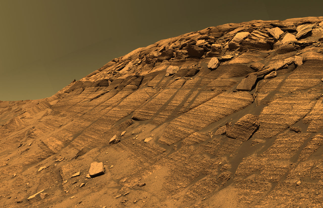

.gif/1280px-Warm_Season_Flows_on_Slope_in_Newton_Crater_(animated).gif)


.jpg/1280px-Frouin_(Martian_crater).jpg)


![Vista cercana de la pared de la depresión triangular, como se ve con HiRISE. En la pared se pueden ver capas que contienen hielo. Las capas inferiores están inclinadas, mientras que las capas cercanas a la superficie son más o menos horizontales. Esta disposición de capas se denomina "discordancia angular".[269]](http://upload.wikimedia.org/wikipedia/commons/thumb/7/7e/50345_1230icelayersangular.jpg/1280px-50345_1230icelayersangular.jpg)


