Adjacent sea zone in which a state has special rights
Las zonas económicas exclusivas del mundo según tipos de límites y tipos de ZEE
Una zona económica exclusiva ( ZEE ), según lo prescrito por la Convención de las Naciones Unidas sobre el Derecho del Mar de 1982 , es un área del mar en la que un estado soberano tiene derechos exclusivos respecto de la exploración y utilización de los recursos marinos , incluida la producción de energía a partir del agua y el viento. [1]
Se extiende desde el límite exterior del mar territorial (22,224 kilómetros o 12 millas náuticas desde la línea de base) hasta 370,4 kilómetros (o 200 millas náuticas ) desde la costa del estado en cuestión. También se le conoce como margen continental marítimo y, en el uso coloquial, puede incluir la plataforma continental . El término no incluye ni el mar territorial ni la plataforma continental más allá del límite de 200 millas náuticas. La diferencia entre el mar territorial y la zona económica exclusiva es que el primero confiere soberanía plena sobre las aguas, mientras que la segunda es meramente un "derecho soberano" que se refiere a los derechos del estado costero debajo de la superficie del mar. Las aguas superficiales son aguas internacionales . [2]
Definición
Áreas marítimas en derechos internacionales (vista de arriba hacia abajo)
En general, la zona económica exclusiva de un estado es un área que se extiende más allá y adyacente al mar territorial, hacia el mar hasta una distancia de no más de 200 millas náuticas (370 km) desde su línea de base costera . [3] La excepción a esta regla ocurre cuando las zonas económicas exclusivas se superponen; es decir, las líneas de base costeras de los estados están a menos de 400 millas náuticas (741 km) de distancia. Cuando ocurre una superposición, corresponde a los estados delinear el límite marítimo real . [4] En general, cualquier punto dentro de un área superpuesta se establece por defecto en el estado más cercano. [5]
Los Estados también tienen derechos sobre el lecho marino de lo que se denomina la plataforma continental extendida hasta 350 millas náuticas (648 km) desde la línea de base costera, más allá de las zonas económicas exclusivas, pero dichas áreas no son parte de sus zonas económicas exclusivas.
La definición jurídica de plataforma continental no corresponde exactamente al significado geológico del término, ya que incluye también la emersión y el talud continental y todo el lecho marino dentro de la zona económica exclusiva.
Origen e historia
La idea de asignar ZEE a las naciones para darles más control de los asuntos marítimos fuera de sus límites territoriales ganó aceptación a fines del siglo XX.
Inicialmente, las aguas territoriales soberanas de un país se extendían 3 millas náuticas (6 km) (rango de disparo de cañón) más allá de la costa. [ cita requerida ] En los tiempos modernos, las aguas territoriales soberanas de un país se extienden hasta 12 millas náuticas (22 km) más allá de la costa. [ cita requerida ] Una de las primeras afirmaciones de jurisdicción exclusiva más allá de los mares territoriales tradicionales fue hecha por los Estados Unidos en la Proclamación Truman del 28 de septiembre de 1945. Sin embargo, fueron Chile y Perú respectivamente los primeros en reclamar zonas marítimas de 200 millas náuticas con la Declaración Presidencial Relativa a la Plataforma Continental firmada por el Presidente chileno Gabriel González Videla el 23 de junio de 1947 [6] y por el Presidente peruano José Luis Bustamante y Rivero mediante el Decreto Presidencial No. 781 del 1 de agosto de 1947 [7] [8]
La extensión exacta de las zonas económicas exclusivas es una fuente común de conflictos entre Estados por las aguas marinas.
Irresoluto
Océano Ártico
Una sección en forma de cuña del Mar de Beaufort , un área que supuestamente contiene importantes reservas de petróleo , es objeto de disputa entre Canadá y Estados Unidos.
Mar Caribe
En 1996, la República Dominicana y el Reino Unido firmaron un acuerdo que establecía una frontera equidistante simplificada entre el Territorio Británico de Ultramar de las Islas Turcas y Caicos y la República Dominicana. Mouchoir Bank se encontraba en el lado de las Islas Turcas y Caicos de la frontera, y Silver y Navidad Banks en el lado de la República Dominicana. Sin embargo, el acuerdo no fue ratificado posteriormente por ninguna de las partes. En cambio, la República Dominicana se declaró un estado archipelágico en 2007, reclamando la soberanía sobre Mouchoir Bank y extendiendo su ZEE más allá del acuerdo de límites con el Reino Unido. El Reino Unido no acepta el estatus archipelágico y los límites marítimos reclamados por la República Dominicana. [9]
Mauricio reclama una ZEE para la isla de Tromelin frente a Francia y una ZEE respecto del Territorio Británico del Océano Índico frente al Reino Unido. Mauricio reclama una Zona Económica Exclusiva que abarca 2,3 millones de kilómetros cuadrados.
Turquía reclama una parte de la ZEE reclamada por Chipre basándose en la definición turca de que ninguna isla, incluida Chipre, puede tener una ZEE completa [12] [13] y solo debería tener derecho a 12 millas náuticas. Además, la República Turca del Norte de Chipre (RTNC), no reconocida internacionalmente, también reclama partes de la ZEE reclamada por Chipre. Turquía también disputa la ZEE de Grecia por la misma razón con respecto a sus islas en el mar Egeo . Turquía es uno de los pocos países que no ha firmado la CNUDM .
Japón reclama una ZEE alrededor de Okinotorishima , pero esto es disputado por China, Taiwán y Corea del Sur, quienes afirman que es un islote incapaz de generar una ZEE.
Potencial
Las regiones donde una plataforma de hielo permanente se extiende más allá de la costa también son una fuente potencial de disputa. [15]
Resuelto
Las Guerras del Bacalao entre el Reino Unido e Islandia ocurrieron periódicamente durante muchas décadas hasta que se resolvieron con un acuerdo final en 1976.
En 1992, un tribunal arbitral que coincidió en su totalidad con los argumentos expuestos por Canadá decidió resolver el caso de la frontera marítima entre Canadá y Francia , centrado en la ZEE en torno a las islas francesas de San Pedro y Miquelón. Se le concedió a Francia el 18% de la superficie que había reclamado originalmente.
En 2009, en una disputa entre Rumania y Ucrania sobre la Isla de la Serpiente , la Corte Internacional de Justicia de las Naciones Unidas decidió que la Isla de la Serpiente no tiene ZEE más allá de las 12 millas náuticas de su propio territorio. [18]
En 2010, se resolvió una disputa entre Noruega y Rusia sobre las aguas territoriales y la ZEE en relación con el archipiélago de Svalbard , ya que afecta a la ZEE de Rusia debido a su estatus de tratado único . En abril de 2010, los dos Estados acordaron un tratado de principio y posteriormente lo ratificaron oficialmente, lo que resolvió esta disputa de demarcación. [19] El acuerdo se firmó en Murmansk el 15 de septiembre de 2010. [20]
En 2014, los Países Bajos y Alemania resolvieron una antigua disputa fronteriza sobre la ubicación exacta de la frontera en la bahía de Dollart . [21] [22]
Poblaciones transfronterizas
La ordenación pesquera , que suele ajustarse a las directrices establecidas por la Organización de las Naciones Unidas para la Agricultura y la Alimentación (FAO), proporciona mecanismos prácticos importantes para el control de las ZEE. Las poblaciones de peces transfronterizas son un concepto importante en este control. [23]
Las poblaciones transfronterizas son poblaciones de peces que se encuentran en las ZEE de al menos dos países. Las poblaciones transzonales , por otra parte, se encuentran tanto dentro de una ZEE como en alta mar , fuera de cualquier ZEE. Una población puede ser tanto transfronteriza como transzonal. [24]
Argelia estableció el 17 de abril de 2018 una zona económica exclusiva (ZEE) frente a sus costas mediante el Decreto Presidencial No. 18-96 de 2 Rajab 1439 correspondiente al 20 de marzo de 2018. [25] [26] La misión permanente de España ante las Naciones Unidas el 27 de julio de 2018 declaró su desacuerdo con la ZEE anunciada por Argelia y que el gobierno de España indicó su voluntad de entablar negociaciones con el gobierno de Argelia con miras a alcanzar un acuerdo mutuamente aceptable sobre los límites exteriores de sus respectivas zonas económicas exclusivas, [27] Lo mismo hizo la misión italiana el 28 de noviembre de 2018. [28] Los dos países indicaron que la medida argelina había sido tomada unilateralmente y sin consultarles.
El 25 de noviembre de 2018, el Ministerio de Asuntos Exteriores argelino envió una nota oral en respuesta a la protesta española, explicando que el gobierno argelino no reconoce las coordenadas, en gran medida exorbitantes, contenidas en el Real Decreto 236/2013, que se superponen con las coordenadas del Decreto Presidencial n° 18-96 por el que se establece una zona económica exclusiva frente a las costas de Argelia. El gobierno argelino deseaba destacar que la delimitación unilateral realizada por España no se ajusta a la letra de la Convención de las Naciones Unidas sobre el Derecho del Mar y no ha tenido en cuenta la configuración, las características específicas y las circunstancias especiales del mar Mediterráneo, en particular para el caso de los dos países cuyas costas se encuentran frente a frente, así como las normas objetivas y los principios pertinentes del derecho internacional que rigen la delimitación equitativa de las zonas marítimas entre Argelia y España, de conformidad con el artículo 74 de la Convención de las Naciones Unidas sobre el Derecho del Mar. Argelia expresó su voluntad de negociar para lograr una solución justa. [29]
El 20 de junio de 2019 se envió una comunicación desde Argelia dirigida a la Embajada de Italia [30] y a la Embajada de España en Argel [31] para demostrar su elegibilidad en la zona económica exclusiva de Argelia.
Considerando las áreas marítimas reclamadas, la superficie total de Argentina alcanza los 3.849.756 km2 . La superficie de la ZEE argentina reconocida es de 1.159.063 km2 .
Australia
Las zonas económicas exclusivas de Australia, incluida su reclamación antártica
La zona económica exclusiva de Australia fue declarada el 1 de agosto de 1994, y se extiende desde 12 a 200 millas náuticas desde la línea costera de Australia y sus territorios externos , excepto donde exista un acuerdo de delimitación marítima con otro estado. [32] [33] Hasta el límite de 12 millas náuticas se encuentran las aguas territoriales de Australia . Australia tiene la tercera zona económica exclusiva más grande, detrás de Francia y Estados Unidos, pero por delante de Rusia, con una superficie total de 8.148.250 kilómetros cuadrados, que en realidad excede su territorio terrestre.
En abril de 2008, la Comisión de las Naciones Unidas sobre los Límites de la Plataforma Continental (CLPC) confirmó los derechos de Australia sobre 2,5 millones de kilómetros cuadrados adicionales de lecho marino más allá de los límites de la ZEE de Australia. [34] [35] Australia también reclamó, en su presentación a la Comisión de las Naciones Unidas sobre los Límites de la Plataforma Continental, una plataforma continental adicional más allá de su ZEE desde el Territorio Antártico Australiano , [36] pero estas reclamaciones fueron aplazadas a petición de Australia. Sin embargo, la ZEE de Australia desde su Territorio Antártico es de aproximadamente 2 millones de kilómetros cuadrados. [35]
Zona económica exclusiva y aguas territoriales de Canadá
Canadá es inusual en el sentido de que su zona económica exclusiva, que cubre 5.599.077 km2 ( 2.161.816 millas cuadradas), es ligeramente más pequeña que sus aguas territoriales. [39] Estas últimas generalmente se extienden solo 12 millas náuticas desde la costa, pero también incluyen aguas marinas interiores como la Bahía de Hudson (aproximadamente 300 millas náuticas (560 km) de ancho), el Golfo de San Lorenzo y las aguas internas del Archipiélago Ártico .
Chile
Las zonas económicas exclusivas de Chile, incluida su reivindicación antártica
En 2020 y 2022, Chile presentó sus reclamaciones parciales ante la Comisión de Límites de la Plataforma Continental (CLPC) de las Naciones Unidas para ampliar su margen continental marítimo.
Porcelana
Zona económica exclusiva reclamada por la República Popular China:
La ZEE indiscutible de China: 960.556 km2 [ 41]
ZEE reclamada por China, disputada por Taiwán – 1.148.485 km2 [ 42]
ZEE reclamada por China, disputada por otros países – 210.926 km 2
Total: 2.236.430 km2 [ 43]
La primera cifra excluye todas las aguas en disputa, mientras que la última cifra indica las fronteras reclamadas por China y no tiene en cuenta las reivindicaciones de las potencias adyacentes. [ aclaración necesaria ]
La ZEE de Chipre cubre una superficie de 98.707 km² (38.100 millas²). La ZEE de Chipre limita con las de Grecia , Turquía , Siria , Líbano , Israel y Egipto .
Dinamarca
Las zonas económicas exclusivas y las aguas territoriales del Reino de Dinamarca
El Reino de Dinamarca incluye el país constituyente ( selvstyre ) de Groenlandia y el país constituyente ( hjemmestyre ) de las Islas Feroe .
Ecuador
Zona económica exclusiva del Ecuador
Superficie: 1.077.231 km2
Francia
Zonas económicas exclusivas de Francia, incluida su reivindicación territorial antártica
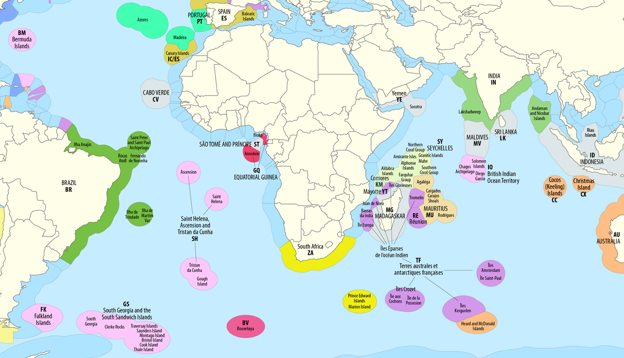
Debido a sus numerosos departamentos y territorios de ultramar repartidos por todos los océanos del planeta, Francia posee la ZEE más grande del mundo, con una superficie de 11.691.000 km2 ( 4.514.000 millas cuadradas). [47] La ZEE de Francia cubre aproximadamente el 7% de la superficie total de todas las ZEE del mundo, mientras que la superficie terrestre de la República Francesa es solo el 0,45% de la superficie terrestre total de la Tierra.
Alemania
Alemania declaró el establecimiento de su zona económica exclusiva en los mares del Norte y Báltico el 1 de enero de 1995. [48] Las disposiciones legales alemanas pertinentes que son aplicables dentro de la ZEE incluyen la Ley de Tareas Marítimas (Seeaufgabengesetz) de 1965, la Ley de Instalaciones Marítimas (Seeanlagengesetz) de 2017 y, antes de eso, la Ordenanza de Instalaciones Marítimas (Seeanlagenverordnung) de 1997, la Ley Federal de Minería (Bundesberggesetz) y la Ley de Planificación Regional (Raumordnungsgesetz).
La ZEE alemana tiene una superficie de 32.982 km2 . Alrededor del 70% de la ZEE cubre toda la zona del Mar del Norte de Alemania, mientras que alrededor del 29% abarca la zona del Mar Báltico. [49]
Indonesia tiene la sexta zona económica exclusiva más grande del mundo. El tamaño total es de 6.159.032 km² ( 2.378.016 millas cuadradas). Reclama una ZEE de 200 millas náuticas desde sus costas. Esto se debe a las 13.466 islas del archipiélago indonesio . [53] Tiene la segunda costa más grande de 54.720 km (34.000 mi). Las cinco islas principales son: Sumatra , Java , Borneo , Sulawesi y Nueva Guinea Occidental . Hay dos grupos de islas principales ( Nusa Tenggara y las islas Molucas ) y sesenta grupos de islas más pequeños.
Irlanda
Se informó que la zona económica exclusiva de Irlanda fue la ubicación de un ejercicio militar ruso en enero de 2022. [54] Luego, el ejercicio de Rusia se trasladó fuera de la zona económica. [55]
Israel
En 2010, se firmó un acuerdo con Chipre sobre el límite de las aguas territoriales entre Israel y Chipre en el punto intermedio marítimo, una aclaración esencial para salvaguardar los derechos de Israel sobre los yacimientos de petróleo y gas submarinos. El acuerdo fue firmado en Nicosia por el Ministro de Infraestructura israelí, Uzi Landau, y el Ministro de Asuntos Exteriores chipriota, Markos Kyprianou. Los dos países acordaron cooperar en el desarrollo de cualquier recurso transfronterizo descubierto y negociar un acuerdo sobre la división de los recursos conjuntos.
Italia tiene una ZEE de 541.915 km² ( 209.235 millas cuadradas). [51] El país reclama una ZEE de 200 millas náuticas desde sus costas, y sus tres costas son el mar Tirreno al oeste, el mar Jónico al sur y el mar Adriático al este. La ZEE de Italia está limitada por fronteras marítimas con los países vecinos al noroeste, este y sureste.
El territorio marítimo occidental de Italia se extiende desde la costa oeste de Italia en el mar Tirreno , incluida la isla de Cerdeña . La isla de Sicilia se encuentra en la zona más meridional. Lampedusa , una pequeña isla en el mar Mediterráneo, es el punto más meridional del país. Italia comparte fronteras marítimas definidas por tratado con Francia , España , Argelia , Túnez , Libia , Malta , Grecia , Albania , Montenegro , Croacia y Eslovenia .
Japón posee la octava zona económica exclusiva más grande del mundo, con una extensión de 4.479.674 km2 ( 1.729.612 millas cuadradas). [56] Reclama una ZEE de 200 millas náuticas desde sus costas.
Japón tiene disputas sobre los límites de su ZEE con todos sus vecinos asiáticos (China, Rusia, Corea del Sur y Taiwán ). Los mapas anteriores y los mapas pertinentes del Sea Around Us Project [57] [58] [59] indican los límites reclamados por Japón y no tienen en cuenta los reclamos de las jurisdicciones adyacentes.
Japón también se refiere a varias categorías de "zona de navegación" –zona de aguas tranquilas, zona costera, zona costera mayor o principal, zona oceánica–, pero no está claro si éstas tienen alguna implicación territorial o económica.
Malasia
México
Zona económica exclusiva de México
Las zonas económicas exclusivas de México cubren una superficie total de 3,269,386 km 2 , [51] y colocan a México entre los países con mayores áreas del mundo.
New Zealand's EEZ covers 4,083,744 km2 (1,576,742 sq mi),[60][61] which is approximately fifteen times the land area of the country. Sources vary significantly on the size of New Zealand's EEZ; for example, a recent government publication gave the area as roughly 4,300,000 km2.[62] These figures are for the EEZ of New Zealand proper, and do not include the EEZs of other territories in the Realm of New Zealand (the Cook Islands, Niue, Tokelau, and the Ross Dependency).
The exclusive economic zone of North Korea stretches 200 nautical miles from its basepoints in both the West Sea (Yellow Sea) and the Sea of Japan.[63] The EEZ was declared in 1977 after North Korea had contested the validity of the Northern Limit Lines (NLL) set up after the Korean War as maritime borders.[64] The EEZ has not been codified in law and North Korea has never specified its coordinates, making it difficult to determine its specific scope.[65]
In the West Sea, the EEZ remains unspecified in the Korea Bay because China has not determined its own EEZ in the area.[66] The border between the North Korean and South Korean EEZs in the West Sea cannot be determined because of potential overlap and disputes over certain islands.[67]
In the Sea of Japan, the North Korean EEZ can be approximated to be trapezoidal-shaped.[68] The border between North Korea and Russia's respective EEZs is the only such border that has been determined in East Asia.[69] Here, the EEZ does not cause many problems, even with regards to South Korea, because the sea is not thought to be rich in resources.[68]
Norway has a large exclusive economic zone of 819,620 km2 around its coast. The country has a fishing zone of 1,878,953 km2, including fishing zones around Svalbard and Jan Mayen.[70]
In April 2009, the United Nations Commission for the Limits of the Continental Shelf approved Norway's claim to an additional 235,000 square kilometres of continental shelf. The commission found that Norway and Russia both had valid claims over a portion of the shelf in the Barents Sea.[71]
Pakistan
Area: 290,000 km2
Pakistan coast is a 1046 km long coast, extending from Sir Creek in the east to Gwadar Bay in the west and the EEZ extends up to 290,000sqkm which is more than 30% of its land area and ranks sixty-sixth in the world by area.
Pakistan had an EEZ of 240,000sq km before their case was accepted by UNCLCS. Pakistan Navy with the help of the National Oceanographic Organization (NIO) initiated the continental shelf case at ministerial level in 1995.
On 26 Aug 2013, a seven-member sub-commission with members from Japan, China, Mozambique, Kenya, Denmark, Georgia and Argentina was formulated at UNCLCS to evaluate the technical details of Pakistan's case and after a year accepted Pakistan's claim.
On 13 March 2015, UN Commission on the Limits of Continental Shelf (UNCLCS) accepted recommendations for extension of the outer limits of the continental shelf on Pakistan's case so far 80 countries had submitted claims to UNCLCS out of which recommendations of 22 countries including Pakistan had been finalised.
It was a historic event in the country's history when Pakistan became the first country in the region to have its continental shelf extended to 350 nm.
Some of the claimed territories overlapped the Omani claim. It is believed that the verdict in favour of Pakistan was announced after successful negotiation with Oman.
Peru
Peru's exclusive economic zone
Area: 857,000 km2[72]
Philippines
The exclusive economic zone of the Philippines shown in blue lines,[73] Eleven Dash-line shown in red lines, and treaty line of the Treaty of Paris (1898) shown in green line
The Philippines' EEZ covers 2,263,816 km2 (874,064 sq mi).[74]
Poland
The Polish EEZ covers the area of 30,533 km2 (11,789 sq mi) within the Baltic Sea.[75]
Portugal
Portugal's Exclusive Economic Zones plus submitted Extended Continental Shelf to the UN[76]
Portugal has the 20th largest EEZ in the world. Presently, it is divided in three non-contiguous sub-zones:
Portugal submitted a claim to extend its jurisdiction over an additional 2.15 million square kilometres of the adjacent continental shelf in May 2009,[77] resulting in an area with a total of more than 3,877,408 km2. The submission, as well as a detailed map, can be found in the Task Group for the extension of the Continental Shelf website.
Spain previously objected to the EEZ's southern border, maintaining that it should be drawn halfway between Madeira and the Canary Islands. But Portugal exercises sovereignty over the Savage Islands, a small archipelago north of the Canaries, claiming an EEZ border further south. Spain has no longer disputed the Portuguese claim since 2015.[78][79]
Romania
Area: 23,627 km2
Russia
Russia's exclusive economic zone
Russia's exclusive economic zone, the world's fourth largest, is composed of:
Spain's exclusive economic zone (Labels in Spanish)
Area: 1,039,233 km2
Sri Lanka
Thailand
Thailand's exclusive economic zone
Area: 299,397 km2
Turkey
Turkey's EEZ is bordered by Georgia, Russia, Ukraine, Romania and Bulgaria in the Black Sea to the north, Greece in the Aegean Sea to the west, and Cyprus and Syria in the Mediterranean Sea to the south. Turkey is one of the few countries to not have signed UNCLOS and disputes Greece's and Cyprus' EEZ.
United Kingdom
The exclusive economic zones of the United Kingdom in blue, including the British Overseas Territories and the Crown Dependencies. The British claim in Antarctica is shown in shaded blue.[81]UK, Ireland, Iceland & Faroes exclusive economic zones
The United Kingdom has the world's fifth-largest exclusive economic zone of 6,805,586 km2 (2,627,651 sq mi) square km. It comprises the EEZs surrounding the United Kingdom,[82] the Crown Dependencies, and the British Overseas Territories. The figure does not include the EEZ of the British Antarctic Territory.
The United States' exclusive economic zone is the second largest in the world, covering 11,351,000 km2. Areas of its EEZ are located in three oceans, the Gulf of Mexico, and the Caribbean Sea.
Note, the totals in the table actually add up to 12,234,403 square km and 4,723,705 square miles.
Vietnam
Vietnam claims an exclusive economic zone (EEZ) of 1,395,096 km2 (538,650 sq mi) with 200 nautical miles from its shores.[89][90] These figures do not include the claimed EEZ areas of the Paracel Islands and the Spratly Islands. Vietnam has disputes mainly with the People's Republic of China due to the nine-dash line.
^The reference gives an approximate figure of 2 million square kilometres for the EEZ claimed by Australia as part of its Antarctic Territory. This is in addition to the 8 million square kilometres total given in the reference. This EEZ is also distinct from the 2.56 million square kilometres of additional continental shelf mentioned in the reference.
^A joint Cuba–Haiti Maritime Boundary Agreement signed at Havana in 1977 bilaterally divides the waters between both local nations and Cuba's maritime boundary places the island within Haitian waters and doesn't recognize any local U.S. claim in the area.
^If the claimed Argentine Antarctica and its associated EEZ area are included, the total internal area of Argentina plus its EEZ area reaches 6,581,500 km2.
^The Exclusive Economic Zone: A Historical Perspective. Fao.org. Retrieved 23 July 2013.
^"The Situation at Mouchoir Bank". Sovereign Limits. Retrieved 14 September 2024.
^"Limits in the Seas No. 130 Dominican Republic: Archipelagic and other Maritime Claims and Boundaries" (PDF). United States Department of State Bureau of Oceans and International Environmental and Scientific Affairs. Retrieved 14 January 2014.
^"ANALYSIS ON THE LEGITIMACY OF THE DECLARATION OF THE DOMINICAN REPUBLIC AS AN ARCHIPELAGIC STATE AND ITS LEGALITY UNDER THE UNITED NATIONS CONVENTION ON THE LAW OF THE SEA (UNCLOS) AND THE INTERNATIONAL LAW" (PDF). DIVISION FOR OCEAN AFFAIRS AND THE LAW OF THE SEA, OFFICE OF LEGAL AFFAIRS, THE UNITED NATIONS, NEW YORK, 2018. 15 December 2018. Retrieved 11 July 2024.
^"Turkey sends non-paper to EU, warning to stay away from Cyprus EEZ". KeepTalkingGreece. 23 June 2019. Retrieved 11 July 2019.
^"Greece's maritime claims 'maximalist,' violate international boundaries law". Daily Sabah. 13 June 2019. Retrieved 11 July 2019.
^"Turkey threatens Greece over disputed Mediterranean territorial claims". DW.com. 5 September 2020.
^"The Legal Status of Ice in the Antarctic Region". Archived from the original on 27 February 2006.
^"AWARD OF THE ARBITRAL TRIBUNAL IN THE SECOND STAGE OF THE PROCEEDINGS (MARITIME DELIMITATION)". Permanent Court of Arbitration. Archived from the original on 12 April 2015. Retrieved 12 April 2015.
^Kwiatkowska, Barbara (January 2001). "The Eritrea-Yemen Arbitration: Landmark Progress in the Acquisition of Territorial Sovereignty and Equitable Maritime Boundary Delimitation". Ocean Development and International Law. 32 (1): 1–25. doi:10.1080/00908320150502177. S2CID 154096546.
^United Nations International Court of Justice Archived 16 April 2015 at the Wayback Machine Decision year: 2009
^Russia and Norway Reach Accord on Barents Sea, The New York Times, 28 April 2010. Retrieved 28 April 2010
^Russia and Norway resolve Arctic border dispute, The Guardian, 15 September 2010. Retrieved 21 September 2010
^Elizabeth Schumacher (24 October 2014). "Germany and the Netherlands end centuries-old border dispute". DW.com.
^"Germany and the Netherlands end Ems River border dispute". Boundary News. Durham University. 6 November 2014. Archived from the original on 9 October 2015.
^FAO: The State of the World Fisheries and Aquaculture 2006 Part3: highlights of Special studies Archived 29 December 2010 at the Wayback Machine Rome. ISBN 978-92-5-105568-7
^Report of the FAO workshop on vulnerable ecosystems and destructive fishing in deep sea fisheries: Rome, 26-29 June 2007. Rome: Food and Agriculture Organization of the Unite Nations. 2008. ISBN 978-92-5-105994-4. Fisheries Report No. 829.
^"Deposit by Algeria of a list of geographical coordinates of points, pursuant to article 75, paragraph 2, of the Convention" (PDF).
^"Presidential Decree No. 18-96 of 2 Rajab 1439 corresponding to March 20, 2018 establishing an exclusive economic zone off the Algerian coast" (PDF).
^"Letter from Spain to the Secretary-General of 27 July 2018" (PDF).
^"Letter from Italy to the Secretary-General of November 28, 2018" (PDF).
^"oral note of the Algerian Ministry of Foreign Affairs response to the Spanish protest" (PDF).
^"Communication from Algeria addressed to Italy dated 20 June 2019" (PDF).
^"Communication from Algeria addressed to Spain dated 20 June 2019" (PDF).
^"The Australian Fishing Zone". Department of Agriculture.
^"Maritime Boundary Definitions". Geoscience Australia. Australian Government. Archived from the original on 5 April 2005.
^UN confirms Australia's rights over extra 2.5 million square kilometres of seabed. Archived 25 October 2009 at the Wayback Machine Minister for Resources and Energy, The Hon Martin Ferguson AM MP, Media Release, 21 April 2008."Minister for Resources and Energy, Minister for Tourism". Archived from the original on 27 August 2008. Retrieved 13 November 2008.
^ a b c"Oceans and Seas". Geoscience Australia. Australian Government. 15 May 2014. Retrieved 22 May 2020.
^Division for Ocean Affairs and the Law of the Sea. Commission on the Limits of the Continental Shelf, Submission by Australia
^See Around Us Project (n.d.). "Exclusive Economic Zones (EEZ)". Retrieved 3 June 2015. EEZ waters of: Mainland Brazil 2,570,917 km2, Fernando de Noronha Islands 363,362 km2, Saint Peter and Saint Paul Archipelago 413,636 km2, and the Trindade and Martim Vaz Islands 468,599 km2
^"UN Continental Shelf and UNCLOS Article 76: Brazilian Submission" (PDF).
^"Canada's Marine Waters: Integrating the Boundaries of Politics and Nature". Wildlife Habitat Canada. Archived from the original on 21 December 2005.
^See Around Us Project (n.d.). "Exclusive Economic Zones (EEZ)". Retrieved 3 June 2015. EEZ waters of: Mainland Chile 1,975,760 km2, the Desventuradas Islands 449,836 km2, Easter Island 720,412 km2, the Juan Fernández, Felix and Ambrosio Islands 502,524 km2
^"China · MRGID 8486". Marineregions.org. Retrieved 12 October 2023.
^EEZ and shelf areas of Taiwan – Sea Around Us Project – Fisheries, Ecosystems & Biodiversity – Data and Visualization.
^EEZ and shelf areas of China – Sea Around Us Project – Fisheries, Ecosystems & Biodiversity – Data and Visualization.
^"Hrvatska proglasila svoj Isključivi gospodarski pojas u Jadranskom moru: Zastupnici jednoglasno podržali odluku" [Croatia declared its Exclusive Economic Zone in the Adriatic Sea: MPs unanimously supported the decision]. Novi List (in Croatian). 5 February 2021. Retrieved 8 January 2023.
^"Hrvatska i Italija potpisale Ugovor o razgraničenju isključivih gospodarskih pojaseva. U odnosu na ZERP donosi dva nova prava" [Croatia and Italy signed the Agreement on Demarcation of Exclusive Economic Zones. In relation to ZERP, it brings two new rights.]. tportal.hr (in Croatian). 25 May 2022. Retrieved 8 January 2023.
^"Danish foreign ministry". Archived from the original on 23 November 2008.
^"Espaces maritimes français | Limites maritimes". limitesmaritimes.gouv.fr. 26 January 2023.
^Marker, Sherry; Kerasiotis, Peter (2010). "Greece in depth". In Nadeau, Mark (ed.). Frommer's Greece. Hoboken: Wiley. p. 12.
^ a b c d e f"Sea Around Us – Fisheries, Ecosystems and Biodiversity". Retrieved 1 April 2017.
^Sunderarajan, P. (12 June 2011). "India hopes to double its EEZ". The Hindu. Retrieved 1 April 2017.
^"Hanya ada 13.466 Pulau di Indonesia". National Geographic Indonesia (in Indonesian). 8 February 2012.
^Murphy, Ray (25 January 2022). "Why are Russian naval and air forces setting up off the Irish coast?". RTÉ News. Retrieved 30 January 2022.
^"Russia to move military drills outside Ireland's EEZ". RTÉ News. 30 January 2022. Retrieved 30 January 2022.
^"海洋白書 2004". Nippon Foundation. Retrieved 11 February 2008.
^EEZ and shelf areas of Japan (main islands) – Sea Around Us Project – Fisheries, Ecosystems & Biodiversity – Data and Visualization.
^EEZ and shelf areas of Japan (Daitō Islands) – Sea Around Us Project – Fisheries, Ecosystems & Biodiversity – Data and Visualization.
^EEZ and shelf areas of Japan (Ogasawara Islands) – Sea Around Us Project – Fisheries, Ecosystems & Biodiversity – Data and Visualization.
^ a b cEEZ and shelf areas of New Zealand (mainland) – Sea Around Us Project – Fisheries, Ecosystems & Biodiversity – Data and Visualization.
^ a b cEEZ and shelf areas of New Zealand (Kermadec Islands) – Sea Around Us Project – Fisheries, Ecosystems & Biodiversity – Data and Visualization.
^New Zealand Ministry for the Environment (August 2007). "Introduction". Improving Regulation of Environmental Effects in New Zealand's Exclusive Economic Zone: Discussion Paper. ISBN 978-0-478-30160-1. ME824. Archived from the original on 7 February 2012. Retrieved 7 January 2006.
^Prescott & Schofield 2001, p. 25.
^Kim 2017, p. 20.
^Kim 2017, pp. 20, 71–72.
^Kim 2017, p. 77.
^Kotch & Abbey 2003, p. 179.
^ a bVan Dyke 2009, p. 42.
^Kim 2017, p. 51.
^Statistisk årbok 2007 Accessed January 2008
^UN backs Norway claim to Arctic seabed extension Archived 11 December 2009 at the Wayback Machine, Canwest News Service, 15 April 2009. Retrieved 13 May 2009.
^Brittany, Derrick; Khalfallah, Myriam; Relano, Veronica; Zeller, Dirk; Pauly, Daniel (31 March 2021). "Updating to 2018 the 1950- 2010 marine catch reconstructions of the Sea Around Us. Part II: The Americas and Asia-Pacific". Fisheries Centre Research Reports. 28 (6): 270. ISSN 1198-6727. Retrieved 27 December 2023 – via The University of British Columbia.
^https://www.fao.org/fishery/en/openasfa/a9b133df-8b25-409e-9066-906893bc39e7 Figure 1. The UNCLOS mandated exclusive economic zone (EEZ) of the Philippines
^EEZ and shelf areas of the Philippines – Sea Around Us Project – Fisheries, Ecosystems & Biodiversity – Data and Visualization.
^"Exploration and Extraction of Sand and Gravel Resources in the Polish Exclusive Economical Zone of the Baltic Sea" (PDF). Advanced Solutions International Inc. Archived from the original (PDF) on 23 March 2004. Retrieved 1 April 2017.
^"Task Group for the Extension of the Portuguese Continental Shelf". Archived from the original on 18 December 2009.
^Portugal applies to UN to Extend Its Continental Shelf Zone. Retrieved 3 July 2011
^United Nations Division for Ocean Affairs and The Law of The Sea
^Communications received with regard to the submission made by Portugal to the Commission on the Limits of the Continental Shelf
^"Sea Around Us Project – Data and Visualization". Archived from the original on 27 April 2006. Retrieved 1 April 2017.
^"Countries within a country". 10 Downing Street. Archived from the original on 16 April 2010. Retrieved 16 January 2010.
^"The Exclusive Economic Zone Order 2013" at Legislation.gov.uk. Retrieved 20 July 2014.
^EEZ and shelf areas of the Republic of Cyprus – Sea Around Us Project – Fisheries, Ecosystems & Biodiversity – Data and Visualization.
^EEZ and shelf areas of Northern Cyprus – Sea Around Us Project – Fisheries, Ecosystems & Biodiversity – Data and Visualization.
^"Exclusive Economic Zones (EEZ)". Sea Around Us | Fisheries, Ecosystems and Biodiversity. Retrieved 12 October 2023.
^"Catches by Taxon in the waters of Haiti". Sea Around Us | Fisheries, Ecosystems and Biodiversity.
^"Catches by Taxon in the waters of Jamaica". Sea Around Us | Fisheries, Ecosystems and Biodiversity.
^"Field Listing :: Maritime claims — The World Factbook". Central Intelligence Agency. Archived from the original on 9 January 2019.
^EEZ and shelf areas of Vietnam – Sea Around Us Project – Fisheries, Ecosystems & Biodiversity – Data and Visualization.
^"Vietnam · MRGID 8484". Marineregions.org.
^ a bEEZ and shelf areas of Tokelau – Sea Around Us Project – Fisheries, Ecosystems & Biodiversity – Data and Visualization.
^"FAO Country Profiles:New Zealand". Food and Agriculture Organization of the United Nations.
^"FAO Country Profiles:Tokelau". Food and Agriculture Organization of the United Nations.
^ a bEEZ and shelf areas of North Korea (Yellow Sea) – Sea Around Us Project – Fisheries, Ecosystems & Biodiversity – Data and Visualization.
^ a bEEZ and shelf areas of North Korea (Sea of Japan) – Sea Around Us Project – Fisheries, Ecosystems & Biodiversity – Data and Visualization.
^"FAO Country Profiles:Democratic People's Republic of Korea". Food and Agriculture Organization of the United Nations.
Works cited:
Suk Kyoon Kim (2017). Maritime Disputes in Northeast Asia: Regional Challenges and Cooperation. Leiden: BRILL. ISBN 978-90-04-34422-8.
Kotch, John Barry; Abbey, Michael (2003). "Ending naval clashes on the Northern Limit Line and the quest for a West Sea peace regime" (PDF). Asian Perspectives. 27 (2): 175–204. doi:10.1353/apr.2003.0024. Archived from the original (PDF) on 25 July 2011.
Prescott, John Robert Victor; Schofield, Clive H. (2001). Furness, Shelagh (ed.). "Undelimited Maritime Boundaries of the Asian Rim in the Pacific Ocean". Maritime Briefing. 3 (1). Durham: International Boundaries Research Unit, University of Durham. ISBN 978-1-897643-43-3.
Van Dyke, Jon M. (2009). "Disputes Over Islands and Maritime Boundaries in East Asia". In Seoung Yong Hong, Jon M.; Van Dyke (eds.). Maritime Boundary Disputes, Settlement Processes, and the Law of the Sea. Leiden: BRILL. pp. 39–76. ISBN 978-90-04-17343-9.
External links
Wikimedia Commons has media related to Exclusive economic zones.
Interactive map at MarineRegions.org, showing boundaries and disputes
United Nations Convention on the Law of the Sea – Part V
Sea Around Us Project – View the EEZ of all countries (note that this website does not distinguish between the territorial seas and the EEZs, therefore it tends to overstate the EEZ areas. See: EEZ AREA MEASURE)
The USA zone since 1977
GIS data: VLIZ.be
Foreign Military Activities in Asian EEZs: Conflict Ahead? by Mark J. Valencia (May 2011)


.png/1280px-Italy-Exclusive-Economic-Zone-Map_(cropped).png)


.jpg/1280px-ZEE_S%C3%A9n%C3%A9gal_(zone_%C3%A9conomique_exclusive).jpg)


