Esta lista contiene la mayoría de las montañas más altas del país. Se limita a los picos de montaña con, si se conoce, una elevación de al menos 200 metros (660 pies) sobre el nivel del mar , y puede incluir aquellos considerados como colinas . La distinción entre una colina y una montaña en términos de elevación no está clara y es en gran medida subjetiva, pero se considera universalmente que una colina es menos alta y menos empinada que una montaña. [2]
Nombre : las montañas se ordenan según el nombre (sin el prefijo "Monte") para facilitar la referencia en el nombre y las variantes ortográficas. Los picos sin nombre se escriben en cursiva . (Nota: para minimizar el desorden, las citas de nombres se limitan solo a las montañas con nombres y ortografías variantes y/o aquellas que actualmente no tienen datos de elevación)
Elevación : ordenada en metros sobre el nivel del mar (nota: algunas montañas pueden contener varias elevaciones diferentes que pueden entrar en conflicto entre sí. Cada una de ellas está respaldada por sus propias fuentes proporcionadas) .
Provincia(s) cubierta(s) : Algunas montañas se encuentran dentro de los límites de dos o más provincias. Las entradas "Lanao" y "Davao", que se derivaron del sitio web del Instituto Filipino de Vulcanología y Sismología , están en cursiva porque ya no son provincias.
^ a b c d"PHIVOLCS Volcano Monitoring". Philippine Institute of Volcanology and Seismology. May 9, 2008. Archived from the original on January 22, 2018. Retrieved November 14, 2015.
^"Hill". National Geographic Society. Archived from the original on October 2, 2015. Retrieved November 14, 2015. Hills are easier to climb than mountains. They are less steep and not as high. But, like a mountain, a hill will usually have an obvious summit, which is its highest point.
^ a b c d e f g h i j k l m n o p q r s t u v w x y z aa ab ac ad ae af ag ah ai aj ak al am an ao ap aq ar as at aude Ferranti (compiler), Jonathan; Maizlish (compiler), Aaron (August 11, 2005). "PHILIPPINES MOUNTAINS; 29 Mountain Summits with Prominence of 1,500 meters or greater". Peaklist.org. Retrieved November 12, 2015.
^ a b c d e f g h i j k l m n o p q r s t u v w x y z aa ab ac ad ae af ag ah ai aj ak al am an ao ap aq ar as at au av aw ax ay az ba bb bc bd be bf bg bh bi bj bk bl bm bn bo bp bq br bs bt bu bv bw bx by bz ca cb cc cd ce cf cg ch ci cj ck cl cm cn co cp cq cr cs ct cu cv cw cx cy cz da db dc dd de df dg dh di dj dk dl dm dn do dp dq dr ds dt du dv dw dx dy dz ea eb ec ed ee ef eg eh ei ej ek el em en eo ep eq er es et eu ev ew ex ey ez fa fb fc fd fe ff fg fh fi fj fk fl fm fn fo fp fq fr fs ft fu fv fw fx fy fz ga gb gc gd ge gf gg gh gi gj gk gl gm gn go gp gq gr gs gt gu gv gw gx gy gz ha hb hc hd he hf hg hh hi hj hk hl hm hn ho hp hq hr hs ht hu hv hw hx hy hz ia ib ic id ie if ig ih ii ij ik il im in io ip iq ir is it iu iv iw ix iy iz ja jb jc jd je jf jg jh ji jj jk jl jm jn jo jp jq jr js jt ju jv jw jx jy jz ka kbLancion, Conrado M. Jr. (1995). "The Provinces". Fast Facts about Philippine Provinces. cartography by de Guzman, Rey (The 2000 Millenium ed.). Makati, Metro Manila, Philippines: Tahanan Books. pp. 16–167. ISBN 971-630-037-9. Retrieved November 12, 2015.
^ a b c d e f g h i j k l m n o p q r s t u v w x y z aa ab ac ad ae af ag ah ai aj ak al am an ao ap aq ar as at au av aw ax ay az ba bb bc bd be bf bg bh bi bj bk bl bm bn bo bp bq br bs bt bu bv bw bx by bz ca cb cc cd ce cf cg ch ci cj ck cl cm cn co cp cq cr cs ct cu cv cw cx cy cz da db dc dd de df dg dh di dj dk dl dm dn do dp dq dr ds dt du dv dw dx dy dz ea eb ec ed ee ef eg eh ei"Philippine Mountains and Peaks in Luzon". GeoCities; Singarong Backpackers Website. 2001. Archived from the original on October 22, 2009. Retrieved November 14, 2015.
^"Mount Abao". Peakery.com. Retrieved November 14, 2015.
^"Mount Abao". PeakVisor. Retrieved March 14, 2022.
^ a b c d e f g h i j k l m n o p q r s t u v w x y z aa ab ac ad ae af ag ah ai aj ak al am an ao ap aq ar as at au av aw ax ay az ba bb bc bd be bf bg bh bi bj bk bl bm bn bo bp bq br bs bt bu bv bw bx by bz ca cb cc cd ce cf cg ch ci cj ck cl cm"Volcanoes of the Philippines; Inactive Volcanoes (Part 1)". Philippine Institute of Volcanology and Seismology. July 30, 2008. Archived from the original on September 24, 2015. Retrieved November 13, 2015.
^ a b c d e f g h i j k l m n o p q r s t u v w x y z aa ab ac ad ae af ag ah ai aj ak al am an ao ap aq ar as at au av aw ax ay az ba bb bc bd be bf bg bh bi bj bk bl bm bn bo bp bq br bs bt bu bv bw bxSulit-Braganza 2005, p. 69.
^ a b c d e f g h i j k l m n o p q r s t u v w x ySulit-Braganza 2005, p. 72.
^ a b c d e f g h i j k l m n o p q r s t u v w x y z aa ab ac ad ae af ag ah ai"Philippine Mountains and Peaks in Mindanao". Geocities; Singarong Backpackers Website. 2001. Archived from the original on October 22, 2009. Retrieved November 14, 2015.
^ a b"Mount Agustin". PeakVisor. Retrieved March 29, 2022.
^ a b c"Mount Alal". Peakery.com. Retrieved November 14, 2015.
^ a b"Mount Alchan". Peakery.com. Retrieved November 14, 2015.
^"Mt. Aminduen (Alto Peak)". PeakVisor. Retrieved March 18, 2022.
^ a b c d e f g h i j k l m n o p q r s t u v w x y z aa ab ac ad ae af ag ah ai aj ak al am an ao ap aq ar as at au av aw ax ay az ba bb bc bd be bf bg bh bi bj"Philippine Mountains and Peaks in the Visayas". GeoCities; Singarong Backpackers Website. 2001. Archived from the original on October 22, 2009. Retrieved November 14, 2015.
^ a b c d e f g h i j k l m n o p q r s t u v w x y z aa ab ac ad ae af ag ah ai aj ak al am an ao ap aq ar as at au av aw ax ay az ba bb bc bd beSulit-Braganza 2005, p. 71.
^ a b c d e f g h i j"Natural Attractions found in Kibungan". Benguet Province (official government website). Archived from the original on March 19, 2015. Retrieved November 15, 2015.
^"Mount Amuyao". Peakery.com. Retrieved November 14, 2015.
^ a b"Mount Amuyao". PeakVisor. Retrieved March 11, 2022.
^ a b"Global Volcanism Program; Amorong". Smithsonian Institution. Retrieved November 12, 2015.
^ a b c d e f g h i j k l m n o p q r s t u v w x y z aa ab ac ad ae af ag ah ai aj ak al am an ao ap aq ar as at au av aw ax ay az ba bb bc bd be bf bg bh biSulit-Braganza 2005, p. 70.
^ a b c d e f g h i j"Natural Attractions found in Buguias". Benguet Province (official government website). Archived from the original on March 19, 2015. Retrieved November 15, 2015.
^"Global Volcanism Program; Apo". Smithsonian Institution. Retrieved November 12, 2015.
^"Global Volcanism Program; Biliran". Smithsonian Institution. Retrieved November 12, 2015.
^"Mount Binuluan". Peakery.com. Archived from the original on November 17, 2015. Retrieved November 14, 2015.
^ a b c d e f g h i j k l m n o p q r s t u v w x y z aa ab ac ad ae af ag ah ai aj ak al am an ao ap aq ar as at au av aw ax ay az ba bb bc bd be bf bg bh bi bj bk bl bm bn bo bp bq br bs bt bu bv bw bx by bz ca cb cc cd ce cf cg ch ci cj ck cl cm cn co cp cq cr cs ct cu cv cw cx"Volcanoes of the Philippines; Inactive Volcanoes (Part 2)". Philippine Institute of Volcanology and Seismology. July 30, 2008. Archived from the original on September 24, 2015. Retrieved November 13, 2015.
^ a b c d e f g h"Natural Attractions found in Kapangan". Benguet Province (official government website). Archived from the original on March 19, 2015. Retrieved November 15, 2015.
^ a b c d e f g h i j k l m n o p q r s t u v w x y z aa ab ac ad ae af ag ah ai aj ak al am an ao ap aq ar as at au av aw ax ay az ba bb bc bd be bf bg bh bi bj bk bl bm bn bo bp bq br bs bt bu bv bw bx by bz ca cb cc cd ce cf cg ch"Volcanoes of the Philippines; Inactive Volcanoes (Part 4)". Philippine Institute of Volcanology and Seismology. July 30, 2008. Archived from the original on November 23, 2016. Retrieved November 13, 2015.
^ a b c d e f g h i j k l m n o p q r s t u v w x y z aa ab ac ad ae af ag ah ai aj ak al am an ao ap aq ar as at au av aw ax ay az ba bb bc bd be bf bg bh bi bj bk bl bm bn bo bp bq br bs bt bu bv bw bx by bz ca cb cc cd ce cf cg ch ci cj ck cl cm cn co cp cq cr cs ct cu cv cw cx cy cz da db"Volcanoes of the Philippines; Inactive Volcanoes (Part 3)". Philippine Institute of Volcanology and Seismology. July 30, 2008. Archived from the original on September 24, 2015. Retrieved November 13, 2015.
^ a b c d e f"Natural Attractions found in Sablan". Benguet Province (official government website). Archived from the original on March 19, 2015. Retrieved November 15, 2015.
^"Mount Dulang Dulang". Peakery.com. Archived from the original on November 17, 2015. Retrieved November 14, 2015.
^"Mount Dulang-Dulang". PeakVisor. Retrieved March 12, 2022.
^ a b c d e f g h i j"Topography". Provincial Government of Camarines Sur (official government website). Archived from the original on December 3, 2016. Retrieved November 15, 2015. The ravines are deep and steep slopes are covered only by cogon. The Ragay coast is hilly and rolling. Mt. Isarog with an elevation of 1, 976 meters and Mt. Iriga with 1, 196 meters, in the central and southern parts are inactive volcanoes. Also there is the Tangkong Baka mountain range which is the lower portion of the Sierra Madre mountain system and the Calinigan Mountain Range (904 meters) in the Partido area. Other mountains in the province are: Mt. Sugutin- 366m, Mt. Tiis- 610 m, Saddle Peak- 1,028m, Triple Peak- 638m, Mt. Putianay- 640m, Mt. Elizario- 508m, Mt. Talitig- 385m.
^ a b c d e f g h i j"Natural Attractions found in Bakun". Benguet Province (official government website). Archived from the original on March 19, 2015. Retrieved November 15, 2015.
^"Mount Halcon". Peakery.com. Retrieved November 14, 2015.
^"Kalatungan Mountains High Point, Philippines". Peakbagger.com. Retrieved November 5, 2008.
^"Mount Kalatungan". Peakery.com. Retrieved November 14, 2015.
^ a b c d e f g h"Natural Attractions found in La Trinidad". Benguet Province (official government website). Archived from the original on March 19, 2015. Retrieved November 15, 2015.
^ a b"Natural Attractions found in Bokod". Benguet Province (official government website). Archived from the original on March 19, 2015. Retrieved November 15, 2015.
^"Mount Kampalili". Peakery.com. Retrieved November 14, 2015.
^"Global Volcanism Program; Kanlaon". Smithsonian Institution. Retrieved November 12, 2015.
^ a b"Mount Kapiligan". Peakery.com. Retrieved November 14, 2015.
^"Mount Kapiligan". PeakVisor. Retrieved March 14, 2022.
^"Mount Dulang-dulang - Peakbagger.com". www.peakbagger.com. Retrieved March 9, 2022.
^"Mount Kilakron". Peakery.com. Retrieved November 14, 2015.
^ a bTa-as, Apple (April 26, 2015). "Climbing the Osmena Peak". Cebu Daily News. Retrieved November 16, 2015. It's a nearly two hour trip from Cebu City to Osmeña Peak, the highest mountain in Cebu that is a favorite among hikers for its picturesque view of the countryside. Osmena Peak rises 1,013 meters above sea level and is nestled between the southern towns of Dalaguete and Badian. It straddles the Mantalongon range in the southwest and offers a 360 degree view of nature, including the islands of Bohol and Negros.
^ a bBernardino, Tere (June 30, 2014). "Cebu's Highest Point: Osmeña Peak". Choose Philippines. Retrieved November 16, 2015. A must-see in this part of Cebu is Osmeña Peak, which stands 1013+ meters above sea level (MASL).
^ a b"Global Volcanism Program; Labo". Smithsonian Institution. Retrieved November 12, 2015.
^"Conquer Mt. Lantoy". Argao Tourism (The Official Website of Argao Tourism). 2005. Archived from the original on July 8, 2006. Retrieved November 16, 2015. Going to Mt. Lantoy, Argao's second highest peak (1,945 ft. or 593 meters), involves many exciting and challenging activities, ...
^ a b"Global Volcanism Program; Latukan". Smithsonian Institution. Retrieved November 16, 2015.
^"Mount Latukan". Peakery.com. Retrieved November 14, 2015.
^ a b c d e f g h i j k l m n o p q r s t u v w x y z aa ab ac ad ae af ag ah ai aj ak al am an ao ap aq ar as at au av aw ax ay az ba bb bc bd be bf bg bh bi bj bk bl bm bn bo bp bq br bs bt bu bv bw bx by bz ca cb cc cd ce cf cg ch ci cj ck cl cm cn co cp cq cr cs ct cu cv cw cx cy cz da db dc dd de df dg dh di dj dk dl"Volcanoes of the Philippines; Inactive Volcanoes (Part 5)". Philippine Institute of Volcanology and Seismology. July 30, 2008. Archived from the original on September 24, 2015. Retrieved November 13, 2015.
^ a b"Mount Loco-ono". Peakery.com. Retrieved November 14, 2015.
^"Mount Lumuluyaw". PeakVisor. Retrieved March 14, 2022.
^"Mount Ma-agnaw". Peakery.com. Retrieved November 14, 2015.
^ a b"Mount Maagnaw". PeakVisor. Retrieved March 11, 2022.
^ a b"Global Volcanism Program; Mahagnao". Smithsonian Institution. Retrieved November 16, 2015.
^"Mount Mangabon". Peakery.com. Retrieved November 14, 2015.
^ a b c"Natural Attractions found in Itogon". Benguet Province (official government website). Archived from the original on March 19, 2015. Retrieved November 15, 2015.
^ a b"Global Volcanism Program; Mayon". Smithsonian Institution. Retrieved November 16, 2015.
^ a b c d e f g h i j k l m n o p q r s t u v w x y z aa ab ac ad ae af ag ah ai aj ak al am an ao ap aq ar as at au av aw ax ay az ba bb bc bd be bf bg bh bi bj bk bl bm bn bo bp bq br bs bt bu bv bw bx by bz ca cb cc cd ce cf cg ch ci cj ck cl cm cn co cp cq cr cs ct cu cv cw cx cy cz da db dc dd de df dg dh di dj dk dl dm dn do dp dq dr ds dt du dv dw dx dy dz ea eb ec ed ee ef eg eh ei ej ek"Volcanoes of the Philippines; Inactive Volcanoes (Part 6)". Philippine Institute of Volcanology and Seismology. July 30, 2008. Archived from the original on September 24, 2015. Retrieved November 13, 2015.
^ a b"Mount Mongawto". PeakVisor. Retrieved March 14, 2022.
^"Global Volcanism Program; Ragang". Smithsonian Institution. Retrieved November 16, 2015.
^Lindo, Aaron Nathaniel (May 13, 2018). "Mount Kalatungan Traverse Mount Wiji: Unending Assault Awaits!". Not Just Your Ordinary Scientist. Retrieved August 5, 2024.
^"Philippines Mountain Ultra-Prominence - peaklist.org". peaklist.org. Retrieved March 10, 2022.
^"Natural Attractions found in Tuba". Benguet Province (official government website). Archived from the original on March 19, 2015. Retrieved November 15, 2015.
^"Mount Sicapoo". Peakery.com. Archived from the original on November 17, 2015. Retrieved November 14, 2015.
^"Mount Sumagaya". Peakery.com. Retrieved November 14, 2015.
^ a b c d e f g h i j k l m n o p q r s t u v w x y z aa ab ac ad ae af ag ah ai aj ak al am an ao ap aq ar as at au av aw ax ay az ba bb bc bd be bf bg bh bi bj bk bl bm bn bo bp bq br bs bt bu bv bw bx by bz ca cb cc cd ce cf cg ch ci cj ck cl cm cn co cp cq cr cs ct cu cv cw cx cy cz"Volcanoes of the Philippines; Inactive Volcanoes (Part 7)". Philippine Institute of Volcanology and Seismology. July 30, 2008. Archived from the original on September 24, 2015. Retrieved November 13, 2015.
^ a b"Mount Tabeyo". Peakery.com. Archived from the original on November 17, 2015. Retrieved November 14, 2015.
^"Mount Tagubud". Peakery.com. Retrieved November 14, 2015.
^ a b"Mount Talomo". PeakVisor. Retrieved March 14, 2022.
^"Mount Talomo". Peakery.com. Retrieved November 14, 2015.
^ "Monte Tirad". Peakery.com . Consultado el 16 de noviembre de 2015 .
^ "Monte Tuminungan". PeakVisor . Consultado el 17 de marzo de 2022 .
Referencias
Sulit-Braganza, Maria Chona (2005). Ciencias de la Tierra: un libro de texto sobre ciencias de la Tierra para el nivel terciario (edición revisada (2005) ed.). Ciudad Quezón, Filipinas: Rex Bookstore, Inc. ISBN 9712339386. Recuperado el 14 de febrero de 2016 .
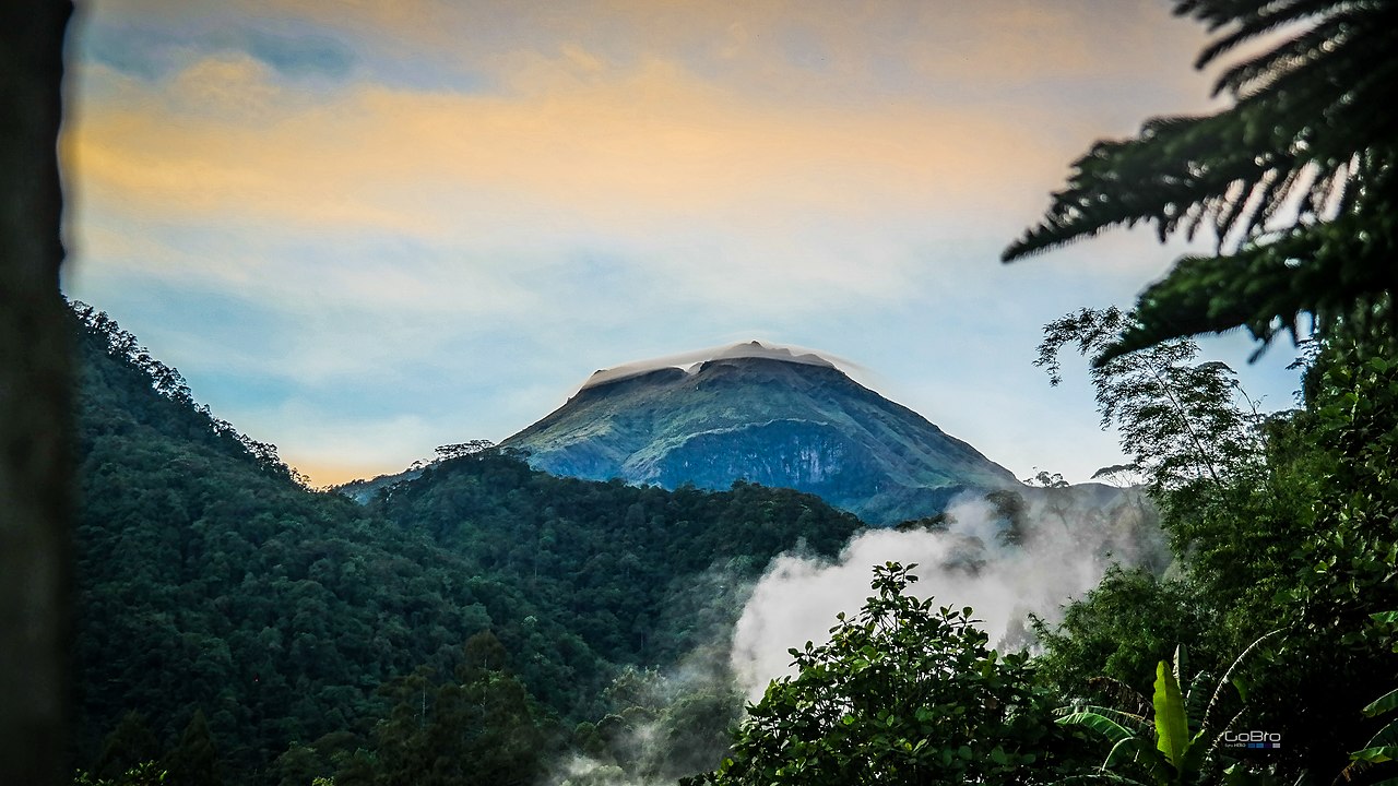
 Dulang-dulang, Philippines' 2nd highest