Anaheim Hills

[1]​ Anaheim Hills está ubicada justo al sur de Yorba Linda, en el lado opuesto de la Ruta 91 en Imperial Highway.

La parte occidental se encuentra ubicada junto a la Ruta 55, en el lado opuesto de la ciudad de Orange.

El noreste de la comunidad se extiende desde Gypsum Canyon hasta los límites con los condados de Orange/Riverside, y es rodeada por áreas no incorporadas y el Bosque Nacional Cleveland en el lado este.

Al sur se encuentran las Montañas Santa Ana, en el lado opuesto de Villa Park.

[4]​ En 2006 Anaheim Hills tenía un ingreso anual promedio de $127,298.
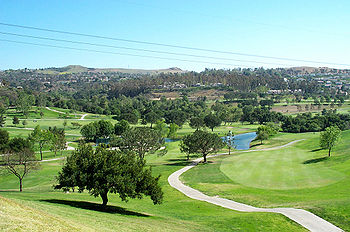
Vista de Anaheim Hills desde el Anaheim Hills Golf Club.
Santa Ana Mountains seen from Hidden Hills Estate in Yorba Linda, California, U.S.A. - Yorba Linda is known as the birthplace of Richard Nixon (37th President of the United States). The freeway that goes sideways in this photo is California State Route 91, with the left side being east (toward Riverside; the road that extends upward (southbound) from the 91 is California State Route 241, which is a toll road. The town below the 91 in this photo, the north side of the 91, is also part of Yorba Linda. The town above the 91 and to the right of the 241, the southwest corner of the interchange, is Anaheim Hills, which technically belongs to the city of Anaheim.)