A topographic map of the Republic, excluding all the overseas departments and territoriesSimplified physical map
The geography of France consists of a terrain that is mostly flat plains or gently rolling hills in the north and the west and mountainous in the south (including the Massif Central and the Pyrenees) and the east (the country's highest points being in the Alps). Metropolitan France has a total size of 551,695 km2 (213,011 sq mi) (Europe only). It is the third-largest country in Europe by area (after Russia and Ukraine) and the largest in Western Europe.
Physical geography of Metropolitan France
Köppen climate classification map of Metropolitan FranceLand use in Metropolitan France, with urban areas shown in red, 2006.Natural resources of France. Metals are in blue (Al — aluminium ore, Fe — iron ore, W — tungsten, Au — gold, U — uranium). Fossil fuels are in red (C — coal, L — lignite, P — petroleum, G — natural gas). Non-metallic minerals are in green (F — fluorite, K — potash, T — talc).
Climate
Metroplitan France's territory is relatively large and so it climate is not uniform and gives rise to the following climate nuances:
The cool semi-arid climate (BSk) is found in the western part of the Bouches-du-Rhône area and the Roussillon plain of the Pyrénées-Orientales. Summers are hot, winters are cool winters. There is insufficient average annual rainfall in some years.
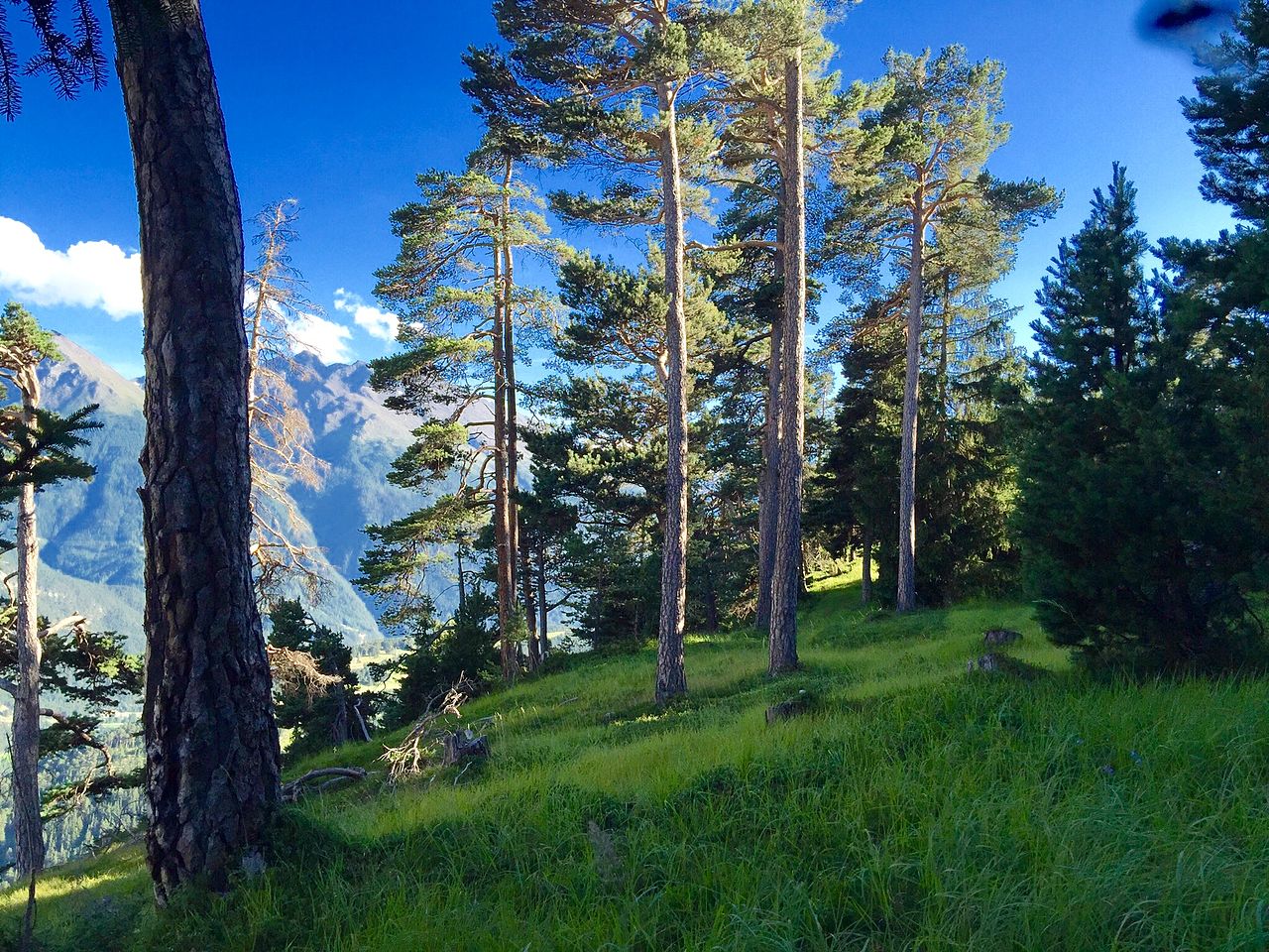
The warm-summer Mediterranean climate (Csb) is found in the northwestern part of Brittany and along the Gulf of Lion but higher in altitude, in the mountains. Summers are warm (but not hot) and dry, winters are cool and can be cold in the mountains and autumns are rainy.
The cool-summer dry-summer continental climate (Dsc) is found in all the mountainous regions of Southern France between 1,400 and 2,300-2,400 metres a.s.l. Summers are cool, short and dry, and winters are very cold and snowy.
The warm-summer humid continental climate (Dfb) is found in the far east of France or in all the mountain ranges far from the ocean or the sea. Summers are warm to hot and stormy and winters are cold and somewhat dry, and snow is not uncommon. Above 500–600 meters a.s.l in the northeastern quarter of France, the snowpack can persist throughout the winter. In January 1985, in Mouthe, the temperature has dropped under −41.2 °C (−42.2 °F).
The subalpine climate (Dfc) is found in all the mountainous regions of France between 1,100-1,400 meters a.s.l in the Vosges mountains and 1,400-2,300 metres a.s.l in the southern French Alps or in the Pyrenees. Summers are cool, short and stormy while winters are very cold, long and snowy.
The alpine tundra climate (ET) is found in all the mountainous regions of France, generally above 2,000 or 2,300-2,400 metres a.s.l depending on the mountain ranges. Summers are chilly, stormy and windy and winters are extremely cold, long and snowy.
The ice cap climate (EF) is found in all the mountainous regions of France that have a glacier, in the highest mountains of the Alps or the Pyrenees. The climate in the Mont Blanc massif (up to 4,810 meters a.s.l) is an ice cap climate for example. Summers are cold and wet and winters are extremely cold, long and snowy.
The region that now comprises France consisted of open grassland during the Pleistocene Ice Age. France gradually became forested as the glaciers retreated starting in 10,000 BC, but clearing of theoe primeval forests began in Neolithic times. These forests were still fairly extensive until the medieval era.
In prehistoric times, France was home to large predatory animals such as wolves and brown bears, as well as herbivores such as elk. The larger fauna have disappeared outside the Pyrenees Mountains where bears live as a protected species. Smaller animals include martens, wild pigs, foxes, weasels, bats, rodents, rabbits, and assorted birds.
By the 15th century, France had largely been denuded of its forests and was forced to rely on Scandinavia and their North American colonies for lumber. Significant remaining forested areas are in the Gascony region and north in the Alsace-Ardennes area. The Ardennes Forest was the scene of extensive fighting in both world wars.
The northcentral part of the region is dominated by the Paris Basin, which consists of a layered sequence of sedimentary rocks. Fertile soils over much of the area make good agricultural land. The Normandy coast to the northwest is characterized by high, chalk cliffs, while the Brittany coast (the peninsula to the west) is highly indented in places that deep valleys were drowned by the sea, and the Biscay coast to the southwest is marked by flat, sandy beaches.
A recent global remote sensing analysis suggested that there were 1,433 km2 of tidal flats in France, making it the 23rd ranked country in terms of tidal flat area.[2]
Regions and departments of Metropolitan France in 2016.
France has several levels of internal divisions. The first-level administrative division of Metropolitan France is regions. Alsom the French Republic has sovereignty over several other territories, with various administrative levels.
Metropolitan (i.e. European) France is divided into 12 régions and 1 territorial collectivity, Corsica. However, Corsica is referred to as a region in common speech. These regions are subdivided into 96 départements, which are further divided into 320 arrondissements, which are further divided into 1,995 cantons, which are further divided into 34,836 communes (as of 1/1/2021).[3]
Five overseas regions (régions d'outre-mer, or ROM): Guadeloupe, French Guiana, Martinique, Mayotte, and Réunion, with identical status to metropolitan regions. Each of these overseas regions also being an overseas département (département d'outre-mer, or DOM), with the same status as a département of metropolitan France. This double structure (région/département) is new, due to the recent extension of the regional scheme to the overseas départements, and may soon transform into a single structure, with the merger of the regional and departmental assemblies. Another proposed change is that new départements are created such as in the case of Réunion, where it has been proposed to create a second département in the south of the island, with the région of Réunion above these two départements.
One overseas "country" (pays d'outre-mer, or POM): French Polynesia. In 2003 it became an overseas collectivity (or COM). Its statutory law of 27 February 2004 gives it the particular designation of overseas country inside the Republic (or POM), but without legal modification of its status.
One uninhabited island in the Pacific Ocean off the coast of Mexico that belongs directly to the central government public land and is administered by the high-commissioner of the French Republic in French Polynesia: Clipperton.
Sint Maarten 10.2 kilometres (6.3 mi) (Saint Martin)
Coastline: 5,500 kilometres (3,400 mi) (Metropolitan). 20,000 kilometres (12,000 mi) including all overseas territories.[4]
Maritime claims:
Territorial sea: 12 nmi (22.2 km; 13.8 mi)
Contiguous zone: 24 nmi (44.4 km; 27.6 mi)
Exclusive economic zone: 334,604 km2 (129,191.3 sq mi) only in Europe. 11,691,000 km2 (4,513,920.3 sq mi) including all overseas territories. The 200 nmi (370.4 km; 230.2 mi) does not apply to the Mediterranean Sea
Continental shelf: 200 metres (660 ft) depth or to the depth of exploitation
The lands making up the French Republic, shown at the same geographic scale.
^"Climate change in France". Climatechangepost.com. Retrieved 2 June 2021.
^Murray, N.J.; Phinn, S.R.; DeWitt, M.; Ferrari, R.; Johnston, R.; Lyons, M.B.; Clinton, N.; Thau, D.; Fuller, R.A. (2019). "The global distribution and trajectory of tidal flats". Nature. 565 (7738): 222–225. doi:10.1038/s41586-018-0805-8. PMID 30568300. S2CID 56481043.
^"Les collectivités locales en chiffres 2021" (PDF) (in French). Ministère de la Cohésion des territoires et des Relations avec les collectivités territoriales. August 2021. p. 18.
^"Longueur du trait de côte en 2019". eaufrance.fr (in French). Retrieved 12 July 2024.
^"METEO FRANCE - le site institutionnel de Météo-France".
External links
Wikibooks has more on the topic of: Geography of France
(in French) GéoPortail - Geography portal of France, high altitude imagery, maps ...
A detailed map of France showing all régions and numbered départements, including their préfectures.


-2016.svg/1280px-D%C3%A9partements+r%C3%A9gions_(France)-2016.svg.png)


.jpg/1280px-France_-_Marseille_(29878897633).jpg)

