Boston ( EE. UU .: / ˈ b ɔː s t ə n / [9]) es la capital y ciudad más poblada de laMancomunidaddeMassachusettsen losEstados Unidos. La ciudad sirve comocentro cultural y financierode laNueva Inglaterradelnoreste de los Estados Unidos. Tiene un área de 48,4 millas cuadradas (125 km2)[10]y una población de 675.647 según elcenso de 2020, lo que la convierte en la tercera ciudad más grande del noreste después dela ciudad de Nueva YorkyFiladelfia.[4]Elárea estadística metropolitanaBoston , que incluye y rodea la ciudad, tiene una población de 4.919.179 en 2023, lo que la convierte en la más grande de Nueva Inglaterra y la undécima más grande del país.[11][12][13]
Boston fue fundada en la península de Shawmut en 1630 por colonos puritanos . La ciudad recibió el nombre de Boston, Lincolnshire , Inglaterra. [14] [15] Durante la Revolución estadounidense , Boston fue sede de varios eventos que resultaron fundamentales para la revolución y la posterior Guerra de la Independencia , incluida la Masacre de Boston (1770), el Motín del té de Boston (1773), la Cabalgata de medianoche de Paul Revere (1775), la Batalla de Bunker Hill (1775) y el Sitio de Boston (1775-1776). Después de la independencia estadounidense de Gran Bretaña , la ciudad continuó desempeñando un papel importante como puerto, centro de fabricación y centro de educación y cultura. [16] [17] La ciudad también se expandió significativamente más allá de la península original al rellenar tierras y anexar ciudades vecinas. Entre los muchos hitos de Boston se incluyen el primer parque público de los Estados Unidos ( Boston Common , 1634), [18] la primera escuela pública ( Boston Latin School , 1635), [19] y el primer sistema de metro ( el metro de Tremont Street , 1897). [20]
Boston ha emergido como un líder global en educación superior e investigación [21] y el centro de biotecnología más grande del mundo. [22] La ciudad también es un líder nacional en investigación científica, derecho, medicina, ingeniería y negocios. Con casi 5,000 empresas emergentes, la ciudad es considerada pionera global en innovación y emprendimiento , [23] [24] [25] y más recientemente en inteligencia artificial . [26] La economía de Boston también incluye finanzas , [27] servicios profesionales y comerciales, tecnología de la información y actividades gubernamentales. [28] Los hogares de Boston proporcionan la tasa promedio más alta de filantropía en la nación, [29] y las empresas e instituciones de la ciudad se encuentran entre las mejores del país en sostenibilidad ambiental y nuevas inversiones. [30]
En uno de sus últimos actos oficiales como líder de la comunidad de Charlestown antes de morir el 30 de septiembre de 1630, Isaac Johnson nombró al entonces nuevo asentamiento al otro lado del río "Boston". El nombre del asentamiento provenía de la ciudad natal de Johnson, Boston, Lincolnshire , de donde él, su esposa (homónima de los Arbella ) y John Cotton (abuelo de Cotton Mather ) habían emigrado a Nueva Inglaterra . El nombre de la ciudad inglesa deriva en última instancia de su santo patrón, San Botolfo , en cuya iglesia John Cotton sirvió como rector hasta su emigración con Johnson. En las primeras fuentes, Boston de Lincolnshire era conocida como "la ciudad de San Botolfo", más tarde contraída a "Boston". Antes de este cambio de nombre, el asentamiento en la península había sido conocido como "Shawmut" por William Blaxton y "Tremontaine" [31] por los colonos puritanos que había invitado. [32] [33] [34] [35] [36]
Antes de la colonización europea , la región que rodea la actual Boston estaba habitada por el pueblo de Massachusett , que tenía pequeñas comunidades estacionales. [37] [38] Cuando un grupo de colonos liderado por John Winthrop llegó en 1630, la península de Shawmut estaba casi vacía de nativos, ya que muchos habían muerto de enfermedades europeas traídas por los primeros colonos y comerciantes. [39] [40] Las excavaciones arqueológicas desenterraron uno de los vertederos para peces más antiguos de Nueva Inglaterra en Boylston Street , que los nativos construyeron ya 7000 años antes de la llegada de los europeos al hemisferio occidental. [38] [37] [41]
El primer europeo que vivió en lo que se convertiría en Boston fue un clérigo anglicano educado en Cambridge llamado William Blaxton . Fue la persona más directamente responsable de la fundación de Boston por colonos puritanos en 1630. Esto ocurrió después de que Blaxton invitara a uno de sus líderes, Isaac Johnson , a cruzar Back Bay desde la colonia en decadencia de Charlestown y compartir la península. Los puritanos hicieron el cruce en septiembre de 1630. [42] [43] [44]
La influencia puritana en Boston comenzó incluso antes de que se fundara el asentamiento con el Acuerdo de Cambridge de 1629. Este documento creó la Colonia de la Bahía de Massachusetts y fue firmado por su primer gobernador , John Winthrop . La ética puritana y su enfoque en la educación también influyeron en la historia temprana de la ciudad. La primera escuela pública de Estados Unidos, Boston Latin School , se fundó en Boston en 1635. [19] [45]
Boston fue la ciudad más grande de las Trece Colonias hasta que Filadelfia la superó a mediados del siglo XVIII. [46] La ubicación de Boston frente al mar la convirtió en un puerto animado , y la ciudad de entonces se dedicó principalmente al transporte marítimo y la pesca durante sus días coloniales. Boston era una parada principal en una ruta comercial del Caribe e importaba grandes cantidades de melaza, lo que llevó a la creación de los frijoles horneados de Boston . [47]
La economía de Boston se estancó en las décadas anteriores a la Revolución. A mediados del siglo XVIII, la ciudad de Nueva York y Filadelfia habían superado a Boston en riqueza. Durante este período, Boston atravesó dificultades financieras mientras otras ciudades de Nueva Inglaterra crecían rápidamente. [48] [49]


El tiempo continuó tempestuoso el día y la noche siguientes, lo que dio tiempo al enemigo para mejorar sus obras, traer sus cañones y ponerse en tal estado de defensa que podía prometerme poco éxito en atacarlos, dadas todas las desventajas que tenía que encontrar.
William Howe, quinto vizconde Howe , en una carta a William Legge, segundo conde de Dartmouth , sobre la decisión del ejército británico de abandonar Boston, fechada el 21 de marzo de 1776. [50]
Muchos acontecimientos cruciales de la Revolución estadounidense [51] ocurrieron en Boston o cerca de allí. La presencia de la turba en la ciudad de entonces, junto con la creciente falta de fe de los colonos en Gran Bretaña o en su Parlamento , fomentó un espíritu revolucionario allí. [48] Cuando el parlamento británico aprobó la Ley del Timbre en 1765, una turba de Boston arrasó las casas de Andrew Oliver , el funcionario encargado de hacer cumplir la Ley, y de Thomas Hutchinson , entonces vicegobernador de Massachusetts. [48] [52] Los británicos enviaron dos regimientos a Boston en 1768 en un intento de sofocar a los colonos enojados. Sin embargo, esto no les sentó bien a los colonos. En 1770, durante la Masacre de Boston , las tropas británicas dispararon contra una multitud que había comenzado a acosarlos violentamente. Los colonos obligaron a los británicos a retirar sus tropas. El evento fue ampliamente publicitado y alimentó un movimiento revolucionario en Estados Unidos. [49]
En 1773, el Parlamento aprobó la Ley del Té . Muchos de los colonos vieron la ley como un intento de obligarlos a aceptar los impuestos establecidos por las Leyes Townshend . La ley provocó el Motín del Té de Boston , donde un grupo de bostonianos enfurecidos arrojó un cargamento entero de té enviado por la Compañía de las Indias Orientales al puerto de Boston . El Motín del Té de Boston fue un evento clave que condujo a la revolución, ya que el gobierno británico respondió furiosamente con las Leyes Coercitivas , exigiendo una compensación por el té destruido a los bostonianos. [48] Esto enfureció aún más a los colonos y condujo a la Guerra de Independencia de los Estados Unidos . La guerra comenzó en el área que rodea a Boston con las Batallas de Lexington y Concord . [48] [53]
La propia Boston estuvo sitiada durante casi un año durante el asedio de Boston , que comenzó el 19 de abril de 1775. La milicia de Nueva Inglaterra impidió el movimiento del ejército británico . Sir William Howe , entonces comandante en jefe de las fuerzas británicas en América del Norte, dirigió al ejército británico en el asedio. El 17 de junio, los británicos capturaron Charlestown (ahora parte de Boston) durante la batalla de Bunker Hill . El ejército británico superó en número a la milicia estacionada allí, pero fue una victoria pírrica para los británicos porque su ejército sufrió bajas irremplazables. También fue un testimonio de la habilidad y el entrenamiento de la milicia, ya que su tenaz defensa dificultó que los británicos capturaran Charlestown sin sufrir más bajas irremplazables. [54] [55]
Varias semanas después, George Washington se hizo cargo de la milicia después de que el Congreso Continental estableciera el Ejército Continental para unificar el esfuerzo revolucionario. Ambos bandos enfrentaron dificultades y escasez de suministros en el asedio, y la lucha se limitó a incursiones y escaramuzas a pequeña escala. El estrecho Boston Neck, que en ese momento tenía solo unos treinta metros de ancho, impidió que Washington pudiera invadir Boston, y se produjo un largo punto muerto. Un joven oficial, Rufus Putnam , ideó un plan para hacer fortificaciones portátiles de madera que pudieran erigirse en el suelo helado al amparo de la oscuridad. Putnam supervisó este esfuerzo, que instaló con éxito tanto las fortificaciones como las docenas de cañones en Dorchester Heights que Henry Knox había traído laboriosamente a través de la nieve desde Fort Ticonderoga . Los asombrados británicos se despertaron a la mañana siguiente para ver una gran variedad de cañones acercándose a ellos. Se cree que el general Howe dijo que los estadounidenses habían hecho más en una noche de lo que su ejército podría haber hecho en seis meses. El ejército británico intentó un bombardeo de cañones durante dos horas, pero sus disparos no pudieron alcanzar los cañones de los colonos a esa altura. Los británicos se dieron por vencidos, abordaron sus barcos y se marcharon. Este hecho se conoció como el " Día de la Evacuación ", que Boston todavía celebra cada año el 17 de marzo. Después de esto, Washington quedó tan impresionado que nombró a Rufus Putnam como su ingeniero jefe. [53] [54] [56]

Después de la Revolución, la larga tradición marinera de Boston ayudó a convertirla en uno de los puertos más activos del país tanto para el comercio nacional como para el internacional. La actividad portuaria de Boston se vio significativamente restringida por la Ley de Embargo de 1807 (adoptada durante las Guerras napoleónicas ) y la Guerra de 1812. El comercio exterior regresó después de estas hostilidades, pero los comerciantes de Boston habían encontrado alternativas para sus inversiones de capital mientras tanto. La manufactura se convirtió en un componente importante de la economía de la ciudad, y la manufactura industrial de la ciudad superó al comercio internacional en importancia económica a mediados del siglo XIX. Los pequeños ríos que bordean la ciudad y la conectan con la región circundante facilitaron el envío de mercancías y llevaron a una proliferación de molinos y fábricas. Más tarde, una densa red de ferrocarriles impulsó la industria y el comercio de la región. [57]
Durante este período, Boston también floreció culturalmente. Fue admirada por su enrarecida vida literaria y su generoso patrocinio artístico . [58] [59] Los miembros de las antiguas familias de Boston, finalmente apodados los Brahmanes de Boston , llegaron a ser considerados como las élites sociales y culturales de la nación. [60] A menudo se los asocia con la clase alta estadounidense , la Universidad de Harvard , [61] y la Iglesia Episcopal . [62] [63]
Boston fue un puerto importante del comercio de esclavos del Atlántico en las colonias de Nueva Inglaterra , pero pronto fue superado por Salem, Massachusetts y Newport, Rhode Island . [64] Boston finalmente se convirtió en un centro del movimiento abolicionista estadounidense . [65] La ciudad reaccionó en gran medida negativamente a la Ley de Esclavos Fugitivos de 1850 , [66] contribuyendo al intento del presidente Franklin Pierce de hacer de Boston un ejemplo después del intento de Anthony Burns de escapar a la libertad. [67] [68]
En 1822, [16] los ciudadanos de Boston votaron para cambiar el nombre oficial de "Pueblo de Boston" a "Ciudad de Boston", y el 19 de marzo de 1822, los habitantes de Boston aceptaron la carta que incorporaba la ciudad. [69] En el momento en que Boston fue declarada ciudad, la población era de aproximadamente 46.226 habitantes, mientras que el área de la ciudad era de solo 4,8 millas cuadradas (12 km 2 ). [69]

En la década de 1820, la población de Boston creció rápidamente y la composición étnica de la ciudad cambió drásticamente con la primera ola de inmigrantes europeos . Los inmigrantes irlandeses dominaron la primera ola de recién llegados durante este período, especialmente después de la Gran Hambruna ; en 1850, alrededor de 35.000 irlandeses vivían en Boston . [70] En la segunda mitad del siglo XIX, la ciudad vio un número cada vez mayor de irlandeses, alemanes , libaneses , sirios, [71] francocanadienses y judíos rusos y polacos asentándose allí. A finales del siglo XIX, los barrios centrales de Boston se habían convertido en enclaves de inmigrantes étnicamente distintos y su residencia produjo un cambio cultural duradero. Los italianos se convirtieron en los habitantes más numerosos del North End , [72] los irlandeses dominaron el sur de Boston y Charlestown , y los judíos rusos vivían en el West End . Los inmigrantes irlandeses e italianos trajeron consigo el catolicismo romano. En la actualidad, los católicos constituyen la comunidad religiosa más grande de Boston, [73] y los irlandeses han desempeñado un papel importante en la política de Boston desde principios del siglo XX; entre sus figuras más destacadas se incluyen los Kennedy , Tip O'Neill y John F. Fitzgerald . [74]
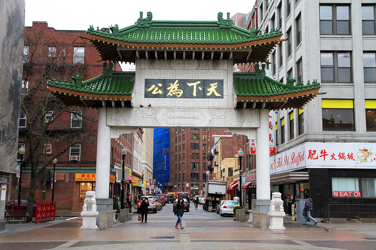
Entre 1631 y 1890, la ciudad triplicó su superficie mediante la recuperación de tierras , rellenando pantanos, marismas y huecos entre los muelles a lo largo de la costa. Los proyectos de recuperación de mediados de siglo crearon partes importantes del South End , el West End , el distrito financiero y Chinatown . [75]
Después del gran incendio de Boston de 1872 , los trabajadores utilizaron escombros de construcción como relleno a lo largo de la costa del centro de la ciudad. Durante mediados y fines del siglo XIX, los trabajadores rellenaron casi 600 acres (240 ha) de marismas salobres del río Charles al oeste de Boston Common con grava traída por ferrocarril desde las colinas de Needham Heights. La ciudad anexó las ciudades adyacentes de South Boston (1804), East Boston (1836), Roxbury (1868), Dorchester (incluyendo la actual Mattapan y una parte de South Boston ) (1870), Brighton (incluyendo la actual Allston ) (1874), West Roxbury (incluyendo la actual Jamaica Plain y Roslindale ) (1874), Charlestown (1874) y Hyde Park (1912). [76] [77] Otras propuestas no tuvieron éxito para la anexión de Brookline , Cambridge, [78] y Chelsea . [79] [80]

Muchos edificios arquitectónicamente significativos fueron construidos durante estos primeros años del siglo XX: Horticultural Hall , [81] el Tennis and Racquet Club , [82] Isabella Stewart Gardner Museum , [83] Fenway Studios , [84] Jordan Hall , [85] y la Boston Opera House . El puente Longfellow , [86] construido en 1906, fue mencionado por Robert McCloskey en Make Way for Ducklings , describiendo su característica de "saleros y pimenteros". [87] Fenway Park , sede de los Boston Red Sox , abrió en 1912, [88] y el Boston Garden abrió en 1928. [89] El Aeropuerto Internacional Logan abrió el 8 de septiembre de 1923. [90]
Boston entró en decadencia a principios y mediados del siglo XX, a medida que las fábricas se volvían viejas y obsoletas y las empresas se mudaban de la región en busca de mano de obra más barata en otros lugares. [91] Boston respondió iniciando varios proyectos de renovación urbana , bajo la dirección de la Autoridad de Reurbanización de Boston (BRA), establecida en 1957. En 1958, la BRA inició un proyecto para mejorar el histórico barrio de West End. La demolición extensiva se encontró con una fuerte oposición pública y miles de familias fueron desplazadas. [92]
La BRA continuó implementando proyectos de dominio eminente , incluyendo la limpieza de la vibrante zona de Scollay Square para la construcción del Centro de Gobierno de estilo modernista . En 1965, el Centro de Salud Columbia Point abrió en el vecindario de Dorchester , el primer Centro de Salud Comunitario en los Estados Unidos. Principalmente servía al enorme complejo de viviendas públicas Columbia Point adyacente, que se construyó en 1953. El centro de salud todavía está en funcionamiento y fue reinaugurado en 1990 como el Centro de Salud Comunitario Geiger-Gibson. [93] El complejo Columbia Point en sí fue remodelado y revitalizado entre 1984 y 1990 para convertirse en un desarrollo residencial de ingresos mixtos llamado Harbor Point Apartments. [94]
En la década de 1970, la economía de la ciudad había comenzado a recuperarse después de 30 años de recesión económica. Durante este período se construyó una gran cantidad de rascacielos en el Distrito Financiero y en Back Bay de Boston . [95] Este auge continuó hasta mediados de la década de 1980 y se reanudó después de algunas pausas. Hospitales como el Massachusetts General Hospital , el Beth Israel Deaconess Medical Center y el Brigham and Women's Hospital lideran la nación en innovación médica y atención al paciente. Escuelas como el Boston Architectural College , Boston College , Boston University , la Harvard Medical School , la Tufts University School of Medicine , la Northeastern University , el Massachusetts College of Art and Design , el Wentworth Institute of Technology , el Berklee College of Music , el Boston Conservatory y muchas otras atraen estudiantes a la zona. Sin embargo, la ciudad experimentó un conflicto a partir de 1974 por el transporte en autobús para la desegregación , que resultó en disturbios y violencia en torno a las escuelas públicas a mediados de la década de 1970. [96] Boston también ha experimentado un proceso de gentrificación en la segunda mitad del siglo XX, [97] con un marcado aumento de los precios de las viviendas desde los años 1990, cuando el régimen de control de alquileres de la ciudad fue derribado por una propuesta de votación estatal . [98]

Boston es un centro intelectual, tecnológico y político. Sin embargo, ha perdido algunas instituciones regionales importantes, [99] incluida la pérdida por fusiones y adquisiciones de instituciones financieras locales como FleetBoston Financial , que fue adquirida por Bank of America, con sede en Charlotte , en 2004. [100] Los grandes almacenes Jordan Marsh y Filene's, con sede en Boston , se han fusionado con Macy's, con sede en la ciudad de Nueva York . [101] La adquisición de The Boston Globe por parte de The New York Times en 1993 [102] se revirtió en 2013 cuando se revendió al empresario de Boston John W. Henry . En 2016, se anunció que General Electric trasladaría su sede corporativa de Connecticut al Seaport District en Boston, uniéndose a muchas otras empresas en este vecindario en rápido desarrollo. [103] La ciudad también vio la finalización del Proyecto de Túnel/Arteria Central, conocido como Big Dig , en 2007 después de muchos retrasos y sobrecostos. [104]
El 15 de abril de 2013, dos hermanos islamistas chechenos detonaron un par de bombas cerca de la línea de meta del Maratón de Boston , matando a tres personas e hiriendo a aproximadamente 264. [105] La posterior búsqueda de los atacantes condujo al cierre de Boston y los municipios circundantes. La región mostró solidaridad durante este tiempo, como lo simboliza el lema Boston Strong . [106]
En 2016, Boston se postuló brevemente como candidato estadounidense para los Juegos Olímpicos de Verano de 2024. La candidatura fue apoyada por el alcalde y una coalición de líderes empresariales y filántropos locales, pero finalmente fue abandonada debido a la oposición pública. [107] Luego, el Comité Olímpico de los Estados Unidos seleccionó a Los Ángeles como candidato estadounidense y Los Ángeles finalmente se aseguró el derecho a albergar los Juegos Olímpicos de Verano de 2028. [ 108] Sin embargo, Boston es una de las once ciudades estadounidenses que albergarán partidos durante la Copa Mundial de la FIFA 2026 , y los juegos se llevarán a cabo en el Estadio Gillette . [109]
El centro geográfico de Boston se encuentra en Roxbury . Al norte del centro se encuentra el South End. No debe confundirse con South Boston, que se encuentra directamente al este del South End. Al norte de South Boston se encuentra East Boston y al suroeste de East Boston se encuentra el North End.
Desconocido, Un coloquialismo local [110]


Boston tiene una superficie de 232,1 km² (89,63 mi² ) . De esta superficie, 125,4 km² (48,4 mi² ) , o el 54 %, es tierra y 106,7 km² (41,2 mi² ) , o el 46 %, es agua. La elevación oficial de la ciudad, medida en el Aeropuerto Internacional Logan , es de 5,8 m (19 pies) sobre el nivel del mar . [111] El punto más alto de Boston es Bellevue Hill a 100 m (330 pies) sobre el nivel del mar, y el punto más bajo está al nivel del mar. [112] Boston está situada junto al puerto de Boston , un brazo de la bahía de Massachusetts , a su vez un brazo del océano Atlántico.
Boston está rodeada por la región metropolitana de Greater Boston . Limita al este con la ciudad de Winthrop y las islas del puerto de Boston , al noreste con las ciudades de Revere , Chelsea y Everett , al norte con las ciudades de Somerville y Cambridge , al noroeste con Watertown , al oeste con la ciudad de Newton y la ciudad de Brookline , al suroeste con la ciudad de Dedham y pequeñas partes de Needham y Canton , y al sureste con la ciudad de Milton y la ciudad de Quincy .
El río Charles separa los barrios de Allston-Brighton , Fenway-Kenmore y Back Bay de Boston de Watertown y Cambridge, y la mayor parte de Boston de su propio barrio de Charlestown . El río Neponset forma el límite entre los barrios del sur de Boston y Quincy y Milton . El río Mystic separa Charlestown de Chelsea y Everett, y Chelsea Creek y el puerto de Boston separan East Boston del centro de la ciudad , el North End y el puerto marítimo . [113]

A Boston se le denomina a veces una "ciudad de barrios" debido a la profusión de diversas subsecciones. [114] [115] La Oficina de Servicios Vecinales del gobierno de la ciudad ha designado oficialmente 23 barrios: [116]
Más de dos tercios de la superficie actual del interior de Boston no existían cuando se fundó la ciudad. En cambio, se crearon mediante el relleno gradual de las zonas de marea circundantes a lo largo de los siglos. [75] Esto se logró utilizando tierra proveniente de la nivelación o rebajamiento de las tres colinas originales de Boston (el "Trimountain", de donde toma su nombre la calle Tremont), así como con grava traída en tren desde Needham para rellenar la Back Bay . [17]
El centro de la ciudad y sus alrededores inmediatos (incluido el distrito financiero, el centro gubernamental y South Boston ) consisten en gran parte en edificios de mampostería de baja altura, a menudo de estilo federal y renacimiento griego , intercalados con rascacielos modernos. [117] Back Bay incluye muchos puntos de referencia destacados, como la Biblioteca Pública de Boston , el Centro de la Ciencia Cristiana , Copley Square , Newbury Street y los dos edificios más altos de Nueva Inglaterra: la Torre John Hancock y el Prudential Center . [118] Cerca de la Torre John Hancock se encuentra el antiguo edificio John Hancock con su prominente faro iluminado , cuyo color pronostica el clima. [119] Las áreas comerciales más pequeñas se intercalan entre áreas de casas unifamiliares y casas adosadas multifamiliares de madera/ladrillo. El Distrito Histórico de South End es el vecindario contiguo de la era victoriana más grande que aún se conserva en los EE. UU. [120]
La geografía del centro y del sur de Boston se vio particularmente afectada por el proyecto de la arteria central y el túnel (que se desarrolló entre 1991 y 2007 y se conocía extraoficialmente como " Big Dig "). Ese proyecto eliminó la arteria central elevada e incorporó nuevos espacios verdes y áreas abiertas. [121]
.jpg/1280px-Urban-Rural_Population_and_Land_Area_Estimates,_v2,_2010_Greater_Boston,_U.S._(13873746295).jpg)
Boston se encuentra dentro de la ecorregión de Boston Basin , que se caracteriza por colinas bajas y onduladas con varios estanques, lagos y embalses. Los bosques son principalmente maderas duras de transición como el roble y el nogal mezclados con pino blanco . [122] Como ciudad costera construida en gran parte sobre relleno , el aumento del nivel del mar es una gran preocupación para el gobierno de la ciudad. Un plan de acción climática de 2019 anticipa de 2 pies (1 m) a más de 7 pies (2 m) de aumento del nivel del mar en Boston para fines del siglo XXI. [123] Muchos edificios antiguos en ciertas áreas de Boston están sostenidos por pilotes de madera clavados en el relleno del área; estos pilotes permanecen sólidos si se sumergen en agua, pero están sujetos a pudrición seca si se exponen al aire durante períodos prolongados. [124] Los niveles de agua subterránea han estado cayendo en muchas áreas de la ciudad, debido en parte a un aumento en la cantidad de agua de lluvia descargada directamente en las alcantarillas en lugar de ser absorbida por el suelo. El Boston Groundwater Trust coordina el monitoreo de los niveles de agua subterránea en toda la ciudad a través de una red de pozos de monitoreo públicos y privados. [125]
La ciudad desarrolló un plan de acción climática que abarca la reducción de carbono en los edificios, el transporte y el uso de energía. El primer plan de este tipo se puso en marcha en 2007, y se publicaron actualizaciones en 2011, 2014 y 2019. [126] Este plan incluye la Ordenanza de divulgación e información sobre el consumo de energía en los edificios, que exige que los edificios más grandes de la ciudad divulguen sus estadísticas anuales de consumo de energía y agua y participen en una evaluación energética cada cinco años. [127] Una iniciativa independiente, Resilient Boston Harbor, establece recomendaciones específicas para cada barrio en materia de resiliencia costera . [128] En 2013, el alcalde Thomas Menino presentó el Incentivo para renovar toda la construcción de Boston, que reduce el coste de vida en los edificios que se consideran energéticamente eficientes. [129]
Según la clasificación climática de Köppen , Boston tiene un clima continental húmedo de veranos cálidos (Köppen Dfa ) bajo la isoterma de 0 °C (32,0 °F) o un clima subtropical húmedo (Köppen Cfa ) bajo la isoterma de −3 °C (26,6 °F). [130] Los veranos son cálidos a calurosos y húmedos, mientras que los inviernos son fríos y tormentosos, con períodos ocasionales de fuertes nevadas. La primavera y el otoño suelen ser frescos y templados, con condiciones variables que dependen de la dirección del viento y la posición de la corriente en chorro . Los patrones de viento predominantes que soplan en alta mar minimizan la influencia del océano Atlántico. Sin embargo, en invierno, las áreas cercanas a la costa inmediata a menudo ven más lluvia que nieve, ya que a veces el aire cálido se extrae del Atlántico. [131] La ciudad se encuentra en el límite entre las zonas de rusticidad de plantas del USDA 6b (lejos de la costa) y 7a (cerca de la costa). [132]
El mes más cálido es julio, con una temperatura media de 23,4 °C (74,1 °F). El mes más frío es enero, con una temperatura media de -1,2 °C (29,9 °F). Los periodos con temperaturas superiores a 32 °C (90 °F) en verano y por debajo del punto de congelación en invierno no son raros, pero tienden a ser bastante cortos, con unos 13 y 25 días al año de cada uno, respectivamente. [133]
Las lecturas por debajo de 0 °F (−18 °C) suelen ocurrir cada 3 a 5 años. [134] La lectura por debajo de 0 °F (−18 °C) más reciente ocurrió el 4 de febrero de 2023, cuando la temperatura bajó a −10 °F (−23 °C); esta fue la lectura de temperatura más baja en la ciudad desde 1957. [133] Además, pueden pasar varias décadas entre lecturas de 100 °F (38 °C); La última lectura de este tipo se produjo el 24 de julio de 2022. [133] La ventana promedio de temperaturas bajo cero de la ciudad es del 9 de noviembre al 5 de abril. [133] [a] Los registros oficiales de temperatura han variado desde -18 °F (-28 °C) el 9 de febrero de 1934 hasta 104 °F (40 °C) el 4 de julio de 1911. El récord de temperatura máxima diaria fría es de 2 °F (-17 °C) el 30 de diciembre de 1917, mientras que el récord de temperatura mínima diaria cálida es de 83 °F (28 °C) tanto el 2 de agosto de 1975 como el 21 de julio de 2019. [135] [133]
Boston tiene un promedio de 1110 mm (43,6 pulgadas) de precipitación al año, con 125 cm (49,2 pulgadas) de nieve por temporada. [133] La mayoría de las nevadas ocurren desde mediados de noviembre hasta principios de abril, y la nieve es rara en mayo y octubre. [136] [137] También hay una alta variabilidad interanual en las nevadas; por ejemplo, el invierno de 2011-12 vio solo 23,6 cm (9,3 pulgadas) de nieve acumulada, pero el invierno anterior, la cifra correspondiente fue de 2,06 m (81,0 pulgadas). [133] [b] La ubicación costera de la ciudad en el Atlántico Norte hace que la ciudad sea muy propensa a los nordestes , que pueden producir grandes cantidades de nieve y lluvia. [131]
La niebla es bastante común, particularmente en primavera y principios de verano. Debido a su ubicación costera, la ciudad a menudo recibe brisas marinas , especialmente a fines de la primavera, cuando las temperaturas del agua aún son bastante frías y las temperaturas en la costa pueden ser más de 20 °F (11 °C) más frías que unas pocas millas tierra adentro, a veces cayendo en esa cantidad cerca del mediodía. [138] [139] Las tormentas eléctricas suelen ocurrir de mayo a septiembre; ocasionalmente, pueden volverse severas, con granizo grande , vientos dañinos y fuertes lluvias. [131] Aunque el centro de Boston nunca ha sido golpeado por un tornado violento , la ciudad en sí ha experimentado muchas advertencias de tornado . Las tormentas dañinas son más comunes en las áreas al norte, oeste y noroeste de la ciudad. [140]
Ver o editar datos gráficos sin procesar.

En 2020, se estimó que Boston tenía 691.531 residentes que vivían en 266.724 hogares [4] , un aumento de población del 12% con respecto a 2010. La ciudad es la tercera ciudad grande más densamente poblada de los EE. UU. con más de medio millón de residentes y la capital estatal más densamente poblada. Alrededor de 1,2 millones de personas pueden estar dentro de los límites de Boston durante el horario laboral y hasta 2 millones durante eventos especiales. Esta fluctuación de personas se debe a cientos de miles de residentes suburbanos que viajan a la ciudad para trabajar, estudiar, recibir atención médica y eventos especiales. [159]
En la ciudad, el 21,9% de la población tenía 19 años o menos, el 14,3% tenía entre 20 y 24 años, el 33,2% entre 25 y 44 años, el 20,4% entre 45 y 64 años y el 10,1% tenía 65 años o más. La edad media era de 30,8 años. Por cada 100 mujeres, había 92,0 hombres. Por cada 100 mujeres de 18 años o más, había 89,9 hombres. [160] Había 252.699 hogares, de los cuales el 20,4% tenía hijos menores de 18 años viviendo en ellos, el 25,5% eran parejas casadas que vivían juntas, el 16,3% tenía una mujer como cabeza de familia sin marido presente y el 54,0% no eran familias. El 37,1% de los hogares estaban formados por una sola persona y el 9,0% tenía a alguien viviendo solo que tenía 65 años o más. El tamaño promedio del hogar era de 2,26 y el tamaño promedio de la familia era de 3,08. [160]
El ingreso familiar promedio en Boston era de $51,739, mientras que el ingreso familiar promedio era de $61,035. Los trabajadores masculinos a tiempo completo durante todo el año tenían un ingreso promedio de $52,544 frente a los $46,540 de las trabajadoras a tiempo completo durante todo el año. El ingreso per cápita de la ciudad era de $33,158. El 21.4% de la población y el 16.0% de las familias estaban por debajo del umbral de pobreza. Del total de la población, el 28.8% de los menores de 18 años y el 20.4% de los mayores de 65 años vivían por debajo del umbral de pobreza. [161] Boston tiene una brecha de riqueza racial significativa , ya que los bostonianos blancos tienen un patrimonio neto promedio de $247,500 en comparación con un patrimonio neto promedio de $8 para los residentes negros no inmigrantes y $0 para los residentes inmigrantes dominicanos. [162]
Desde la década de 1950 hasta finales del siglo XX, la proporción de blancos no hispanos en la ciudad disminuyó. En 2000, los blancos no hispanos constituían el 49,5% de la población de la ciudad, lo que convirtió a la ciudad en una minoría mayoritaria por primera vez. Sin embargo, en el siglo XXI, la ciudad ha experimentado una gentrificación significativa , durante la cual los blancos adinerados se han mudado a áreas que antes no eran blancas. En 2006, la Oficina del Censo de los EE. UU. estimó que los blancos no hispanos volvieron a formar una ligera mayoría, pero a partir de 2010 [update], en parte debido al colapso de la vivienda, así como a los mayores esfuerzos para hacer que las viviendas más asequibles estén más disponibles, la población no blanca se ha recuperado. Esto también puede tener que ver con el aumento de las poblaciones latinoamericanas y asiáticas y una mayor claridad en torno a las estadísticas del censo de EE. UU., que indican una población blanca no hispana del 47% (algunos informes dan cifras ligeramente inferiores). [163] [164] [165]
_as_they_march_in_the_108th_Annual_St._Patrick's_Day_Parade.jpg/1280px-thumbnail.jpg)

Los afroamericanos representan el 22% de la población de la ciudad. Las personas de ascendencia irlandesa forman el segundo grupo étnico más grande de la ciudad, representando el 15,8% de la población, seguidos por los italianos , que representan el 8,3% de la población. Las personas de ascendencia antillana y caribeña son otro grupo considerable, en conjunto representan más del 15%. [169]
En el área metropolitana de Boston, estos números crecieron significativamente, con 150.000 dominicanos según estimaciones de 2018, 134.000 puertorriqueños, 57.500 salvadoreños, 39.000 guatemaltecos, 36.000 mexicanos y más de 35.000 colombianos. [170] East Boston tiene una población hispana/latina diversa de salvadoreños, colombianos, guatemaltecos, mexicanos, dominicanos y puertorriqueños. Las poblaciones hispanas en los vecindarios del suroeste de Boston están compuestas principalmente por dominicanos y puertorriqueños, que generalmente comparten vecindarios en esta sección con afroamericanos y negros con orígenes del Caribe y África, especialmente caboverdianos y haitianos. Barrios como Jamaica Plain y Roslindale han experimentado un número creciente de dominicanos estadounidenses . [171]
Hay una gran comunidad armenia histórica en Boston, [172] y la ciudad alberga el Parque del Patrimonio Armenio . [173] Además, más de 27.000 estadounidenses de origen chino establecieron su hogar en la ciudad de Boston en 2013. [174] En general, según las Estimaciones de 5 años de la Encuesta sobre la comunidad estadounidense de 2012-2016, los grupos de ascendencia más grandes en Boston son: [175] [176]
Los datos proceden de las estimaciones quinquenales de la Encuesta sobre la comunidad estadounidense de 2008 a 2012. [177] [178] [179]
.jpg/1280px-Sunset_in_Copley_Square_(25887).jpg)
Según un estudio de 2014 del Pew Research Center , el 57% de la población de la ciudad se identificó como cristiana , el 25% asistía a una variedad de iglesias protestantes y el 29% profesaba creencias católicas romanas ; el 33% afirma no tener ninguna afiliación religiosa , mientras que el 10% restante está compuesto por seguidores del judaísmo , el budismo , el islam , el hinduismo y otras religiones. [180] [181]
En 2010 [update], la Iglesia católica tenía el mayor número de seguidores como denominación única en el área metropolitana de Boston , con más de dos millones de miembros y 339 iglesias, seguida por la Iglesia Episcopal con 58.000 seguidores en 160 iglesias. La Iglesia Unida de Cristo tenía 55.000 miembros y 213 iglesias. [182]
En 2015, el área metropolitana de Boston contenía una población judía de aproximadamente 248 000 personas . [183] Más de la mitad de los hogares judíos en el área metropolitana de Boston residen en la ciudad misma, Brookline , Newton , Cambridge , Somerville o pueblos adyacentes. [183] Una pequeña minoría practica el confucianismo , y algunos practican el confucianismo de Boston , una evolución estadounidense del confucianismo adaptada para los intelectuales de Boston. [184]
Boston, una ciudad global , se encuentra entre las 30 ciudades económicamente más poderosas del mundo. [187] Con una economía de 363 mil millones de dólares, el área metropolitana de Boston tiene la sexta economía más grande del país y la duodécima más grande del mundo . [188]
Las universidades de Boston ejercen un impacto significativo en la economía regional. Boston atrae a más de 350.000 estudiantes universitarios de todo el mundo, que aportan más de 4.800 millones de dólares anuales a la economía de la ciudad. [189] [190] Las escuelas de la zona son importantes empleadores y atraen industrias a la ciudad y la región circundante. La ciudad alberga varias empresas de tecnología y es un centro de biotecnología , y el Instituto Milken clasifica a Boston como el principal grupo de ciencias de la vida del país. [191] Boston recibe la mayor cantidad absoluta de financiación anual de los Institutos Nacionales de Salud de todas las ciudades de los Estados Unidos. [192]
La ciudad se considera altamente innovadora por diversas razones, incluida la presencia de la academia , el acceso al capital de riesgo y la presencia de muchas empresas de alta tecnología . [24] [193] El corredor de la Ruta 128 y el Gran Boston siguen siendo un centro importante para la inversión de capital de riesgo, [194] y la alta tecnología sigue siendo un sector importante. [195]
El turismo también constituye una gran parte de la economía de Boston, con 21,2 millones de visitantes nacionales e internacionales que gastaron $8.3 mil millones en 2011. [196] Excluyendo a los visitantes de Canadá y México, más de 1,4 millones de turistas internacionales visitaron Boston en 2014, con los de China y el Reino Unido a la cabeza de la lista. [197] El estatus de Boston como capital del estado, así como sede regional de agencias federales, ha hecho que la ley y el gobierno sean otro componente importante de la economía de la ciudad. [198] La ciudad es un importante puerto marítimo a lo largo de la costa este de los Estados Unidos y el puerto industrial y pesquero en funcionamiento continuo más antiguo del hemisferio occidental . [199]
En el Índice de Centros Financieros Globales de 2018 , Boston fue clasificado como el decimotercer centro de servicios financieros más competitivo del mundo y el segundo más competitivo en los Estados Unidos. [200] Fidelity Investments, con sede en Boston, ayudó a popularizar el fondo mutuo en la década de 1980 y ha convertido a Boston en uno de los principales centros financieros de los Estados Unidos. [201] La ciudad alberga la sede del Banco Santander y Boston es un centro para empresas de capital de riesgo . State Street Corporation , que se especializa en servicios de gestión y custodia de activos, tiene su sede en la ciudad. Boston es un centro de impresión y publicación [202] — Houghton Mifflin Harcourt tiene su sede dentro de la ciudad, junto con Bedford-St. Martin's Press y Beacon Press . Las unidades editoriales de Pearson PLC también emplean a varios cientos de personas en Boston. La ciudad alberga dos centros de convenciones : el Centro de Convenciones Hynes en Back Bay y el Centro de Convenciones y Exposiciones de Boston en la costa de South Boston . [203] Boston alberga las sedes de varias importantes empresas de calzado y atletismo, entre ellas Converse , New Balance y Reebok . Las sedes o las oficinas regionales de Rockport , Puma y Wolverine World Wide, Inc. [204] se encuentran justo en las afueras de la ciudad. [205]

Las escuelas públicas de Boston inscriben a 57.000 estudiantes que asisten a 145 escuelas, incluidas Boston Latin Academy , John D. O'Bryant School of Math & Science y la reconocida Boston Latin School . La Boston Latin School se estableció en 1635 y es la escuela secundaria pública más antigua de los EE. UU. Boston también opera la segunda escuela secundaria pública más antigua de los Estados Unidos y su escuela primaria pública más antigua. [19] Los estudiantes del sistema son 40% hispanos o latinos, 35% negros o afroamericanos, 13% blancos y 9% asiáticos. [206] También hay escuelas privadas, parroquiales y charter , y aproximadamente 3.300 estudiantes minoritarios asisten a escuelas suburbanas participantes a través del Consejo Metropolitano de Oportunidades Educativas . [207] En septiembre de 2019, la ciudad inauguró formalmente Boston Saves, un programa que proporciona a cada niño inscrito en el sistema de jardín de infantes de la ciudad una cuenta de ahorros que contiene $ 50 para usar en la universidad o la capacitación profesional. [208]


Varias de las universidades más reconocidas y mejor clasificadas del mundo están cerca de Boston. [210] Tres universidades con una importante presencia en la ciudad, Harvard , MIT y Tufts , están a las afueras de Boston en las ciudades de Cambridge y Somerville , conocidas como el Triángulo de la Capacidad Intelectual . [211] Harvard es el instituto de educación superior más antiguo del país y está centrado al otro lado del río Charles en Cambridge, aunque la mayoría de sus propiedades de tierra y una cantidad sustancial de sus actividades educativas están en Boston. Su escuela de negocios e instalaciones deportivas están en el vecindario Allston de Boston , y sus escuelas de medicina , odontología y salud pública están ubicadas en el área de Longwood . [212] El Instituto Tecnológico de Massachusetts (MIT) se originó en Boston y durante mucho tiempo fue conocido como " Boston Tech "; se mudó al otro lado del río a Cambridge en 1916. [213] El campus principal de la Universidad Tufts está al norte de la ciudad en Somerville y Medford , aunque ubica sus escuelas de medicina y odontología en el Chinatown de Boston en el Tufts Medical Center . [214]
Greater Boston tiene más de 50 colegios y universidades, con 250.000 estudiantes matriculados solo en Boston y Cambridge. [215] Las universidades privadas más grandes de la ciudad incluyen la Universidad de Boston (también el cuarto empleador más grande de la ciudad), [216] con su campus principal a lo largo de Commonwealth Avenue y un campus médico en South End , la Universidad Northeastern en el área de Fenway , [217] la Universidad de Suffolk cerca de Beacon Hill , que incluye la facultad de derecho y la escuela de negocios , [218] y el Boston College , que se extiende a lo largo de la frontera entre Boston (Brighton) y Newton. [219] La única universidad pública de Boston es la Universidad de Massachusetts Boston en Columbia Point en Dorchester . Roxbury Community College y Bunker Hill Community College son los dos colegios comunitarios públicos de la ciudad. En total, los colegios y universidades de Boston emplean a más de 42.600 personas, lo que representa casi el siete por ciento de la fuerza laboral de la ciudad. [220]
Cinco miembros de la Asociación de Universidades Estadounidenses se encuentran en el Gran Boston (más que cualquier otra área metropolitana): la Universidad de Harvard, el Instituto Tecnológico de Massachusetts, la Universidad de Tufts, la Universidad de Boston y la Universidad de Brandeis . [221] Además, el Gran Boston contiene siete universidades de mayor actividad de investigación (R1) según la Clasificación Carnegie . Esto incluye, además de las cinco mencionadas anteriormente, Boston College y Northeastern University. Esta es, por un amplio margen, la mayor concentración de tales instituciones en una sola área metropolitana. Los hospitales, universidades e instituciones de investigación en el Gran Boston recibieron más de $1.77 mil millones en subvenciones de los Institutos Nacionales de Salud en 2013, más dinero que cualquier otra área metropolitana estadounidense. [222] Esta alta densidad de institutos de investigación también contribuye a la alta densidad de investigadores en el inicio de su carrera en Boston, que, debido a los altos costos de la vivienda en la región, han demostrado enfrentar estrés habitacional. [223] [224]
Las universidades privadas más pequeñas incluyen Babson College , Bentley University , Boston Architectural College , Emmanuel College , Fisher College , MGH Institute of Health Professions , Massachusetts College of Pharmacy and Health Sciences , Simmons University , Wellesley College , Wheelock College , Wentworth Institute of Technology , New England School of Law (originalmente establecida como la primera escuela de derecho exclusivamente femenina de Estados Unidos), [225] y Emerson College . [226] La región también alberga varios conservatorios y escuelas de arte, incluido el New England Conservatory (el conservatorio independiente más antiguo de los Estados Unidos), [227] el Boston Conservatory y Berklee College of Music , que ha hecho de Boston una ciudad importante para la música jazz. [228] También existen muchas escuelas de oficios en la ciudad, como el Boston Career Institute, la North Bennet Street School y el Greater Boston Joint Apprentice Training Center. [229]

Boston tiene un sólido sistema de gobierno de alcalde-concejo en el que el alcalde (elegido cada cuatro años) tiene un amplio poder ejecutivo. Michelle Wu se convirtió en alcaldesa en noviembre de 2021, sucediendo a Kim Janey , quien se convirtió en alcaldesa interina en marzo de 2021 luego de la confirmación de Marty Walsh para el puesto de Secretario de Trabajo en la Administración Biden/Harris . El mandato de veinte años del predecesor de Walsh, Thomas Menino, fue el más largo en la historia de la ciudad. [230] El Concejo Municipal de Boston se elige cada dos años; hay nueve escaños de distrito y cuatro escaños "en general" en toda la ciudad. [231] El Comité Escolar, que supervisa las Escuelas Públicas de Boston , es designado por el alcalde. [232] La ciudad utiliza un algoritmo llamado CityScore para medir la eficacia de varios servicios de la ciudad. Esta puntuación está disponible en un panel público en línea y permite a los administradores de la ciudad en policía, bomberos, escuelas, servicios de gestión de emergencias y 3-1-1 tomar medidas y hacer ajustes en áreas de preocupación. [233]

In addition to city government, numerous commissions and state authorities, including the Massachusetts Department of Conservation and Recreation, the Boston Public Health Commission, the Massachusetts Water Resources Authority (MWRA), and the Massachusetts Port Authority (Massport), play a role in the life of Bostonians. As the capital of Massachusetts, Boston plays a major role in state politics.[f]

The city has several federal facilities, including the John F. Kennedy Federal Office Building, the Thomas P. O'Neill Jr. Federal Building, the John W. McCormack Post Office and Courthouse, and the Federal Reserve Bank of Boston.[236] The United States Court of Appeals for the First Circuit and the United States District Court for the District of Massachusetts are housed in The John Joseph Moakley United States Courthouse.[237][238]
Federally, Boston is split between two congressional districts. Three-fourths of the city is in the 7th district and is represented by Ayanna Pressley while the remaining southern fourth is in the 8th district and is represented by Stephen Lynch,[239] both of whom are Democrats; a Republican has not represented a significant portion of Boston in over a century. The state's senior member of the United States Senate is Democrat Elizabeth Warren, first elected in 2012.[240] The state's junior member of the United States Senate is Democrat Ed Markey, who was elected in 2013 to succeed John Kerry after Kerry's appointment and confirmation as the United States Secretary of State.[241]
Boston included $414 million in spending on the Boston Police Department in the fiscal 2021 budget. This is the second largest allocation of funding by the city after the allocation to Boston Public Schools.[242]
Like many major American cities, Boston has experienced a great reduction in violent crime since the early 1990s. Boston's low crime rate since the 1990s has been credited to the Boston Police Department's collaboration with neighborhood groups and church parishes to prevent youths from joining gangs, as well as involvement from the United States Attorney and District Attorney's offices. This helped lead in part to what has been touted as the "Boston Miracle". Murders in the city dropped from 152 in 1990 (for a murder rate of 26.5 per 100,000 people) to just 31—not one of them a juvenile—in 1999 (for a murder rate of 5.26 per 100,000).[243]
According to the Uniform Crime Reporting (UCR) program in 2022, Boston had 3,955 reported violent crimes (which include homicide, rape, robbery, and aggravated assault) and 11,514 reported property crimes (which include arson, burglary, larceny-theft, and motor vehicle theft). With a violent crime rate of 608.7 per 100,000 people, the city's violent crime rate is higher than Massachusetts' rate of 322 per 100,000 people and the national rate of 380.7 per 100,000 people. While Boston's property crime rate, at 1772.0 per 100,000 people, is higher than Massachusetts' property crime rate of 1070.1 per 100,000 people, it is lower than the national property crime rate of 1954.4 per 100,000 people.[244][g]
.jpg/1280px-Old_State_House_(49280448012).jpg)


Boston shares many cultural roots with greater New England, including a dialect of the non-rhotic Eastern New England accent known as the Boston accent[246] and a regional cuisine with a large emphasis on seafood, salt, and dairy products.[247] Boston also has its own collection of neologisms known as Boston slang and sardonic humor.[248]
In the early 1800s, William Tudor wrote that Boston was "'perhaps the most perfect and certainly the best-regulated democracy that ever existed. There is something so impossible in the immortal fame of Athens, that the very name makes everything modern shrink from comparison; but since the days of that glorious city I know of none that has approached so near in some points, distant as it may still be from that illustrious model.'[249] From this, Boston has been called the "Athens of America" (also a nickname of Philadelphia)[250] for its literary culture, earning a reputation as "the intellectual capital of the United States".[251]
In the nineteenth century, Ralph Waldo Emerson, Henry David Thoreau, Nathaniel Hawthorne, Margaret Fuller, James Russell Lowell, and Henry Wadsworth Longfellow wrote in Boston. Some consider the Old Corner Bookstore to be the "cradle of American literature", the place where these writers met and where The Atlantic Monthly was first published.[252] In 1852, the Boston Public Library was founded as the first free library in the United States.[251] Boston's literary culture continues today thanks to the city's many universities and the Boston Book Festival.[253][254]
Music is afforded a high degree of civic support in Boston. The Boston Symphony Orchestra is one of the "Big Five", a group of the greatest American orchestras, and the classical music magazine Gramophone called it one of the "world's best" orchestras.[255] Symphony Hall (west of Back Bay) is home to the Boston Symphony Orchestra and the related Boston Youth Symphony Orchestra, which is the largest youth orchestra in the nation,[256] and to the Boston Pops Orchestra. The British newspaper The Guardian called Boston Symphony Hall "one of the top venues for classical music in the world", adding "Symphony Hall in Boston was where science became an essential part of concert hall design".[257] Other concerts are held at the New England Conservatory's Jordan Hall. The Boston Ballet performs at the Boston Opera House. Other performing-arts organizations in the city include the Boston Lyric Opera Company, Opera Boston, Boston Baroque (the first permanent Baroque orchestra in the US),[258] and the Handel and Haydn Society (one of the oldest choral companies in the United States).[259] The city is a center for contemporary classical music with a number of performing groups, several of which are associated with the city's conservatories and universities. These include the Boston Modern Orchestra Project and Boston Musica Viva.[258] Several theaters are in or near the Theater District south of Boston Common, including the Cutler Majestic Theatre, Citi Performing Arts Center, the Colonial Theater, and the Orpheum Theatre.[260]
There are several major annual events, such as First Night which occurs on New Year's Eve, the Boston Early Music Festival, the annual Boston Arts Festival at Christopher Columbus Waterfront Park, the annual Boston gay pride parade and festival held in June, and Italian summer feasts in the North End honoring Catholic saints.[261] The city is the site of several events during the Fourth of July period. They include the week-long Harborfest festivities[262] and a Boston Pops concert accompanied by fireworks on the banks of the Charles River.[263]
Several historic sites relating to the American Revolution period are preserved as part of the Boston National Historical Park because of the city's prominent role. Many are found along the Freedom Trail,[264] which is marked by a red line of bricks embedded in the ground.[265]
The city is also home to several art museums and galleries, including the Museum of Fine Arts and the Isabella Stewart Gardner Museum.[266] The Institute of Contemporary Art is housed in a contemporary building designed by Diller Scofidio + Renfro in the Seaport District.[267] Boston's South End Art and Design District (SoWa) and Newbury St. are both art gallery destinations.[268][269] Columbia Point is the location of the University of Massachusetts Boston, the Edward M. Kennedy Institute for the United States Senate, the John F. Kennedy Presidential Library and Museum, and the Massachusetts Archives and Commonwealth Museum. The Boston Athenæum (one of the oldest independent libraries in the United States),[270] Boston Children's Museum, Bull & Finch Pub (whose building is known from the television show Cheers),[271] Museum of Science, and the New England Aquarium are within the city.[272]
Boston has been a noted religious center from its earliest days. The Roman Catholic Archdiocese of Boston serves nearly 300 parishes and is based in the Cathedral of the Holy Cross (1875) in the South End, while the Episcopal Diocese of Massachusetts serves just under 200 congregations, with the Cathedral Church of St. Paul (1819) as its episcopal seat. Unitarian Universalism has its headquarters in the Fort Point neighborhood. The Christian Scientists are headquartered in Back Bay at the Mother Church (1894). The oldest church in Boston is First Church in Boston, founded in 1630.[273] King's Chapel was the city's first Anglican church, founded in 1686 and converted to Unitarianism in 1785. Other churches include Old South Church (1669), Christ Church (better known as Old North Church, 1723), the oldest church building in the city, Trinity Church (1733), Park Street Church (1809), and Basilica and Shrine of Our Lady of Perpetual Help on Mission Hill (1878).[274]
Boston has teams in the four major North American men's professional sports leagues plus Major League Soccer. As of 2024, the city has won 40 championships in these leagues. During a 23-year stretch from 2001 to 2024, the city's professional sports teams have won thirteen championships: Patriots (2001, 2003, 2004, 2014, 2016 and 2018), Red Sox (2004, 2007, 2013, and 2018), Celtics (2008, 2024), and Bruins (2011).[275]
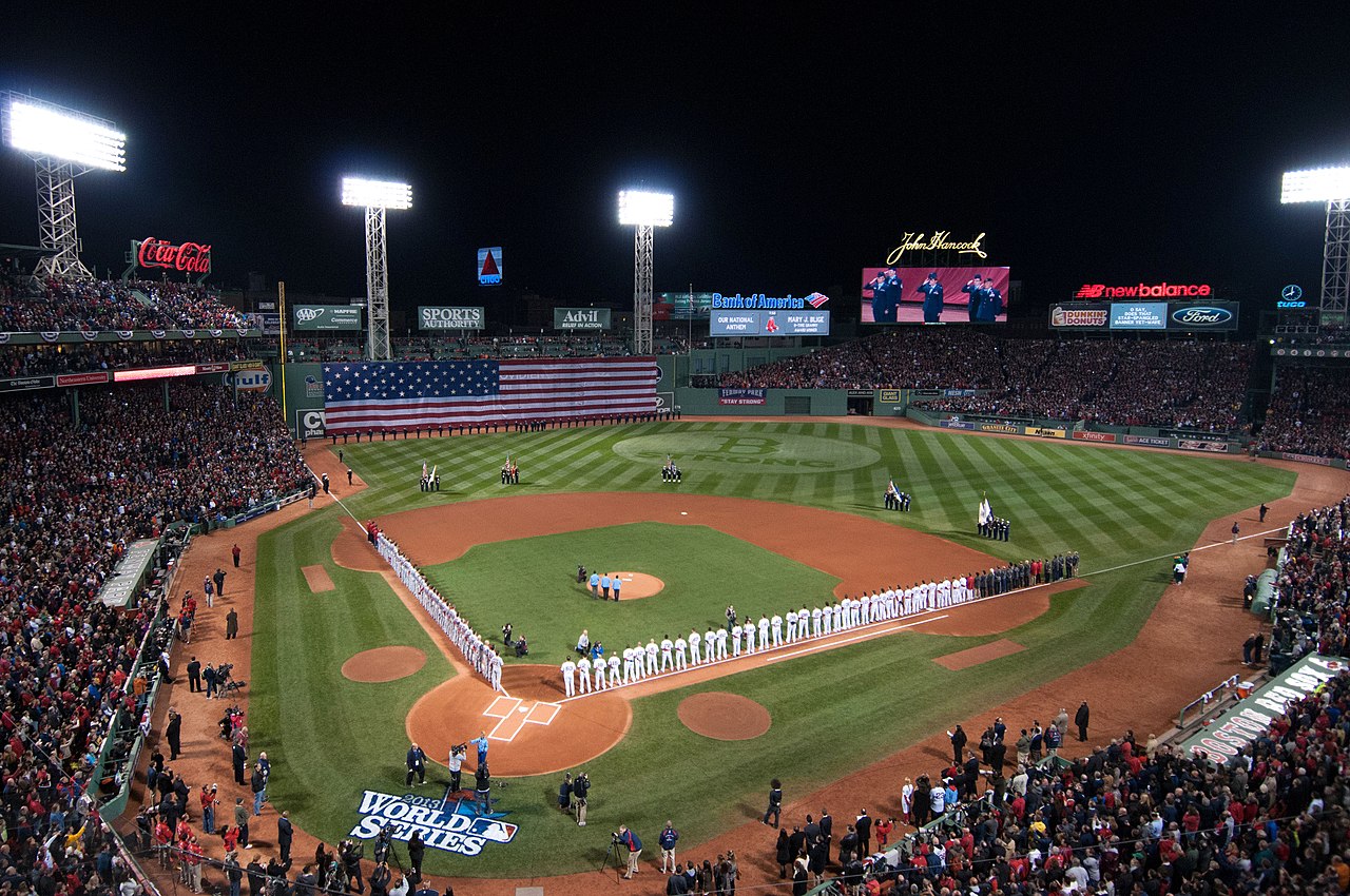
The Boston Red Sox, a founding member of the American League of Major League Baseball in 1901, play their home games at Fenway Park, near Kenmore Square, in the city's Fenway section. Built in 1912, it is the oldest sports arena or stadium in active use in the United States among the four major professional American sports leagues, Major League Baseball, the National Football League, National Basketball Association, and the National Hockey League.[276] Boston was the site of the first game of the first modern World Series, in 1903. The series was played between the AL Champion Boston Americans and the NL champion Pittsburgh Pirates.[277][278] Persistent reports that the team was known in 1903 as the "Boston Pilgrims" appear to be unfounded.[279] Boston's first professional baseball team was the Red Stockings, one of the charter members of the National Association in 1871, and of the National League in 1876. The team played under that name until 1883, under the name Beaneaters until 1911, and under the name Braves from 1912 until they moved to Milwaukee after the 1952 season. Since 1966 they have played in Atlanta as the Atlanta Braves.[280]

The TD Garden, formerly called the FleetCenter and built to replace the since-demolished Boston Garden, is above North Station and is the home of two major league teams: the Boston Bruins of the National Hockey League and the Boston Celtics of the National Basketball Association. The Bruins were the first American member of the National Hockey League and an Original Six franchise.[281] The Boston Celtics were founding members of the Basketball Association of America, one of the two leagues that merged to form the NBA.[282] The Celtics have won eighteen championships, the most of any NBA team.[283]
While they have played in suburban Foxborough since 1971, the New England Patriots of the National Football League were founded in 1960 as the Boston Patriots, changing their name after relocating. The team won the Super Bowl after the 2001, 2003, 2004, 2014, 2016 and 2018 seasons.[284] They share Gillette Stadium with the New England Revolution of Major League Soccer.[285]
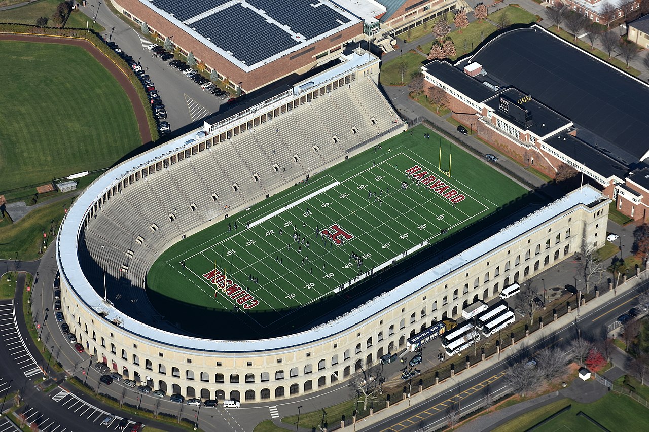
The area's many colleges and universities are active in college athletics. Four NCAA Division I members play in the area—Boston College, Boston University, Harvard University, and Northeastern University. Of the four, only Boston College participates in college football at the highest level, the Football Bowl Subdivision. Harvard participates in the second-highest level, the Football Championship Subdivision. These four universities participate in the Beanpot, an annual men's and women's ice hockey tournament. The men's Beanpot is hosted at the TD Garden,[286] while the women's Beanpot is held at each member school's home arena on a rotating basis.[287]
Boston has Esports teams as well, such as the Overwatch League (OWL)'s Boston Uprising. Established in 2017,[288] they were the first team to complete a perfect stage with 0 losses.[289] The Boston Breach is another esports team in the Call of Duty League (CDL).[290]
One of the best-known sporting events in the city is the Boston Marathon, the 26.2 mi (42.2 km) race which is the world's oldest annual marathon,[291] run on Patriots' Day in April. The Red Sox traditionally play a home game starting around 11 A.M. on the same day, with the early start time allowing fans to watch runners finish the race nearby after the conclusion of the ballgame.[292] Another major annual event is the Head of the Charles Regatta, held in October.[293]

Boston Common, near the Financial District and Beacon Hill, is the oldest public park in the United States.[294] Along with the adjacent Boston Public Garden, it is part of the Emerald Necklace, a string of parks designed by Frederick Law Olmsted to run through the city. The Emerald Necklace includes the Back Bay Fens, Arnold Arboretum, Jamaica Pond, Boston's largest body of freshwater, and Franklin Park, the city's largest park and home of the Franklin Park Zoo.[295] Another major park is the Esplanade, along the banks of the Charles River. The Hatch Shell, an outdoor concert venue, is adjacent to the Charles River Esplanade. Other parks are scattered throughout the city, with major parks and beaches near Castle Island and the south end, in Charlestown and along the Dorchester, South Boston, and East Boston shorelines.[296]
Boston's park system is well-reputed nationally. In its 2013 ParkScore ranking, The Trust for Public Land reported Boston was tied with Sacramento and San Francisco for having the third-best park system among the 50 most populous U.S. cities. ParkScore ranks city park systems by a formula that analyzes the city's median park size, park acres as percent of city area, the percent of residents within a half-mile of a park, spending of park services per resident, and the number of playgrounds per 10,000 residents.[297]
The Boston Globe is the oldest and largest daily newspaper in the city[298] and is generally acknowledged as its paper of record.[299] The city is also served by other publications such as the Boston Herald, Boston magazine, DigBoston, and the Boston edition of Metro. The Christian Science Monitor, headquartered in Boston, was formerly a worldwide daily newspaper but ended publication of daily print editions in 2009, switching to continuous online and weekly magazine format publications.[300] The Boston Globe also releases a teen publication to the city's public high schools, called Teens in Print or T.i.P., which is written by the city's teens and delivered quarterly within the school year.[301] The Improper Bostonian, a glossy lifestyle magazine, was published from 1991 through April 2019.
The city's growing Latino population has given rise to a number of local and regional Spanish-language newspapers. These include El Planeta (owned by the former publisher of the Boston Phoenix), El Mundo, and La Semana. Siglo21, with its main offices in nearby Lawrence, is also widely distributed.[302]
Various LGBT publications serve the city's large LGBT (lesbian, gay, bisexual, and transgender) population such as The Rainbow Times, the only minority and lesbian-owned LGBT news magazine. Founded in 2006, The Rainbow Times is now based out of Boston, but serves all of New England.[303]
Boston is the largest broadcasting market in New England, with the radio market being the ninth largest in the United States.[304] Several major AM stations include talk radio WRKO, sports/talk station WEEI, and news radio WBZ (AM). WBZ is a 50,000 watt "clear channel" station whose nighttime broadcasts are heard hundreds of miles from Boston.[305] A variety of commercial FM radio formats serve the area, as do NPR stations WBUR and WGBH. College and university radio stations include WERS (Emerson), WHRB (Harvard), WUMB (UMass Boston), WMBR (MIT), WZBC (Boston College), WMFO (Tufts University), WBRS (Brandeis University), WRBB (Northeastern University) and WMLN-FM (Curry College).[306]
The Boston television DMA, which also includes Manchester, New Hampshire, is the eighth largest in the United States.[307] The city is served by stations representing every major American network, including WBZ-TV 4 and its sister station WSBK-TV 38 (the former a CBS O&O, the latter an independent station), WCVB-TV 5 and its sister station WMUR-TV 9 (both ABC), WHDH 7 and its sister station WLVI 56 (the former an independent station, the latter a CW affiliate), WBTS-CD 15 (an NBC O&O), and WFXT 25 (Fox). The city is also home to PBS member station WGBH-TV 2, a major producer of PBS programs,[308] which also operates WGBX 44. Spanish-language television networks, including UniMás (WUTF-TV 27), Telemundo (WNEU 60, a sister station to WBTS-CD), and Univisión (WUNI 66), have a presence in the region, with WNEU serving as network owned-and-operated station. Most of the area's television stations have their transmitters in nearby Needham and Newton along the Route 128 corridor.[309] Seven Boston television stations are carried by satellite television and cable television providers in Canada.[310]

Many of Boston's medical facilities are associated with universities. The Longwood Medical and Academic Area, adjacent to the Fenway, district, is home to a large number of medical and research facilities, including Beth Israel Deaconess Medical Center, Brigham and Women's Hospital, Boston Children's Hospital, Dana–Farber Cancer Institute, and Joslin Diabetes Center.[311] Prominent medical facilities, including Massachusetts General Hospital, Massachusetts Eye and Ear Infirmary and Spaulding Rehabilitation Hospital are in the Beacon Hill area. Many of the facilities in Longwood and near Massachusetts General Hospital are affiliated with Harvard Medical School.[312]
Tufts Medical Center (formerly Tufts-New England Medical Center), in the southern portion of the Chinatown neighborhood, is affiliated with Tufts University School of Medicine. Boston Medical Center, in the South End neighborhood, is the region's largest safety-net hospital and trauma center. Formed by the merger of Boston City Hospital, the first municipal hospital in the United States, and Boston University Hospital, Boston Medical Center now serves as the primary teaching facility for the Boston University School of Medicine.[313][314] St. Elizabeth's Medical Center is in Brighton Center of the city's Brighton neighborhood. New England Baptist Hospital is in Mission Hill. The city has Veterans Affairs medical centers in the Jamaica Plain and West Roxbury neighborhoods.[315]

Logan International Airport, in East Boston and operated by the Massachusetts Port Authority (Massport), is Boston's principal airport.[317] Nearby general aviation airports are Beverly Regional Airport and Lawrence Municipal Airport to the north, Hanscom Field to the west, and Norwood Memorial Airport to the south.[318] Massport also operates several major facilities within the Port of Boston, including a cruise ship terminal and facilities to handle bulk and container cargo in South Boston, and other facilities in Charlestown and East Boston.[319]
Downtown Boston's streets grew organically, so they do not form a planned grid,[320] unlike those in later-developed Back Bay, East Boston, the South End, and South Boston. Boston is the eastern terminus of I-90, which in Massachusetts runs along the Massachusetts Turnpike. The Central Artery follows I-93 as the primary north–south artery that carries most of the through traffic in downtown Boston. Other major highways include US 1, which carries traffic to the North Shore and areas south of Boston, US 3, which connects to the northwestern suburbs, Massachusetts Route 3, which connects to the South Shore and Cape Cod, and Massachusetts Route 2 which connects to the western suburbs. Surrounding the city is Massachusetts Route 128, a partial beltway which has been largely subsumed by other routes (mostly I-95 and I-93).[321]
With nearly a third of Bostonians using public transit for their commute to work, Boston has the fourth-highest rate of public transit usage in the country.[322] The city of Boston has a higher than average percentage of households without a car. In 2016, 33.8 percent of Boston households lacked a car, compared with the national average of 8.7 percent. The city averaged 0.94 cars per household in 2016, compared to a national average of 1.8.[323] Boston's public transportation agency, the Massachusetts Bay Transportation Authority (MBTA), operates the oldest underground rapid transit system in the Americas and is the fourth-busiest rapid transit system in the country,[20] with 65.5 mi (105 km) of track on four lines.[324] The MBTA also operates busy bus and commuter rail networks as well as water shuttles.[324]

Amtrak intercity rail to Boston is provided through four stations: South Station, North Station, Back Bay, and Route 128. South Station is a major intermodal transportation hub and is the terminus of Amtrak's Northeast Regional, Acela Express, and Lake Shore Limited routes, in addition to multiple MBTA services. Back Bay is also served by MBTA and those three Amtrak routes, while Route 128, in the southwestern suburbs of Boston, is only served by the Acela Express and Northeast Regional.[325] Meanwhile, Amtrak's Downeaster to Brunswick, Maine terminates in North Station, and is the only Amtrak route to do so.[326]
Nicknamed "The Walking City", Boston hosts more pedestrian commuters than do other comparably populated cities. Owing to factors such as necessity, the compactness of the city and large student population, 13 percent of the population commutes by foot, making it the highest percentage of pedestrian commuters in the country out of the major American cities.[327] As of 2024[update], Walk Score ranks Boston as the third most walkable U.S. city, with a Walk Score of 83, a Transit Score of 72, and a Bike Score of 69.[328]

Between 1999 and 2006, Bicycling magazine named Boston three times as one of the worst cities in the U.S. for cycling;[329] regardless, it has one of the highest rates of bicycle commuting.[330] In 2008, as a consequence of improvements made to bicycling conditions within the city, the same magazine put Boston on its "Five for the Future" list as a "Future Best City" for biking,[331][332] and Boston's bicycle commuting percentage increased from 1% in 2000 to 2.1% in 2009.[333] The bikeshare program Bluebikes, originally called Hubway, launched in late July 2011.[334] The system has 480 stations with a total of 4,500 bikes.[335] PBSC Urban Solutions provides bicycles and technology for this bike-sharing system.[336]
The City of Boston has eleven official sister cities:[337]
Boston has formal partnership relationships through a Memorandum Of Understanding (MOU) with five additional cities or regions:
Boston startups are working to overcome some of the largest technical barriers holding AI back, and they're attracting attention across a wide variety of industries in the process.
By the late nineteenth century, one of the strongest bulwarks of Brahmin power was Harvard University. Statistics underscore the close relationship between Harvard and Boston's upper strata.
{{cite web}}: CS1 maint: unfit URL (link)
