La Confederación Muisca fue una confederación laxa de diferentes gobernantes muiscas ( zaques , zipas , iraca y tundama ) en las tierras altas de los Andes centrales de lo que hoy es Colombia antes de la conquista española del norte de América del Sur . El área, actualmente llamada Altiplano Cundiboyacense , comprendía los actuales departamentos de Boyacá , Cundinamarca y partes menores de Santander .
Según algunos estudiosos muiscas, la Confederación Muisca fue una de las confederaciones de tribus mejor organizadas del continente sudamericano. [3] Los antropólogos modernos , como Jorge Gamboa Mendoza , atribuyen el conocimiento actual sobre la confederación y su organización más a una reflexión de los cronistas españoles que escribieron sobre ella predominantemente un siglo o más después de que los muiscas fueran conquistados y propusieron la idea de una colección suelta de diferentes personas con idiomas y antecedentes ligeramente diferentes. [4]

En los tiempos anteriores a la conquista española de los muiscas , la parte central de la actual Colombia; las cordilleras orientales de los Andes colombianos estaban habitadas por el pueblo muisca que estaba organizado en una confederación informal de gobernantes . Las autoridades centrales de Bacatá en el sur y Hunza en el norte se llamaban zipa y zaque respectivamente. Otros gobernantes eran el sacerdote iraca en la ciudad sagrada del Sol Sugamuxi , el Tundama de Tundama y varios otros caciques (jefes). Los muiscas hablaban chibcha , en su propia lengua llamada Muysccubun ; "lengua del pueblo".
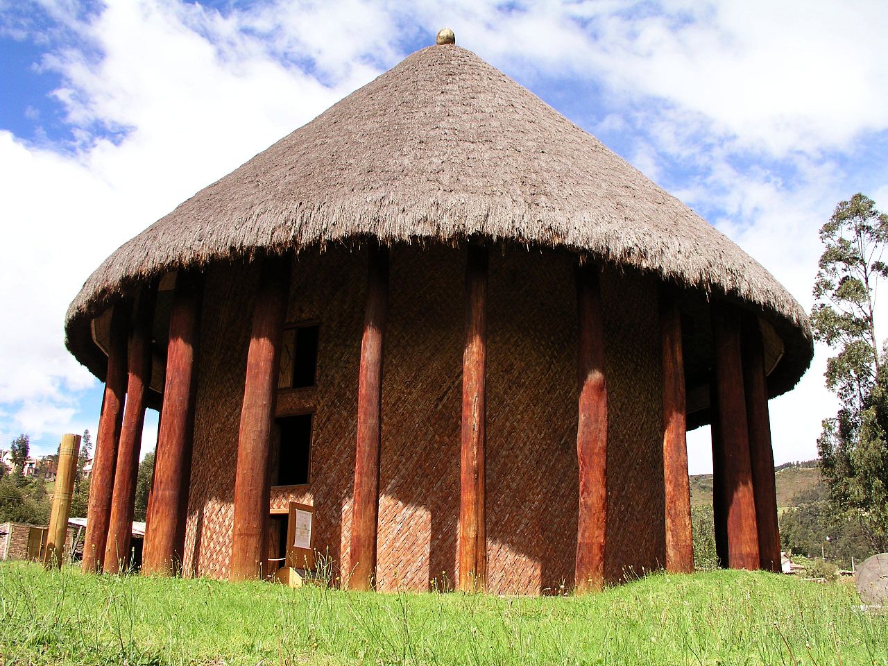
El pueblo muisca, a diferencia de las otras tres grandes civilizaciones de América, la maya , la azteca y la inca , no construyó una gran arquitectura de piedra . Sus asentamientos eran relativamente pequeños y consistían en bohíos , casas circulares de madera y barro, organizadas alrededor de una plaza de mercado central con la casa del cacique en el centro. Existían caminos para conectar los asentamientos entre sí y con los grupos indígenas circundantes, de los cuales los guane y lache al norte, los panche y muzo al oeste y los guayupe , achagua y tegua al este eran los más importantes.
Los primeros colonos amerindios llevaron una vida de cazadores-recolectores entre la megafauna aún existente que vivía en hábitats fríos alrededor de lagos del Pleistoceno, de los cuales los humedales de Bogotá, el lago de Suesca , el lago de Fúquene y el lago Herrera son ejemplos notables. Hasta la fecha se han encontrado múltiples evidencias de población del Pleistoceno tardío al Holoceno medio de la sabana de Bogotá , el altiplano de los Andes colombianos. Como es común con las cuevas y los abrigos rocosos , Tequendama estuvo habitado desde alrededor de 11.000 años AP, y continuó hasta los períodos prehistórico, Herrera y Muisca , lo que lo convierte en el sitio más antiguo de Colombia, junto con El Abra (12.500 AP), ubicado al norte de Zipaquirá y Tibitó , ubicado dentro de los límites de Tocancipá (11.740 AP). [5] [6] Los restos humanos más antiguos y el esqueleto completo más antiguo fueron descubiertos en Tequendama y han sido denominados "Hombre del Tequendama" u Homo Tequendama . Otros artefactos han sido encontrados en Gachalá (9100 AP), Sueva ( Junín ) y Zipacón . [7] Justo al oeste del Altiplano, los restos arqueológicos más antiguos fueron encontrados; en Pubenza , parte de Tocaima y han sido datados en 16.000 años antes del presente. [8]
El Período Herrera es una fase en la historia de Colombia . Forma parte del precerámico y cerámico andino , equivalente temporal de las etapas formativa y clásica precolombina norteamericana y edad datada por varios arqueólogos . [9] El Período Herrera es anterior a la era del pueblo muisca , que habitó el Altiplano Cundiboyacense antes de la conquista española de los muiscas y posterior a la etapa formativa lítica y prehistoria de la región andina oriental de Colombia . El Período Herrera se define generalmente como comprendido entre el 800 a. C. y el 800 d. C., [10] aunque algunos estudiosos lo datan tan temprano como el 1500 a. C., considerado como el "Período Herrera Temprano". [11]
Se ha descubierto amplia evidencia del Período Herrera en el Altiplano Cundiboyacense y los principales arqueólogos que contribuyen al conocimiento actual sobre el Período Herrera son los académicos Ana María Groot , Gonzalo Correal Urrego , Thomas van der Hammen , Carl Henrik Langebaek Rueda , Sylvia M. Broadbent , Marianne Cardale de Schrimpff y otros.
Los Muiscas eran politeístas y su religión y mitología estaban estrechamente ligadas al espacio natural que habitaban. Conocían perfectamente los parámetros astronómicos y desarrollaron un complejo calendario lunisolar , el calendario Muisca . Según este calendario tenían fechas específicas para la siembra, la cosecha y la organización de fiestas en las que cantaban, bailaban, tocaban música y bebían su bebida nacional , la chicha, en grandes cantidades.
Los miembros más respetados de la comunidad eran momificados y las momias no eran enterradas, sino exhibidas en sus templos , en lugares naturales como cuevas e incluso eran llevadas sobre sus espaldas durante la guerra para impresionar a sus enemigos.
Su arte es el vestigio más famoso de su cultura, pues los espacios habitables, templos y otras estructuras existentes han sido destruidas por los españoles que colonizaron los territorios Muisca. Un ejemplo primordial de su fina orfebrería es la balsa Muisca , junto con más objetos hechos de oro, tumbaga , cerámica y algodón que se exhiben en el Museo del Oro en Bogotá , la antigua capital de los Muiscas del sur.
Los Muiscas eran una sociedad predominantemente agrícola con campos de cultivo en pequeña escala, parte de terrenos más extensos. Para diversificar su dieta, intercambiaban mantos, oro , esmeraldas y sal por frutas, verduras, coca , yopo y algodón cultivados en terrenos más cálidos y de menor altitud poblados por sus vecinos, los Muzos, Panches, Yariguíes, Guanes, Guayupes, Achaguas, Teguas, Laches, Sutagao y U'was. El comercio de productos cultivados más lejos se daba con las comunidades calimas , pijaos y costeras del Caribe alrededor de la Sierra Nevada de Santa Marta .
La economía muisca era autosuficiente en lo que respecta a los suministros básicos , [ aclaración necesaria ] gracias a las tecnologías avanzadas de la agricultura en terrazas elevadas por parte de la gente. El sistema de comercio estaba bien establecido y proporcionaba tanto a las clases sociales más altas como a la población en general abundancia de oro, plumas, caracoles marinos, coca, yopo y otros bienes de lujo. Se celebraban mercados cada cuatro a ocho días en varios asentamientos a lo largo de la Confederación Muisca y se organizaban mercados especiales en torno a festividades donde los comerciantes de lugares muy alejados de los Andes intercambiaban sus productos con los muiscas.
Aparte de la agricultura, los muiscas se desarrollaron en la producción de diferentes artesanías, utilizando las materias primas que intercambiaban con los pueblos indígenas de los alrededores. Son famosos los objetos de oro y tumbaga elaborados por el pueblo muisca. Los mantos, paños y redes de algodón eran confeccionados por las mujeres muiscas y se intercambiaban por bienes valiosos, las frutas tropicales y los pequeños paños de algodón se utilizaban como dinero. Los muiscas eran únicos en América del Sur por tener monedas de oro reales, llamadas tejuelos .
La minería fue una fuente importante de ingresos para los muiscas, a quienes se les llamaba "el pueblo de la sal" por sus minas de sal en Zipaquirá , Nemocón y Tausa . Al igual que sus vecinos occidentales, los muzos —a quienes se les llamaba "el pueblo esmeralda"—, extraían esmeraldas en sus territorios, principalmente en Somondoco . El carbón se encontró en toda la región de los muiscas en sedimentos del Eoceno y se utilizó para el fuego para cocinar y la producción de sal y adornos de oro.
El pueblo utilizaba un sistema de conteo decimal, basado en los dígitos de la mano. Su sistema iba del 1 al 10 y para numeraciones superiores utilizaban el prefijo quihicha o qhicha , que significa "pie" en su lengua chibcha Muysccubun . Once se convertía así en "pie uno", doce en "pie dos", etc. Como en las demás civilizaciones precolombinas , el número 20 era especial. Era el número total de todas las extremidades del cuerpo; dedos de manos y pies. Los muiscas utilizaban dos formas para expresar veinte: "pie diez"; quihícha ubchihica o su palabra exclusiva gueta , derivada de gue , que significa "casa". Los números entre 20 y 30 se contaban gueta asaqui ata ("veinte más uno"; 21), gueta asaqui ubchihica ("veinte más diez"; 30). Los números mayores se contaban como múltiplos de veinte; gue-bosa ("20 por 2"; 40), gue-hisca ("20 por 5"; 100). La escritura muisca consistía en jeroglíficos , utilizados únicamente para numerales. [12]


The sacred sites of the Muisca Confederation were based in the Muisca religion and mythology. The Muisca were a highly religious people with their own beliefs on the origin of the Earth and life and human sacrifices were no exception to please the gods for good harvests and prosperity.
Lake Guatavita, Guatavita, was the location where the new zipa would be inaugurated. It became known with the Spanish conquerors as the site of El Dorado where the new zipa was covered in gold dust and installed as the new ruler of the southern Muisca.[24]
In the legends of the Muisca, humankind originated in Lake Iguaque, Monquirá, when the goddess Bachué came out from the lake with a boy in her arms. When the boy grew, they populated the Earth. They are considered the ancestors of the human race. Finally, they disappeared unto the lake in the shape of snakes.[25]
According to Muisca myths, the Tequendama Falls, outside Soacha, was the site where the first zipa Meicuchuca lost his lover who turned in a snake and disappeared in the waters of the Bogotá River.[26][27]
El Infiernito, close to the present town of Villa de Leyva was a sacred site where the Muisca erected structures based on astronomical parameters.[28][29][30]

.JPG/1280px-Cojines_del_Zaque._Vista_actual_(2015).JPG)
The conquest of the Muisca was the heaviest of all four Spanish expeditions to the great American civilisations.[31] More than 80 percent of the soldiers and horses that started the journey of a year to the northern Muisca Confederation did not survive it.[32][33][34] Various settlements were founded by the Spanish between 1537 and 1539.[35][36][37][38][39][40][41][42][43][44]
A delegation of more than 900 men left the tropical city of Santa Marta and went on a harsh expedition through the heartlands of Colombia in search of El Dorado and the civilisation that produced all this precious gold. The leader of the first and main expedition under Spanish flag was Gonzalo Jiménez de Quesada, with his brother Hernán second in command.[34] Several other soldiers were participating in the journey, who would later become encomenderos and taking part in the conquest of other parts of Colombia. Other contemporaneous expeditions into the unknown interior of the Andes, all searching for the mythical land of gold, were starting from later Venezuela, led by Bavarian and other German conquistadors and from the south, starting in the previously founded Kingdom of Quito in later Ecuador.
The first phase of the conquest was ended by the victory of the few conquistadors left over Tisquesusa, the last zipa of Bacatá, who fell and died after the battle at Funza, on the Bogotá savanna, April 20, 1537. The arrival of the Spanish conquerors was revealed to Tisquesusa by the mohan Popón, from the village of Ubaque. He told the Muisca ruler that foreigners were coming and Tisquesusa would die "bathing in his own blood".[45] When Tisquesusa was informed of the advancing invasion of the Spanish soldiers, he sent a spy to Suesca to find out more about their army strength, weapons and with how many warriors they could be beaten. The zipa left the capital Bacatá and took shelter in Nemocón which directed the Spanish troops to there, during this march attacked by more than 600 Muisca warriors.[46]
When Tisquesusa retreated in his fort in Cajicá he allegedly told his men he would not be able to combat against the strong Spanish army in possession of weapons that produced "thunder and lightning". He chose to return to Bacatá and ordered the capital to be evacuated, resulting in an abandoned site when the Spanish arrived. In search for the Muisca ruler the conquistadores went north to find Tisquesusa in the surroundings of Facatativá where they attacked him at night.
Tisquesusa was thrusted by the sword of one of De Quesada's soldiers but without knowing he was the zipa he let him go, after taking the expensive mantle of the ruler. Tisquesusa fled hurt into the mountains and died of his wounds there. His body was only discovered a year later because of the black vultures circling over it.
When Gonzalo Jiménez de Quesada found out the caciques were conspiring against him, he sent out several expeditions of soldiers. His captain Juan de Céspedes went south to found Pasca on July 15, 1537.[47] Hernán was sent north and Gonzalo himself went northeast, to search for the mythical Land of Gold El Dorado. There he did not find golden cities, but emeralds, the Muisca were extracting in Chivor and Somondoco. First foundation was Engativá, presently a locality of Bogotá, on May 22, 1537.[40] Passing through Suba, Chía, Cajicá, Tocancipá, Gachancipá, Guatavita and Sesquilé, he arrived in Chocontá, founding the modern town on June 9.[41] The journey went eastward into the Tenza Valley through Machetá, Tibiritá, Guateque, Sutatenza and Tenza, founded on San Juan; June 24.[42] On the same day, Hernán founded Sutatausa.[43] Gonzalo continued northwest through La Capilla and Úmbita. He arrived in Turmequé that he founded on July 20.[44]
In August 1537 Gonzalo Jiménez de Quesada entered the territories of the zaque, who ruled from Hunza. When the Spanish conquerors entered the outskirts of Hunza and found a hill with poles were bodies were dangling, they named it Cerro de la Horca ("Gallow Hill").[48] At the time of the conquest Quemuenchatocha was the zaque and he ordered his men to not submit to the European invaders or show them the way to his bohío. He sent messengers to the Spanish conquistadors with valuable peace offers. While this was happening, Quemuenchatocha had hidden his treasures from the Spanish. Hunza was located in a valley not as green as the Bogotá savanna. The advantage of the Spanish weaponry and the use of the horses quickly beat the Muisca warriors.[34]
When Gonzalo arrived at the main bohío of Quemuenchatocha, he found the Muisca ruler sitting in his throne and surrounded by his closest companions. All men were dressed in expensive mantles and adorned with golden crowns. On August 20, 1537, the Spanish beat the zaque and the big and strong Muisca ruler was taken captive to Suesca. There he was tortured and the Spanish soldiers hoped he would reveal where he hid his precious properties. The absence of Quemuenchatocha paved the route for his nephew Aquiminzaque to succeed him as ruler of the northern Muisca, a practice common in Muisca traditions. When Quemuenchatocha was finally released from captivity in Suesca, he fled to Ramiriquí, where he died shortly after. The Spanish soldiers found gold, emeralds, silver, mantles and other valuables in Tunja. They were not able to take all the precious pieces and many were secretly taken away by the Muisca, using folded deer skins. They hid the valuables in nearby hills.[34]
Not only the Spanish settlers had lost large percentages of their men due to warfare and diseases. The assessed corregimientos of the province of Tunja between 1537 and 1636 shows a decline of the total Muisca population between 65 and 85%.[75] Epidemics were the main cause of the rapid reduction in population. Various have been reported and many undescribed in the first twenty years of contact.[76]
After the foundation of Bogotá and the installation of the new dependency of the Spanish Crown, several strategies were important to the Spanish conquerors. The rich mineral resources of the Altiplano had to be extracted, the agriculture was quickly reformed, a system of encomiendas was installed and a main concern of the Spanish was the evangelisation of the Muisca. On October 9, 1549, Carlos V sent a royal letter to the New Kingdom directed at the priests about the necessity of population reduction of the Muisca.[77] The indigenous people were working in the encomiendas which limited their religious conversion.[77] To speed up the process of submittance to the Spanish reign, the mobility of the indigenous people was prohibited and the people gathered in resguardos.[78] The formerly celebrated festivities in their religion disappeared. Specific times for the catechesis were controlled by laws, as executed in royal dictates in 1537, 1538 and 1551.[79] The first bishop of Santafé, Juan de los Barrios, ordered to destroy the temples of the Muisca and replace them with Catholic churches.[80] The last public religious ceremony of the Muisca religion was held in Ubaque on December 27, 1563.[81] The second bishop of Santafé, Luis Zapata de Cárdenas, intensified the aggressive policies against the Muisca religion and the burnings of their sacred sites. This formed the final nail in the coffin of the former polytheistic society.[80]
The transition to a mixed agriculture with Old World crops was remarkably fast, mainly to do with the fertility of the lands of the Altiplano permitting European crops to grow there, while in the more tropical areas the soil was not so much suited for the foreign crops. In 1555, the Muisca of Toca were growing European crops as wheat and barley and sugarcane was grown in other areas.[82] The previously self-sustaining economy was quickly transformed into one based on intensive agriculture and mining that produced changes in the landscape and culture of the Muisca.[83]


