Megacity and metropolitan region in the United States
El área metropolitana de Nueva York , conocida ampliamente como el área de los tres estados y a menudo también llamada Gran Nueva York , es el área metropolitana más grande del mundo por superficie urbana , [11] [12] [13] abarcando 4669,0 millas cuadradas (12 093 km 2 ). [14] El área metropolitana de Nueva York es una de las áreas metropolitanas más pobladas del mundo, el área metropolitana más grande de los EE. UU. y la única área metropolitana de los EE. UU. que alberga a más de 20 millones de residentes según el censo de los Estados Unidos de 2020 .
La vasta área metropolitana incluye la ciudad de Nueva York , la ciudad más poblada del país, Long Island , el valle medio y bajo del Hudson en el estado de Nueva York , catorce condados, once de las ciudades más grandes de Nueva Jersey y seis de las siete ciudades más grandes de Connecticut . La frase área triestatal se usa generalmente para referirse a Nueva York , Nueva Jersey y Connecticut , aunque un número cada vez mayor de personas que trabajan en la ciudad de Nueva York viajan desde Pensilvania , particularmente desde las regiones de Lehigh Valley , Bucks County y Poconos en el este de Pensilvania, lo que hace que el área metropolitana se extienda a lo largo de cuatro estados. El área metropolitana de Nueva York es el centro geográfico y demográfico de la megalópolis más grande del noreste .
El área metropolitana de Nueva York es el área estadística metropolitana más poblada de los Estados Unidos con 20,1 millones de residentes, o un poco más del 6% de la población total de la nación, a partir de 2020. [8] El área estadística combinada incluye 23,6 millones de residentes a partir de 2020. [15] [16] Es una de las aglomeraciones urbanas más grandes del mundo. [17] [18] [19] El área metropolitana de Nueva York sigue siendo la principal puerta de entrada para la inmigración legal a los Estados Unidos , [20] [21] [22] [23] teniendo la mayor población nacida en el extranjero de cualquier región metropolitana del mundo. El área estadística metropolitana cubre 6.720 millas cuadradas (17.405 km 2 ) mientras que el área estadística combinada es de 13.318 millas cuadradas (34.493 km 2 ), que abarca una región étnica y geográficamente diversa. La población del área metropolitana de Nueva York es mayor que la del estado de Nueva York, y el espacio aéreo metropolitano albergó a más de 130 millones de pasajeros en 2016. [24]
La Oficina de Administración y Presupuesto de los Estados Unidos utiliza dos definiciones de área urbanizada: el área estadística metropolitana (MSA) y el área estadística combinada (CSA). La definición de MSA se titula Área estadística metropolitana de Nueva York-Newark-Jersey City, NY-NJ-PA , e incluye una población de 20,3 millones de personas según las estimaciones del censo de 2017, aproximadamente 1 de cada 16 estadounidenses y casi 7 millones más que el área metropolitana de Los Ángeles , que ocupa el segundo lugar en los Estados Unidos. El MSA se subdivide a su vez en cuatro divisiones metropolitanas. El MSA de 23 condados incluye 10 condados en el estado de Nueva York (coextensivos con los cinco distritos de Nueva York, los dos condados restantes de Long Island y tres condados en el valle inferior del Hudson ); 12 condados en el norte y centro de Nueva Jersey ; y un condado en el noreste de Pensilvania . La zona urbanizada más grande de los Estados Unidos se encuentra en el corazón del área metropolitana, el área urbanizada de Nueva York-Newark, NY-NJ-CT , que tenía una superficie de 3450 millas cuadradas en 2010 según el censo de 2010. La parte del área metropolitana del estado de Nueva York, que incluye los cinco distritos de la ciudad de Nueva York, el valle inferior del Hudson y Long Island, representa más del 65 por ciento de la población del estado.
Área estadística metropolitana de Nueva York–Newark–Jersey City-Yonkers, NY–NJ–PA (19 043 386)
División metropolitana de Nueva York–Jersey City–White Plains, NY–NJ (11 732 233)
Las áreas estadísticas combinadas (CSAs) agrupan áreas estadísticas adyacentes basadas en núcleos con un alto grado de interconexión económica. [40] El área estadística combinada de Nueva York–Newark, NY–NJ–CT–PA tenía una población estimada de 23,7 millones en 2014. [16] Aproximadamente uno de cada quince estadounidenses reside en esta región, que incluye ocho condados adicionales en Nueva York, Nueva Jersey, Connecticut y Pensilvania. Esta área, menos la parte de Pensilvania, a menudo se conoce como el área triestatal y, con menos frecuencia, la región triestatal . El área de mercado designada para televisión (DMA) de la ciudad de Nueva York incluye el condado de Pike, Pensilvania , [41] que también está incluido en la CSA.
Además de las áreas estadísticas metropolitanas (MSA) de Nueva York–Newark–Jersey City, NY–NJ–PA, las siguientes áreas estadísticas basadas en núcleos también están incluidas en la CSA de Nueva York–Newark, NY–NJ–CT–PA:
El área se divide frecuentemente en las siguientes subregiones: [43] [44]
Ciudad de Nueva York (el principal centro urbano de la región metropolitana, que comprende cinco distritos , uno de los cuales es Manhattan , el núcleo geográfico, cultural y económico de toda el área metropolitana)
Centro y este de Long Island ( condados de Nassau y Suffolk , separados por agua del resto de la región, excepto la ciudad de Nueva York; sin incluir el condado de Queens ni el condado de Kings ( Brooklyn ), que son concurrentes con dos de los cinco distritos de Nueva York)
Las ocho subregiones suelen subdividirse a su vez. Por ejemplo, Long Island se puede dividir en sus costas sur y norte (normalmente cuando se habla del condado de Nassau y el oeste del condado de Suffolk) y el East End . El valle del Hudson y Connecticut a veces se agrupan y se los denomina suburbios del norte, en gran medida debido al uso compartido del sistema ferroviario Metro-North . [45]
Clima
Según la clasificación climática de Köppen , la ciudad de Nueva York, el oeste (y partes del este) de Long Island y la costa de Jersey experimentan un clima subtropical húmedo ( Cfa ), [46] [47] y, por lo tanto, Nueva York es la ciudad principal más septentrional del continente norteamericano con este tipo de clima.
Gran parte del resto del área metropolitana se encuentra en la zona de transición de un clima subtropical húmedo ( Cfa ) a un clima continental húmedo ( Dfa ), [46] [47] y solo las áreas interiores, más exurbanas, más al norte y al oeste, como el condado de Sussex, Nueva Jersey, tienen un promedio diario de enero de −3 °C (26,6 °F) o menos y son completamente continentales húmedos; el régimen Dfb (subtipo de verano cálido) solo se encuentra en el interior a una mayor elevación, [46] y recibe mayores nevadas [48] que la región Dfa . Gran parte de Monroe y la mayor parte del condado de Pike en Pensilvania también tienen un clima continental completamente húmedo.
Los veranos en la zona suelen ser calurosos y húmedos. Las condiciones nocturnas en los cinco distritos de Nueva York y sus alrededores suelen verse exacerbadas por el fenómeno de la isla de calor urbana , y las temperaturas superan los 90 °F (32 °C) en promedio durante 7 u 8 días (en las inmediaciones de Long Island Sound y las costas atlánticas), hasta más de 27 días (suburbios del interior de Nueva Jersey) cada verano y pueden superar los 100 °F (38 °C). [ cita requerida ] Normalmente, las temperaturas cálidas a cálidas comienzan a mediados de mayo y duran hasta principios de octubre. Los veranos también presentan tormentas eléctricas pasajeras que se acumulan en el calor del día y luego dejan caer lluvias breves, pero intensas.
Los inviernos son fríos con una mezcla de lluvia y nieve. Aunque los vientos predominantes en invierno son de alta mar y atenúan los efectos moderadores del océano Atlántico, el Atlántico y la protección parcial de los Apalaches contra el aire más frío mantienen el área de Nueva York más cálida en el invierno que las áreas metropolitanas del interior de América del Norte ubicadas en latitudes similares o menores, incluidas Pittsburgh , Cincinnati e Indianápolis . Ocasionalmente, también pueden ocurrir períodos cálidos con temperaturas de 50 °F (10 °C) o más durante el invierno. [49] La zona de rusticidad en el área metropolitana de Nueva York varía en un amplio rango desde 5a en las áreas más altas de los condados de Dutchess, Monroe y Ulster hasta 7b en la mayor parte de la ciudad de Nueva York, así como en el condado de Hudson desde Bayonne hasta el lado este de Palisades hasta la Ruta 495, la mayor parte del condado de Nassau, la costa norte del condado de Monmouth y Copiague Harbor, Lindenhurst y Montauk en el condado de Suffolk. [50]
Casi toda el área metropolitana recibe al menos 1.070 mm de precipitación al año, que se distribuye de manera relativamente uniforme a lo largo del año, y muchas áreas reciben más de 1.270 mm. La nevada promedio en invierno de 1981 a 2010 varía desde poco menos de 64 cm a lo largo de la costa de Long Island hasta más de 127 cm en algunas áreas del interior, pero esto suele variar considerablemente de un año a otro. [51] Los huracanes y las tormentas tropicales han afectado al área de los tres estados en el pasado, aunque un impacto directo es poco frecuente. Varias áreas de Long Island, Nueva Jersey y la costa de Connecticut se han visto afectadas por graves mareas de tormenta en el pasado. Las áreas del interior se han visto afectadas por fuertes lluvias e inundaciones causadas por ciclones tropicales. [52]
El área metropolitana de Nueva York tiene un promedio de 234 días con al menos algo de sol y un 59% de luz solar posible al año, [53] acumulando entre 2.400 y 2.800 horas de sol al año. [54]
El centro geográfico, cultural y económico del área metropolitana es la ciudad de Nueva York, la ciudad más poblada de los Estados Unidos y ha sido descrita como la capital del mundo . [65] La ciudad consta de cinco distritos , cada uno de los cuales es colindante con un condado del estado de Nueva York . Los cinco distritos ( Brooklyn , Queens , Manhattan , el Bronx y Staten Island ) se consolidaron en una sola ciudad en 1898. [66] Con una población estimada por el censo de 8.335.897 en 2022 (8.467.513 en 2021 [67] [68] ), distribuida en una superficie de tan solo 305 millas cuadradas (790 km 2 ), [69] Nueva York es la ciudad principal más densamente poblada de los Estados Unidos. [70] Ciudad de poder global , [71] la ciudad de Nueva York ejerce un impacto significativo en el comercio, las finanzas, la atención médica y las ciencias de la vida , [26] los medios de comunicación, la gastronomía, el arte, la moda, la investigación, la tecnología, la educación y el entretenimiento, su ritmo rápido [72] [73] define el término minuto de Nueva York . [74] Hogar de la sede de las Naciones Unidas , [75] Nueva York es un centro importante para la diplomacia internacional . [76] Nueva York es una ciudad global [77] y ha sido descrita como la capital cultural , [78] [79] financiera , [31] [32] del entretenimiento , [65] y de los medios de comunicación [34] [35] del mundo, así como la ciudad económicamente más poderosa del mundo. [37] [32] [80] [33]
Long Island , la isla más poblada de los Estados Unidos, está situada frente a la costa noreste de los Estados Unidos y es una región totalmente incluida tanto en el estado estadounidense de Nueva York como en el área metropolitana de Nueva York. La isla, que se extiende 190 kilómetros al este-noreste de Roosevelt Island, Manhattan, desde el puerto de Nueva York hasta el océano Atlántico , comprende cuatro condados: Kings y Queens (que forman los distritos neoyorquinos de Brooklyn y Queens , respectivamente) al oeste; luego Nassau y Suffolk al este. Sin embargo, la mayoría de las personas en el área metropolitana de Nueva York (incluso las que viven en Queens y Brooklyn) usan coloquialmente el término "Long Island" (o "La Isla") exclusivamente para referirse al área del condado de Nassau-Suffolk colectivamente, que es principalmente de carácter suburbano . [81] Al norte de la isla se encuentra Long Island Sound , al otro lado del cual se encuentran los estados estadounidenses de Connecticut y Rhode Island .
Con una población de 8.063.232 habitantes enumerados en el censo de EE. UU. de 2020 , que constituye casi el 40% de la población del estado de Nueva York, [82] [83] [84] [85] [86] la mayoría de los residentes de la ciudad de Nueva York, el 58,4% en 2020, viven en Long Island, es decir, los 4.896.398 residentes estimados que viven en los distritos de Brooklyn y Queens de la ciudad de Nueva York . [87] Long Island es la isla más poblada de cualquier estado o territorio de EE. UU. y la decimoséptima isla más poblada del mundo (por delante de Irlanda , Jamaica y Hokkaidō ). Su densidad de población es de 5.571 habitantes por milla cuadrada (2.151/km 2 ). Si Long Island constituyera geográficamente un área estadística metropolitana independiente, ocuparía el cuarto lugar más poblado de los Estados Unidos; Mientras que si fuera un estado de EE. UU., Long Island ocuparía el puesto 13 en población y el primero en densidad de población . Queens es el área urbana con mayor diversidad étnica del mundo. [88] [89] La ciudad de Hempstead en el condado de Nassau, con una población estimada de 770.367 en 2016, es el municipio más poblado del área metropolitana de Nueva York fuera de la ciudad de Nueva York. [90]
Long Island es también la decimoséptima isla más poblada del mundo , pero es más conocida por la recreación, la navegación y kilómetros de playas públicas, incluidos numerosos parques municipales, de condado y estatales, así como Fire Island National Seashore y enclaves residenciales costeros ricos y costosos. A lo largo de la costa norte, Gold Coast de Long Island , que aparece en la película El gran Gatsby , es una sección exclusiva de los condados de Nassau y Suffolk occidental que alguna vez contó con muchas mansiones lujosas construidas y habitadas por magnates de negocios adinerados en los primeros años del siglo XX, de las cuales solo quedan unas pocas preservadas como sitios históricos. El East End de Long Island (conocido como "Twin Forks" debido a su forma física) cuenta con espacios abiertos para tierras de cultivo y bodegas . South Fork, en particular, comprende numerosos pueblos y aldeas conocidos colectivamente como " The Hamptons " y tiene una reputación internacional como un "patio de recreo para los ricos y famosos", con algunas de las comunidades más ricas de los Estados Unidos. En 2015, según Business Insider , el código postal 11962 que abarca Sagaponack , dentro de Southampton , fue catalogado como el más caro en los EE. UU. por el sitio de listados de bienes raíces Property Shark, con un precio de venta promedio de una vivienda de $ 5,125,000. [91]
Durante la temporada de verano, muchas celebridades y los ricos visitan o residen en mansiones y casas frente al mar, mientras que otros pasan los fines de semana disfrutando de las playas, jardines, bares, restaurantes y discotecas.
Conocido por su terreno montañoso , entornos pintorescos y pequeñas ciudades y pueblos pintorescos , el Valle Inferior del Hudson está centrado alrededor del río Hudson al norte de la ciudad de Nueva York y se encuentra dentro del estado de Nueva York. Los condados de Westchester y Putnam están ubicados en el lado este del río, y los condados de Rockland y Orange están ubicados en el lado oeste del río. Los condados de Westchester y Rockland están conectados por el puente New Tappan Zee , muy transitado , así como por el puente Bear Mountain cerca de sus extremos norte. Varias ramas del ferrocarril MTA Metro-North sirven a los viajeros en tren de la región. El sur del condado de Westchester contiene áreas más densamente pobladas e incluye las ciudades de Yonkers, Mount Vernon, New Rochelle y White Plains. Muchas de las comunidades suburbanas de Westchester son conocidas por su riqueza y gastos (algunos ejemplos: Bronxville, Scarsdale, Chappaqua, Armonk, Katonah y Briarcliff Manor). Las ciudades ribereñas de Rockland a lo largo del río Hudson, incluidas Nyack y Piermont , son conocidas por su vibrante oferta gastronómica y artística. El 30 % de la superficie de Rockland está designada como parque con paisajes impresionantes, que atraen a muchos visitantes del área triestatal. En los últimos años, el alto costo de la vivienda en el valle inferior del Hudson, además del aumento de las oportunidades de trabajo remoto, ha hecho que algunos se muden más al norte, al valle medio del Hudson.
Históricamente, el valle albergaba muchas fábricas, incluidas papeleras, pero un número significativo de ellas han cerrado. Tras años de contaminación persistente, actualmente se están planificando esfuerzos de limpieza para mejorar la calidad del agua del río Hudson, que serán supervisados por la Agencia de Protección Ambiental de los Estados Unidos (EPA). [92]
El norte de Nueva Jersey , también conocido coloquialmente como North Jersey, generalmente se define como el área que comprende los siguientes condados:
Aunque es una región suburbana y rural de Nueva York , gran parte de la región Gateway está altamente urbanizada. La totalidad del condado de Hudson, el este del condado de Essex, el sur del condado de Passaic y Elizabeth en el condado de Union son áreas densamente pobladas.
Los condados de Fairfield, New Haven y Litchfield en el oeste de Connecticut (como el estado en general) son conocidos por su opulencia. Las grandes empresas están dispersas por toda la zona, principalmente en el condado de Fairfield. El terreno es llano a lo largo de la costa con colinas bajas que eventualmente dan paso a colinas más grandes como The Berkshires más al interior, hasta la frontera con Massachusetts . La mayoría de las ciudades más grandes del estado se encuentran en el condado de New Haven (sede de la Universidad de Yale ) y el condado de Fairfield.
El lago Candlewood es el lago recreativo más grande del área metropolitana de Nueva York. El lago se encuentra dentro de la región de Greater Danbury y es el hogar de muchas segundas residencias de los residentes de la ciudad de Nueva York.
El condado de Pike, Pensilvania , está ubicado en el noreste de Pensilvania . Según el censo de 2010, la población era de 57.369 habitantes. [95] Su sede es Milford . [96] Parte de la región de las montañas Pocono se encuentra dentro del condado de Pike, que se ha clasificado entre los condados de más rápido crecimiento de Pensilvania. [97]
La siguiente es una lista de "ciudades principales" y sus respectivas estimaciones de población del Censo de los EE. UU . de 2020. Las ciudades principales incluyen aquellas con poblaciones de más de 100 000 habitantes o centros laborales, culturales, educativos y económicos importantes. [102] [c]
Áreas urbanas
Áreas urbanas dentro del área estadística combinada de la ciudad de Nueva York a partir del censo de 2020. En el núcleo del área estadística combinada de Nueva York (CSA) se encuentra el área urbana de Nueva York– Jersey City – Newark , NY–NJ , la más grande de los Estados Unidos tanto por área como por población. Dentro de los límites del CSA, la Oficina del Censo también define otras 32 áreas urbanas, algunas de las cuales forman el núcleo de sus propias áreas metropolitanas que no se encuentran dentro del área estadística metropolitana de Nueva York. [103] Las áreas urbanas situadas principalmente fuera del área estadística metropolitana de Nueva York pero dentro del CSA se identifican con una cruz (†).
Áreas urbanas
Condados en el Área Estadística Metropolitana de Nueva York
Condados en el CSA de Nueva York pero no en el MSA
During the Wisconsinan glaciation, the region was situated at the edge of a large ice sheet over 1,000 feet in depth. The ice sheet scraped away large amounts of soil, leaving the bedrock that serves as the geologic foundation for much of the New York metropolitan region today. Later on, the ice sheet would help split apart what are now Long Island and Staten Island.
At the time of European contact the region was inhabited by Native Americans, predominantly the Lenape,[104] and others. The Native Americans used the abundant waterways in the area for many purposes, such as fishing and trade routes. Sailing for France in 1524, Giovanni da Verrazzano was the first European to enter the local waters and encounter the residents, but he did not make landfall. Henry Hudson, sailing for the Dutch in 1609, visited the area and built a settlement on Lower Manhattan Island that was eventually renamed New Amsterdam by Dutch colonists in 1626.[105] In 1664, the area went under English control,[105][106] and was later renamed New York after King Charles II of England granted the lands to his brother, the Duke of York.[107][108]
As the fur trade expanded further north, New York became a trading hub, which brought in a diverse set of ethnic groups including Africans, Jews, and Portuguese. The island of Manhattan had an extraordinary natural harbor formed by New York Bay (actually the drowned lower river valley of the Hudson River, enclosed by glacial moraines), the East River, which is a tidal strait, and the Hudson River, all of which merge at the southern tip, from which all later development spread. During the American Revolution, the strategic waterways made New York vitally important as a wartime base for the British navy. Many battles such as the Battle of Long Island and the Battle of New York were fought in the region to secure it. New York was captured by the British early in the war, becoming a haven for Loyalist refugees from other parts of the country, and remained in the hands of the British until the war ended in 1783. New York served as the capital of the United States from 1785 until 1790,[109] after which the capital moved to Philadelphia. New York has been the country's largest city since 1790.[110] In 1792, the Buttonwood Agreement, made by a group of merchants, created what is now the New York Stock Exchange in Lower Manhattan. Today, many people in the metropolitan area work in this important stock exchange.
The Statue of Liberty in New York Harbor greeted millions of immigrants as they came to America by ship in the late 19th and early 20th centuries[112] and is a globally recognized symbol of the United States and its democracy.[113] Large-scale immigration into New York was a result of a large demand for manpower. A cosmopolitan attitude in the city created tolerance for various cultures and ethnic groups. German, Irish, and Italian immigrants were among the largest ethnic groups. Today, many of their descendants continue to live in the region. Cultural buildings such as the Metropolitan Museum of Art, the Metropolitan Opera, and the American Museum of Natural History were built. New York newspapers were read around the country as media moguls James Gordon Bennett, Sr., Joseph Pulitzer and William Randolph Hearst battled for readership. In 1884, over 70% of exports passed through ports in New York or in one of the surrounding towns. The five boroughs of New York — The Bronx, Brooklyn, Manhattan, Queens, and Staten Island — were consolidated into a single city in 1898.[114][115]
The newly unified New York City encouraged both more physical connections between the boroughs and the growth of bedroom communities. The New York City Subway began operating in 1904 as the Interborough Rapid Transit Company, one of three systems (the other two being the Brooklyn-Manhattan Transit Corporation and the Independent Subway System) that were later taken over by the city. Railroad stations such as Grand Central Terminal and Pennsylvania Station helped fuel suburban growth. During the era of the Prohibition, when alcohol was banned nationwide, organized crime grew to supply the high demand for bootleg alcohol. The Broadway Theater District began to develop with the opening of the New York Subway in 1904 and, by the early part of the twentieth century, had been made world-famous as New York's theatrical and entertainment center through popular musical productions like Ziegfeld Follies and Show Boat and the opening of multiple large, extravagantly decorated theatres in the area spanning Broadway from 47th to 42nd Streets.
The Great Depression suspended the region's fortunes as a period of widespread unemployment and poverty began. City planner Robert Moses began his automobile-centered career of building bridges, parkways, and later expressways across the tri-state area. During World War II, the city economy was hurt by blockades of German U-boats, which limited shipping with Europe.
After its population peaked in 1950, a significant portion of the city's population left for the suburbs of New York over the following decades. The effects were a result of white flight. Industry and commerce also declined in this era, with businesses relocating to the suburbs or other regions. The era also saw an increase in the construction of housing projects for the city's low-income population under the New York City Housing Authority, coinciding with the destruction of communities to construct interstate highways to link the city with its suburbs. The city, particularly Brooklyn, was dealt a psychological as well as an economic blow with the loss of the iconic Brooklyn Dodgers major-league baseball team, which moved to Los Angeles after the 1957 season. Crime affected the city severely. Urban renewal projects alleviated decay in poorer neighborhoods to a certain extent, but many of these later proved to be failures and caused unanticipated consequences like ghettoization, informal racial segregation in housing, and disruption of the organic urban fabric that made the city's neighborhoods cohesive and healthy places to live. There was little reported social unrest during the Northeast Blackout of 1965, but the New York City Blackout of 1977 led to massive rioting, looting, and arson in some parts of the city. In addition, the 1970s recession crippled traditional industries such as manufacturing in the New York City region. A rare positive highlight of the period was the completion of the original World Trade Center, a massive office complex in New York's Financial District whose iconic, 110-story Twin Towers for a short time stood as the world's tallest buildings.
In the 1980s, the city's economy was booming, particularly in the financial sector. Wall Street was fueling an economic surge in the real estate market, and later the dot-com bubble. Despite this, crime was still an issue. This was exacerbated by the crack epidemic, with the New York City area being one of the major ports of entry for narcotics entering the United States. Neighborhoods such as the South Bronx became prime examples of late 20th century urban decay. Beginning in the 1990s, however, crime dropped substantially due to tough on crime policies. Crime in New York City has continued to decline through the 21st century.
The September 11th attacks in 2001 were pivotal in the region and nation's history. The attacks killed nearly 3,000 people as two planes crashed into the former World Trade Center and caused the towers to collapse. Businesses led an exodus from Lower Manhattan because of this but were replaced by an increased number of high-rise residences and a building boom in New York continues to this day.
On October 29 and 30, 2012, Hurricane Sandy caused extensive destruction in the metropolitan area, ravaging portions of the Atlantic coastline with record-high storm surge, severe flooding, and high winds, causing power outages for millions of residents via downed trees and power lines and malfunctions at electrical substations, leading to gasoline shortages and snarling mass transit systems. Damage to New York and New Jersey in terms of physical infrastructure and private property as well as including interrupted commerce was estimated at several tens of billions of dollars.[116] The storm and its profound impacts have prompted the discussion of constructing seawalls and other coastal barriers around the shorelines of the metropolitan area to minimize the risk of destructive consequences from another such event in the future.[117][118]
One World Trade Center, also known as Freedom Tower, was completed in 2014 to replace the fallen Twin Towers.
The 2017–2021 New York City transit crisis, which began with what media outlets referred to as the 2017 "summer of hell," led New York Governor Andrew Cuomo to declare a state of emergency. The crisis was due to the interaction of multiple severe problems in the New York City Subway system and in New York City bus lines, as well as at Penn Station, the final stop on several of the commuter lines connecting New York City with other parts of the metropolitan area. Its root causes included long-term neglect of critical infrastructure and lack of adequate funding for ongoing operations, among others. The state of emergency was formally ended on June 30, 2021.
The U.S. Census Bureau first designated metropolitan areas in 1950 as standard metropolitan areas (SMAs). The "New York–Northeastern NJ SMA" was defined to include 17 counties: 9 in New York (the five boroughs of New York City, Nassau, Suffolk, Westchester, and Rockland) and 8 in New Jersey (Bergen, Hudson, Passaic, Essex, Union, Morris, Somerset, and Middlesex). In 1960, the metropolitan area standards were modified and renamed standard metropolitan statistical areas (SMSAs). The new standards resulted in the splitting of the former SMA into several pieces: the nine New York counties became the "New York SMSA"; three of the New Jersey counties (Essex, Union, and Morris) became the "Newark SMSA"; two other New Jersey counties (Bergen and Passaic) became the "Paterson–Passaic–Clifton SMSA"; Hudson County was designated the "Jersey City SMSA"; and Middlesex and Somerset counties lost their metropolitan status. In 1973, a new set of metropolitan area standards resulted in further changes: Nassau and Suffolk counties were split off as their own SMSA ("Nassau–Suffolk SMSA"); Bergen County (originally part of the Paterson–Clifton–Passaic SMSA) was transferred to the New York SMSA; the New York SMSA also received Putnam County (previously non-metropolitan); Somerset County was added to the Newark SMSA; and two new SMSAs, the "New Brunswick–Perth Amboy–Sayreville SMSA" (Middlesex County) and "Long Branch–Asbury Park SMSA" (Monmouth County), were established. In 1983, the concept of a consolidated metropolitan statistical area (CMSA) was first implemented. A CMSA consisted of several primary metropolitan statistical areas (PMSAs), which were individual employment centers within a wider labor market area. The "New York–Northern New Jersey–Long Island CMSA" consisted of 12 PMSAs.
Seven PMSAs were based on the original 1950 New York SMA that were split up: New York, Bergen–Passaic, Jersey City, Middlesex–Somerset–Hunterdon (Hunterdon added for the first time), Monmouth–Ocean (Ocean added for the first time), Nassau–Suffolk, and Newark (Sussex added for the first time). One additional PMSA was the Orange County PMSA (previously the Newburgh–Middletown SMSA). The other four PMSAs were former SMSAs in Connecticut: Bridgeport, Stamford, Norwalk, and Danbury. In 1993, four PMSAs were added to the New York–Northern New Jersey–Long Island CMSA: Trenton PMSA (Mercer County), Dutchess County PMSA, Waterbury PMSA, and New Haven PMSA. Several new counties were also added to the CMSA: Sussex, Warren, and Pike. The CMSA model was originally utilized for tabulating data from the 2000 census. In 2003, a new set of standards was established using the Core Based Statistical Area (CBSA) model was adopted and remains in use as of 2010. The CBSA model resulted in the splitting up of the old CMSA into several metropolitan statistical areas: New York–Northern New Jersey–Long Island, Poughkeepsie–Newburgh–Middletown, Trenton–Princeton, Bridgeport–Stamford–Norwalk (includes Danbury), and New Haven–Milford (includes Waterbury). In 2013, the Census Bureau added Carbon, Lehigh, Northampton, and Monroe counties in Pennsylvania, and Warren County, New Jersey (encompassing collectively the Allentown-Bethlehem-Easton, PA-NJ MSA and the East Stroudsburg, PA MSA), to the Combined Statistical Area,[121] and assimilated Poughkeepsie–Newburgh–Middletown into the larger New York–Northern New Jersey–Long Island–NY–NJ–PA MSA. In 2018, the Allentown-Bethlehem-Easton, PA-NJ MSA was removed from the Combined Statistical Area.[122]
Proposals for the region
The metropolitan region has never had separate political representation from the rest of their original states. This has to do with disagreements in the desired model and the constitutional complexity of the metropolitan region being cross-state. Within the State of New York over the last 30 years,[123] discussions have emerged of splitting the states into different regions with separate governors and legislators whilst remaining part of the same state — as opposed to seeing New York and its metropolitan area being split into a separate state.[124][125] The idea has been seen by Republicans in the state as an opportunity to dislocate the Democratic party's hold in the state legislature.[126][127]
The discussion surrounding the re-organization of New York State has commonly been in two models: The two-region model creates a "downstate" New York region which would consist of all five New York City boroughs, Long Island's Nassau and Suffolk counties, and Westchester and Rockland counties, then Upstate would be the remaining 53;[126][124] and the three-region model is New York having five counties; Montauk would consist of Nassau, Suffolk, Rockland, and Westchester counties and; New Amsterdam would be the remaining portion of New York State.[126][125][128] This debate was reported as recent as February 2019, when Republican state SenatorDaphne Jordan supported the state being split into two states;[126][124] however, it was believed that the proposal would require an act of congress for it to be passed.[129]
The median age was 37.9. 25.5% were under 18, 9.5% were 18 to 24 years, 28% were 25 to 44 years of age, 26.6% were 45 to 64 years old, and 13.2% were over the age of 65. Males composed 48.3% of the population while females were 51.7% of the population.[citation needed]
97.7% of the population were in households, 2.3% were in group quarters, and 1% were institutionalized. There were 8,103,731 households, of which 30.2% or 2,449,343 had children. 46.1% or 3,736,165 were composed of opposite sex and married couples. Male households with no wife composed 4.9% or 400,534. 15.0% or 1,212,436 were female households with no husbands. 34% or 2,754,596 were non-family households. The household density was 684 per square mile. 91.9% of housing units were occupied with a 3.8% vacancy rate. The average household size was 2.65 per household. The average income for non-family households was $90,335, and the average income for families was $104,715. 13.3% or 2,888,493 of the population were below the poverty line.[citation needed]
26.7% or 5,911,993 of the population were born outside the United States. Out of this, most (50.6% or 2,992,639) were born in Latin America, 27.0% or 1,595,523 were born in Asia, 17.4% or 1,028,506 were born in Europe, 3.8% or 224,109 were born in Africa, and 0.2% or 11,957 were born in Oceania.[citation needed]
Population estimates
The Rockefeller Center Christmas Tree, considered the "worldwide symbol of Christmas", is an annual staple of the New York metropolitan area during the Holiday season[138]The New York metropolitan area is home to the largest gay and bisexual community in the United States and one of the world's largest.[139][140]
As of 2020, the United States Census Bureau estimated the population of the New York combined statistical area at 23,582,649, the most populous in the United States and one of the world's most populous urban agglomerations. The increase in the population of the combined statistical area was distributed across the portions of the states of New York, New Jersey, Connecticut, and Pennsylvania which together constitute the greater New York City metropolitan area.
The New York metropolitan region is ethnically diverse. Asian Americans in New York City, according to the 2010 Census, number more than one million, greater than the combined totals of San Francisco and Los Angeles.[141] New York contains the highest total Asian population of any U.S. city proper.[142] The New York borough of Queens is home to the state's largest Asian American population and the largest Andean (Colombian, Ecuadorian, Peruvian, Chilean and Bolivian) populations in the United States, and is also the most ethnically diverse urban area in the world.[143][144] The Han Chinese population constitutes the fastest-growing ethnicity in New York State; multiple satellites of the original Manhattan Chinatown (紐約華埠), in Brooklyn (布鲁克林華埠), and around Flushing, Queens (法拉盛華埠), are thriving as traditionally urban enclaves, while also expanding rapidly eastward into suburban Nassau County.[145] on Long Island,[146] as the New York metropolitan region and New York State have become the top destinations for new Chinese immigrants, respectively, and large-scale Chinese immigration continues into New York City and surrounding areas.[147][148][149][150][151][152] In 2012, 6.3% of New York was of Chinese ethnicity, with nearly three-fourths living in either Queens or Brooklyn, geographically on Long Island.[153] In particular, the New York area has over 100,000 Fuzhounese people.[154] A community numbering 20,000 Korean-Chinese (Chaoxianzu (Chinese: 朝鲜族) or Joseonjok (Korean: 조선족)) is centered in Flushing, Queens, while New York is also home to the largest Tibetan population outside China, India, and Nepal, also centered in Queens.[155]Koreans made up 1.2% of the city's population, and Japanese 0.3%. Filipinos were the largest Southeast Asian ethnic group at 0.8%, followed by Vietnamese, who made up 0.2% of New York's population in 2010. Indians are the largest South Asian group, accounting for 2.4% of the city's population, with Bangladeshis and Pakistanis at 0.7% and 0.5%, respectively.[156] Queens is the preferred borough of settlement for Asian Indians, Koreans, and Filipinos,[157] as well as Malaysians[20] and other Southeast Asians;[158] while Brooklyn is receiving large numbers of both West Indian[159] as well as Asian Indian immigrants.
New York has the largest European and non-Hispanic white population of any American city. At 2.7 million in 2012, New York's non-Hispanic white population is larger than the non-Hispanic white populations of Los Angeles (1.1 million), Chicago (865,000), and Houston (550,000) combined.[160] The European diaspora residing in the city is very diverse. According to 2012 Census estimates, there were roughly 560,000 Italian Americans, 385,000 Irish Americans, 253,000 German Americans, 223,000 Russian Americans, 201,000 Polish Americans, and 137,000 English Americans. Additionally, Greek and French Americans numbered 65,000 each, with those of Hungarian descent estimated at 60,000 people. Ukrainian and Scottish Americans numbered 55,000 and 35,000, respectively. People identifying ancestry from Spain numbered 30,838 total in 2010.[161] People of Norwegian and Swedish descent both stood at about 20,000 each, while people of Czech, Lithuanian, Portuguese, Scotch-Irish, and Welsh descent all numbered between 12,000 and 14,000 people.[162]Arab Americans number over 160,000 in New York City,[163] with the highest concentration in Brooklyn. Central Asians, primarily Uzbek Americans, are a rapidly growing segment of the city's non-Hispanic white population, enumerating over 30,000, and including over half of all Central Asian immigrants to the United States,[164] most settling in Queens or Brooklyn. Albanian Americans are most highly concentrated in the Bronx.[165]
The wider New York metropolitan area is also ethnically diverse.[166] The New York metropolitan area is home the largest African American/Black population in the nation with nearly four million.[167] The New York region continues to be by far the leading metropolitan gateway for legal immigrants admitted into the United States, substantially exceeding the combined totals of Los Angeles and Miami, the next most popular gateway regions.[168][169][170][171] It is home to the largest Jewish as well as Israeli communities outside Israel, with the Jewish population in the region numbering over 1.5 million in 2012 and including many diverse Jewish sects from around the Middle East and Eastern Europe.[155] The metropolitan area is also home to 20% of the nation's Indian Americans and at least 20 Little India enclaves, as well as 15% of all Korean Americans and four Koreatowns;[172][173] the largest Asian Indian population in the Western Hemisphere; the largest Russian American,[147]Italian American, and African American populations; the largest Dominican American, Puerto Rican American, and South American[147] and second-largest overall Hispanic population in the United States, numbering 4.8 million;[161] and includes at least 6 established Chinatowns within New York City alone,[174] with the urban agglomeration consisting of a population of 819,527 uniracial overseas Chinese as of 2014 Census estimates,[175] the largest outside of Asia.[134][135]
New York City has been described as the gay capital of the world, and is home to one of the world's largest LGBTQ populations and the most prominent.[177] The New York metropolitan area is home to a self-identifying gay and bisexual community estimated at 568,903 individuals, the largest in the United States and one of the world's largest.[139][140]Same-sex marriages in New York were legalized on June 24, 2011, and were authorized to take place beginning 30 days thereafter.[178] The annual New York City Pride March (or gay pride parade) traverses southward down Fifth Avenue in Manhattan, ending at Greenwich Village, and is the largest pride parade in the world, attracting tens of thousands of participants and millions of sidewalk spectators each June.[179]
The New York City regional economy is the largest in the world, with a GDP of US$2.5 trillion in 2022, which would rank 8th among sovereign countries. Many Fortune 500 corporations are headquartered in New York,[183] as are a large number of foreign corporations. One out of ten private sector jobs in the city is with a foreign company.[184] In 2012 and 2015, New York topped the first and second Global Economic Power Index lists, respectively, as published by The Atlantic, with cities ranked according to criteria reflecting their presence on five different lists as published by five separate entities.[37][185] Finance, international trade, new and traditional media, real estate, education, fashion and entertainment, tourism, biotechnology, and manufacturing are the leading industries in the area. Along with its wealth, the area has a cost of living that is the highest in the United States.
Gross Domestic Product by County
Wall Street
NYSE on Wall Street, the world's largest stock market by total market capitalization of listed companies.[186][187]Manhattan's Flatiron District was the cradle of Silicon Alley, now metonymous for the New York metropolitan region's high tech sector, which has since expanded beyond the area.[188]
The New York metropolitan area's most important economic sector lies in its role as the headquarters for the U.S. financial industry, metonymously known as Wall Street. Anchored by Wall Street, in the Financial District of Lower Manhattan, New York has been called both the most economically powerful city and the leading financial center of the world,[37][189][190][191][192] and the city is home to the world's two largest stock exchanges by total market capitalization, the New York Stock Exchange and NASDAQ.[186][187] The city's securities industry, enumerating 163,400 jobs in August 2013, continues to form the largest segment of the city's financial sector and an important economic engine, accounting in 2012 for 5 percent of the city's private sector jobs, 8.5 percent (US$3.8 billion) of its tax revenue, and 22 percent of the city's total wages, including an average salary of US$360,700.[193]
Manhattan had approximately 520 million square feet (48.1 million m2) of office space in 2013,[194] making it the largest office market in the United States,[195] while Midtown Manhattan is the largest central business district in the nation.[196]
Lower Manhattan is the third-largest central business district in the United States and is home to both the New York Stock Exchange, on Wall Street, and the NASDAQ, at 165 Broadway, representing the world's largest and second largest stock exchanges, respectively, when measured both by overall average daily trading volume and by total market capitalization of their listed companies in 2013.[187] Wall Street investment banking fees in 2012 totaled approximately US$40 billion,[197] while in 2013, senior New York bank officers who manage risk and compliance functions earned as much as US$324,000 annually.[198]
Many Wall Street firms have added or moved auxiliary financial or technical operations into Jersey City, to take advantage of New Jersey's relatively lower commercial real estate and rental prices, while offering continued geographic proximity to Manhattan's financial industry ecosystem.[200]
The biotechnology sector is also growing in the New York metropolitan region, based upon its strength in academic scientific research and public and commercial financial support. On December 19, 2011, then-New York mayor Michael Bloomberg announced his choice of Cornell University and Technion-Israel Institute of Technology to build Cornell Tech, a US$2 billion graduate school of applied sciences on Roosevelt Island, Manhattan with the goal of transforming New York into the world's premier technology capital.[208][209] By mid-2014, Accelerator, a biotech investment firm, had raised more than US$30 million from investors, including Eli Lilly and Company, Pfizer, and Johnson & Johnson, for initial funding to create biotechnology startups at the Alexandria Center for Life Science, which encompasses more than 700,000 square feet (65,000 m2) on East 29th Street and promotes collaboration among scientists and entrepreneurs at the center and with nearby academic, medical, and research institutions. The New York City Economic Development Corporation's Early Stage Life Sciences Funding Initiative and venture capital partners, including Celgene, General Electric Ventures, and Eli Lilly, committed a minimum of US$100 million to help launch 15 to 20 ventures in life sciences and biotechnology.[210]Westchester County has also developed a burgeoning biotechnology sector in the 21st century, with over US$1 billion in planned private investment as of 2016,[211] earning the county the nickname Biochester.[212]
The Port of New York and New Jersey is the port district of the New York metropolitan area, encompassing the region within approximately a 25-mile (40 km) radius of the Statue of Liberty National Monument. A major economic engine for the New York metropolitan area, the port includes the system of navigable waterways in the estuary along 650 miles (1,050 km) of shoreline in the vicinity of New York and the Gateway Region of northeastern New Jersey, as well as the region's airports and supporting rail and roadway distribution networks. The Port of New York and New Jersey handled a maritimecargo volume in the ten months through October 2022 of over 8.2 million TEUs, benefitting post-Panamax from the expansion of the Panama Canal, and accelerating ahead of California seaports in monthly cargo volumes.[213][214]
Water purity and availability
Water purity and availability are a lifeline for the New York metropolitan region. New York City is supplied with drinking water by the protected Catskill Mountainswatershed.[215] As a result of the watershed's integrity and undisturbed natural water filtration system, New York is one of only four major cities in the United States the majority of whose drinking water is pure enough not to require purification by water treatment plants.[216] The Croton Watershed north of the city is undergoing construction of a US$3.2 billion water purification plant to augment New York's water supply by an estimated 290 million gallons daily, representing a greater than 20% addition to the city's current availability of water.[217] The ongoing expansion of New York City Water Tunnel No. 3, an integral part of the New York City water supply system, is the largest capital construction project in the city's history,[218] with segments serving Manhattan and The Bronx completed, and with segments serving Brooklyn and Queens planned for construction in 2020.[219] Much of the fresh water for northern and central New Jersey is provided by reservoirs, but numerous municipal water wells exist which accomplish the same purpose.
According to the 2010 American Community Survey, of the 14,973,063 persons in this area over 25 years of age, 14.8% (2,216,578) had a graduate or professional degree, 21.1% (3,166,037) had a bachelor's degree, 6.4% (962,007) had an associate degree, 16.0% (2,393,990) had some college education but no degree, 26.8% (4,009,901) had a high school diploma or equivalent, 14.8% (2,224,557) had less than a high school education.[230] In 2010, CNN Money ranked the area as one of the top 10 smartest regions in the United States.[231]
The depth and intricacy of the transportation network in the New York region parallels the size and complexity of the metropolis itself.
In 2013, the New York-Newark-Jersey City metropolitan statistical area (New York MSA) had the lowest percentage of workers who commuted by private automobile (56.9 percent), with 18.9 percent of area workers traveling via rail transit. During the period starting in 2006 and ending in 2013, the New York MSA had a 2.2 percent decline of workers commuting by automobile.[232]
Rail
About one in every three users of mass transit in the United States and two-thirds of the nation's rail riders live in the New York metropolitan area.[233][234]
New York City Subway
The New York City Subway is the largest rapid transit system in the world when measured by stations in operation, with 472, and by length of routes. In 2006 it was the third largest when measured by annual ridership (1.5 billion passenger trips in 2006),[235] However, in 2013, the subway delivered over 1.71 billion rides,[236] but slipped to being the seventh busiest rapid transit rail system in the world.[237] New York's subway is also notable because nearly the entire system remains open 24 hours a day, in contrast to the overnight shutdown common to systems in most cities, including Hong Kong,[238][239]London, Seoul,[240][241]Tokyo, and Toronto.[242]
The metropolitan area is also fundamentally defined by the areas from which people commute into New York. The city is served by three primary commuter rail systems, and is provided intercity rail transit with Amtrak.
The following table shows all train lines operated by these commuter railroads in the New York metropolitan area. New Jersey Transit operates an additional train line in the Philadelphia metropolitan area. (Shown counterclockwise from the Atlantic Ocean):
Alexander Hamilton Bridge connecting the Trans-Manhattan Expressway in the Washington Heights section of Manhattan and the Cross-Bronx Expressway, as part of Interstate 95
Bayonne Bridge (part of NY 440 and NJ 440), underwent a $1 billion project to raise the roadway by 64 feet to 215 feet to allow taller container ships to pass underneath to access seaports in New York City and northern New Jersey.[251]
Brooklyn–Battery Tunnel (part of I-478), officially renamed the Hugh L. Carey Tunnel, in honor of the former New York State governor – connects Brooklyn and lower Manhattan (financial district).
Driscoll Bridge (part of the Garden State Parkway), with a total of 15 travel lanes and 6 shoulder lanes, the widest motor vehicle bridge in the world by number of lanes[253] and one of the world's busiest.
Ed Koch Queensboro Bridge (part of NY 25) – renamed in honor of former New York Mayor Edward I. Koch, also known informally as the "59th Street Bridge". Connects Queens and the east side of Manhattan.
George Washington Bridge (part of I-95 and US 1-9/46), the world's busiest motor vehicle bridge[246][247] and one of the world's widest, with 14 lanes.[253]
Manhattan Bridge, connecting Brooklyn to Chinatown, Manhattan, carries four tracks of the B, D, N, and Q trains of the New York City Subway, in addition to seven lanes of traffic.
Tappan Zee Bridge (part of I-87, I-287, and the New York State Thruway), the longest bridge in New York State; underwent a $4 billion replacement.[254]
Triborough Bridge (part of I-278), officially renamed the Robert F. Kennedy (RFK) Bridge – connects the three boroughs of Manhattan, Bronx and Queens (hence its name).
Verrazzano-Narrows Bridge (part of I-278), the longest suspension bridge in the Americas and one of the longest in the world (formerly the world's longest) – connects the boroughs of Staten Island and Brooklyn.[249][250]
Williamsburg Bridge, carries 2 tracks of the J, M, and Z trains of the New York City Subway, in addition to 8 lanes of traffic – connects Williamsburg, Brooklyn, and the Lower East Side or Manhattan.
The following smaller airports are also in the metro area and provide daily commercial service:
Commuter usage
According to the 2010 American Community Survey, 54.3% (5,476,169) of commuters used a car or other private vehicle alone, 7.0% (708,788) used a carpool, 27.0% (2,721,372) used public transportation, 5.5% (558,434) walked to work, 2.0% (200,448) used some other means of transportation such as a bicycle to get to work.[255]
New York has been described as the cultural capital of the world by the diplomatic consulates of Iceland[265] and Latvia[266] and by New York's own Baruch College.[267] A book containing a series of essays titled New York, culture capital of the world, 1940–1965 has also been published as showcased by the National Library of Australia.[268]Tom Wolfe has quoted regarding New York's culture that "Culture just seems to be in the air, like part of the weather."[269]
Although Manhattan remains the epicenter of cultural life in the metropolitan area, the entire region is replete with prominent cultural institutions, with artistic performances and ethnically oriented events receiving international attention throughout the year.
The New York metropolitan area is extensive enough so that its own channels must compete with channels from neighboring television markets (including Philadelphia, Scranton/Wilkes-Barre, and Hartford) within its outlying counties. Cable companies offer such competition in the Pennsylvania portion, Connecticut, and a few counties in central New Jersey.
860 & 959: Serves the rest of Connecticut not served by 203 or 475.
201: Serves most of Bergen County, as well as parts of Essex, Hudson, and Passaic in NorthernNew Jersey, and is overlaid with 551.
973: Serves portions of Bergen, Essex, Hudson, Morris, Passaic, Sussex, and portions of Union County in Northern New Jersey, and is overlaid with 862.
908: Serves communities in Union County, Somerset County, northern parts of Middlesex County, Hunterdon County, Warren County, and Morris County as well as some cell phones in Monmouth County in Central New Jersey.
732: Serves Middlesex County, Somerset County, portions of Union County, Monmouth and northern Ocean counties in Central New Jersey; overlaid with 848.
609 & 640: Serves Mercer County and parts of Middlesex, Monmouth, and Ocean Counties in Central New Jersey.
^Mean monthly maxima and minima (i.e. the expected highest and lowest temperature readings at any point during the year or given month) calculated based on data at said location from 1991 to 2020
^Official weather observations for Central Park were conducted at the Arsenal at Fifth Avenue and 64th Street from 1869 to 1919, and at Belvedere Castle since 1919.[55]
^Many of the places on this list are towns in New York, but oftentimes only specific villages or hamlets within the towns are significant.
References
^Jones, Huw. "New York widens lead over London in top finance centres index". Reuters. London. Archived from the original on June 11, 2022. Retrieved August 28, 2022.
^"A Nation challenged: in New York; New York Carries On, but Test of Its Grit Has Just Begun" Archived March 24, 2020, at the Wayback Machine, The New York Times, October 11, 2001. Accessed November 20, 2016. "A roaring void has been created in the financial center of the world."
^Sorrentino, Christopher (September 16, 2007). "When He Was Seventeen". The New York Times. Archived from the original on April 17, 2009. Retrieved December 22, 2007. In 1980, there were still the remains of the various downtown revolutions that had reinvigorated New York's music and art scenes and kept Manhattan in the position it had occupied since the 1940s as the cultural center of the world.
^Michael P. Ventura (April 6, 2010). "Manhattan May Be the Media Capital of the World, But Not For iPad Users". DNAinfo. Archived from the original on August 4, 2017. Retrieved June 11, 2017.
^Dawn Ennis (May 24, 2017). "ABC will broadcast New York's pride parade live for the first time". LGBTQ Nation. Archived from the original on July 28, 2017. Retrieved April 23, 2022.
^"Census profile: New York-Newark-Jersey City, NY-NJ-PA Metro Area". Census Reporter. Archived from the original on October 15, 2022. Retrieved October 14, 2022.
^ a b"Urban and Rural: List of 2020 Census Urban Areas". United States Census Bureau. Retrieved July 22, 2023.
^ a b"Metropolitan and Micropolitan Statistical Areas Population Totals: 2020-2023". United States Census Bureau, Population Division. March 14, 2024. Retrieved March 15, 2024.
^ a b c"Gross Domestic Product by County and Metropolitan Area", Federal Reserve Economic Data, Federal Reserve Bank of St. Louis
^"Largest City in the World by Area 2023". World Population Review. Archived from the original on January 19, 2023. Retrieved January 19, 2023.
^"Largest Cities In The World By Land Area". WorldAtlas. January 7, 2019. Archived from the original on January 18, 2023. Retrieved January 18, 2023. New York is often estimated to be the largest city in the world by land area.
^"World Urban Areas" (PDF). Demographia. April 2018. Archived (PDF) from the original on October 13, 2016. Retrieved April 27, 2018.
^Niall McCarthy (February 5, 2021). "The World's Largest Cities By Area". Hamburg: Statista. Archived from the original on February 9, 2021. Retrieved March 1, 2021.
^"USA: Combined Metropolitan Areas". CityPopulation.de. August 2021. Archived from the original on April 2, 2023. Retrieved November 19, 2021.
^ a b"Annual Estimates of the Resident Population: April 1, 2010 to July 1, 2015 – Combined Statistical Area; and for Puerto Rico – 2015 Population Estimates". U.S. Census Bureau. Archived from the original on February 13, 2020. Retrieved March 28, 2016.
^"World's Largest Urban Areas [Ranked by Urban Area Population]". Rhett Butler. 2003–2006. Archived from the original on October 9, 2009. Retrieved November 25, 2011.
^"Largest Cities of the World – (by metro population)". Woolwine-Moen Group d/b/a Graphic Maps. Archived from the original on June 18, 2016. Retrieved November 25, 2011.
^"Largest urban areas in the world: 2008 All Urban Areas 2,000,000 & Over" (PDF). Wendell Cox Consultancy. Archived (PDF) from the original on September 1, 2012. Retrieved November 25, 2011.
^ a b"Yearbook of Immigration Statistics: 2013 Lawful Permanent Residents Supplemental Table 2". U.S. Department of Homeland Security. Archived from the original on October 13, 2016. Retrieved July 31, 2014.
^"Yearbook of Immigration Statistics: 2012 Supplemental Table 2". U.S. Department of Homeland Security. Archived from the original on April 3, 2013. Retrieved July 31, 2014.
^"Yearbook of Immigration Statistics: 2011 Supplemental Table 2". U.S. Department of Homeland Security. Archived from the original on August 8, 2012. Retrieved July 31, 2014.
^"Yearbook of Immigration Statistics: 2010 Supplemental Table 2". U.S. Department of Homeland Security. Archived from the original on July 12, 2012. Retrieved July 31, 2014.
^ a b"The Port Authority of NY and NJ 2016 Air Traffic Report" (PDF). The Port Authority of New York and New Jersey. April 14, 2017. Archived (PDF) from the original on May 25, 2017. Retrieved June 26, 2017.
^"Top 50 science cities in life sciences". www.natureindex.com. Archived from the original on October 24, 2021. Retrieved March 26, 2022.
^ a b"Governor Hochul, Mayor Adams Announce Plan for SPARC Kips Bay, First-of-Its-Kind Job and Education Hub for Health and Life Sciences Innovation" (Press release). Albany: NY State Office of Information Technology Services. October 13, 2022. Archived from the original on November 1, 2022. Retrieved October 13, 2022.
^"Consulate General of Iceland New York Culture". Consulate General of Iceland New York. Archived from the original on February 5, 2013. Retrieved February 17, 2013.
^"Consulate of Latvia in New York". Consulate of Latvia. Archived from the original on February 8, 2013. Retrieved February 17, 2013.
^"Introduction to Chapter 14: New York City (NYC) Culture". The Weissman Center for International Business Baruch College/CUNY 2011. Archived from the original on May 5, 2013. Retrieved February 17, 2013.
^"New York, Culture Capital of the World, 1940–1965 / edited by Leonard Wallock; essays by Dore Ashton ... [et al.]". NATIONAL LIBRARY OF AUSTRALIA. Archived from the original on January 13, 2013. Retrieved February 17, 2013.
^ a bHuw Jones (January 27, 2020). "New York surges ahead of Brexit-shadowed London in finance: survey". Reuters. Archived from the original on January 27, 2020. Retrieved January 27, 2020. New York remains the world's top financial center, pushing London further into second place as Brexit uncertainty undermines the UK capital and Asian centers catch up, a survey from consultants Duff & Phelps said on Monday.
^ a b c"Top 8 Cities by GDP: China vs. The U.S." Business Insider, Inc. July 31, 2011. Archived from the original on October 16, 2015. Retrieved October 28, 2015. For instance, Shanghai, the largest Chinese city with the highest economic production, and a fast-growing global financial hub, is far from matching or surpassing New York, the largest city in the U.S. and the economic and financial super center of the world. "PAL sets introductory fares to New York". Philippine Airlines. Archived from the original on March 27, 2015. Retrieved March 25, 2015.
^ a bRichard Florida (May 8, 2012). "What Is the World's Most Economically Powerful City?". The Atlantic Monthly Group. Archived from the original on March 18, 2015. Retrieved March 25, 2015.
^ a bFelix Richter (March 11, 2015). "New York Is The World's Media Capital". Statista. Archived from the original on July 14, 2017. Retrieved May 29, 2017.
^ a bDawn Ennis (May 24, 2017). "ABC will broadcast New York's pride parade live for the first time". LGBTQ Nation. Archived from the original on July 28, 2017. Retrieved May 29, 2017.
^"Top 8 Cities by GDP: China vs. The U.S." Business Insider, Inc. July 31, 2011. Archived from the original on October 16, 2015. Retrieved February 4, 2017. For instance, Shanghai, the largest Chinese city with the highest economic production, and a fast-growing global financial hub, is far from matching or surpassing New York, the largest city in the U.S. and the economic and financial super center of the world. "PAL sets introductory fares to New York". Philippine Airlines. Archived from the original on March 27, 2015. Retrieved February 4, 2017.
^ a b c dRichard Florida (March 3, 2015). "Sorry, London: New York Is the World's Most Economically Powerful City". Bloomberg.com. The Atlantic Monthly Group. Archived from the original on March 14, 2015. Retrieved March 25, 2015. Our new ranking puts the Big Apple firmly on top.
^Erin Carlyle (October 8, 2014). "New York Dominates 2014 List of America's Most Expensive ZIP Codes". Forbes. Archived from the original on October 12, 2014. Retrieved October 12, 2014.
^"These Are the 100 Richest Places in America". Bloomberg News. Archived from the original on June 13, 2018. Retrieved June 11, 2018.
^"OMB's Decisions Regarding Recommendations From the Metropolitan and Micropolitan Statistical Area Standards Review Committee Concerning Changes to the Standards for Defining Metropolitan and Micropolitan Statistical Areas". Federal Register. Archived from the original on October 29, 2013. Retrieved October 8, 2013.
^"New York City Designated Market Area map PDF" (PDF). Archived (PDF) from the original on October 22, 2011. Retrieved September 10, 2011.
^"Elevations and Distances in the United States". U.S. Geological Survey. April 29, 2005. Archived from the original on November 2, 2006. Retrieved August 31, 2012.
^Geography Explained (see Change in Labor Market Areas) "Geography Explained - New York State Department of Labor". Archived from the original on October 10, 2011. Retrieved September 16, 2011.
^"Census Map" (PDF). Archived from the original (PDF) on October 30, 2011.
^"Metro-North Railroad". Metropolitan Transportation Authority of the State of New York. Archived from the original on July 14, 2013. Retrieved September 27, 2011.
^ a b cPeel, M. C.; Finlayson, B. L.; McMahon, T. A. "World Map of Köppen-Geiger climate classification". The University of Melbourne. Archived from the original on April 30, 2011. Retrieved September 3, 2012.
^ a b"New York Polonia Polish Portal in New York". NewYorkPolonia.com. Archived from the original on January 4, 2013. Retrieved September 3, 2012.
^"united states annual snowfall map". HowStuffWorks, Inc. Archived from the original on July 5, 2012. Retrieved September 3, 2012.
^"The Climate of New York". New York State Climate Office. Archived from the original on April 12, 2008. Retrieved September 3, 2012.
^"Weatherbase New York, New York". Canty and Associates LLC. Archived from the original on September 16, 2012. Retrieved September 3, 2012.
^Sam Dolnick (August 28, 2011). "Damage From Irene Largely Spares New York – Recovery Is Slower in New York Suburbs". The New York Times. Archived from the original on September 13, 2012. Retrieved September 3, 2012.
^"WXPART4: Average Annual Percentage of Possible Sunshine at Phoenix as Compared to Other Major U.S. Cities". Public.asu.edu. Archived from the original on January 13, 2013. Retrieved April 26, 2013.
^"united states annual sunshine map". HowStuffWorks, Inc. Archived from the original on April 29, 2011. Retrieved April 26, 2013.
^"Station: West Point, NY". U.S. Climate Normals 2020: U.S. Monthly Climate Normals (1991-2020). National Oceanic and Atmospheric Administration. Archived from the original on August 11, 2021. Retrieved August 11, 2021.
^"Average Weather for Morristown, New Jersey – Temperature and Precipitation". Weather.com. Archived from the original on October 23, 2012. Retrieved March 28, 2008.
^Average weather for Toms River, New Jersey Archived July 14, 2023, at the Wayback Machine, Weather.com. Accessed November 3, 2019.
^"Weatherbase: Weather for Stroudsburg, Pennsynlvania". Weatherbase. 2011. Archived from the original on August 10, 2014. Retrieved November 14, 2013. Retrieved on November 22, 2011.
^ a bEdward Robb Ellis (December 21, 2004). The Epic of New York City: A Narrative History. Basic Books. p. 594. ISBN 9780786714360. Archived from the original on April 4, 2023. Retrieved December 12, 2022.
^"A 5-Borough Centennial Preface for Katharine Bement Davis Mini-History". The New York City Department of Correction. 1997. Archived from the original on October 23, 2011. Retrieved October 26, 2011.
^"Annual Estimates of the Resident Population for Incorporated Places of 50,000 or More, Ranked by July 1, 2014 Population: April 1, 2010 to July 1, 2014 – United States – Places of 50,000+ Population – 2014 Population Estimates". United States Census Bureau. Archived from the original on February 13, 2020. Retrieved May 24, 2015.
^"Annual Estimates of the Resident Population: April 1, 2010 to July 1, 2014 – 2014 Population Estimates". United States Census Bureau. Archived from the original on April 4, 2015. Retrieved May 24, 2015.
^"New York City Land Use". The City of New York. Archived from the original on March 28, 2014. Retrieved March 27, 2014.
^US-25S&-_lang=en County and City Data Book:2007 (U.S. Census Bureau), Table B-1, Area and Population Archived February 12, 2020, at archive.today, Retrieved July 12, 2008.
^"Global Power City Index 2009" (PDF). The Mori Memorial Foundation. Archived (PDF) from the original on June 29, 2014. Retrieved June 1, 2012.
^Poliak, Shira. "Adjusting To New York City". Sun Sentinel. Archived from the original on December 3, 2015. Retrieved November 1, 2015. Additionally, the fast-paced lifestyle of New York demands adjusting.
^Stephen Miller (October 3, 2016). Walking New York: Reflections of American Writers from Walt Whitman to Teju Cole pp.46, 50, 131. Fordham University Press. ISBN 9780823274253. Archived from the original on July 17, 2017. Retrieved May 10, 2017.
^"Dictionary – Full Definition of NEW YORK MINUTE". Merriam-Webster. Archived from the original on September 23, 2015. Retrieved November 1, 2015.
^Plan your visit Archived March 14, 2017, at the Wayback Machine, United Nations. Accessed February 9, 2017. "The Headquarters of the United Nations is located in New York, along the East River. When you pass through the gates of the United Nations visitors’ entrance, you enter an international territory. This 18-acre site does not belong to just one country, but to all countries that have joined the Organization; currently, the United Nations has 193 Member States."
^"NYC Mayor's Office for International Affairs". The City of New York. Archived from the original on June 16, 2015. Retrieved June 24, 2015.
^"Global power city index 2009" (PDF). The Mori Memorial Foundation. Archived (PDF) from the original on June 29, 2014. Retrieved August 2, 2014.
^"Introduction to Chapter 14: New York City (NYC) Culture". The Weissman Center for International Business Baruch College/CUNY 2011. Archived from the original on May 5, 2013. Retrieved August 2, 2014.
^New York, Culture Capital of the World, 1940–1965 / edited by Leonard Wallock; essays by Dore Ashton ... [et al.]. NATIONAL LIBRARY OF AUSTRALIA. 1988. ISBN 9780847809905. Archived from the original on January 13, 2013. Retrieved August 2, 2014.
^"PAL sets introductory fares to New York". Philippine Airlines. Archived from the original on March 27, 2015. Retrieved March 25, 2015.
^About Long Island Archived May 16, 2015, at the Wayback Machine, LongIsland.com
^"Annual Estimates of the Resident Population: April 1, 2010 to July 1, 2015 – 2015 Population Estimates". United States Census Bureau. Archived from the original on February 13, 2020. Retrieved March 28, 2016.
^"Kings County, New York QuickFacts". U.S. Census Bureau. Archived from the original on February 17, 2016. Retrieved March 28, 2016.
^"Queens County, New York QuickFacts". U.S. Census Bureau. Archived from the original on August 8, 2014. Retrieved March 28, 2016.
^"Nassau County, New York QuickFacts". U.S. Census Bureau. Archived from the original on June 7, 2011. Retrieved March 28, 2016.
^"Suffolk County, New York QuickFacts". U.S. Census Bureau. Archived from the original on July 29, 2011. Retrieved March 28, 2016.
^[2] Archived February 14, 2020, at archive.today Accessed July 21, 2017.
^Christine Kim; Demand Media. "Queens, New York, Sightseeing". USA TODAY. Archived from the original on June 16, 2016. Retrieved June 23, 2014.
^Andrew Weber (April 30, 2013). "Queens". NewYork.com. Archived from the original on May 13, 2015. Retrieved June 23, 2014.
^"QuickFacts Hempstead town, Nassau County, New York". Archived from the original on October 1, 2023. Retrieved July 5, 2017.
^[3] Archived August 8, 2015, at the Wayback Machine Accessed August 8, 2015.
^"Frequently Asked Questions". Hudson River PCBs. New York, NY: U.S. Environmental Protection Agency. Archived from the original on November 21, 2011. Retrieved September 29, 2011.
^Mark J. Magyar (November 8, 2011). "Paterson Great Falls National Park: More Than Scenery". njSPOTLIGHT. Archived from the original on January 17, 2013. Retrieved September 2, 2012.
^"National Historic Landmarks Program – Lake Mohonk Mountain House". National Park Service. Archived from the original on November 10, 2013. Retrieved September 3, 2012.
^"Pike County, Pennsylvania QuickFacts". U.S. Census Bureau. Archived from the original on June 6, 2011. Retrieved September 11, 2012.
^"Pike County, PA Court Administration". Pike County Commissioners. Archived from the original on February 6, 2013. Retrieved September 11, 2012.
^David Pierce (June 25, 2010). "Population pops in Pike, Monroe counties". The Pocono Record. Archived from the original on March 11, 2012. Retrieved September 11, 2012.
^"National Historic Landmarks Program – New Haven Green Historic District". National Park Service. Archived from the original on July 1, 2019. Retrieved September 3, 2012.
^"City of Paterson – Silk City". Archived from the original on November 9, 2013. Retrieved April 2, 2013.
^"A Brief History of Peruvian Immigration to the United States". yumimmigrantcity.com. Archived from the original on July 31, 2013. Retrieved April 20, 2013.
^Joe Malinconico & Charlie Kratovil (May 9, 2012). "Paterson's Bengali Community Takes Pride in Akhtaruzzaman's Upset Victory". The Alternative Press. Archived from the original on May 14, 2013. Retrieved April 20, 2013.
^"U.S. Census Bureau Quickfacts". United States Census Bureau. April 1, 2020. Archived from the original on February 6, 2021. Retrieved November 25, 2023.
^"List of 2020 Census Urban Areas". United States Census Bureau. Archived from the original on January 14, 2023. Retrieved January 7, 2023.
^"About the Lenapes". [Lenape Lifeways]. Archived from the original on May 14, 2012. Retrieved September 8, 2012.
^ a b"United States History – History of New York City, New York". Archived from the original on September 8, 2012. Retrieved September 9, 2012.
^Shorto, Russell (2005). The Island at the Center of The World, 1st Edition. New York: Vintage Books. p. 30. ISBN 1-4000-7867-9.
^"New Jersey Colony Reading Comprehension". MrNussbaum.com. Archived from the original on October 24, 2012. Retrieved September 9, 2012.
^"KINGSTON Discover 300 Years of New York History DUTCH COLONIES". National Park Service, U.S. Department of the Interior. Archived from the original on November 23, 2008. Retrieved September 9, 2012.
^"The Nine Capitals of the United States". United States Senate. Archived from the original on March 20, 2016. Retrieved September 9, 2012.
^"Rank by Population of the 100 Largest Urban Places, Listed Alphabetically by State: 1790–1990". U.S. Census Bureau. June 15, 1998. Archived from the original on October 12, 2012. Retrieved September 9, 2012.
^"Statue of Liberty". World Heritage. UNESCO. Archived from the original on August 28, 2012. Retrieved August 31, 2012.
^"Statue of Liberty". A&E Television Networks. Archived from the original on September 23, 2012. Retrieved September 9, 2012.
^"Statue of Liberty". World Heritage. UNESCO World Heritage Centre. Archived from the original on October 24, 2011. Retrieved October 23, 2011.
^"A 5-Borough Centennial Preface for Katharine Bement Davis Mini-History". The New York City Department of Correction. 1997. Archived from the original on October 23, 2011. Retrieved September 2, 2012.
^"New York: A City of Neighborhoods". New York City Department of City Planning. Archived from the original on September 15, 2012. Retrieved September 2, 2012.
^Martin Z. Braun & Freeman Klopott (November 26, 2012). "Bloomberg Seeks $9.8 Billion Aid for NYC Sandy Storm Losses". Bloomberg. Archived from the original on November 28, 2012. Retrieved November 27, 2012.
^Jeff Stone & Maria Gallucci (October 29, 2014). "Hurricane Sandy Anniversary 2014: Fortifying New York – How Well Armored Are We For The Next Superstorm?". International Business Times. Archived from the original on July 24, 2015. Retrieved July 23, 2015.
^Robert S. Eshelman (November 15, 2012). "ADAPTATION: Political support for a sea wall in New York Harbor begins to form". E&E Publishing, LLC. Archived from the original on February 5, 2013. Retrieved July 23, 2015.
^"Queens – The NYC Experience". The City of New York. February 16, 2011. Archived from the original on May 4, 2012. Retrieved September 7, 2012.
^Schenkler, Michael. "We Are A Nation Of Immigrants". Queens Tribune. Archived from the original on May 11, 2008. Retrieved September 7, 2012.
^"Combined Statistical Areas 2013" (PDF). Archived from the original (PDF) on July 21, 2014. Retrieved October 28, 2013.
^OMB BULLETIN NO. 18-04: Revised Delineations of Metropolitan Statistical Areas, Micropolitan Statistical Areas, and Combined Statistical Areas, and Guidance on Uses of the Delineations of These Areas Archived March 4, 2020, at the Wayback Machine. Office of Management and Budget. September 14, 2018.
^Campbell, Jon. "Upstate, Downstate: Why New York secession efforts haven't been successful". Rochester Democrat and Chronicle. Archived from the original on November 1, 2020. Retrieved March 1, 2020.
^ a b c"Split New York into 2 states? Upstate NY lawmaker wants study for idea". Syracuse. Advance Media New York. February 25, 2019. Archived from the original on October 8, 2019. Retrieved August 29, 2019.
^ a bKearney, Brent (March 11, 2019). "Should New York be split into three separate regions?". WKTV. Heartland Media. Archived from the original on August 29, 2019. Retrieved August 29, 2019.
^ a b c dMikelionis, Lucas (March 8, 2019). "Break liberals' grip on New York by splitting state into 3 regions, Republican proposes". Fox News. Archived from the original on August 29, 2019. Retrieved August 29, 2019.
^Linge, Mary Kay (April 6, 2019). "New York bill proposes splitting Empire State into three districts". New York Post. Archived from the original on August 29, 2019. Retrieved August 29, 2019.
^Linge, Mary Kay (April 6, 2019). "New York bill proposes splitting Empire State into three districts". New York Post. Archived from the original on August 29, 2019. Retrieved March 1, 2020.
^"New New York? Lawmaker Proposes Turning NYC, Long Island Into Its Own State". CBS local. February 23, 2019. Archived from the original on August 24, 2019. Retrieved March 1, 2020.
^Kiniry, Laura. "Moon Handbooks New Jersey", Avalon Travel Publishing, 2006. pg. 34 ISBN 1-56691-949-5. Retrieved April 10, 2015.
^Laryssa Wirstiuk (April 21, 2014). "Neighborhood Spotlight: Journal Square". Jersey City Independent. Archived from the original on June 30, 2018. Retrieved May 24, 2015.
^"Palisades Park borough, New Jersey QuickLinks". United States Census Bureau. Archived from the original on May 13, 2014. Retrieved August 8, 2014.
^Kirk Semple (May 18, 2012). "In New Jersey, Memorial for 'Comfort Women' Deepens Old Animosity". The New York Times. Archived from the original on May 29, 2019. Retrieved May 24, 2015.
^ a bVivian Yee (February 22, 2015). "Indictment of New York Officer Divides Chinese-Americans". The New York Times. Archived from the original on February 24, 2015. Retrieved February 23, 2015.
^ a b"Chinese New Year 2012 in Flushing". QueensBuzz.com. January 25, 2012. Archived from the original on May 26, 2013. Retrieved July 18, 2014.
^Forstall, Richard L., ed. (March 27, 1995). "Population of Counties by Decennial Census: 1900 to 1990". United States Census Bureau. Archived from the original on July 18, 2015. Retrieved August 9, 2015.
^U.S. Census Bureau. "U.S. Census website". United States Census Bureau. Archived from the original on December 27, 1996. Retrieved August 10, 2015.
^[4] Archived August 9, 2017, at the Wayback Machine, Schulz, Dana (November 29, 2017). "The History of the Rockefeller Center Christmas Tree, a NYC Holiday Tradition". 6sqft.
^ a bGary J. Gates. "Same-sex Couples and the Gay, Lesbian, Bisexual Population: New Estimates from the American Community Survey" (PDF). The Williams Institute on Sexual Orientation. Archived from the original (PDF) on June 9, 2013. Retrieved December 7, 2013.
^ a bBrian Silverman & Kelsy Chauvin (2013). Frommer's New York City 2013. Wiley. ISBN 9781118331446. Archived from the original on September 6, 2015. Retrieved March 24, 2015.
^Kirk Semple (June 23, 2011). "Asian New Yorkers Seek Power to Match Numbers". The New York Times. Archived from the original on June 27, 2011. Retrieved July 5, 2011. Asians, a group more commonly associated with the West Coast, are surging in New York, where they have long been eclipsed in the city's kaleidoscopic racial and ethnic mix. For the first time, according to census figures released in the spring, their numbers have topped one million—nearly 1 in 8 New Yorkers—which is more than the Asian population in the cities of San Francisco and Los Angeles combined.
^"Asian American Statistics". Améredia Incorporated. Archived from the original on July 14, 2011. Retrieved July 5, 2011.
^Christine Kim; Demand Media. "Queens, New York, Sightseeing". USA TODAY. Archived from the original on June 16, 2016. Retrieved July 18, 2014.
^Andrew Weber (April 30, 2013). "Queens". NewYork.com. Archived from the original on May 13, 2015. Retrieved July 18, 2014.
^"State & County QuickFacts Nassau County, New York QuickLinks". United States Census Bureau. Archived from the original on October 7, 2014. Retrieved July 18, 2014.
^Heng Shao (April 10, 2014). "Join The Great Gatsby: Chinese Real Estate Buyers Fan Out To Long Island's North Shore". Forbes. Archived from the original on August 8, 2014. Retrieved August 2, 2014.
^ a b c"Yearbook of Immigration Statistics: 2011 Supplemental Table 2". U.S. Department of Homeland Security. Archived from the original on August 8, 2012. Retrieved July 18, 2014.
^"Yearbook of Immigration Statistics: 2013 Lawful Permanent Residents Supplemental Table 2". U.S. Department of Homeland Security. Archived from the original on October 13, 2016. Retrieved July 18, 2014.
^"Yearbook of Immigration Statistics: 2013 Lawful Permanent Residents Supplemental Table 1". U.S. Department of Homeland Security. Archived from the original on October 13, 2016. Retrieved July 18, 2014.
^"Yearbook of Immigration Statistics: 2012 Supplemental Table 2". U.S. Department of Homeland Security. Archived from the original on April 3, 2013. Retrieved July 18, 2014.
^"Yearbook of Immigration Statistics: 2010 Supplemental Table 2". U.S. Department of Homeland Security. Archived from the original on July 12, 2012. Retrieved February 24, 2013.
^John Marzulli (May 9, 2011). "Malaysian man smuggled illegal Chinese immigrants into Brooklyn using Queen Mary 2: authorities". The New York Daily News. New York. Archived from the original on May 5, 2015. Retrieved February 24, 2013.
^"U.S. Census website". United States Census Bureau. Archived from the original on December 27, 1996. Retrieved July 19, 2014.
^Cosmologies of Credit: Transnational Mobility and the Politics of Destination in China, 2010, Julie Y. Chu
^ a b"Most Significant Unreached People Group Communities in Metro NY". GLOBAL GATES. July 17, 2012. Archived from the original on October 27, 2014. Retrieved October 27, 2014.
^"Table SF1-P9 NYC: Total Asian Population by Selected Subgroups" (PDF). NYC.gov. Archived from the original (PDF) on May 5, 2012. Retrieved August 27, 2011.
^"Queens County, New York QuickFacts". U.S. Census Bureau. Archived from the original on August 8, 2014. Retrieved August 13, 2014.
^John Roleke. "A Growing Chinatown in Elmhurst". About.com. Archived from the original on July 11, 2014. Retrieved August 13, 2014.
^Boothe, Emilia (August 31, 2017). "West Indian Immigration and Carnival: Coming to Brooklyn". Brooklynology. Posted by Jen Hoyer. Brooklyn Public Library. Archived from the original on December 3, 2022. Retrieved October 6, 2023.
^"American FactFinder – Results". U.S. Department of Commerce. Archived from the original on February 12, 2020. Retrieved October 8, 2014.
^ a b"Hispanic or Latino by Type: 2010". United States Census Bureau. Retrieved October 8, 2014.[permanent dead link]
^"American FactFinder – Results". United States Census Bureau. Archived from the original on March 16, 2015. Retrieved October 8, 2014.
^"A Community of Many Worlds: Arab Americans in New York City". Allied Media Corp. Archived from the original on November 8, 2014. Retrieved October 9, 2014.
^"Yearbook of Immigration Statistics: 2013 Lawful Permanent Residents Supplemental Table 2". U.S. Department of Homeland Security. Archived from the original on October 13, 2016. Retrieved July 19, 2014.
^Nadège Ragaru & Amilda Dymi. "The Albanian-American Community in the United States : A Diaspora Coming to Visibility" (PDF). Archived (PDF) from the original on August 22, 2014. Retrieved July 29, 2014.
^Ian Gordon; Tony Travers; and Christine Whitehead (July 2007). "The Impact of Recent Immigration on the London Economy" (PDF). The City of London Corporation. Archived (PDF) from the original on November 3, 2013. Retrieved September 8, 2013.
^Moslimani, Mohamad; Tamir, Christine; Budiman, Abby; Noe-Bustamante, Luis; Mora, Lauren (January 18, 2024). "Facts About the U.S. Black Population". Pew Research Center. Retrieved August 14, 2024.
^"Yearbook of Immigration Statistics: 2012 Supplemental Table 2". U.S. Department of Homeland Security. Archived from the original on April 3, 2013. Retrieved April 2, 2013.
^"Yearbook of Immigration Statistics: 2011 Supplemental Table 2". U.S. Department of Homeland Security. Archived from the original on August 8, 2012. Retrieved April 26, 2012.
^"Yearbook of Immigration Statistics: 2010 Supplemental Table 2". U.S. Department of Homeland Security. Archived from the original on July 12, 2012. Retrieved April 26, 2012.
^"Yearbook of Immigration Statistics: 2009 Supplemental Table 2". U.S. Department of Homeland Security. Archived from the original on August 8, 2012. Retrieved April 26, 2012.
^"Profile of General Population and Housing Characteristics: 2010 Demographic Profile Data Geography: New York-Newark-Bridgeport, NY-NJ-CT-PA CSA". Archived from the original on February 12, 2020. Retrieved September 2, 2012.
^"Profile of General Population and Housing Characteristics: 2010 Demographic Profile Data Geography: United States". U.S. Census Bureau. Archived from the original on December 27, 1996. Retrieved September 2, 2012.
^Kirk Semple (June 23, 2011). "Asian New Yorkers Seek Power to Match Numbers". The New York Times. Archived from the original on December 19, 2014. Retrieved September 2, 2012.
^"SELECTED POPULATION PROFILE IN THE UNITED STATES – 2014 American Community Survey 1-Year Estimates New York-Newark-Bridgeport, NY-NJ-CT-PA CSA – Chinese alone". U.S. Census Bureau. Archived from the original on February 14, 2020. Retrieved August 29, 2016.
^"Persons Obtaining Lawful Permanent Resident Status by Leading Core Based Statistical Areas (CBSAs) of Residence and Region and Country of Birth: Fiscal Year 2013". United States Department of Homeland Security. Archived from the original on May 1, 2015. Retrieved March 6, 2015.
^Peter Minkoff (April 5, 2018). "New York - The World's Gay Capital". Your LGBTQ+ Voice. Archived from the original on January 4, 2023. Retrieved January 4, 2023.
^Nicholas Confessore & Michael Barbaro (June 24, 2011). "New York Allows Same-Sex Marriage, Becoming Largest State to Pass Law". The New York Times Company. Archived from the original on February 9, 2014. Retrieved September 2, 2012.
^"Revelers Take To The Streets For 48th Annual NYC Pride March". CBS New York. June 25, 2017. Archived from the original on June 28, 2017. Retrieved July 3, 2017. A sea of rainbows took over the Big Apple for the biggest pride parade in the world Sunday.
^Simone Weichselbaum (June 26, 2012). "Nearly one in four Brooklyn residents are Jews, new study finds". New York Daily News. Archived from the original on July 4, 2018. Retrieved May 30, 2013.
^"Largest Indoor Buddha in the Western Hemisphere". RoadsideAmerica.com. Archived from the original on November 15, 2015. Retrieved October 27, 2015.
^Pew Research Center, "Religious Landscape Study: New York City metro area" Archived October 24, 2016, at the Wayback Machine
^Fortune 500 web site (cities) Archived August 24, 2011, at the Wayback Machine, retrieved July 21, 2011; Fortune, Vol. 163, no. 7 (May 23, 2011), page F-45
^Wylde, Kathryn (January 23, 2006). "Keeping the Economy Growing". Gotham Gazette. Archived from the original on October 6, 2008. Retrieved March 24, 2015.
^Richard Florida (May 8, 2012). "What Is the World's Most Economically Powerful City?". The Atlantic Monthly Group. Archived from the original on March 18, 2015. Retrieved November 22, 2012.
^ a b"NYSE Listings Directory". Archived from the original on June 21, 2013. Retrieved October 27, 2014.
^ a b c"2013 WFE Market Highlights" (PDF). World Federation of Exchanges. Archived from the original (PDF) on March 27, 2014. Retrieved October 27, 2014.
^Karim Lahlou. "Startups move to co-shared offices amid high real estate prices". The Midtown Gazette. Archived from the original on August 21, 2014. Retrieved October 27, 2014.
^"Top 8 Cities by GDP: China vs. The U.S." Business Insider, Inc. July 31, 2011. Archived from the original on February 5, 2013. Retrieved June 22, 2014.
^John Glover (November 23, 2014). "New York Boosts Lead on London as Leading Finance Center". Bloomberg L.P. Archived from the original on January 12, 2015. Retrieved March 25, 2015.
^"UBS may move US investment bank to NYC". e-Eighteen.com Ltd. June 10, 2011. Archived from the original on January 26, 2012. Retrieved March 25, 2015.
^"The Global Financial Centres Index 17" (PDF). Long Finance. March 23, 2015. Archived from the original (PDF) on April 14, 2015. Retrieved March 25, 2015.
^Thomas P. DiNapoli (New York State Comptroller) and Kenneth B. Bleiwas (New York State Deputy Comptroller) (October 2013). "The Securities Industry in New York City" (PDF). Archived (PDF) from the original on August 22, 2014. Retrieved July 30, 2014.
^"What is an office condominium?". Rudder Property Group. Archived from the original on September 29, 2010. Retrieved May 28, 2013.
^"Understanding The Manhattan Office Space Market". Officespaceseeker.com. Archived from the original on July 13, 2014. Retrieved May 18, 2013.
^"Marketbeat United States CBD Office Report 2Q11" (PDF). Cushman & Wakefield, Inc. Archived from the original (PDF) on May 8, 2013. Retrieved May 18, 2013.
^Ambereen Choudhury, Elisa Martinuzzi & Ben Moshinsky (November 26, 2012). "London Bankers Bracing for Leaner Bonuses Than New York". Bloomberg L.P. Archived from the original on August 4, 2014. Retrieved July 20, 2014.
^Sanat Vallikappen (November 10, 2013). "Pay Raises for Bank Risk Officers in Asia Trump New York". Bloomberg L.P. Archived from the original on August 4, 2014. Retrieved July 20, 2014.
^David Enrich; Jacob Bunge & Cassell Bryan-Low (July 9, 2013). "NYSE Euronext to Take Over Libor". The Wall Street Journal. Archived from the original on October 19, 2013. Retrieved July 10, 2013.
^Ronda Kaysen (August 15, 2013). "New Yorkers Discover Jersey City". The New York Times. Archived from the original on August 11, 2014. Retrieved August 1, 2014.
^Megan Rose Dickey & Jillian D'Onfro (October 24, 2013). "SA 100 2013: The Coolest People In New York Tech". Business Insider. Archived from the original on July 22, 2014. Retrieved July 30, 2014.
^Matt Flegenheimer (March 23, 2016). "Ted Cruz Deplores 'Liberal, Left-Wing Values' While Lobbying for New York Votes". The New York Times. Archived from the original on April 13, 2016. Retrieved April 22, 2016.
^"The Latest: China Hopes US Joins Climate Deal Quickly". The New York Times. Associated Press. April 22, 2016. Archived from the original on May 3, 2016. Retrieved April 22, 2016.
^Lisa Foderaro (September 21, 2014). "Taking a Call for Climate Change to the Streets". The New York Times. Archived from the original on May 26, 2015. Retrieved April 22, 2016.
^"Telecommunications and Economic Development in New York City: A Plan for Action" (PDF). New York City Economic Development Corporation. March 2005. Archived from the original (PDF) on March 4, 2006. Retrieved July 29, 2014.
^Ivan Pereira (December 10, 2013). "City opens nation's largest continuous Wi-Fi zone in Harlem". amNewYork/Newsday. Archived from the original on August 12, 2014. Retrieved July 29, 2014.
^Jon Brodkin (June 9, 2014). "Verizon will miss deadline to wire all of New York City with FiOS". Condé Nast. Archived from the original on August 10, 2014. Retrieved July 30, 2014.
^RICHARD PÉREZ-PEÑA (December 19, 2011). "Cornell Alumnus Is Behind $350 Million Gift to Build Science School in City". The New York Times. Archived from the original on December 19, 2014. Retrieved August 1, 2014.
^Ju, Anne (December 19, 2011). "'Game-changing' Tech Campus Goes to Cornell, Technion". Cornell University. Archived from the original on September 1, 2015. Retrieved August 1, 2014.
^Morris, Keiko (July 28, 2014). "Wanted: Biotech Startups in New York City: The Alexandria Center for Life Science Looks to Expand". The Wall Street Journal. Archived from the original on August 1, 2014. Retrieved August 1, 2014.
^John Jordan (January 2016). "$1.2 Billion Project Could Make Westchester a Biotech Destination". Hudson Gateway Association of Realtors. Archived from the original on April 24, 2016. Retrieved April 9, 2016.
^Steve Ditlea (May 7, 2015). "Westchester's Unexpected Powerhouse Position In the Biotech Industry – Four years after our initial look at Westchester's biotech industry, the sector has gone from fledgling to behemoth". Today Media. Archived from the original on April 16, 2016. Retrieved April 7, 2016. All around, there are signs of a Biochester bloom:
^"Port of New York and New Jersey Monthly Cargo Volumes". Port Authority of New York and New Jersey. Archived from the original on December 16, 2022. Retrieved December 10, 2022.
^Vanessa Yurkevich (December 9, 2022). "The busiest port in America is no longer on the West Coast". CNN. Archived from the original on December 11, 2022. Retrieved December 11, 2022.
^"Current Reservoir Levels". New York City Department of Environmental Protection. Archived from the original on July 7, 2016. Retrieved July 4, 2016.
^Lustgarten, Abrahm (August 6, 2008). "City's Drinking Water Feared Endangered; $10B Cost Seen". The New York Sun. Archived from the original on August 20, 2016. Retrieved July 4, 2016.
^Dunlap, David W. (July 23, 2014). "Quiet Milestone in Project to Bring Croton Water Back to New York City". The New York Times. Archived from the original on July 17, 2016. Retrieved July 4, 2016.
^Flegenheimer, Matt (October 16, 2013). "After Decades, a Water Tunnel Can Now Serve All of Manhattan". The New York Times. Archived from the original on July 17, 2016. Retrieved July 4, 2016.
^Jim Dwyer (April 6, 2016). "De Blasio Adding Money for Water Tunnel in Brooklyn and Queens". The New York Times. Archived from the original on July 17, 2016. Retrieved July 4, 2016.
^"National University Rankings". U.S. News & World Report. Archived from the original on May 21, 2011. Retrieved March 27, 2018.
^"List of Ivy League Schools". University Review. Archived from the original on October 4, 2013. Retrieved September 10, 2013.
^"Academic Ranking of World Universities 2013". ShanghaiRanking Consultancy. Archived from the original on September 27, 2017. Retrieved September 10, 2013.
^Largest Colleges Archived September 6, 2015, at the Wayback Machine, niche.com
^"Hofstra at a Glance - Hofstra University, New York". www.hofstra.edu. Archived from the original on January 30, 2017. Retrieved February 17, 2017.
^"Fordham University". U.S. News & World Report. Archived from the original on September 28, 2013. Retrieved October 2, 2013.
^Kurian, George Thomas; Lamport, Mark A. (eds.) (2015). Encyclopedia of Christian Education. 3. Rowman & Littlefield. ISBN 978-0-8108-8492-2. OCLC 881399583.|p=510
^Shelley, Thomas J. (2016). Fordham, A History of the Jesuit University of New York: 1841–2003. New York: Fordham University Press. ISBN 978-0-8232-7151-1. OCLC 6933280401
^"Selected statistics on enrollment, teachers, dropouts, and graduates in public school districts enrolling more than 15,000 students, by state: 1990, 2000, and 2006" (PDF). Digest of Education Statistics 2008. U.S. Department of Education. Institute of Education Sciences, National Center for Education Statistics. March 18, 2009. pp. 129–139. Archived (PDF) from the original on May 7, 2009. Retrieved April 26, 2009.
^"U.S. News & World Report Best High Schools National Rankings". U.S. News & World Report. Archived from the original on May 5, 2016. Retrieved September 10, 2012.
^"SELECTED SOCIAL CHARACTERISTICS IN THE UNITED STATES 2010 American Community Survey 1-Year Estimates". U.S. Census Bureau. Archived from the original on February 12, 2020. Retrieved November 16, 2011.
^Christie, Les (October 1, 2010). "America's brainiest places to live". CNN Money. Archived from the original on November 16, 2011. Retrieved November 16, 2011.
^McKenzie, Brian (August 2015). "Who Drives to Work? Commuting by Automobile in the United States: 2013" (PDF). American Survey Reports. Archived (PDF) from the original on December 21, 2017. Retrieved December 26, 2017.
^"The MTA Network: Public Transportation for the New York Region". Metropolitan Transportation Authority. Archived from the original on June 3, 2019. Retrieved September 7, 2012.
^Pisarski, Alan (October 16, 2006). "Commuting in America III: Commuting Facts" (PDF). Transportation Research Board. Archived (PDF) from the original on January 13, 2013. Retrieved September 7, 2012.
^"The MTA Network: Public Transportation for the New York Region". Metropolitan Transportation Authority. Archived from the original on June 3, 2019. Retrieved September 4, 2012.
^"MTA: Subway Ridership At Highest Level Since 1950". NY1. April 10, 2012. Archived from the original on April 14, 2012. Retrieved April 11, 2012.
^"(New York City) Subways (Facts and Figures under title of Annual Subway Ridership)". MTA.info. April 2, 2013. Archived from the original on June 22, 2013. Retrieved April 2, 2013.
^"Service Hours". MTR. Archived from the original on September 29, 2012. Retrieved September 6, 2012.
^"Tsuen Wan Line". TravelChinaGuide.com. Archived from the original on October 20, 2012. Retrieved September 6, 2012.
^"Subway map". Seoul Metropolitan Rapid Transit Corporation. Archived from the original on April 14, 2012. Retrieved September 6, 2012.
^McGinn, Stuart (October 31, 2022). "Toronto Transit Users Want The Subway To Start Earlier & Here's What The TTC Has To Say". Narcity. Narcity Media. Archived from the original on October 13, 2023. Retrieved October 6, 2023.
^"PATH Timetable, Map and Guide" (PDF). Port Authority of New York and New Jersey. September 2017. Archived (PDF) from the original on May 8, 2018. Retrieved April 30, 2018.
^"World Trade Center Progress" (PDF). panynj.gov. The Port Authority of New York and New Jersey. February 2010. p. 2. Archived (PDF) from the original on September 24, 2015. Retrieved August 31, 2014.
^ a b c"Public Transportation Ridership Report Fourth Quarter 2015" (PDF). American Public Transportation Association (APTA). March 2, 2016. Archived (PDF) from the original on October 6, 2016. Retrieved August 29, 2016.
^ a b"Port Authority of New York and New Jersey – George Washington Bridge". The Port Authority of New York and New Jersey. Archived from the original on September 20, 2013. Retrieved September 13, 2013.
^ a bBod Woodruff; Lana Zak & Stephanie Wash (November 20, 2012). "GW Bridge Painters: Dangerous Job on Top of the World's Busiest Bridge". ABC News. Archived from the original on September 28, 2013. Retrieved September 13, 2013.
^ a b"Guinness World Records 2014 – Officially Amazing". Archived from the original on December 11, 2013. Retrieved December 7, 2013.
^ a b"Longest Suspension Bridges in the World". Pearson Education, publishing as Infoplease. Archived from the original on August 10, 2012. Retrieved September 7, 2012.
^ a b"Verrazano–Narrows Bridge". Eastern Roads. Archived from the original on September 3, 2012. Retrieved September 7, 2012.
^"Port Authority: Bayonne Bridge Project 6 Months Ahead Of Schedule". CBS New York. July 18, 2012. Archived from the original on May 24, 2013. Retrieved September 7, 2012.
^"Brooklyn Bridge – National Historic Landmarks Program". U.S. National Park Service. Archived from the original on November 28, 2002. Retrieved September 7, 2012.
^ a b"Garden State Parkway opens world's widest bridge – 15 lanes". TOLLROADSnews, Peter Samuel. April 11, 2006. Archived from the original on March 23, 2012. Retrieved September 7, 2012.
^Khurram Saeed & Theresa Juva-Brown (December 17, 2012). "It's official: State picks builder for new Tappan Zee Bridge". lohud.com. Archived from the original on October 10, 2014. Retrieved December 19, 2012.
^"SELECTED ECONOMIC CHARACTERISTICS 2010 American Community Survey 1-Year Estimates". US Census Bureau. 2010. Archived from the original on February 13, 2016. Retrieved April 5, 2020.
^"The Metropolitan Museum of Art General Information". Metropolitan Museum of Art. Archived from the original on April 18, 2012. Retrieved September 10, 2012.
^ a bEsteban (October 27, 2011). "11 Most Expensive Stadiums In The World". Total Pro Sports. Archived from the original on August 27, 2012. Retrieved May 18, 2013.
^Belson, Ken (April 8, 2010). "New Stadium, a Football Palace, Opens Saturday With Lacrosse". The New York Times. Archived from the original on April 13, 2010. Retrieved May 18, 2013.
^"Big Apple History Arts and Entertainment The Crossroads of the World". Thirteen/WNET New York 2005 Educational Broadcasting Corporation. Archived from the original on January 5, 2008. Retrieved September 3, 2012.
^"Crossroads of the world – Times Square the official website of Times Square". Times Square District Management Association, Inc. Archived from the original on February 21, 2011. Retrieved September 3, 2012.
^"Times Square New York, NY Times Square". 2011 NYCTourist.com. Archived from the original on April 21, 2012. Retrieved September 3, 2012.
^Aditya Rangroo (October 14, 2010). "Times Square Crossroads of the World New York City Info". (C) 1980 – 2010 TimesSquare.com A Dataware Corporation Company. Archived from the original on July 22, 2013. Retrieved September 3, 2012.
^Allan Tannenbaum. "New York in the 70s: A Remembrance". The Digital Journalist. Archived from the original on March 20, 2012. Retrieved September 3, 2012.
^Joshua Pramis (October 2011). "World's Most-Visited Tourist Attractions No. 1: Times Square, New York City". American Express Publishing Corporation. Archived from the original on February 1, 2015. Retrieved September 3, 2012.
^"Consulate General of Iceland New York Culture". Consulate General of Iceland New York. Archived from the original on February 5, 2013. Retrieved September 10, 2012.
^"Consulate of Latvia in New York". Consulate of Latvia. Archived from the original on February 8, 2013. Retrieved September 10, 2012.
^"Introduction to Chapter 14: New York City (NYC) Culture". The Weissman Center for International Business, Baruch College/CUNY 2011. Archived from the original on May 5, 2013. Retrieved September 10, 2012.
^New York, Culture Capital of the World, 1940–1965 / edited by Leonard Wallock; essays by Dore Ashton ... [et al.]. NATIONAL LIBRARY OF AUSTRALIA. 1988. ISBN 9780847809905. Archived from the original on January 13, 2013. Retrieved September 10, 2012.
^"Speeches: Tom Christopher Exhibit Opening" (Press release). Consulate General of the United States: Frankfurt, Germany. May 9, 2007. Archived from the original on July 23, 2007. Retrieved September 10, 2012.
^"National Football League Company Information". Hoover's, Inc. Archived from the original on October 3, 2013. Retrieved May 18, 2013.
^"Major League Baseball Company Information". Hoover's, Inc. Archived from the original on March 21, 2013. Retrieved May 18, 2013.
^"National Basketball Association, Inc. Company Information". Hoover's, Inc. Archived from the original on May 18, 2013. Retrieved May 18, 2013.
^"National Hockey League Company Information". Hoover's, Inc. Archived from the original on May 21, 2013. Retrieved May 18, 2013.
^"Major League Soccer, L.L.C. Company Information". Hoovers, Inc. Archived from the original on September 28, 2013. Retrieved May 18, 2013.
^"Six Flags Great Adventure To Become The World's Largest Theme Park In 2013". njtoday.net. August 30, 2012. Archived from the original on January 17, 2013. Retrieved September 2, 2012.
^KarlFabricius (September 20, 2010). "10 Highest Roller Coasters on Earth". EntertainmentDesigner.com. Archived from the original on September 15, 2012. Retrieved September 2, 2012.
^James Barron (September 27, 2012). "World's Tallest Ferris Wheel Planned for Staten Island". The New York Times. Archived from the original on September 29, 2012. Retrieved September 29, 2012.


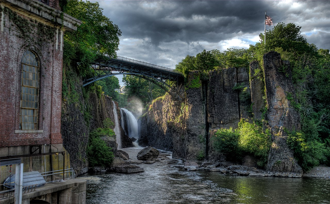


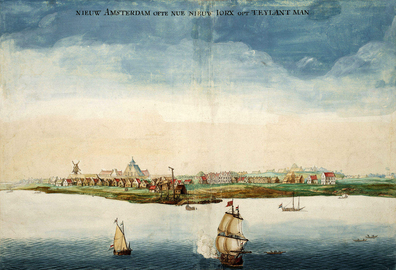


_4.JPG/1280px-I-495_(NY)_4.JPG)

.jpg/1280px-CT15sRoad-Exit44-CT58_(39144462790).jpg)
_from_the_overpass_for_the_Capital_to_the_Coast_Trail_in_Wall_Township,_Monmouth_County,_New_Jersey.jpg/1280px-thumbnail.jpg)